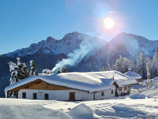
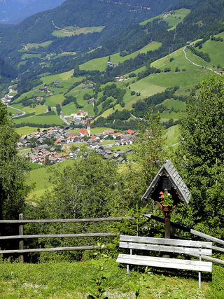
1/36
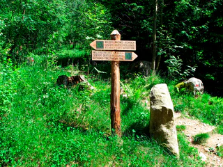
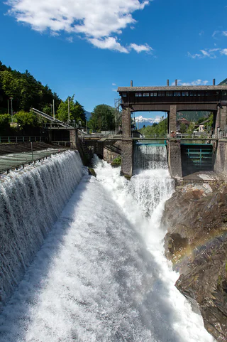
Aschbach Forest Adventure Trail – Family Circular Walk with Panoramic Views
Rablà/Rabland, Algund/Lagundo, Meran/Merano and environs
easy
Difficulté
94 m
Gain d'altitude
1h:10 min
durée
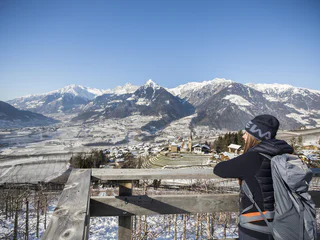
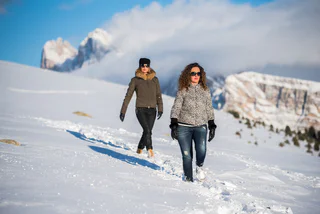
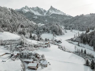
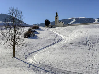
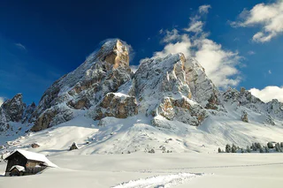
Partir pour une randonnée hivernale, sur des sentiers parfaitement tracés, c'est découvrir le côté paisible du Sud-Tyrol. Points de vue enchanteurs dans les Dolomites, forêts enneigées dans les tranquilles vallées voisines, dans la région du Kronplatz... Les endroits ne manquent pas où vous pouvez profiter de vous-même et de la nature, dans un silence absolu. En raquettes, vous vous éloignerez des pistes de ski et des remontées mécaniques pour découvrir des forêts encore totalement préservées. Mais, que ce soit en raquettes ou à pied, randonner en hiver dans le Sud-Tyrol sera toujours une expérience inoubliable.
1/36
Rablà/Rabland, Algund/Lagundo, Meran/Merano and environs
easy
Difficulté
94 m
Gain d'altitude
1h:10 min
durée

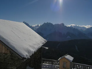
Sopranessano/Aschbach, Percha/Perca, Dolomites Region Kronplatz/Plan de Corones
easy
Difficulté
243 m
Gain d'altitude
1h:00 min
durée
1/2
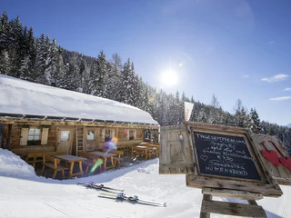
Aldino/Aldein, Aldein/Aldino
easy
Difficulté
225 m
Gain d'altitude
1h:58 min
durée
Selva/Sëlva/Wolkenstein/Sëlva, Urtijëi/Ortisei, Dolomites Region Val Gardena
easy
Difficulté
61 m
Gain d'altitude
2h:31 min
durée
1/4
Scena/Schenna, Schenna/Scena, Meran/Merano and environs
easy
Difficulté
320 m
Gain d'altitude
2h:00 min
durée
Ausserprags/Braies di Fuori, Prags/Braies, Dolomites Region 3 Zinnen
easy
Difficulté
47 m
Gain d'altitude
0h:40 min
durée
San Leonardo i.P./St. Leonhard i.P., St.Leonhard in Passeier/San Leonardo in Passiria, Meran/Merano and environs
medium
Difficulté
183 m
Gain d'altitude
1h:31 min
durée
Valgiovo/Jaufental, Ratschings/Racines, Sterzing/Vipiteno and environs
medium
Difficulté
569 m
Gain d'altitude
2h:31 min
durée
1/2
Ortisei/Urtijëi/St. Ulrich/Urtijëi, Urtijëi/Ortisei, Dolomites Region Val Gardena
easy
Difficulté
101 m
Gain d'altitude
0h:39 min
durée
1/2
Obereggen/Obereggen, Deutschnofen/Nova Ponente, Dolomites Region Eggental
easy
Difficulté
183 m
Gain d'altitude
1h:25 min
durée
1/11
Parcines/Partschins, Partschins/Parcines, Meran/Merano and environs
easy
Difficulté
118 m
Gain d'altitude
0h:58 min
durée
Monguelfo/Welsberg, Welsberg-Taisten/Monguelfo-Tesido
medium
Difficulté
144 m
Gain d'altitude
2h:00 min
durée
1/2
Obereggen/Obereggen, Deutschnofen/Nova Ponente, Dolomites Region Eggental
medium
Difficulté
454 m
Gain d'altitude
3h:30 min
durée
1/3
Mazzon/Mazon, Neumarkt/Egna, Alto Adige Wine Road
difficult
Difficulté
1408 m
Gain d'altitude
7h:00 min
durée
1/2
Valdaora di Sopra/Oberolang, Olang/Valdaora, Dolomites Region Kronplatz/Plan de Corones
easy
Difficulté
291 m
Gain d'altitude
1h:07 min
durée

1/2
Alpe di Rodengo/Rodenecker Alm, Lüsen/Luson, Dolomites Region Lüsen Villnöss
medium
Difficulté
0 m
Gain d'altitude
5h:00 min
durée
1/2
S. Candido/Innichen, Toblach/Dobbiaco, Dolomites Region 3 Zinnen
medium
Difficulté
715 m
Gain d'altitude
2h:30 min
durée
1/3
Nova Levante/Welschnofen, Welschnofen/Nova Levante, Dolomites Region Eggental
medium
Difficulté
429 m
Gain d'altitude
2h:34 min
durée
Obereggen/Obereggen, Deutschnofen/Nova Ponente, Dolomites Region Eggental
medium
Difficulté
519 m
Gain d'altitude
3h:00 min
durée
1/2
Maranza/Meransen, Mühlbach/Rio di Pusteria, Brixen/Bressanone and environs
medium
Difficulté
218 m
Gain d'altitude
1h:49 min
durée
1/3
Luson/Lüsen, Lüsen/Luson, Dolomites Region Lüsen Villnöss
medium
Difficulté
403 m
Gain d'altitude
2h:10 min
durée
1/2
Valdaora di Mezzo/Mitterolang, Welsberg-Taisten/Monguelfo-Tesido
easy
Difficulté
40 m
Gain d'altitude
1h:25 min
durée

1/2
Salorno/Salurn, Alto Adige Wine Road
easy
Difficulté
115 m
Gain d'altitude
0h:30 min
durée
1/2
S. Candido/Innichen, Toblach/Dobbiaco, Dolomites Region 3 Zinnen
easy
Difficulté
319 m
Gain d'altitude
2h:00 min
durée
1/2
San Cassiano/San Cassiano, Badia, Dolomites Region Alta Badia
easy
Difficulté
545 m
Gain d'altitude
2h:30 min
durée
Niederdorf/Villabassa, Dolomites Region 3 Zinnen
medium
Difficulté
416 m
Gain d'altitude
2h:06 min
durée
1/8
Montesole/Sonnenberg - Parcines/Partschins, Partschins/Parcines, Meran/Merano and environs
easy
Difficulté
155 m
Gain d'altitude
2h:04 min
durée
1/5
Longiarù/Campill, San Martin /San Martino, Dolomites Region Kronplatz/Plan de Corones
medium
Difficulté
284 m
Gain d'altitude
1h:40 min
durée
Ponticolo/Pontigl, Brenner/Brennero, Sterzing/Vipiteno and environs
medium
Difficulté
529 m
Gain d'altitude
1h:49 min
durée
1/5
Aldino/Aldein, Aldein/Aldino
medium
Difficulté
18 m
Gain d'altitude
1h:46 min
durée