1/5
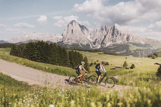
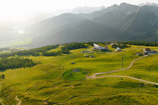
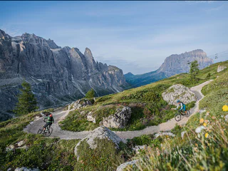
253 Seiser Alm Hut Tour
Alpe di Siusi/Seiseralm, Kastelruth/Castelrotto, Dolomites Region Seiser Alm
medium
Poziom trudności
825 m
Wzlot
22.6 Km
odległość
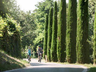
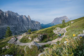
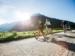
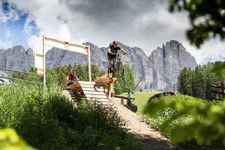
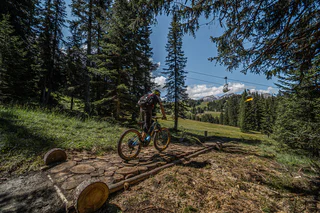
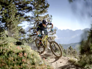
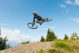
Czysta adrenalina na tle imponującej górskiej scenerii: Wycieczki MTB w Południowym Tyrolu oferują zabawę dla każdego rowerzysty. Ruszaj na szlak! Eksploruj zbocza doliny w Vinschgau jako freerider, odkryj Alpe di Siusi, największe wysokogórskie pastwisko w Europie, na dwóch kółkach lub poczuj wiatr podczas płynnego zjazdu z Kronplatz. Wycieczki MTB w Południowym Tyrolu gwarantują radość z jazdy i doświadczenie natury.
1/5
Alpe di Siusi/Seiseralm, Kastelruth/Castelrotto, Dolomites Region Seiser Alm
medium
Poziom trudności
825 m
Wzlot
22.6 Km
odległość

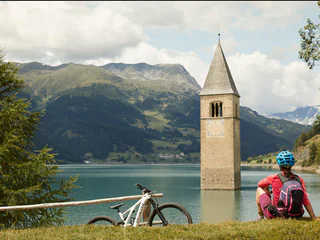
Piavenna/Plawenn, Graun im Vinschgau/Curon Venosta, Vinschgau/Val Venosta
medium
Poziom trudności
404 m
Wzlot
2.2 Km
odległość
1/3
Colfosco/Colfosco, Badia, Dolomites Region Alta Badia
easy
Poziom trudności
49 m
Wzlot
368.0 m
odległość
1/2
Colfosco/Colfosco, Badia, Dolomites Region Alta Badia
easy
Poziom trudności
0 m
Wzlot
157.0 m
odległość
1/2
Seis/Siusi, Kastelruth/Castelrotto, Dolomites Region Seiser Alm
difficult
Poziom trudności
3913 m
Wzlot
96.4 Km
odległość
1/2
Riscone/Reischach, Olang/Valdaora, Dolomites Region Kronplatz/Plan de Corones
easy
Poziom trudności
0 m
Wzlot
2.0 Km
odległość
Anterselva di Sotto/Antholz-Niedertal, Rasen-Antholz/Rasun Anterselva, Dolomites Region Kronplatz/Plan de Corones
difficult
Poziom trudności
583 m
Wzlot
25.7 Km
odległość
1/3
Schenna/Scena, Meran/Merano and environs
easy
Poziom trudności
790 m
Wzlot
24.4 Km
odległość
Sesto/Sexten, Sexten/Sesto, Dolomites Region 3 Zinnen
difficult
Poziom trudności
1 m
Wzlot
90.0 m
odległość
Nove Case/Neunhäusern, Rasen-Antholz/Rasun Anterselva, Dolomites Region Kronplatz/Plan de Corones
difficult
Poziom trudności
1309 m
Wzlot
47.9 Km
odległość
1/5
Selva/Sëlva/Wolkenstein/Sëlva, Sëlva/Selva di Val Gardena, Dolomites Region Val Gardena
difficult
Poziom trudności
2018 m
Wzlot
29.2 Km
odległość
Lüsen/Luson, Dolomites Region Lüsen Villnöss
medium
Poziom trudności
231 m
Wzlot
8.0 Km
odległość
1/3
Campo Tures/Sand in Taufers, Bruneck/Brunico, Dolomites Region Kronplatz/Plan de Corones
easy
Poziom trudności
47 m
Wzlot
17 Km
odległość
1/4
Selva/Sëlva/Wolkenstein/Sëlva, Sëlva/Selva di Val Gardena, Dolomites Region Val Gardena
medium
Poziom trudności
843 m
Wzlot
15.3 Km
odległość
1/3
Nova Levante/Welschnofen, Welschnofen/Nova Levante, Dolomites Region Eggental
medium
Poziom trudności
0 m
Wzlot
4.5 Km
odległość
1/3
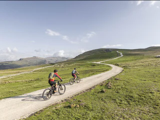
Graun/Curon, Graun im Vinschgau/Curon Venosta, Vinschgau/Val Venosta
easy
Poziom trudności
431 m
Wzlot
88.5 Km
odległość
S. Martino al Monte/St. Martin - Laces/Latsch, Latsch/Laces, Vinschgau/Val Venosta
easy
Poziom trudności
214 m
Wzlot
15.0 Km
odległość
1/3
Soprabolzano/Oberbozen, Ritten/Renon, Bolzano/Bozen and environs
medium
Poziom trudności
1216 m
Wzlot
33.6 Km
odległość
Resia/Reschen
medium
Poziom trudności
200 m
Wzlot
1.5 Km
odległość
Resia/Reschen
medium
Poziom trudności
350 m
Wzlot
1.7 Km
odległość
Montefontana/Tomberg, Kastelbell-Tschars/Castelbello-Ciardes, Vinschgau/Val Venosta
medium
Poziom trudności
840 m
Wzlot
18.4 Km
odległość
1/4
San Cassiano/San Cassiano, Badia, Dolomites Region Alta Badia
easy
Poziom trudności
0 m
Wzlot
1.9 Km
odległość
Naturno/Naturns, Naturns/Naturno, Meran/Merano and environs
easy
Poziom trudności
1408 m
Wzlot
29.1 Km
odległość
1/2
Pflersch/Fleres, Brenner/Brennero, Sterzing/Vipiteno and environs
easy
Poziom trudności
584 m
Wzlot
6.9 Km
odległość
1/2
Plose/Plose, Brixen/Bressanone, Brixen/Bressanone and environs
easy
Poziom trudności
0 m
Wzlot
1.9 Km
odległość
Caldaro Paese/Kaltern Dorf, Kaltern an der Weinstraße/Caldaro sulla Strada del Vino, Alto Adige Wine Road
medium
Poziom trudności
1008 m
Wzlot
33.2 Km
odległość
Kastelruth/Castelrotto, Dolomites Region Seiser Alm
difficult
Poziom trudności
1346 m
Wzlot
55.4 Km
odległość
1/2
Riscone/Reischach, Al Plan/San Vigilio, Dolomites Region Kronplatz/Plan de Corones
medium
Poziom trudności
0 m
Wzlot
491.0 m
odległość
San Vigilio, Al Plan/San Vigilio, Dolomites Region Kronplatz/Plan de Corones
easy
Poziom trudności
256 m
Wzlot
7.4 Km
odległość
Sesto/Sexten, Sexten/Sesto, Dolomites Region 3 Zinnen
easy
Poziom trudności
2 m
Wzlot
22.0 m
odległość
Dziękujemy za zapisanie się!
Subskrypcja jest już aktywna
Potwierdź rejestrację
Aby zakończyć rejestrację, otwórz e-mail, który właśnie wysłaliśmy, i kliknij link potwierdzający.
Nie widzisz wiadomości? Sprawdź folder spam.
Zauważyliśmy, że próbowałeś(-aś) zapisać się do newslettera, ale Twój adres e-mail jest już zarejestrowany. Nadal będziesz otrzymywać nasze oferty, wskazówki i inspiracje na Twój urlop.
Już próbowałeś zapisać się do naszego newslettera, ale nie potwierdziłeś rejestracji. Właśnie wysłaliśmy ci ponownie e‑mail. Sprawdź swoją skrzynkę odbiorczą i folder ze spamem i potwierdź teraz.


