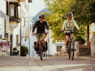
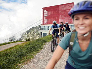
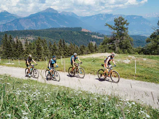
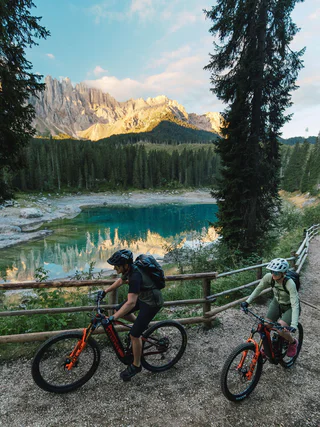
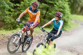
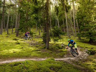
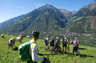
Pure adrenaline in front of an impressive mountain scenery: MTB tours in South Tyrol offer fun for every biker. On the trail, get going! Explore the valley sides in Vinschgau as a freerider, discover the Alpe di Siusi, Europe's largest high alpine pasture, on two wheels or feel the wind on a flowing descent from Kronplatz. South Tyrol's MTB tours guarantee riding fun and nature experience.
Starting point: Aschbach cableway mountain station (1,342 m)
Destination point: Vigiljoch mountain (1,743m)
Starting in the centre of Trodena we follow the main road until we reach Fontanefredde and San Lugano, passing the old railroad. After a nice climb-down we arrive at Molina. With a panoramic view over the lake "Lago di Stramentizzo" we go uphill until Guggal, Anterivo and to the Passo Cisa (1448m). The tour continues with an uphill to the highest Point, the Malga Monte Corno. Then we follow the European long distance path E5 until we reach Trodena.
Tour Nr. 5
Possible restaurant stops: Malga Monte Corno, Hotel Restaurant Schönwies and Hotel Retaurant Trudnerhof at Trodena
Starting in the centre of Trodena on an asphalted street we drive down to Fontanefredde (1005m). Then we drive past the farm "Pausa" until we reach Montagna (672m). The track leads past Castelfeder (377m), between Ora and Egna we reach the connection to the Adige Cycle Route.
Tour Nr. 4
This line offers a more comfortable and flowing alternative to the far rougher and more technical Herrnsteig trail section.
Level: easy to medium
Starting from the Etschbrüücke bridge in Kastelbell, the uphill trail to Marzoner Alm mountain pasture leads first along a very steep, paved mountain road to the hamlet of Freiberg (1,200 m). Above Freiberg, at the Pramanthof farm (6,6 km), the surface changes to a gravel road and the slope becomes less steep.The forest path winds its way to the Freiberger Säge parking lot (1.480 m) and then to the Marzoner Alm mountain pasture
We start in the centre of Trodena (1127 m) and ride until we reach Fontanefredde. Then we have to get over 100 hm until we reach San Lugano. From the Passo San Lugano we start downhill until we reach Molina and the Val di Fiemme cycle route. the track includes less frequented asphaltic roads and some forest trails.
Tour Nr. 3
Possible restaurant stops: Hotel Restaurant Schönwies and Hotel Restaurant Trudnerhof at Trodena.
Up and down below Piz Salve, Munwartl and Glurnser Köpfl mountains.
From Trafoi, a lift takes you up to the Furkelhütte hut (2,153 m), where you can have a coffee before starting the tour. Then up and down on gravel paths, meadow paths towards the Stilfser Alm Alpine pasture (2,077 m). Here, another opportunity presents itself to enjoy the panoramic view. Now downhill around 500 metres of height, below the Stilfser Alm to the 6er trail (S1) and forest as well as gravel path downhill to the Faslarhöfe farms (1,550 m), to then carry on uphill again, towards Schartalm Alpine pasture (1,825 m). At the junction Schartalm, take the gravel path towards the Lichtenberger Almen Alpine pastures (2,066 m) to the beautiful Gutfalltal Valley. From the pastures, a lovely trail, with occasional roots and a brilliant panoramic view leads to the Glurnser Alm Alpine pasture (1,978 m). This part is challenging and occasionally requires some skill and fitness. At the pasture, it is worth taking a break and a snack you brought along (Marend).
From the Glurnser Alm Alpine pasture, follow the forest trail downhill up to the town walls of the beautiful little town of Glorenza/Glurns, with its cobbled old town and nice cafés. From Glorenza, briefly follow the road from the south gate of the town wall, then turn right into the meadow path to Prato.
This easy and short bike tour is perfect for the whole family.
Road bike tour with view to the marble quarry, the Ortler group and the orchards of the Lasa and Sluderno Monte Sole mountain
From the Etschbrücke bridge in Naturns, this classic Transalpine route leads along a pleasant slope with a moderate climb. The first 7.3 km are set on a paved road, and from there, a gravel path leads up to the Kreuzbrünnl parking lot (1,570m) and up to the Naturnser Alm mountain pasture (1,910m). After 7.6 km and 710m gain, there is also the opportunity to bike to the Platzgummhof farm and enter from there halfway up along the crossing Ötzi Trail. Shuttle services to the Kreuzbrünnl parking lot are offered on different days. Information is available at the Naturns Information Office.
Before setting off on this tour, it is legitimate to think about the delicious Kaiserschmarren at the Rescher Alm. Follow the cycle path along the lakeshore from Reschen towards the Schöneben valley station. From the valley station, cycle uphill on the main road, in the direction of Rojen and then in the direction of St. Valentin to the hamlet of Spin. Shortly after the Spin´s farm, take a sharp right onto the forest and meadow path. In the forest, bend the way north above lake Resia and the Rojen road past a small forest lake (1,850 m). Follow the forest road, meet the Rojen road a little later and follow it to the trendy Rescher Alm hut. Here, at an altitude of 2,000 m, with a splendid view from the terrace, enjoy one of the best lunches. From the Rescher Alm alpine hut, continue north along the forest road, down to Tenders, where the Tendershof farmhouse invites for refreshment. From here, it is not far to the final destination: Reschen. Tip: For enduro enthusiasts: there is the option of rocking down via the 3-Länder Trail in the direction of Nauders to the Mutzkopf. From Mutzkopf, take one of the trails to Nauders.
Starting point: Töll Etschbrücke bridge (525m)
Destination point: Aschbach cableway mountain station (1,342m)
Challenging climbs, rewarding views, a "gschmackige Marend" and several trail options.
The tour starts at the village square of Tarres (Schulweg). Follow the signs on the asphalt road to the valley station of the chairlift Tarres Alp (1,200 m). At the finish house of the toboggan run, turn right and take a fairly leisurely route to Platzleng. From this fantastic picnic spot in the forest, we then crank up the forest road on partly very steep ramps to the Malga di Tarres (1,935 m) and earn a proper stop at the Malga di Tarres and the Mountain Restaurant Malga di Tarres.
From Laces: from the Laces sports stadium (SportForum) in a southerly direction to the AquaForum adventure pool and either via the forest road and Raminiwaal or the road on to Tarres.
Shortcut: The Malga di Tarres lift transports bikes. From Laces we are then almost exclusively on asphalt.
Downhill or connecting variants: Tarscher Alm Trail, Roatbrunn Trail, 4-wins-13.
Route length in km: 36,4
Vertical climb: ascent 1.552m – descent 1.521m (the ascent with the cableway Aschbach/Riolagundo helps you saving 800 m of altitude difference in the ascent)
Surface: asphalt, forest path, cart path
Required technical skills: S0/S1/S2 – easy with 2 short Single-Trail-Sections S1/S2
Beautiful tour demanding in terms of fitness with three trail highlights.
The strenuous tour starts in Prato/Prad in the shadow of the Stelvio Pass and the Ortler Range, via the famous Stelvio road in the direction of Gomagoi. In Gomagoi, turn right towards Stelvio/Stilfs and a few metres higher, turn left to the sports field and further to Platz (1,500m). Here, we are welcomed by the gravel path and the meadow trail, leading past the Prader Alm Alpine pasture and, leaving the Furkelhütte hut (2,153 m) at the left-hand side, up and down to the Stilfser Alm Alpine pasture (2,077 m). It is worth stopping and sampling a traditional Venosta Valley dish. The breathtaking panorama in view, the 6er trail with a length of 1.8 km, branches off to the right, below the Stilfser Alm Alpine pasture. Turning left, his very beautiful trail joins the forest path towards Schartalm Alpine pasture. The next reward for the height gain of more than 1,600 metres, presents itself below the Schartalm in a left bend: The 15er trail turns off here, to a short passage where you need to push your bike, before you are rewarded with “something for the soul” (S1/S2). According to the locals, this trail belongs to the most beautiful trails in Venosta Valley and also the 12er trails which joins the 15er trail after a short ride in the woods above the Platzhof farm, does not leave much to be desired, with several tight bends for trail enthusiasts. At Wartamstein, we reach a narrow tarmacked road back to Prato
Tip: Please to not ride the bike on the popular family trails below Wartamstein.
From the Etschbrücke bridge in Tschars (Winkler Inn) the trail leads along a slight climb past various farms up to Tomberg and from there to the Schartegg parking lot (1,460m). The last stretch from the parking lot to the pasture requires a little stamina, as the trail becomes steeper. The first 8.3 km are on a paved road and the rest of the route on a gravel path. The trail to the Tablander Alm mountain pasture offers various opportunities to enter the Lupo and Fontana trails. After 6.7 km and 570m gain it is possible to take the crossing Fontana Trail, and after 4.3 km and 360m gain the crossing Lupo Trail.
Starting point: Töll Etschbrücke bridge (525 m)
Destination point: Seespitz mountain inn (1,750m)
This tour is one of the classics in the border triangle, is very demanding and not recommended for bikers with a fear of heights.
The physically demanding well-known tour for those who are free from giddiness through the tripoint.
Flowing, slightly demanding trail with traditional stop for refreshment and fabulous views.
Gravel trail section. Cross the San Martino road to a beautiful S3 trail characterized by forest floor and stone passages. Turn right towards Ratschillhof at the gravel road and refresh yourself after some 500m.
By the way: This trail owes its name to this farm and not to its spicy characteristics! The second part of the trail ranges from root passages to hilly S3 sections and thus offers something for all trail enthusiasts. Look forward to the subsequent flatter flowing “Share the Trail” passage along Piani di Annenberg. Continue and before the suspension bridge on the left on path no. 5A downhill to Tiss.
Return on the asphalt road towards Laces or Coldrano.
Please note: “Share the Trail” sections for some parts, especially on paths no. 5 and 7. Please show consideration for hikers as they have right of way!
What goes up comes back around
Uschi branches off the Richard-Anton trail and is brand-new: Hand-crafted in 2020, this trail through the woods is one to watch out for: It starts off with a climb to its highest point, after which it's bend after bend, roller after roller and some more tricky challenges that require creative solutions. Uschi briefly forks off Richard-Anton before merging back into it again just before it ends.
Length: 600 m
Difference in altitude: 81 m
Level: medium to difficult
The classic itinerary of the region starts in Trodena. It leads downhill to the old sawmill and goes along a forest road with a pleasant incline through the "Kaltwassertal" up to the col Passo Cisa (1448m). We keep walking on this altitude and follow the way towards the Malghette, the highest point of the tour. In an easy descent, we reach Anterivo and San Lugano. We follow the old railroad track to Fontanefredde. The last gradient brings us back to Trodena.
Tour Nr. 7
Advice: This tour can also be started from the town hall square in Anterivo
Possible restaurant stops: Le Malghette - Krabes Alm, Hotel Restaurant Schönwies andHotel Restaurant Trudnerhof at Truden
Before setting off on this tour, it is legitimate to think about the delicious Kaiserschmarren at the Rescher Alm. Follow the cycle path along the lakeshore from Reschen towards the Schöneben valley station. From the valley station, cycle uphill on the main road, in the direction of Rojen and then in the direction of St. Valentin to the hamlet of Spin. Shortly after the Spin's farm, take a sharp right onto the forest and meadow path. In the forest, follow the way north above lake Resia and the Rojen road past a small forest lake (1,850 m). Follow the forest road, meet the Rojen road a little later and follow it to the trendy Rescher Alm hut. Here, at an altitude of 2,000 m, with a splendid view from the terrace, enjoy one of the best lunches. From the Rescher Alm alpine hut, continue north along the forest road, down to Tenders, where the Tendershof farmhouse invites for refreshments. From here, it is not far to the final destination: Reschen.
Tip: For enduro enthusiasts: there is the option of rocking down via the 3-Länder Trail in the direction of Nauders to the Mutzkopf. From Mutzkopf, take one of the trails to Nauders.
The mountainbike tour from Solda across the Madriccio Pass is a slightly steep path to the Passo del Madriccio, where you can enjoy a fabulous panoramic view. Marvel at Ortler, Zebru and Gran Zebru as well as at the glaciers around Cima Cevedale and Monte Cevedale. Also the downhill to the Rifugio Martello and Rifugio Corsi is absolutely a highlight.