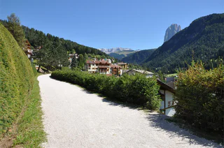
Passer au contenu

ajouté(e) aux favoris

supprimé(e) des favoris

Oups ! Une erreur s’est produite. Réessayer

Ton compte est en cours de création

Ton compte a été créé avec succès et tu es maintenant connecté

Tu es connecté!

Ton compte a été créé avec succès, mais nous n'avons pas pu te connecter automatiquement

Tu es déconnecté

Filtrer
Filtres sélectionnés
    Niveau de difficulté
    Durée
    Distance en km

    Vacances dans la Région des Dolomites Val Gardena

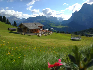
    Pour vos vacances dans la région des Dolomites Val Gardena dans le Sud-Tyrol, sous le signe du bien-être et du divertissement, vous pouvez choisir parmi de nombreux hébergements qui répondent à vos souhaits.
    Résultats
    Mountain bike
    297a Mont Sëura Tour Variante (alternate route)
    S.Crestina Gherdëina/Santa Cristina Val Gardana, Dolomites Region Val Gardena

    The ascent to the Comici Hut is sweaty, but the biker is spared the remaining metres in altitude thanks to the Gran Paradiso chairlift. The absolute highlight of the variant are the flow trails: from the highest point of the City of Stones, which is reached thanks to the chairlift, the Paravis Trail, which lives up to its name, leads to the mountain station of the Piz Seteur cable car. From there, you can choose between the flowy Family Trail or the adrenaline-pumping Easy Jump Line. From Plan de Gralba, a last trail leads to the left side of the stream to Selva Gardena and via the valley cycle path you finally reach the starting point in S. Cristina.

    Difficulté : difficile
    199 m altitude
    9.3 Km distance
    Mountain bike
    Cir Giara
    Sëlva/Selva, Dolomites Region Val Gardena

    On July 15, 2017 opens the Cir flow trail. A sequence of bumps, parabolic and north shore, whose rhythm, along with an average slope of 8%, makes it almost impossible to use the brakes. Particular care was reserved for the bottom covered with a layer of binder. Some variants allow the most beloved to make some nice jump. The route runs from Dantercepies 2300 mt, reachable both by the cable car from Selva and the chairlift from the Gardena Pass (and then from Corvara with the Plans Frara lft), to the Gardena Pass at 2120 mt.

    Difficulté : moyenne
    0 m altitude
    1.6 Km distance
    Downhills
    211 Paravis Trail
    Sëlva/Selva, Dolomites Region Val Gardena

    An absolute pleasure trail: flowing and embedded in the beautiful Dolomite landscape, the Paravis Trail winds its way from the mountain station of the Gran Paradiso chairlift, at the highest point of the famous Città dei Sassi (Stone City), to the valley station. The Ladin name Paravis stands for paradise and the trail lives up to its name, as it is constantly accompanied by paradisiacal views of the Sella massif and the Sassolungo. Fun for big and small bikers alike, and anyone sitting on the chairlift can often hear the bikers whooping with joy on the trail.

    Difficulté : moyenne
    2433 m altitude
    2.8 Km distance
    Mountain bike
    300 - Family Tour Val d'Anna
    Urtijëi/Ortisei, Dolomites Region Val Gardena
    The Family Tour Val d’Anna/Annatal is an ideal tour for families with children. The road, which has very little traffic, has a very gentle gradient and leads past the Col de Flam climbing garden to the Annatal hut, where parents can relax in the sun and the children find super fun playgrounds.
    Difficulté : facile
    115 m altitude
    2.8 Km distance
    Mountain bike
    309 Sassolungo Tour
    Sëlva/Selva, Dolomites Region Val Gardena
    This tour impresses with its wonderful views of the Sassolungo and Sella massifs and the fewer metres in altitude that you have to climb under your own muscle power. Bikers who like to ride downhill and have a good basis in mountain bike riding technique will love this tour. Also for kids who are already good mountain bikers, the trails of this tour guarantee a perfect biking day. Surrounded by breathtaking panoramas and thanks to the lift support from the Ciampinoi cable car and the Gran Paradiso chairlift, the tour can easily be completed in half a day.
    Difficulté : moyenne
    1022 m altitude
    16.3 Km distance
    Mountain bike
    298 Rifugio Firenze Tour
    S.Crestina Gherdëina/Santa Cristina Val Gardana, Dolomites Region Val Gardena

    There are rarely so many facets to a tour: the Via Crucis from the Vallunga to Daunëi, the gravel path to the Juac Hut with its wonderful panorama, the gravel road that leads to the Regensburger Hut accompanied by the imposing rock faces of the surrounding Dolomites, the wonderful view from Col Raiser and Seceda. The descent on gravel roads from Seceda towards S. Cristina should not be underestimated on this tour, as they demand a lot of driving skills and strength.

    To the map


    Difficulté : difficile
    780 m altitude
    24.4 Km distance
    Dolomiti Superski
    Val Gardena - Alpe di Siusi ski area
    Dolomites Region Val Gardena
    From the valley floor below, the jagged peaks of the Sella massif, the towers of the Sassolungo and Fermeda peaks and the Odle mountains all seem within easy reach. With 175 km of slopes, Val Gardena is not only the largest but also one of the most famous ski areas in South Tyrol. It became famous for the Ski World Championships held there in 1970. Today, cable cars and lifts bring visitors directly from the village centre up to the mountains where they can tackle slopes of all difficulty levels and with connections to the Dolomiti Superski carousel. From the huts, guests can enjoy culinary delicacies and panoramic views of the Dolomites. The famous 'Sellaronda ski circuit' can be started from all Val Gardena villages. So too can the less well-known but equally diverse 'Gherdeina Skiring' from the Alpe di Seceda mountain hut to Dantercepies. Only bold skiers dare to descend the steep 'Saslong' slope on the Ciampinoi, while the 10.5 km 'La Longia' route from Seceda to Urtijëi/Ortisei requires good fitness.
    175km pente totale
    81 randonnées
    Point le plus haut : 2,520 m
    Mountain bike
    303 Passo Gardena circuit
    Sëlva/Selva, Dolomites Region Val Gardena
    This Val Gardena MTB loop with its two single trails guarantees a total of over 10 km of trail riding pleasure and pure action. After a relaxed gondola ride in the direction of Dantercëpies, a flow trail begins directly below the breathtaking Cir peaks. Thanks to the Trail Arena ticket, this Cir Tiera Trail, as well as the other trails of the Trail Arena Val Gardena, can be repeated as often as you like. The trail continues along a path that is also open to mountain bikers: from the Gardena Pass it descends below the imposing rock faces of the Sella massif to the Miramonti zone, where the two main roads coming from the Sella Pass and Gardena Pass meet. Continue along a gravel path until you reach the entrance to the last stretch of the Family Trail to Plan de Gralba. If you want, you can take the Piz Seteur cable car and ride this flow trail and the other trails in this area a couple of more times, as they are part of the Trail Arena Val Gardena. Or simply return to Selva via a path that runs to the left of the stream.
    Difficulté : moyenne
    843 m altitude
    15.3 Km distance
    Mountain bike
    309 Family Trail
    Sëlva/Selva, Dolomites Region Val Gardena

    An easy trail for the whole family of 3,600 meters leads from the modern Piz Seteur cableway down to the Plan de Gralba. The flowing track is the ideal starting point for those who want to improve their basic biking skills.

    Difficulté : moyenne
    0 m altitude
    3.5 Km distance
    Mountain bike
    304 The Passo Gardena circuit alternative
    Sëlva/Selva, Dolomites Region Val Gardena

    For this tour you’ll need plenty of leg power if you want to experience the reward of a thrilling descent.

    Download the route as a single map (PDF) HERE!

    Difficulté : moyenne
    650 m altitude
    4.5 Km distance
    Mountain bike
    301 - Tour Resciesa
    Urtijëi/Ortisei, Dolomites Region Val Gardena

    The Resciesa tour is a moderately difficult tour with rewarding panoramic views.
    The consistently steep gravel road leads from Ortisei through the Resciesa forest to the Resciesa area. Due to its characteristic steep incline and treacherous descent, this tour is only recommended for experienced bikers with good physical condition. The effort of the 900 m of ascent is rewarded on the Resciesa alp with a breathtaking view of the Dolomites.

    Difficulté : moyenne
    938 m altitude
    14.2 Km distance
    Cycling
    Racing bike tour at Passo delle Erbe
    Sëlva/Selva, Dolomites Region Val Gardena

    Starting from Val Gardena, take the state road n. 242 which leads to Chiusa and continues up to Bressanone on the cycle path that runs alongside the SS12. Once in Bressanone take the ascent through S. Andrea up to Passo delle Erbe. At the top you cycle down towards San Martino in Badia to reach Corvara. Turning right you start the ascent to the Gardena Pass passing through Colfosco. After passing the Gardena Pass a pleasant descent leads to Selva.

    Difficulté : difficile
    3536 m altitude
    114.4 Km distance
    Mountain bike
    308 Passo Sella circuit
    Sëlva/Selva, Dolomites Region Val Gardena

    What an optimal start to an e-bike tour: a view across Sella Mountain and the impressive background of the City of Stones.

    Download the route as a single map (PDF) HERE!

    Difficulté : moyenne
    796 m altitude
    17.0 Km distance
    Mountain bike
    302 - Variante Tour Resciesa
    Urtijëi/Ortisei, Dolomites Region Val Gardena

    This tour is for all those who would like to enjoy the beautiful panorama view, but do not dare to ride up the moderately difficult trail on their MTB and to cycle up over 900 m of altitude. Thanks to the lift support, only a few metres of altitude have to be mastered with your own steam. The last meters, you can expect a nice access with a pleasant incline, up to the Resciesa alp.

    Difficulté : moyenne
    828 m altitude
    2.9 Km distance
    E-Bikes
    Cycle route Rodaval
    Urtijëi/Ortisei, Dolomites Region Val Gardena
    The Rodaval cycle path is a scenic and enjoyable route that allows cyclists to experience the beauty of the Val Gardena region in Italy. Starting from the picturesque village of Roncadizza, located at an elevation of 1130 meters, the path winds its way along the Derjon stream, providing cyclists with stunning views of the surrounding mountains and valleys.
    As you ride along the path, you'll have the opportunity to stop in the charming villages of Ortisei and S. Cristina, where you can explore local shops, restaurants, and cultural attractions. The route is mostly asphalted and easy to navigate, making it suitable for cyclists of all skill levels. However, there are some climbs into the valley that may be challenging for some, so using an e-bike can be helpful.
    Difficulté : facile
    20 m altitude
    12.3 Km distance
    Mountain bike
    299 Rifugio Firenze Tour Alternative
    S.Crestina Gherdëina/Santa Cristina Val Gardana, Dolomites Region Val Gardena

    This variant leads to one of the most famous photo spots since the advent of social media. The ascent is only for really fit bikers and even with an ebike, the slope is only suitable for trained legs. But at the summit you are rewarded with a wonderful view of the Odle peaks, the Sella massif and the Sassolungo. But beware: if you cycle up the steep gravel roads, you also have to cycle down on them, and that requires a lot of strength, both uphill and downhill.                                                          

    Difficulté : difficile
    399 m altitude
    2.9 Km distance
    Mountain bike
    213 - Panoramic-Tour Val Gardena - Seiser Alm
    Urtijëi/Ortisei, Dolomites Region Val Gardena

    The Alpe di Siusi is probably the most ideal "playground" for bikers who want a relaxed tour combined with breathtaking views of the surrounding Dolomites. Europe's largest high alp offers not only breathtaking panoramas on this tour, but also a great mix of ascents and descents for pleasure bikers.

    Difficulté : moyenne
    680 m altitude
    36 Km distance
    Mountain bike
    207 Sellaronda MTB TOUR counterclockwise
    Sëlva/Selva, Dolomites Region Val Gardena

    The counter-clockwise Sellaronda MTB Tour has a total altitude difference of approx. 1,020 m to ride uphill and descents that vary from single trails to gravel roads. It is therefore suitable for uphill cycling with or without pedal assistance/e-bike. The time required varies according to MTB riding ability: from a minimum of 6 to a maximum of 9 hours, including lunch break.

    Difficulté : difficile
    3501 m altitude
    60.3 Km distance
    Mountain bike
    Cir Tiera
    Sëlva/Selva, Dolomites Region Val Gardena

    The FLOW definition was invented for this trail: the path initially has individual "bumps", which can, but not at all costs be jumped. The track continues with a very fluid line with numerous parabols under the upstream station of the Dantercepies lift, up to the intermediate station. Beginners and advanced, but also kids will enjoy a world on this trail. Repeating the Flow Trail will not be a problem: thanks to the Dantercepies lifts, bikers and bikes will be transported from the intermediate station to the upstream station in the shortest time.

    Difficulté : moyenne
    0 m altitude
    1.4 Km distance
    Mountain bike
    223 Clockwise Val Duron tour
    Sëlva/Selva, Dolomites Region Val Gardena

    The longest tour in the Alpe di Siusi and Val Gardena region will win you over with two demanding climbs to Passo Sella and Passo Duron.

    Download the route as a single map (PDF) HERE!

    Difficulté : difficile
    1764 m altitude
    41.0 Km distance
    Downhills
    Freeride Ciampinoi
    Sëlva/Selva, Dolomites Region Val Gardena

    The freeride track is unique in the whole valley. It starts from the mountain station of the Ciampinoi and leads you down until the Pra Valentini hut. The track was built in the woods and the ride down to the bottom is for everyone an unforgettable experience.

    Difficulté : difficile
    5 m altitude
    2.4 Km distance
    Mountain bike
    297 Mont de Seura Tour
    S.Crestina Gherdëina/Santa Cristina Val Gardana, Dolomites Region Val Gardena
    This tour scores with a leisurely ascent in an enchanted-looking forest and the breathtaking view of the Dolomite landscape at the top of Mont Sëura.
    Difficulté : difficile
    873 m altitude
    25.5 Km distance
    Mountain bike
    208 Sellaronda MTB TOUR clockwise
    Sëlva/Selva, Dolomites Region Val Gardena

    The clockwise Sellaronda MTB TOUR involves relatively few uphill metres to cycle (about 370 m), thanks to the use of lifts that allow the transport of mountain bikes and e-bikes. There are numerous trails that require good riding technique. The total time varies according to riding ability: from a minimum of 5 to a maximum of 9 hours, including lunch break.

    Difficulté : difficile
    3750 m altitude
    62.1 Km distance
    Mountain bike
    310 - Variante Bulla
    Kastelruth/Castelrotto, Dolomites Region Val Gardena

    For the sporty ones, who want to earn the panoramic view on the Seiser Alm, we recommend the Bulla variant. This tour is particularly recommended for mountain bikers of a high level, and at the same time it offers the chance to prove your technical skills. It is a difficult route and intended for the absolute professional bikers.


    Difficulté : moyenne
    765 m altitude
    8.4 Km distance
    Mountain bike
    303a Trail Arena Tour
    Sëlva/Selva, Dolomites Region Val Gardena

    Flow lovers will love this tour. The Trail Arena Val Gardena is probably the most panorama-rich trail park in the Alps and impresses not only with its wonderful views, but also with its 4 flow trails and the challenging freeride trail. All in all, a circuit around the tourist stronghold of Wolkenstein, with bends, jumps and lots of speed. Those who like it really technical will love to ride the Ciampinoi trail. Thanks to the 5 lifts of the Trail Arena (Dantercepies, Cir, Piz Seteur, Gran Paradiso, Ciampinoi), which can be used with the Trail Arena Ticket or with the Super Summer Card, there are hardly any metres in altitude that have to be pedalled uphill and the trails can be repeated as many times you want.

    Difficulté : difficile
    2018 m altitude
    29.2 Km distance