
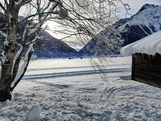
1/2
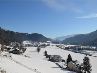
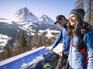
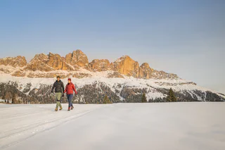
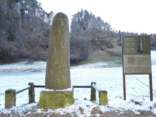
Winter hike along the artists' path from La Villa to San Cassiano
San Cassiano/San Cassiano, Badia, Dolomites Region Alta Badia
easy
Difficulté
237 m
Gain d'altitude
1h:40 min
durée
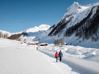
Partir pour une randonnée hivernale, sur des sentiers parfaitement tracés, c'est découvrir le côté paisible du Sud-Tyrol. Points de vue enchanteurs dans les Dolomites, forêts enneigées dans les tranquilles vallées voisines, dans la région du Kronplatz... Les endroits ne manquent pas où vous pouvez profiter de vous-même et de la nature, dans un silence absolu. En raquettes, vous vous éloignerez des pistes de ski et des remontées mécaniques pour découvrir des forêts encore totalement préservées. Mais, que ce soit en raquettes ou à pied, randonner en hiver dans le Sud-Tyrol sera toujours une expérience inoubliable.
1/2
San Cassiano/San Cassiano, Badia, Dolomites Region Alta Badia
easy
Difficulté
237 m
Gain d'altitude
1h:40 min
durée
1/3
Chienes/Kiens, Kiens/Chienes, Dolomites Region Kronplatz/Plan de Corones
medium
Difficulté
418 m
Gain d'altitude
2h:43 min
durée

Valdaora di Sopra/Oberolang, Olang/Valdaora, Dolomites Region Kronplatz/Plan de Corones
easy
Difficulté
24 m
Gain d'altitude
0h:16 min
durée
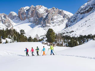
1/16
Selva/Sëlva/Wolkenstein/Sëlva, S.Crestina Gherdëina/Santa Cristina Val Gardana, Dolomites Region Val Gardena
medium
Difficulté
207 m
Gain d'altitude
2h:00 min
durée
S. Maddalena/St. Magdalena - Casies/Gsies, Gsies/Valle di Casies
easy
Difficulté
485 m
Gain d'altitude
1h:15 min
durée
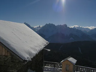
1/2
S. Candido/Innichen, Toblach/Dobbiaco, Dolomites Region 3 Zinnen
medium
Difficulté
715 m
Gain d'altitude
2h:30 min
durée
1/3
Falzeben/Falzeben, Hafling/Avelengo, Meran/Merano and environs
easy
Difficulté
145 m
Gain d'altitude
0h:52 min
durée
1/5
Avenes/Afens, Pfitsch/Val di Vizze, Sterzing/Vipiteno and environs
easy
Difficulté
12 m
Gain d'altitude
0h:55 min
durée
1/2
Casere/Kasern, Prettau/Predoi, Ahrntal/Valle Aurina
easy
Difficulté
98 m
Gain d'altitude
1h:15 min
durée
1/3
Alpe di Rodengo/Rodenecker Alm, Lüsen/Luson, Dolomites Region Lüsen Villnöss
medium
Difficulté
423 m
Gain d'altitude
3h:01 min
durée
1/2
Steinhaus/Cadipietra, Ahrntal/Valle Aurina, Ahrntal/Valle Aurina
easy
Difficulté
111 m
Gain d'altitude
1h:40 min
durée
Onies/Onach, St.Lorenzen/San Lorenzo di Sebato, Dolomites Region Kronplatz/Plan de Corones
easy
Difficulté
30 m
Gain d'altitude
1h:30 min
durée
Selva die Molini/Mühlwald, Mühlwald/Selva dei Molini, Ahrntal/Valle Aurina
easy
Difficulté
66 m
Gain d'altitude
1h:00 min
durée
Sesto/Sexten, Sexten/Sesto, Dolomites Region 3 Zinnen
easy
Difficulté
108 m
Gain d'altitude
0h:34 min
durée
1/16
Selva/Sëlva/Wolkenstein/Sëlva, S.Crestina Gherdëina/Santa Cristina Val Gardana, Dolomites Region Val Gardena
medium
Difficulté
80 m
Gain d'altitude
1h:10 min
durée
1/9
Montesole/Sonnenberg - Parcines/Partschins, Partschins/Parcines, Meran/Merano and environs
easy
Difficulté
128 m
Gain d'altitude
0h:55 min
durée
1/8
Pinzano/Pinzon, Montan/Montagna, Alto Adige Wine Road
medium
Difficulté
750 m
Gain d'altitude
5h:00 min
durée
1/5
Rio Lagundo/Aschbach, Algund/Lagundo, Meran/Merano and environs
easy
Difficulté
299 m
Gain d'altitude
3h:10 min
durée
1/4
Carezza/Karersee, Welschnofen/Nova Levante, Dolomites Region Eggental
easy
Difficulté
346 m
Gain d'altitude
5h:19 min
durée
Transacqua/Ennewasser, Martell/Martello, Vinschgau/Val Venosta
difficult
Difficulté
1424 m
Gain d'altitude
4h:16 min
durée
1/5
Nova Levante/Welschnofen, Welschnofen/Nova Levante, Dolomites Region Eggental
easy
Difficulté
274 m
Gain d'altitude
1h:40 min
durée
Sesto/Sexten, Sexten/Sesto, Dolomites Region 3 Zinnen
medium
Difficulté
702 m
Gain d'altitude
4h:00 min
durée
Selva/Sëlva/Wolkenstein/Sëlva, Urtijëi/Ortisei, Dolomites Region Val Gardena
easy
Difficulté
61 m
Gain d'altitude
2h:31 min
durée
Monte Scena/Schennaberg, Schenna/Scena, Meran/Merano and environs
easy
Difficulté
200 m
Gain d'altitude
1h:30 min
durée
1/2
S. Pietro/St. Peter - Valle Aurina/Ahrntal, Ahrntal/Valle Aurina, Ahrntal/Valle Aurina
easy
Difficulté
213 m
Gain d'altitude
2h:00 min
durée
Valdaora di Sopra/Oberolang, Olang/Valdaora, Dolomites Region Kronplatz/Plan de Corones
easy
Difficulté
25 m
Gain d'altitude
0h:15 min
durée
1/2
Vallesina/Versein, Mölten/Meltina, Bolzano/Bozen and environs
medium
Difficulté
601 m
Gain d'altitude
4h:04 min
durée
medium
Difficulté
0 m
Gain d'altitude
2h:00 min
durée
1/6
Chienes/Kiens, Kiens/Chienes, Dolomites Region Kronplatz/Plan de Corones
easy
Difficulté
50 m
Gain d'altitude
1h:30 min
durée
1/3
Verano/Vöran, Vöran/Verano, Meran/Merano and environs
easy
Difficulté
18 m
Gain d'altitude
0h:25 min
durée