E-Bikes
Olang/Valdaora, Dolomites Region Kronplatz/Plan de Corones
From the Antholz Valley to Niederolang and further on to Mitterolang.
From the Antholz Valley to Niederolang and further on to Mitterolang.
Passo di Monte Giovo Tour
San Leonardo, Passiria – Valtina – Passo di Monte Giovo –
Valtina – San Leonardo, Passiria
You start your tour to Sexten/Sesto in Niederdorf/Villabassa. You leave the village in an easterly direction. Then turn right at Camping Olympia. Here you follow the bike path past the beautiful villages of Toblach/Dobbiaco and Innichen/San Candido, which are worth a visit. Your tour continues into the Sexten/Sesto Valley. Also suitable for e-bikes.
Along the Pustertal cycling route to Welsberg / Monguelfo.
Bike tour Riffian/Rifiano - Vernuer/Vernurio - Riffian/Rifiano
Circuito di Naturno (Naturno – Plon – Kreuzbrünnl lungo la Bike Highline Meran/o fino a Ötzi trail – Platzgumm – Ötzi Flow Trai - Naturno)
The beginning of our Bolzano bike-tour is the Talvera/Talfer bridge. We follow the cycle-lane along the left-hand bank of the river, going northwards, passing idyllic Castle Mareccio/Maretsch, nestling in the vineyards, up to Sant'Antonio/St. Anton, where the valley begins to narrow, and on to the fairy-tale Castle Roncolo/Runkelstein with its amazing frescoes. After visiting the castle (leave your bike in the bike-park below, before walking up the short but steep path to the castle), you make your way back to the Talfer bridge. At the Piazza Vittoria/Siegesplatz you could visit the new museum-display entitled "BZ 18-45" in the crypt of the Victory Monument. Then we cycle down the Corso Libertá/Freiheitsstrasse to the square of Gries, formerly a village-municipality in its own right and an internationally-renowned spa. The square is dominated by the massive baroque parish church and Benedictine monastery. Nearby is the old parish church of Gries with its romantic cemetery outside and a gem of Gothic wood-carving inside, the beautiful altar by Michael Pacher. From Gries we take the Vittorio Veneto street westwards. For the first 100 metres you will really need to pay attention to the traffic until you hit the cycle lane again. You then pass farms and vineyards before you come to the hospital. Here the cycle lane forks and you head for the Via Druso/Drususstraße. At the big roundabout follow the signs for Appiano/Eppan as far as the bridge, then take the cycle lane to Castle Firmiano/Sigmundskron and the Messner Mountain Museum. The way back follows the bank of the Isarco/Eisack river, passing below several bridges. After the swimming pool complex we turn left just before the yellow iron bridge, now following the Talvera river until we come opposite the futuristic glass cube of the Museion modern art gallery. We are now back in the town centre, but we have to watch out: the Via Museo/Museumstraße, the Piazza Erbe/Obstplatz and the Piazza Walther Platz are pedestrianized and closed to cyclists, so that means pushing the bike. If you still have got some energy left, you could visit the Ötzi Museum, the Civic museum or the Natural History Museum.
From Graun, the wonderful Langtaufers valley opens up to the east. First, follow the asphalt road in the direction of Melag until the fork in Kapron. In Kapron, turn right in the direction of Riegl and then follow the shady forest path to the Kaproner Alm alpine pasture (1,960 m), which is closed. Continue slightly up and down to the Masebner Alm alpine pasture, which is closed as well. Following the path upwards, sometimes a bit steep - arrive at the Maseben mountain hut at 2,267 m. Here the innkeeper of the hut welcomes guests with traditional schnapps and local foods. The 2 km back to the Masebner Alm continue towards the valley and Karlin creek. Once on the forest road, turn right and follow a beautiful forest path along the rushing stream to the Melager Alm alpine pasture. Enjoy the views of the glacier world from the rest areas and then follow the forest path again on the orographic left bank to Riegl. Here go briefly uphill to the main road in Kapron. This road will lead you back to Graun.
The Regglberg is a high-altitude plateau rising above the eastern shores of the Etsch / Adige River. If you choose to ascend from Leifers / Laives to Deutschnofen / Nova Ponente, you'll land in a landscape of alpine meadows. Here you'll find plenty of rest-stop options – too many, in fact, since you couldn't possibly stop for a break in every inn and cafe situated along this challenging and long tour.
This tour is challenging, but allows you to explore the east of the Etsch / Adige Valley, on the fringe of the foot of the Dolomites. The meadow landscape at the Regglberg between Deutschnofen and Aldein / Aldino resembles a verdant carpet stretching out in front of the impressive Latemar – from the perspective of Kaltern, the nearest outpost of the Dolomites, this most-prominent peak looms 2,842 meters above sea-level. But to approach it, you'll have to constantly pedal. The first milestone of your journey is the Mitterberg / Monte di Mezzo, accessible via the little Pass Road and the Kreither Saddle and then into the Etsch / Adige Valley. After a couple of relatively level kilometers, you'll reach Leifers / Laives, where the Branten Valley indicate the continued upward direction. At the upper end of the Branten Valley, you'll find the town of Deutschnofen / Nova Ponente perched on a high-altitude plateau. There is a path in the valley basin for your ascent, but the winding trails on the north flank of the valley offer more scenic beauty and are just as quick – besides giving you more panoramic views towards Deutschnofen. You will now proceed upwards into the rolling meadow landscape. You've mastered the steep uphill grade; now, it's a constant up and down. This route offers beauty and variety, and every couple of kilometers, you can take a rest-stop at one of the many charming inns and cafes along the way: the Laabalm, the Neuhütt-Alm, the Schmiederalm, or the Schönrast-Alm. In view of this wealth of options, you might be tempted to spend too much time here – but don't forget: The return leg is still ahead of you! The trail will first take you down into the Etsch Valley. But because the direct way from the Regglberg into the valley is possible only via very steep trails that are best traversed on foot, you'll have to instead take a slight diversion and follow the trail along the former Fleims / Fiemme Valley railroad, which displays a pleasant downhill grade at Montan / Montagna. And you'll be treated to spectacular scenery along the way: First, there's the unobstructed view of the valley, then the rolling terrain of the Castelfeder biotope with its mystical medieval cult site. Once you've arrived in Auer / Ora, you can traverse the Etsch River and quickly reach Lake Caldaro. On warm summer days, you could now take a pleasant dip at Klughammer. After a refreshing dip, you'll be ready to attack the final 200 meters of altitude differential from the lake up to Kaltern / Caldaro.
On the Pustertal cycling route from the Antholz Valley to Bruneck.
This bike route through the Isarco Valley is a pleasure tour that offers idyllic scenery. Rolling hills, small towns and cultural treasures line this well-marked bike route, which leads from Brennero to South Tyrol’s capital city of Bolzano. The Brennero/Brenner–Bolzano/Bozen Bike Route starts at the Brenner Pass and runs along the former railway line, which is at a slight downhill grade, to Vipiteno/Sterzing. The marked bike path then continues, partly flat and with a light ascent, through picturesque villages and small hamlets up to Franzensfeste Fortress, past Lake Vahrn, and along the Kastanienweg (Chestnut) Trail towards Novacella/Neustift Abbey and then continuing on towards Bressanone/Brixen. The section from Bressanone to Bolzano is again a brisk ride through the narrow Isarco Valley, with a stopover in the little artists’ town of Chiusa/Klausen, known for its imposing hilltop Säben Abbey. From there, the route continues to the capital city of Bolzano. The Brennero/Brenner–Bolzano/Bozen Bike Route runs a total length of 96 kilometers from Brennero to Bolzano.
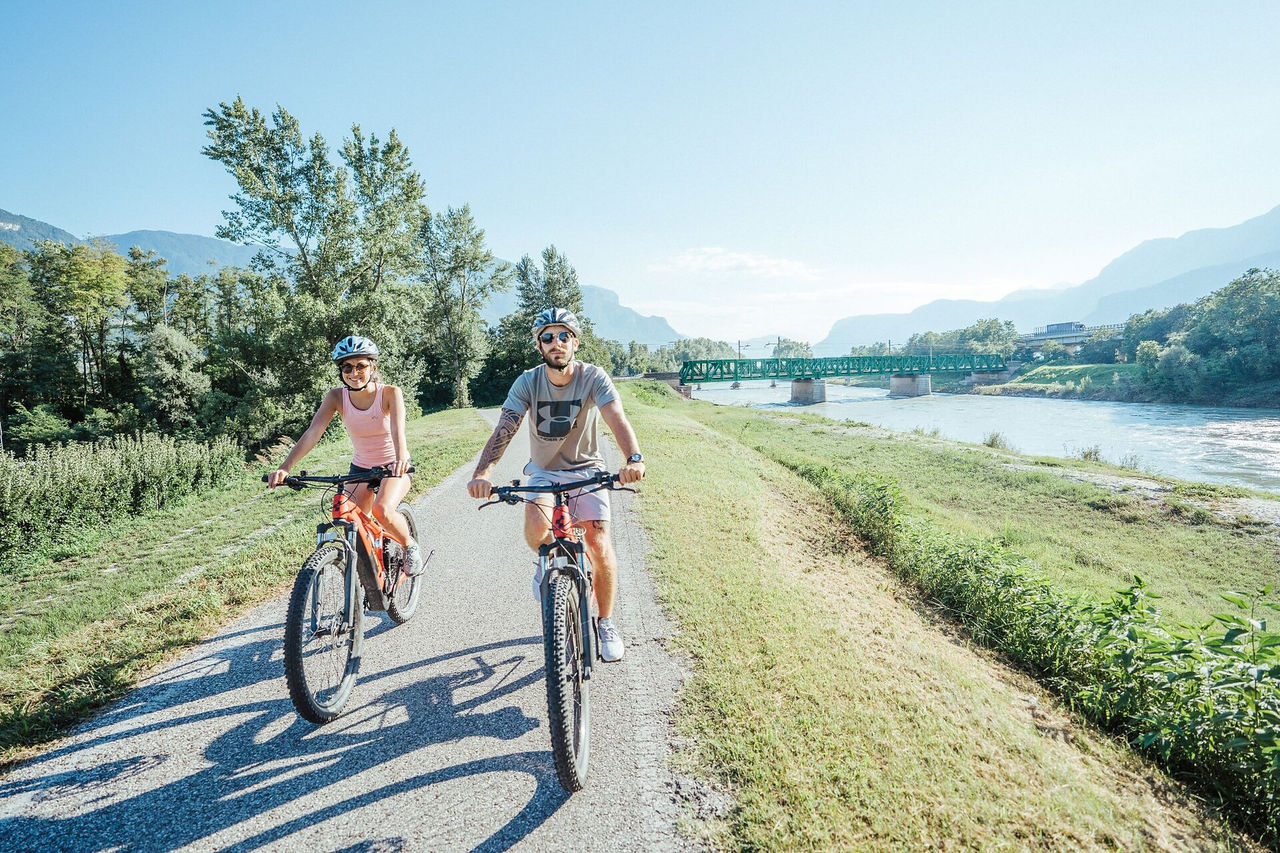
Enjoy mountain bike tours also on steeper trails with the latest e-bike. Even beginners will be impressed by the electric mobility! Explore effortlessly the Geisler mountain landscape with an E-Bike. It’s emission-free, climate-friendly and without being stiff and sore.
E-Bikes are for everyone due to the very simple operation. Overcome steep inclines with ease and cycle into the wind with a smile on your face, because that makes your bike trip even more fun.
The Adige cycling path along the Via Claudia Augusta is a cultural experience through gardens and architecture. The cycling path leads you through the beautiful landscapes of the Etschtal Valley from the Vinschgau Valley to Merano/Meran and to the south to Bolzano/Bozen and Caldaro/Kaltern. Here is the description of the tour from Stava/Staben near Naturno/Naturns to Nalles/Nals, which leads you to Merano and further south. Without any big efforts you can explore the wide valley. The tour is ideal for families and bikers who want to take it slow.
https://maps.merano-suedtirol.it/en/etschradroute
South Tyrol is a paradise for cyclists: well-developed bike paths, gentle hills, idyllic vineyards, and charming historic towns make every tour a unique experience. Five of Italy’s most beautiful villages, recognized as “Borghi più belli d’Italia”, are located in South Tyrol: Castelrotto, Egna, Glorenza, Chiusa, and Vipiteno.
This collection takes you on a cycling journey to these historic places, each full of winding alleys, centuries-old architecture, and a truly special atmosphere. The routes lead you along peaceful river valleys, through lush vineyards and orchards, and across rolling hills with stunning panoramic views. You’ll ride past ancient castles, under arcades, and over cobbled streets that whisper stories from the past.
The small squares and charming corners are just some of the highlights of these beautiful village centers. Whether you're an active cyclist or simply looking to relax and enjoy the landscape, these tours perfectly combine nature, culture, and pleasure. Hop on your bike, discover South Tyrol’s most beautiful borghi, and experience the region from a whole new perspective!
By the way: you can ride the full route as a multi-day tour, or explore each stage as a day trip – depending on how much time you have. The final stage of the multi-day route follows the same path back to Chiusa, allowing you to enjoy a complete cycling experience each day and explore all of the borghi equally. You’ll find tips for getting to each day tour in the individual descriptions.
On the Pustertal cycling route from the Antholz Valley to Bruneck and then in direction Ahnrtal to Sand in Taufers to the starting point of the waterfalls Reinbach. From there you can visit the waterfalls on foot.
The scenery is dominated by the panorama of the Dolomites UNESCO World Heritage. The route follows the old railway from Toblach/Dobbiaco to Cortina d´Ampezzo, from the Hochpustertal/Alta Pusteria valley across the Höhlensteintal/Val di Landro valley, past lakes and the View of the Three Peaks.
WARNING: CLOSURE WITH DEVIATION FROM 01.04.2022
In the period from 01.04. to 09.07.2022, the rink route from the Nordic Arena - Dobbiaco Lake to the Nasswand will be closed with diversion to an alternative route.
Planimetry
The South Wine Route then runs about 40 km in a long circuit to Salorno / Salurn, the southernmost community of South Tyrol. Along the way, you'll pass through the charming wine villages of Tramin / Termeno, Kurtatsch / Cortaccia, Margreid / Magrè, and Kurtinig / Cortina all’Adige as you glide along the Wine Route.
The South of South Tyrol: Bicycle tour
This tour begins at the square in front of the large winery cooperatives (Kellerei Kaltern and Erste + Neue). From here, the bike trail will lead you through the vineyards and down to Lake Caldaro and past its eastern shore (by Klughammer) towards Auer / Ora. You'll pass the reeds and the biotope on the southern banks of the lake before the route enters the Auer-Tramin Bicycle Trail. There, it also bends into the South Wine Route. You can ride on it in either direction. In other words: There are two paths to the southernmost point in Salurn.
If you now take the right turn, you'll first proceed on the South Tyrolean Wine Route and enter into the historic wine village Tramin / Termeno. The Gewürztraminer variety of grape – which is indigenous to this locality and is used to make some of the finest wines available – is named after this village. The route continues to the south through the historical wine village of Kurtatsch / Cortaccia and past the famous "original grapevine" grafted here in the year in Margreid / Magrè. From here, you will proceed to Kurtinig – often referred to as "Little Venice" by the locals because it is flooded so often. It's only now that the route crosses the Etsch River. Salurn is located on its eastern side. You can take the short side-trip to the Haderburg – which was established here on a rocky prominence in the 11th century as a fortress.
On the return trip back to Kaltern, you will encounter the villages of Neumarkt / Egna and Auer / Ora on this side of the valley. In Neumarkt, you ought to visit the centuries-old and impressive leafy arcades in the center (which is closed to motor traffic). It's a wonderful opportunity to exit the hustle-and-bustle of modern times and immerse yourself in the Middle Ages. You can admire the handsome old manors, enjoy the coolness of the arcades, and explore the village's shopping options.
Farther to the north, the bicycle trail will take you past the Castelfeder biotope – an ancient cult site located on a wild, romantic hilly landscape abounding with fascinating geological formations and enormous boulders left behind by receding glaciers, and that has lost none of its magical appeal. If you wish, you can now pay a visit to Auer before continuing across the Etsch River to Lake Caldaro and up to Kaltern.
A fitting conclusion would be, e.g., a visit to the wine house at the starting-point / finish line of this tour. Or at the market square. The "Punkt" wine house there carries a wide assortment of wines from the Lake Caldaro area.
Variants: At Margreid / Magrè and Neumarkt / Egna, there are two additional bridges over the Etsch River which you can use as short-cuts. There is also rail service between Salorno / Salurn, Kurtinig / Cortina, Margreid, Neumarkt, and Auer – a great way to save yourself a few kilometers (www.suedtirolmobil.info).
General information about these three wine village tours:
Biking along the South Tyrolean Wine Route is always a very special experience. Mild temperatures and about 300 days of sunshine per year make the oldest Wine Route of Italy an ideal place for active vacationers and pleasure-seekers wishing to explore the vicinity by bike. The three pleasure cycling routes of the low-traffic South Tyrolean Wine Route offer a wealth of options to experience the vineyards, visit the wine cellars, and explore the castles. The three wine routes (North, Middle, and South) display almost no significant grades – and they can be cycled throughout the year, both individually and in combination.
This is a wild and demanding gravel tour which will take you across the "Green Line" of the South Tyrolean forests and down to Lago Santo ("Lake Heilig") in Trentino. You'll proceed along winding forest trails and curving paths – requiring a good command of your gravel bike on earthy terrain.
You'd better have an adventurous spirit if you want to undertake this tour. In the border area between South Tyrol and the province of Trentino, you'll be passing through seemingly endless forests radiating an enchanting quality. There are many reasons to undertake this tour: You'll love the unparalleled peace and quiet – in part on earthy trails where you can have some fun. And idyllic "Lago Santo" is certainly a worthwhile destination. You'll first proceed at a quick pace via Lake Caldaro and down into the Etsch / Adige Valley. You'll start your ascent on the valley's left flank near Auer / Ora. The trail along the former Fleims / Fiemme Valley railroad will afford you splendid views of the "South of South Tyrol." Once you've passed the last few hamlets, you'll be leaving civilization and ascending on forest roads to the Gfrill Saddle. After a short ascent, you'll arrive in the hamlet of Gfrill / Cauria, 1,000 meters above the Etsch Valley, the last small outpost of South Tyrol before you pass over the provincial border to Trentino. You'll enter into this wild forest and proceed along earthy trails on your way to Lake Heilig. But the adventure isn't over yet! First, there's an exciting descent where you'll come out in Salorno / Salurn, on the shores of the Etsch River. The Etsch Bicycle Trail is the quickest connection back to Lake Caldaro where you can perhaps take a refreshing dip and maybe enjoy a snack near Klughammer. The real end of this tour is only after you have accomplished the final 200 meters of altitude differential on your way to Kaltern / Caldaro. But you'll already have rest-stop options along the way – e.g., at the Albergo Lago Santo or in Salurn. Neumarkt / Egna is likewise worth a side-trip. The bicycle trail will lead you right to it.
Variants: This tour can also be taken in the reverse order. However, when cycling from Salorno / Salurn up to Lake Heilig, you'll have to overcome slight ramps.
Short and very varied circular tour near San Vigilio, between the meadows and fields of the many mountain farms and adjoining woods.
Aby zakończyć rejestrację, otwórz e-mail, który właśnie wysłaliśmy, i kliknij link potwierdzający.
Nie widzisz wiadomości? Sprawdź folder spam.