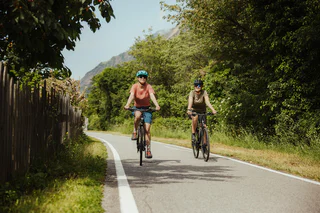
1/3
Mölten- Schlaneid- Cable Car to Vilpian- Terlan- Mölten
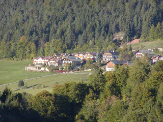
Vallesina/Versein, Mölten/Meltina, Bolzano/Bozen and environs
medium
Moeilijkheidsgraad
1476 m
Hoogteverschil
43.5 Km
Route
1/3
Vallesina/Versein, Mölten/Meltina, Bolzano/Bozen and environs
medium
Moeilijkheidsgraad
1476 m
Hoogteverschil
43.5 Km
Route
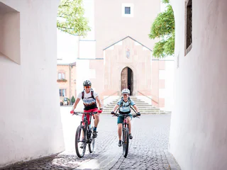
1/4
Malles/Mals, Mals/Malles, Vinschgau/Val Venosta
medium
Moeilijkheidsgraad
1249 m
Hoogteverschil
26.4 Km
Route

Cortaccia s.S.d.V./Kurtatsch, Kurtatsch an der Weinstraße/Cortaccia sulla Strada del Vino, Alto Adige Wine Road
easy
Moeilijkheidsgraad
473 m
Hoogteverschil
40.0 Km
Route

1/2
Siusi/Seis, Kastelruth/Castelrotto, Dolomites Region Seiser Alm
medium
Moeilijkheidsgraad
842 m
Hoogteverschil
10.0 Km
Route
1/3
Karthaus/Certosa, Naturns/Naturno, Meran/Merano and environs
medium
Moeilijkheidsgraad
912 m
Hoogteverschil
9.2 Km
Route
1/4
Parcines/Partschins, Algund/Lagundo, Meran/Merano and environs
easy
Moeilijkheidsgraad
765 m
Hoogteverschil
30.9 Km
Route
1/3
Cortaccia s.S.d.V./Kurtatsch, Kurtatsch an der Weinstraße/Cortaccia sulla Strada del Vino, Alto Adige Wine Road
easy
Moeilijkheidsgraad
436 m
Hoogteverschil
62.7 Km
Route
1/4
Cauria/Gfrill, Salorno/Salurn, Alto Adige Wine Road
medium
Moeilijkheidsgraad
1741 m
Hoogteverschil
121.4 Km
Route
Caldaro Paese/Kaltern Dorf, Kaltern an der Weinstraße/Caldaro sulla Strada del Vino, Alto Adige Wine Road
difficult
Moeilijkheidsgraad
1936 m
Hoogteverschil
76.2 Km
Route
Nove Case/Neunhäusern, Rasen-Antholz/Rasun Anterselva, Dolomites Region Kronplatz/Plan de Corones
difficult
Moeilijkheidsgraad
1656 m
Hoogteverschil
38.0 Km
Route
Resia/Reschen, Graun im Vinschgau/Curon Venosta, Vinschgau/Val Venosta
easy
Moeilijkheidsgraad
30 m
Hoogteverschil
2.5 Km
Route
1/4
Marlengo/Marling, Mals/Malles, Vinschgau/Val Venosta
medium
Moeilijkheidsgraad
892 m
Hoogteverschil
63.3 Km
Route
Novale/Ried - San Martino i.P./St. Martin i.P., St.Martin in Passeier/San Martino in Passiria, Meran/Merano and environs
medium
Moeilijkheidsgraad
682 m
Hoogteverschil
17.5 Km
Route
Colle/Koll, Villnöss/Funes, Dolomites Region Lüsen Villnöss
medium
Moeilijkheidsgraad
0 m
Hoogteverschil
673.0 m
Route
Lana di Sotto/Niederlana, Lana, Meran/Merano and environs
difficult
Moeilijkheidsgraad
0 m
Hoogteverschil
113.3 Km
Route
Naturno/Naturns, Naturns/Naturno, Meran/Merano and environs
easy
Moeilijkheidsgraad
1250 m
Hoogteverschil
23.9 Km
Route
1/4
Marlengo/Marling, Mals/Malles, Vinschgau/Val Venosta
easy
Moeilijkheidsgraad
168 m
Hoogteverschil
60.8 Km
Route
Transacqua/Ennewasser, Martell/Martello, Vinschgau/Val Venosta
medium
Moeilijkheidsgraad
764 m
Hoogteverschil
11.0 Km
Route
Montesole/Sonnenberg - Parcines/Partschins, Partschins/Parcines, Meran/Merano and environs
easy
Moeilijkheidsgraad
821 m
Hoogteverschil
17.1 Km
Route
1/3
Ora/Auer, Auer/Ora, Alto Adige Wine Road
easy
Moeilijkheidsgraad
0 m
Hoogteverschil
0.0 m
Route
1/3
Malles/Mals, Mals/Malles, Vinschgau/Val Venosta
medium
Moeilijkheidsgraad
1051 m
Hoogteverschil
30 Km
Route
Nove Case/Neunhäusern, Rasen-Antholz/Rasun Anterselva, Dolomites Region Kronplatz/Plan de Corones
medium
Moeilijkheidsgraad
778 m
Hoogteverschil
18.1 Km
Route
1/4
Tubre/Taufers i. M., Mals/Malles, Vinschgau/Val Venosta
easy
Moeilijkheidsgraad
355 m
Hoogteverschil
22.5 Km
Route
Cortaccia s.S.d.V./Kurtatsch, Kurtatsch an der Weinstraße/Cortaccia sulla Strada del Vino, Alto Adige Wine Road
easy
Moeilijkheidsgraad
545 m
Hoogteverschil
46.6 Km
Route
Maranza/Meransen, Bolzano/Bozen, Bolzano/Bozen and environs
medium
Moeilijkheidsgraad
327 m
Hoogteverschil
103 Km
Route
Caminata di Tures/Kematen, Sand in Taufers/Campo Tures, Ahrntal/Valle Aurina
medium
Moeilijkheidsgraad
92 m
Hoogteverschil
15.9 Km
Route
1/3
Scena/Schenna, Schenna/Scena, Meran/Merano and environs
easy
Moeilijkheidsgraad
369 m
Hoogteverschil
19.5 Km
Route
1/3
Naturno/Naturns, Naturns/Naturno, Meran/Merano and environs
medium
Moeilijkheidsgraad
455 m
Hoogteverschil
38.5 Km
Route
1/2
Kastelruth/Castelrotto, Sterzing/Vipiteno, Sterzing/Vipiteno and environs
medium
Moeilijkheidsgraad
984 m
Hoogteverschil
65.3 Km
Route
Nove Case/Neunhäusern, Rasen-Antholz/Rasun Anterselva, Dolomites Region Kronplatz/Plan de Corones
medium
Moeilijkheidsgraad
342 m
Hoogteverschil
25.3 Km
Route
Bedankt voor je inschrijving!
Inschrijving al actief
Bevestig je inschrijving
Om je inschrijving te voltooien, open de e-mail die we je net hebben gestuurd en klik op de bevestigingslink.
Niet gevonden? Kijk ook even in je spammap.
Je ontvangt al onze exclusieve aanbiedingen, handige tips en speciale suggesties om volop van je vakantie te genieten.
Je hebt je al geprobeerd in te schrijven voor onze nieuwsbrief maar deze nog niet bevestigd. We hebben je de e‑mail zojuist opnieuw gestuurd. Controleer je inbox en je spammap en bevestig nu.


