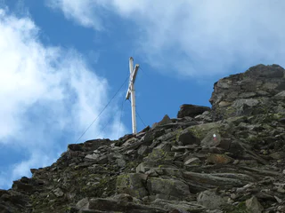
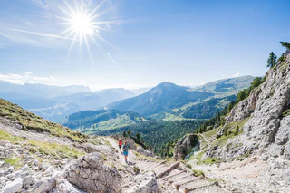
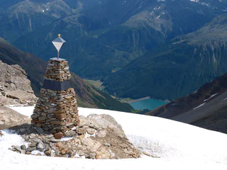
Skip to content
added to favourites
removed from favourites
Oops! Something went wrong. Try again
Your account is being created
Your account has been successfully created and you are now logged in
You are logged out.
Filter
Selected filters
    Level of difficulty
    Duration
    Distance in KM

    All mountain peak tours

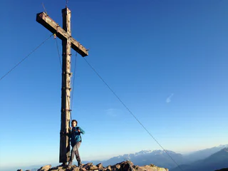
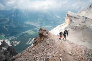
    Explore South Tyrol's unique mountain peaks while climbing the most beautiful peaks. Safe tours bring you to your destination and enable a mountain experience that you will not soon forget.

    Results
    Mountaineering
    Punta di Trumes (Gamseck)
    Kastelbell-Tschars/Castelbello-Ciardes, Vinschgau/Val Venosta

    The route on the sunny side is mostly snow-free and offers special mountain experiences, especially in early summer and autumn.

    Difficulty: difficult
    1510 altitude up
    6h:00 min duration
    Hiking
    Summer hiking tour - Prato Piazza/Plätzwiese - Monte Specie/Strudelkopf
    Prags/Braies, Dolomites Region 3 Zinnen

    From the Plätzwiese/Prato Piazza alpine guesthouse to Dürrenteinhütte/Rifugio Vallandro hut and to the old Austrian Prato Piazza works. From there to Strudelkopf/Monte Specie ridge and on easy terrain to the summit. Sign-post: No. 37, from Dürrensteinhütte/Rifugio Vallandro hut No.34

    Difficulty: medium
    359 altitude up
    1h:28 min duration
    Mountaineering
    Hike to the Weißhorn Mountain
    Deutschnofen/Nova Ponente, Dolomites Region Eggental

    This uniquely beautiful summit tour provides a panoramic view of the Rosengarten, Latemar and Zanggen peaks, as well as the surrounding villages in the Val d'Ega/Eggental valley.

    Difficulty: difficult
    0 altitude up
    6h:30 min duration
    Mountaineering
    Ifinger Summit Hike
    Schenna/Scena, Meran/Merano and environs

    This hike on the Ifinger, Scena's local mountain, provides a magnificent panoramic view of the Merano mountains, but requires a head for heights and is only recommended for sure-footed, experienced hikers.

    Difficulty: medium
    754 altitude up
    3h:00 min duration
    Mountaineering
    Mountain hiking on Monte Luco
    U.L.Frau i.W.-St. Felix/Senale-S.Felice, Meran/Merano and environs

    Mountain hike to the panoramic summit of the Mount Luco (2434 m). The hike starts at the Gampenpass/Passo Palade (1518 m) on the opposite side of the Gasthof Gampenpass hotel. The hiking path no. 10A leads you in 1,5 hour to the Laugen Alm - Malga Monte Luco. After a short break at the Alm the tour continuous on the hiking path 10 to the peak of Mount Luco (2434 m). Just before of the last steep ascent, on a small mountain saddle you have the option to take the less technical way to the top of the Monte Luco Piccolo (2290 m). Between the summits oft the great and small Mount Luco there is the beautiful and magnificent mountain lake Luco. Thanks to its widely outlook and awe-inspiring view, the Mount Luco belongs to one of the most outstanding lookouts of South Tyrol. The way back is along the hiking path no. 8A through the grass-grown south ridge and then on the hiking path no 10A firsts toward the Laugen Alm and further down to the Gampen Pass.

    Difficulty: medium
    920 altitude up
    3h:12 min duration
    Mountaineering
    Round walk Redagno-Corno Bianco
    Aldein/Aldino, Bolzano/Bozen and environs

    The tour starts at the GEOMuseum of Radein, near the parking space behind the church. We follow the road "W", called Zirmersteig, to the Lahnerwiesen. On the way you can enjoy wonderful views into the GEOparc Bletterbach canyon. Following the forest road through mountain pines and across boulders we reach the top of the Weißhorn. 360° astonishing view to the tops of the Dolomites, the Sarntaler Alpen, the Brenta-mountains and the Texler-mountains.

    After the break a road in the south goes down to the Jochgrimm, from there we follow the road 7 over fresh meadows back to the start point.

    Difficulty: medium
    0 altitude up
    4h:30 min duration
    Hiking
    Lake Tarres
    Latsch/Laces, Vinschgau/Val Venosta

    Simple tour for the whole family to the Lake Tarres, which lies in the middle of the forest and invites you to dream and linger.

    Difficulty: medium
    291 altitude up
    1h:26 min duration
    Hiking
    Zufritt Peak
    Martell/Martello, Vinschgau/Val Venosta

    From the Lake Gioveretto up to the Grün- and Gelbsee Lake until the Gioveretto Peak with its wondreful view.

    Difficulty: difficult
    1583 altitude up
    4h:54 min duration
    Hiking
    Orecchia di Lepre
    Latsch/Laces, Vinschgau/Val Venosta

    High mountain tour to the peak that dominates Laces – an "easy" three-thousander

    Difficulty: difficult
    1362 altitude up
    5h:05 min duration
    Hiking
    Mittagspitze
    Ratschings/Racines, Sterzing/Vipiteno and environs

    Starting point is the hamlet Schluppes at the end of the Jaufental valley. From this point first you go 600 meters along a forest and then on the path no. 12 further into the valley. Turn left at the sign Mittagsspitze/no. 16 and walk up the quite steep way through the mountain forest. Continue on the marked trail over the tree line and towards the avalanche barrier under the mountain Mittagsspitze. The last piece again steeply along the ridge, to the summit cross at 2052 m. Hike the same path back to reach the starting point.

    Difficulty: medium
    710 altitude up
    2h:53 min duration
    Mountaineering
    Ciardes weather cross
    Kastelbell-Tschars/Castelbello-Ciardes, Vinschgau/Val Venosta

    The view from the Ciardes weather cross into the Vinschgau and into the Martelltal Valley is wonderful.

    Difficulty: difficult
    657 altitude up
    2h:10 min duration
    Hiking
    Rifugio Nino Corsi & Rifugio Martello
    Latsch/Laces, Vinschgau/Val Venosta

    Marvelous hike in Alta Val Martello, to the rustic refuges with a magnificent view of the Ortler mountain group in the heart of the Stelvio National Parc.

    Difficulty: easy
    550 altitude up
    2h:46 min duration
    Mountaineering
    Peak Roteck / Monte Rosso (3.337 m)
    Partschins/Parcines, Meran/Merano and environs

    The Roteck/Monte Rosso peak is the highest three-thousand-meter peak in the Texelgruppe Nature Park. Due to the long and partly steep ascent through the Zieltal, this tour is best divided into two days. The Lodnerhütte can be used as an overnight accommodation.

    Difficulty: difficult
    2467 altitude up
    9h:41 min duration
    Hiking
    Punta di Lasa
    Martell/Martello, Vinschgau/Val Venosta
    The massive mountain, in Val Venosta known as the Laaser Peak, offers an impressive panorama and numerous meditative places. The path runs through light larch and Swiss stone pine (Pinus cembra) stands, across flowering alpine lawns and leads in the imposing rocky zone through a plateau with stone-men as an orientation aid, the "Steinmann Gasseloch". If there is strong wind, organ pipes are said to sound there, hence the Martell name "Orgelspitze". Via a pathless but well marked blocky summit, one reaches the highest point at 3305m.
    Difficulty: difficult
    1326 altitude up
    4h:25 min duration
    Mountaineering
    Similaun Alpine Tour
    Schnals/Senales, Meran/Merano and environs

    This challenging glacier tour for experienced Alpinists, featuring magnificent views of the Ötztal Alps, begins in the Vernago/Vernagt car park with limited parking spaces.

    Difficulty: difficult
    1909 altitude up
    9h:00 min duration
    Hiking
    Saxner
    Ratschings/Racines, Sterzing/Vipiteno and environs

    From the end of the valley Ratschings/Racines follow path no. 10, walk steeply at first through the mountain forest, then up through alpine meadows to the inner pasture of Wumblsalm. Following the mark you will reach the pass Schlotterjoch (2,283 m), left from here, on path no. 12 climb to the top of the mountain Saxner. From here you will enjoy a spectacular view, on a clear day as far as to the mountain Ortler-area! The decent follows the same route.

    Difficulty: medium
    1303 altitude up
    5h:45 min duration
    Hiking
    Ebenes Jöchl
    Martell/Martello, Vinschgau/Val Venosta

    Crossing different altitudes you reach the top where you can enjoy a splendid view.

    Difficulty: difficult
    632 altitude up
    3h:00 min duration
    Mountaineering
    Peak Lazinser Rötelspitze/Cima Rossa (3,037 m)
    Partschins/Parcines, Meran/Merano and environs

    The Lazinser Rötelspitze/Cima Rossa Summit (3,037 m) is one of the most popular summits in the area of Meran/o and environs in the Texel Group Nature Park!


    Difficulty: difficult
    2146 altitude up
    8h:00 min duration
    Hiking
    Lyfi peak
    Martell/Martello, Vinschgau/Val Venosta
    This ski-tour starts at the Lake Gioveretto, from there you follow the path no. 10 to the managed Malga Lyfi. There you pass the mountain hut on your right and continue through the forest by following the same signposting until the junction of paths. When you reach the "Lyfiknott", a wonderful snow-covered winter landscape awaits you. From there the way is steep and demanding, but when you reach the Lyfi Peak, you have a wonderful view over the snow-covered Val Venosta.
    Difficulty: difficult
    1424 altitude up
    4h:16 min duration
    Hiking
    Mareiter Stein
    Ratschings/Racines, Sterzing/Vipiteno and environs

    Starting from Pardaun/farm Platzhof (parking in Pardaun, no available parking at the farm Platzhof). In front of the farm Platzhof to the left, at first follow a wider path, no. 25, which tightens to a narrow path through the woods and leads into a steeper climb towards the timberline. Then with a wonderful panoramic view along the broad ridge of the mountain to the large summit plateau with its cross. The return follows the same route as the ascent.

    Variant: Starting from Gasse/Entholz along the path no. 24 and later on the path no. 25 to the pasture Wurzeralm. Always on path no. 25 it goes up to the Mareiter Stein. The return goes first on the path no. 25 and then on path no. 25B to the pasture Kerschbaumeralm. Contiune on path no. 23 to the Joggelealm and in the descent briefly on path 24B and 24A down to Gasse. Duration 5 hours.

    Difficulty: medium
    1104 altitude up
    6h:30 min duration
    Mountaineering
    To the peak of the Plattkofel
    Kastelruth/Castelrotto, Dolomites Region Seiser Alm

    The Plattkofel is the only summit of the Langkofel group which can be tackled with success by inexperienced climbers. The ascent does, however, require a good level of physical fitness and, above all, surefootedness when you get to the summit ridge. The scene which awaits at the ridge is more than ample compensation for the ascent, as your view sweeps down to the Plattkofel cirque, over the Seiser Alm and on to the Vinschgau/Ötztal and Ortler Alps.

    Difficulty: difficult
    964 altitude up
    3h:01 min duration
    Mountaineering
    High Altitude Trail Lausitz
    Prettau/Predoi, Ahrntal/Valle Aurina

    The High Altitude Lausitz is one of the oldest high-altitude trails through the mountains of the rearmost Valli dei Tures e Aurina-Tauferer Ahrntal valley. It leads from the Birnlücke Pass/ Passo Forcella di Picco to Hundskehljoch Pass/Passo del Cane.

    The hike is rated intermediate for level of difficulty and offers unforgettable moments. The tour requires experience, not to suffer from vertigo, sure-footedness, physical fitness as well as suitable equipment. 

    Difficulty: difficult
    2000 altitude up
    9h:30 min duration
    Mountaineering
    Sarner Scharte Gap and Villanderer Berg Mountain
    Sarntal/Sarentino, Bolzano/Bozen and environs

    Sarner Scharte, Sarentino/Sarnthein’s local mountain, is a ridge which extends from the frazione of Ponticino/Bundschen to the frazione of San Martino/Reinswald.

    Difficulty: medium
    1002 altitude up
    5h:07 min duration
    Mountaineering
    Peak Tschigat (3.000 m)
    Partschins/Parcines, Meran/Merano and environs

    The popular Tschigat summit (Tschigot) is one of the 13 peaks in Partschins/Parcines rising above 3,000 meters.
     

    Difficulty: difficult
    2224 altitude up
    8h:09 min duration
    Mountaineering
    Wilde Kreuzspitze
    Mühlbach/Rio di Pusteria, Brixen/Bressanone and environs

    From Fane Alm (1,741 m), the prettiest Alpine-farm village in South Tyrol, follow trail no. 17 as it climbs gently through the "Schramme" gorge to the Brixner Hütte mountain hut (2,282 m). Here you can often see marmots on the hillsides to the left and right. The trail continues over the Sandjöchl saddle (2,651 m), then, where the trail forks, you continue on trail no. 2A and along the ridge on the difficult mountain trail no. 2 to just before the peak, where trail no. 18 takes you up to the summit cross (3,132 m). The highest peak in our Alpine-pasture region rewards hikers with magnificent views of the surrounding mountains. The descent takes you steeply down along trail no. 18 and over the Rauhtaljoch ridge (2,807 m). Below the trail you can see the Wilder See lake, which is a stunning azure blue in fine weather. Due of the altitude and the surrounding mountains, there can be sudden extreme changes in the weather here, which probably gave the lake its name. At Langeben take trail no. 18B, past the little Marblsee lake (2,399 m) and the Aschila Alm Alpine farm (2,255 m) back to where you started at Fane Alm.

    Difficulty: difficult
    1484 altitude up
    6h:15 min duration
    Hiking
    Around the Zwölferkreuz peak
    Latsch/Laces, Vinschgau/Val Venosta

    Long, very worthwhile and panoramic circular hike in alpine terrain during which you round the Zwölferkreuz peak. And the variant directly takes you to the peak!

    Difficulty: medium
    1247 altitude up
    5h:57 min duration
    Hiking
    Cima Gioveretto & Monte Cevedale
    Martell/Martello, Vinschgau/Val Venosta

    Alpine tour with impressive views of Ortler and Gran Zebru and overnight-stay possibility at Rifugio Martello or Rifugio Nino Corsi.

    Difficulty: difficult
    1873 altitude up
    8h:01 min duration
    Mountaineering
    Mountain hike to Piz da Peres peak
    Al Plan/San Vigilio, Dolomites Region Kronplatz/Plan de Corones
    Piz da Peres (2507 m) is one of San Vigilio's local mountains. It rises above the village and, together with the nearby peaks of Munt Paracia and Monte Sella, watches over its inhabitants.  
    Once you reach the summit, there is a magnificent view of the various surrounding villages and the peaks of Val Badia and Val Pusteria. Seize the opportunity and immortalize yourself in the summit book.
    Difficulty: medium
    1272 altitude up
    3h:51 min duration
    1 2