
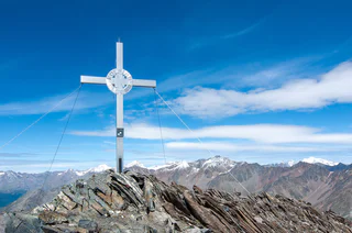
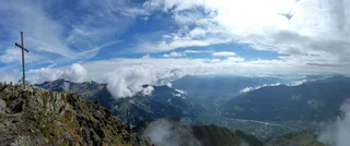
Around the Zwölferkreuz peak (2.516 m)
Tarres/Tarsch, Latsch/Laces, Vinschgau/Val Venosta
medium
Poziom trudności
1247 m
Wzlot
5h:57 min
czas trwania
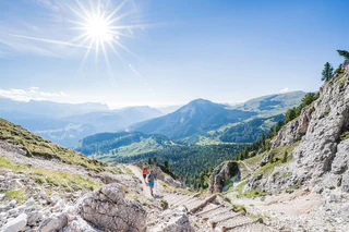
Odkryj wyjątkowe szczyty górskie Południowego Tyrolu, wspinając się na najpiękniejsze z nich. Bezpieczne wycieczki doprowadzą Cię do celu i umożliwią przeżycie górskich wrażeń, których szybko nie zapomnisz.
Tarres/Tarsch, Latsch/Laces, Vinschgau/Val Venosta
medium
Poziom trudności
1247 m
Wzlot
5h:57 min
czas trwania
Martello/Martell, Martell/Martello, Vinschgau/Val Venosta
medium
Poziom trudności
630 m
Wzlot
5h:00 min
czas trwania
S. Martino al Monte/St. Martin - Laces/Latsch, Latsch/Laces, Vinschgau/Val Venosta
difficult
Poziom trudności
1191 m
Wzlot
3h:58 min
czas trwania
1/12
Selva/Sëlva/Wolkenstein/Sëlva, Sëlva/Selva di Val Gardena, Dolomites Region Val Gardena
medium
Poziom trudności
922 m
Wzlot
3h:40 min
czas trwania
1/2
Ridanna/Ridnaun, Ratschings/Racines, Sterzing/Vipiteno and environs
medium
Poziom trudności
1005 m
Wzlot
4h:13 min
czas trwania
1/8
San Cassiano/San Cassiano, Badia, Dolomites Region Alta Badia
difficult
Poziom trudności
985 m
Wzlot
7h:00 min
czas trwania
Transacqua/Ennewasser, Martell/Martello, Vinschgau/Val Venosta
difficult
Poziom trudności
1424 m
Wzlot
4h:16 min
czas trwania
Casere/Kasern, Prettau/Predoi, Ahrntal/Valle Aurina
difficult
Poziom trudności
4800 m
Wzlot
30h:00 min
czas trwania
Sarentino/Sarnthein, Sarntal/Sarentino, Bolzano/Bozen and environs
medium
Poziom trudności
1002 m
Wzlot
5h:07 min
czas trwania
1/3
Vernago/Vernagt, Schnals/Senales, Vinschgau/Val Venosta
medium
Poziom trudności
1607 m
Wzlot
8h:00 min
czas trwania
1/9
Tablà/Tabland - Parcines/Partschins, Partschins/Parcines, Meran/Merano and environs
difficult
Poziom trudności
2033 m
Wzlot
11h:34 min
czas trwania

1/2
Lappago/Lappach, Mühlwald/Selva dei Molini, Ahrntal/Valle Aurina
difficult
Poziom trudności
1086 m
Wzlot
5h:46 min
czas trwania
Ciardes/Tschars, Kastelbell-Tschars/Castelbello-Ciardes, Vinschgau/Val Venosta
difficult
Poziom trudności
711 m
Wzlot
2h:10 min
czas trwania
Martello/Martell, Martell/Martello, Vinschgau/Val Venosta
difficult
Poziom trudności
910 m
Wzlot
4h:45 min
czas trwania
Stanghe/Stange, Ratschings/Racines, Sterzing/Vipiteno and environs
medium
Poziom trudności
1104 m
Wzlot
6h:30 min
czas trwania
Casere/Kasern, Prettau/Predoi, Ahrntal/Valle Aurina
difficult
Poziom trudności
2618 m
Wzlot
12h:15 min
czas trwania
Valgiovo/Jaufental, Ratschings/Racines, Sterzing/Vipiteno and environs
medium
Poziom trudności
1303 m
Wzlot
5h:45 min
czas trwania
Braies di Fuori/Ausserprags, Prags/Braies, Dolomites Region 3 Zinnen
medium
Poziom trudności
359 m
Wzlot
1h:28 min
czas trwania
1/4
Scena/Schenna, Hafling/Avelengo, Meran/Merano and environs
medium
Poziom trudności
750 m
Wzlot
3h:45 min
czas trwania
1/4
Tablà/Tabland - Parcines/Partschins, Partschins/Parcines, Meran/Merano and environs
difficult
Poziom trudności
1763 m
Wzlot
10h:45 min
czas trwania
Casere/Kasern, Prettau/Predoi, Ahrntal/Valle Aurina
difficult
Poziom trudności
5521 m
Wzlot
24h:00 min
czas trwania
1/4
Senale/U.L. Frau i.W., U.L.Frau i.W.-St. Felix/Senale-S.Felice, Meran/Merano and environs
medium
Poziom trudności
797 m
Wzlot
2h:42 min
czas trwania
Ciardes/Tschars, Kastelbell-Tschars/Castelbello-Ciardes, Vinschgau/Val Venosta
difficult
Poziom trudności
1210 m
Wzlot
5h:00 min
czas trwania
Martello/Martell, Martell/Martello, Vinschgau/Val Venosta
difficult
Poziom trudności
1873 m
Wzlot
8h:01 min
czas trwania
Juvale/Juval, Kastelbell-Tschars/Castelbello-Ciardes, Vinschgau/Val Venosta
difficult
Poziom trudności
1631 m
Wzlot
4h:50 min
czas trwania
Alpe di Siusi/Seiseralm, Kastelruth/Castelrotto, Dolomites Region Seiser Alm
difficult
Poziom trudności
964 m
Wzlot
3h:01 min
czas trwania
Montefontana/Tomberg, Kastelbell-Tschars/Castelbello-Ciardes, Vinschgau/Val Venosta
difficult
Poziom trudności
1013 m
Wzlot
3h:46 min
czas trwania
1/10
Tablà/Tabland - Parcines/Partschins, Partschins/Parcines, Meran/Merano and environs
difficult
Poziom trudności
1767 m
Wzlot
9h:15 min
czas trwania
Tarres/Tarsch, Latsch/Laces, Vinschgau/Val Venosta
medium
Poziom trudności
291 m
Wzlot
1h:26 min
czas trwania
1/6
Campo Tures/Sand in Taufers, Mühlwald/Selva dei Molini, Ahrntal/Valle Aurina
difficult
Poziom trudności
617 m
Wzlot
6h:07 min
czas trwania
Dziękujemy za zapisanie się!
Subskrypcja jest już aktywna
Potwierdź rejestrację
Aby zakończyć rejestrację, otwórz e-mail, który właśnie wysłaliśmy, i kliknij link potwierdzający.
Nie widzisz wiadomości? Sprawdź folder spam.
Zauważyliśmy, że próbowałeś(-aś) zapisać się do newslettera, ale Twój adres e-mail jest już zarejestrowany. Nadal będziesz otrzymywać nasze oferty, wskazówki i inspiracje na Twój urlop.
Już próbowałeś zapisać się do naszego newslettera, ale nie potwierdziłeś rejestracji. Właśnie wysłaliśmy ci ponownie e‑mail. Sprawdź swoją skrzynkę odbiorczą i folder ze spamem i potwierdź teraz.


