
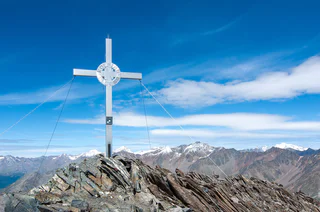
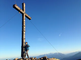
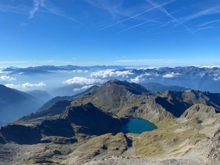
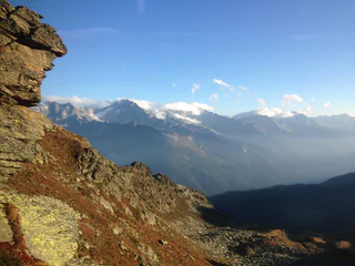
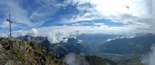
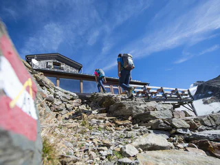
Sarner Scharte Gap and Villanderer Berg Mountain
Sarentino/Sarnthein, Sarntal/Sarentino, Bolzano/Bozen and environs
medium
Obtížnost
1002 m
Převýšení
5h:07 min
doba trvání
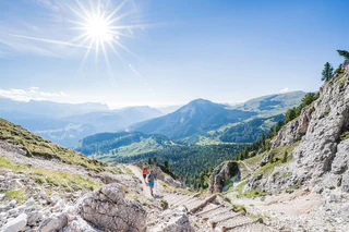
Prozkoumejte jedinečné vrcholy Jižního Tyrolska při výstupu na nejkrásnější vrcholy. Bezpečné túry vás dovezou do cíle a poskytnou vám horské zážitky, na které jen tak nezapomenete.
Sarentino/Sarnthein, Sarntal/Sarentino, Bolzano/Bozen and environs
medium
Obtížnost
1002 m
Převýšení
5h:07 min
doba trvání
1/9
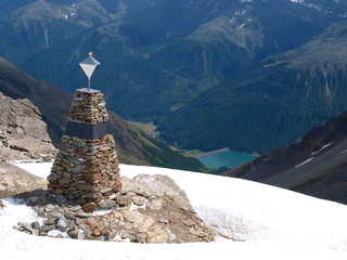
Tablà/Tabland - Parcines/Partschins, Partschins/Parcines, Meran/Merano and environs
difficult
Obtížnost
2033 m
Převýšení
11h:34 min
doba trvání
1/3
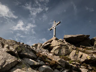
Vernago/Vernagt, Schnals/Senales, Vinschgau/Val Venosta
medium
Obtížnost
1607 m
Převýšení
8h:00 min
doba trvání
Transacqua/Ennewasser, Martell/Martello, Vinschgau/Val Venosta
difficult
Obtížnost
1424 m
Převýšení
4h:16 min
doba trvání

1/2
Lappago/Lappach, Mühlwald/Selva dei Molini, Ahrntal/Valle Aurina
difficult
Obtížnost
1086 m
Převýšení
5h:46 min
doba trvání
Martello/Martell, Martell/Martello, Vinschgau/Val Venosta
difficult
Obtížnost
1873 m
Převýšení
8h:01 min
doba trvání
Laces/Latsch, Latsch/Laces, Vinschgau/Val Venosta
easy
Obtížnost
550 m
Převýšení
2h:46 min
doba trvání
1/4
Scena/Schenna, Hafling/Avelengo, Meran/Merano and environs
medium
Obtížnost
750 m
Převýšení
3h:45 min
doba trvání
1/12
Selva/Sëlva/Wolkenstein/Sëlva, Sëlva/Selva di Val Gardena, Dolomites Region Val Gardena
medium
Obtížnost
922 m
Převýšení
3h:40 min
doba trvání
Martello/Martell, Martell/Martello, Vinschgau/Val Venosta
medium
Obtížnost
630 m
Převýšení
5h:00 min
doba trvání
Juvale/Juval, Kastelbell-Tschars/Castelbello-Ciardes, Vinschgau/Val Venosta
difficult
Obtížnost
1631 m
Převýšení
4h:50 min
doba trvání
Casere/Kasern, Prettau/Predoi, Ahrntal/Valle Aurina
difficult
Obtížnost
2618 m
Převýšení
12h:15 min
doba trvání
Tarres/Tarsch, Latsch/Laces, Vinschgau/Val Venosta
medium
Obtížnost
291 m
Převýšení
1h:26 min
doba trvání
Casere/Kasern, Prettau/Predoi, Ahrntal/Valle Aurina
difficult
Obtížnost
5521 m
Převýšení
24h:00 min
doba trvání
1/4
Senale/U.L. Frau i.W., U.L.Frau i.W.-St. Felix/Senale-S.Felice, Meran/Merano and environs
medium
Obtížnost
797 m
Převýšení
2h:42 min
doba trvání
Alpe di Siusi/Seiseralm, Kastelruth/Castelrotto, Dolomites Region Seiser Alm
difficult
Obtížnost
964 m
Převýšení
3h:01 min
doba trvání
Valgiovo/Jaufental, Ratschings/Racines, Sterzing/Vipiteno and environs
medium
Obtížnost
1303 m
Převýšení
5h:45 min
doba trvání
1/3
Valles/Vals, Mühlbach/Rio di Pusteria, Brixen/Bressanone and environs
difficult
Obtížnost
1484 m
Převýšení
6h:15 min
doba trvání
1/6
Campo Tures/Sand in Taufers, Mühlwald/Selva dei Molini, Ahrntal/Valle Aurina
difficult
Obtížnost
617 m
Převýšení
6h:07 min
doba trvání
Transacqua/Ennewasser, Martell/Martello, Vinschgau/Val Venosta
difficult
Obtížnost
1326 m
Převýšení
4h:25 min
doba trvání
Riobianco/Weissenbach - Valle Aurina/Ahrntal, Ahrntal/Valle Aurina, Ahrntal/Valle Aurina
difficult
Obtížnost
5543 m
Převýšení
30h:00 min
doba trvání
Casere/Kasern, Prettau/Predoi, Ahrntal/Valle Aurina
difficult
Obtížnost
4800 m
Převýšení
30h:00 min
doba trvání
Martello/Martell, Martell/Martello, Vinschgau/Val Venosta
difficult
Obtížnost
1099 m
Převýšení
4h:19 min
doba trvání
1/10
Tablà/Tabland - Parcines/Partschins, Partschins/Parcines, Meran/Merano and environs
difficult
Obtížnost
1767 m
Převýšení
9h:15 min
doba trvání
Transacqua/Ennewasser, Martell/Martello, Vinschgau/Val Venosta
difficult
Obtížnost
1583 m
Převýšení
4h:54 min
doba trvání
Solda/Sulden, Stilfs/Stelvio, Vinschgau/Val Venosta
difficult
Obtížnost
900 m
Převýšení
4h:30 min
doba trvání
1/4
Vernago/Vernagt, Schnals/Senales, Vinschgau/Val Venosta
difficult
Obtížnost
1909 m
Převýšení
9h:00 min
doba trvání
S. Martino al Monte/St. Martin - Laces/Latsch, Latsch/Laces, Vinschgau/Val Venosta
difficult
Obtížnost
1191 m
Převýšení
3h:58 min
doba trvání
Tarres/Tarsch, Latsch/Laces, Vinschgau/Val Venosta
medium
Obtížnost
1247 m
Převýšení
5h:57 min
doba trvání
1/3
San Leonardo i.P./St. Leonhard i.P., Ratschings/Racines, Sterzing/Vipiteno and environs
medium
Obtížnost
1032 m
Převýšení
3h:51 min
doba trvání


