
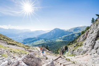
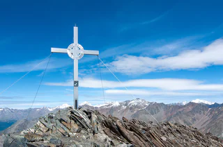
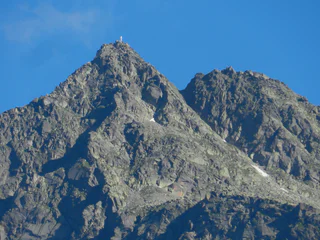
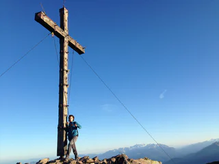
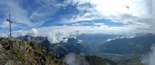
Around the Zwölferkreuz peak (2.516 m)
Tarres/Tarsch, Latsch/Laces, Vinschgau/Val Venosta
medium
Moeilijkheidsgraad
1247 m
Hoogteverschil
5h:57 min
Duur
Verken de unieke bergtoppen van Zuid-Tirol terwijl je de mooiste toppen beklimt. Veilige tochten brengen je naar je bestemming en zorgen voor een bergervaring die je niet snel zult vergeten.
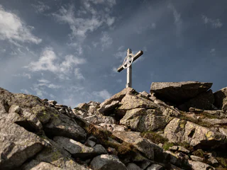
Tarres/Tarsch, Latsch/Laces, Vinschgau/Val Venosta
medium
Moeilijkheidsgraad
1247 m
Hoogteverschil
5h:57 min
Duur
Martello/Martell, Martell/Martello, Vinschgau/Val Venosta
medium
Moeilijkheidsgraad
630 m
Hoogteverschil
5h:00 min
Duur
S. Martino al Monte/St. Martin - Laces/Latsch, Latsch/Laces, Vinschgau/Val Venosta
difficult
Moeilijkheidsgraad
1191 m
Hoogteverschil
3h:58 min
Duur
1/12
Selva/Sëlva/Wolkenstein/Sëlva, Sëlva/Selva di Val Gardena, Dolomites Region Val Gardena
medium
Moeilijkheidsgraad
922 m
Hoogteverschil
3h:40 min
Duur
1/2
Ridanna/Ridnaun, Ratschings/Racines, Sterzing/Vipiteno and environs
medium
Moeilijkheidsgraad
1005 m
Hoogteverschil
4h:13 min
Duur
1/8
San Cassiano/San Cassiano, Badia, Dolomites Region Alta Badia
difficult
Moeilijkheidsgraad
985 m
Hoogteverschil
7h:00 min
Duur
Transacqua/Ennewasser, Martell/Martello, Vinschgau/Val Venosta
difficult
Moeilijkheidsgraad
1424 m
Hoogteverschil
4h:16 min
Duur
Casere/Kasern, Prettau/Predoi, Ahrntal/Valle Aurina
difficult
Moeilijkheidsgraad
4800 m
Hoogteverschil
30h:00 min
Duur
Sarentino/Sarnthein, Sarntal/Sarentino, Bolzano/Bozen and environs
medium
Moeilijkheidsgraad
1002 m
Hoogteverschil
5h:07 min
Duur
1/3
Vernago/Vernagt, Schnals/Senales, Vinschgau/Val Venosta
medium
Moeilijkheidsgraad
1607 m
Hoogteverschil
8h:00 min
Duur
1/9
Tablà/Tabland - Parcines/Partschins, Partschins/Parcines, Meran/Merano and environs
difficult
Moeilijkheidsgraad
2033 m
Hoogteverschil
11h:34 min
Duur

1/2
Lappago/Lappach, Mühlwald/Selva dei Molini, Ahrntal/Valle Aurina
difficult
Moeilijkheidsgraad
1086 m
Hoogteverschil
5h:46 min
Duur
Ciardes/Tschars, Kastelbell-Tschars/Castelbello-Ciardes, Vinschgau/Val Venosta
difficult
Moeilijkheidsgraad
711 m
Hoogteverschil
2h:10 min
Duur
Martello/Martell, Martell/Martello, Vinschgau/Val Venosta
difficult
Moeilijkheidsgraad
910 m
Hoogteverschil
4h:45 min
Duur
Stanghe/Stange, Ratschings/Racines, Sterzing/Vipiteno and environs
medium
Moeilijkheidsgraad
1104 m
Hoogteverschil
6h:30 min
Duur
Casere/Kasern, Prettau/Predoi, Ahrntal/Valle Aurina
difficult
Moeilijkheidsgraad
2618 m
Hoogteverschil
12h:15 min
Duur
Valgiovo/Jaufental, Ratschings/Racines, Sterzing/Vipiteno and environs
medium
Moeilijkheidsgraad
1303 m
Hoogteverschil
5h:45 min
Duur
Braies di Fuori/Ausserprags, Prags/Braies, Dolomites Region 3 Zinnen
medium
Moeilijkheidsgraad
359 m
Hoogteverschil
1h:28 min
Duur
1/4
Scena/Schenna, Hafling/Avelengo, Meran/Merano and environs
medium
Moeilijkheidsgraad
750 m
Hoogteverschil
3h:45 min
Duur
1/4
Tablà/Tabland - Parcines/Partschins, Partschins/Parcines, Meran/Merano and environs
difficult
Moeilijkheidsgraad
1763 m
Hoogteverschil
10h:45 min
Duur
Casere/Kasern, Prettau/Predoi, Ahrntal/Valle Aurina
difficult
Moeilijkheidsgraad
5521 m
Hoogteverschil
24h:00 min
Duur
1/4
Senale/U.L. Frau i.W., U.L.Frau i.W.-St. Felix/Senale-S.Felice, Meran/Merano and environs
medium
Moeilijkheidsgraad
797 m
Hoogteverschil
2h:42 min
Duur
Ciardes/Tschars, Kastelbell-Tschars/Castelbello-Ciardes, Vinschgau/Val Venosta
difficult
Moeilijkheidsgraad
1210 m
Hoogteverschil
5h:00 min
Duur
Martello/Martell, Martell/Martello, Vinschgau/Val Venosta
difficult
Moeilijkheidsgraad
1873 m
Hoogteverschil
8h:01 min
Duur
Juvale/Juval, Kastelbell-Tschars/Castelbello-Ciardes, Vinschgau/Val Venosta
difficult
Moeilijkheidsgraad
1631 m
Hoogteverschil
4h:50 min
Duur
Alpe di Siusi/Seiseralm, Kastelruth/Castelrotto, Dolomites Region Seiser Alm
difficult
Moeilijkheidsgraad
964 m
Hoogteverschil
3h:01 min
Duur
Montefontana/Tomberg, Kastelbell-Tschars/Castelbello-Ciardes, Vinschgau/Val Venosta
difficult
Moeilijkheidsgraad
1013 m
Hoogteverschil
3h:46 min
Duur
1/10
Tablà/Tabland - Parcines/Partschins, Partschins/Parcines, Meran/Merano and environs
difficult
Moeilijkheidsgraad
1767 m
Hoogteverschil
9h:15 min
Duur
Tarres/Tarsch, Latsch/Laces, Vinschgau/Val Venosta
medium
Moeilijkheidsgraad
291 m
Hoogteverschil
1h:26 min
Duur
1/6
Campo Tures/Sand in Taufers, Mühlwald/Selva dei Molini, Ahrntal/Valle Aurina
difficult
Moeilijkheidsgraad
617 m
Hoogteverschil
6h:07 min
Duur
Bedankt voor je inschrijving!
Inschrijving al actief
Bevestig je inschrijving
Om je inschrijving te voltooien, open de e-mail die we je net hebben gestuurd en klik op de bevestigingslink.
Niet gevonden? Kijk ook even in je spammap.
We hebben gezien dat je je probeerde aan te melden voor de nieuwsbrief, maar je e-mailadres is al geregistreerd. Je blijft onze aanbiedingen, tips en inspiratie voor je vakantie ontvangen.
Je hebt je al geprobeerd in te schrijven voor onze nieuwsbrief maar deze nog niet bevestigd. We hebben je de e‑mail zojuist opnieuw gestuurd. Controleer je inbox en je spammap en bevestig nu.


