
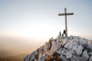
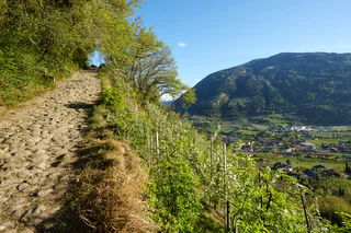
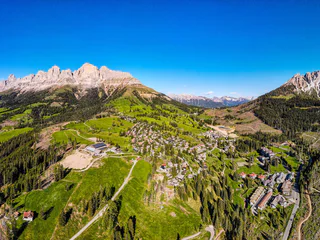
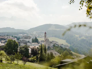
360° Alta Val Venosta: San Valentino a.M. - Reschen
Piavenna/Plawenn, Graun im Vinschgau/Curon Venosta, Vinschgau/Val Venosta
medium
Difficulty
1010 m
Elevation gain
5h:42 min
duration
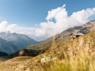
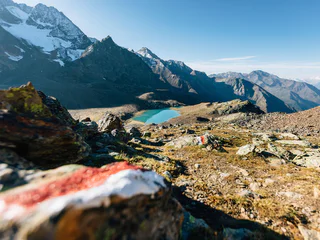
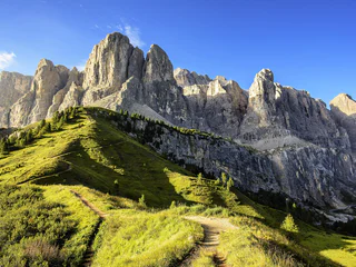
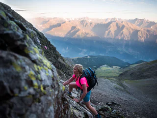
Whether you're interested in the breathtaking Stilfser Joch National Park, the UNESCO World Heritage Dolomites, or the secluded Pfunderer Berge mountains, the region's high-altitude and long-distance hiking trails provide an opportunity for multi-day hikes that take you through stunning landscapes from one mountain hut to another. These extended hikes in the mountains offer an ideal escape from the demands of everyday life, allowing you to truly disconnect and immerse yourself in nature.
Piavenna/Plawenn, Graun im Vinschgau/Curon Venosta, Vinschgau/Val Venosta
medium
Difficulty
1010 m
Elevation gain
5h:42 min
duration
San Vigilio, Badia, Dolomites Region Alta Badia
difficult
Difficulty
3174 m
Elevation gain
17h:28 min
duration
1/4
Radein/Redagno, Aldein/Aldino
difficult
Difficulty
3700 m
Elevation gain
23h:04 min
duration
1/2
Maso Corto/Kurzras, Mals/Malles, Vinschgau/Val Venosta
difficult
Difficulty
1109 m
Elevation gain
5h:00 min
duration
1/2
San Vigilio, Prags/Braies, Dolomites Region 3 Zinnen
medium
Difficulty
1305 m
Elevation gain
6h:22 min
duration
1/3
Anterselva di Mezzo/Antholz-Mittertal, Rasen-Antholz/Rasun Anterselva, Dolomites Region Kronplatz/Plan de Corones
medium
Difficulty
716 m
Elevation gain
2h:13 min
duration
Tubre/Taufers i. M., Mals/Malles, Vinschgau/Val Venosta
difficult
Difficulty
918 m
Elevation gain
6h:00 min
duration
1/3
Velloi/Vellau, Algund/Lagundo, Meran/Merano and environs
easy
Difficulty
423 m
Elevation gain
3h:00 min
duration
1/2
Mazia/Matsch, Mals/Malles, Vinschgau/Val Venosta
difficult
Difficulty
388 m
Elevation gain
5h:30 min
duration
1/2
Radein/Redagno, Aldein/Aldino
difficult
Difficulty
3699 m
Elevation gain
23h:04 min
duration
Passo Stelvio/Stilfserjoch, Stilfs/Stelvio, Vinschgau/Val Venosta
difficult
Difficulty
1776 m
Elevation gain
8h:00 min
duration
S. Maddalena/St. Magdalena - Casies/Gsies, Gsies/Valle di Casies
difficult
Difficulty
1666 m
Elevation gain
8h:07 min
duration
1/3
Tires/Tiers, Völs am Schlern/Fiè allo Sciliar, Dolomites Region Seiser Alm
difficult
Difficulty
772 m
Elevation gain
6h:24 min
duration
Luson/Lüsen, Villnöss/Funes, Dolomites Region Lüsen Villnöss
medium
Difficulty
742 m
Elevation gain
4h:31 min
duration
Velloi/Vellau, Marling/Marlengo, Meran/Merano and environs
medium
Difficulty
459 m
Elevation gain
2h:16 min
duration
1/2
Collepietra/Steinegg, Tiers am Rosengarten/Tires al Catinaccio, Dolomites Region Seiser Alm
medium
Difficulty
1138 m
Elevation gain
5h:31 min
duration
1/6
Passo Stelvio/Stilfserjoch, Stilfs/Stelvio, Vinschgau/Val Venosta
difficult
Difficulty
8126 m
Elevation gain
55h:15 min
duration
1/14
S.Cristina Gherdëina/S.Cristina Val Gardena/S.Cristina Gherdëina/St.Christina in Gröden, Sëlva/Selva di Val Gardena, Dolomites Region Val Gardena
difficult
Difficulty
3627 m
Elevation gain
8h:00 min
duration
1/2
Vallesina/Versein, Mölten/Meltina, Bolzano/Bozen and environs
medium
Difficulty
722 m
Elevation gain
4h:54 min
duration
Malles/Mals, Mals/Malles, Vinschgau/Val Venosta
medium
Difficulty
5 m
Elevation gain
5h:00 min
duration
Laghetti/Laag, Montan/Montagna, Alto Adige Wine Road
medium
Difficulty
376 m
Elevation gain
3h:28 min
duration
1/4
Deutschnofen Dorf/Nova Ponente Centro, Deutschnofen/Nova Ponente, Dolomites Region Eggental
medium
Difficulty
591 m
Elevation gain
3h:40 min
duration
1/4
Falzeben/Falzeben, Hafling/Avelengo, Meran/Merano and environs
difficult
Difficulty
1300 m
Elevation gain
5h:30 min
duration
Predoi/Prettau, Prettau/Predoi, Ahrntal/Valle Aurina
difficult
Difficulty
1659 m
Elevation gain
9h:09 min
duration
1/5
Selva/Sëlva/Wolkenstein/Sëlva, Sëlva/Selva di Val Gardena, Dolomites Region Val Gardena
medium
Difficulty
878 m
Elevation gain
3h:37 min
duration
Altrei/Anterivo
medium
Difficulty
429 m
Elevation gain
2h:55 min
duration
1/4
Vellau/Velloi, Algund/Lagundo, Meran/Merano and environs
difficult
Difficulty
2431 m
Elevation gain
8h:58 min
duration
Passo Stelvio/Stilfserjoch, Stilfs/Stelvio, Vinschgau/Val Venosta
difficult
Difficulty
898 m
Elevation gain
8h:30 min
duration
S. Martino al Monte/St. Martin - Laces/Latsch, Latsch/Laces, Vinschgau/Val Venosta
difficult
Difficulty
1300 m
Elevation gain
8h:00 min
duration
Gomagoi/Gomagoi, Stilfs/Stelvio, Vinschgau/Val Venosta
difficult
Difficulty
323 m
Elevation gain
3h:00 min
duration
Thank you for signing up!
Your subscription is already active
Confirm your registration
To complete your subscription, open the email we just sent you and click on the confirmation link.
Can’t find it? Check your spam folder too.
We noticed that you tried to subscribe to the newsletter, but your email address is already registered. You will continue to receive our offers, tips and inspiration for your holiday.
We noticed that you already tried to subscribe to our Newsletter in the past but didn’t confirmed the subscription. We have resent you an email now, please check your inbox and spam folder to confirm.


