Ga meteen naar de inhoud

toegevoegd aan favorieten

verwijderd uit favorieten

Helaas is er een probleem opgetreden. Probeer het opnieuw.

Uw account wordt aangemaakt

Je account is succesvol aangemaakt en je bent nu ingelogd

U bent succesvol ingelogd!

Uw account is succesvol aangemaakt, maar we konden u niet automatisch aanmelden

U bent uitgelogd

Filteren
Moeilijkheidsgraad
Duur
Afstand in km

Wandelingen in het zuiden van Zuid-Tirol

Te midden van een adembenemend natuurlandschap biedt het zuiden van Zuid-Tirol talrijke wandelroutes die door dichte bossen, bloeiende weiden en schilderachtige wijngaarden leiden. Of je nu van een ontspannen wandeling houdt of een uitdagende tocht zoekt – hier vind je de perfecte route voor jouw wandelavontuur.

Resultaten
Hiking
Hiking to the Planer alm pasture
Freienfeld/Campo di Trens, Sterzing/Vipiteno and environs

Nice tour from the the characteristic village Mules/Mauls over Flains hamlet to the Planer Alm, a typical mountain pasture.

Moeilijkheidsgraad: gemiddeld
1251 m Hoogtemeters
5h:00 min Duur
Hiking
Via Crucis from Gossensass/Colle Isarco to Pflersch/Fleres
Brenner/Brennero, Sterzing/Vipiteno and environs

This contemplative walk starts in Silbergasse and takes you gently up to the Mooshöfe farms. There, the path climbs steeply to the right and then heads south through the forest towards the railway line. Past the ‘Jagglkapelle’ chapel, the trail continues to the ‘Ploserkreuz’ cross, where you pass through a narrow railway subway. This takes you towards the Pflersch river. The path crosses the road from Pflersch and finally leads to the Maria-Hilf chapel in Außerpflersch. You can return to Gossensass along the riverside promenade. Or you can continue right along the cycle path to the church path to Ladurns.
The perfect walk for a relaxing afternoon.

Moeilijkheidsgraad: gemakkelijk
156 m Hoogtemeters
1h:19 min Duur
Hiking
Resia Lake Round
Graun im Vinschgau/Curon Venosta, Vinschgau/Val Venosta
The 15.3 km circuit runs directly alongside the largest lake in South Tyrol. This can be enjoyed as a hiking, biking or running tour and can be started at several points in either direction. About 80 % of the route is asphalt, the rest is gravel. The orographic left side is flat, whereas the opposite side shows small variations in altitude in the forests and meadows. The circuit offers a scenic composition of lakes and mountains.
Moeilijkheidsgraad: gemakkelijk
55 m Hoogtemeters
3h:30 min Duur
Waalwege
Neuwaal irrigation channel path
Latsch/Laces, Vinschgau/Val Venosta
In the footsteps of the ancient rock paintings of the Waaler.
We start at the IceForum in Laces and follow trail no. 5 to the Margrinböden picnic area. There we enjoy the view over the castle ruins of Ober- & Untermontani. We then continue to the fork in the path where we follow path number 5a downhill to the Bierkeller. From there, the route leads through the orchards along the tarmac road back to the starting point. Variation: if you prefer a longer walk, you can descend from the Marginböden via the ruins of Ober- & Untermontani Castle and walk back along the irrigation channel path Mareinwaal via the Bierkeller.
Moeilijkheidsgraad: gemakkelijk
177 m Hoogtemeters
1h:26 min Duur
Hiking
From Tall via the Waalerhof farms to Sterneck Inn in Prenn
Schenna/Scena, Meran/Merano and environs
Through forest and over mountain meadows, this family hike leads first along a forest track, then a somewhat steep trail to Prenn and to the Sterneck Inn. The Sterneck Inn, better known as “beim Gustl”, after the landlord, is open all year round. Close to inn (next to the road towards Hochwies Inn) there is a well preserved and restored watermill, the Tonigbauern Mill from days gone by, which is well worth a visit.
Moeilijkheidsgraad: gemiddeld
225 m Hoogtemeters
2h:00 min Duur
Themed Hikes
Hike & Bike | From Passo Costalunga to Obereggen
Welschnofen/Nova Levante, Dolomites Region Eggental

Hike & Bike Eggental – You can't decide whether you'd rather explore the Eggental on foot or by bike? Then it's best to do both! The Eggental E-Bike Sharing in combination with our countless hiking routes make it possible.

With the bus we reach Passo Costaluga where we take the path to a mysterious rock labyrinth which a huge landslide from the Latemar a long time ago has formed at the foot of the Latemar.where we follow the signposts no. 21 and 17, stretching underneath the Latemar. First we walk along a broad forested trail, until we reach the first signpost "Labyrinth". Immediately the forest ends and the mighty Latemar towers into the sky in front of our eyes.
Moeilijkheidsgraad: gemiddeld
606 m Hoogtemeters
4h:34 min Duur
Hiking
Walk along the green promenade in Brixen
Brixen/Bressanone, Brixen/Bressanone and environs

The leisurely Green Town Walk in Brixen/Bressanone leads through its most picturesque green zones, highlighting the more significant historic areas and buildings in the oldest town in Tyrol.

Moeilijkheidsgraad: gemakkelijk
18 m Hoogtemeters
1h:04 min Duur
Themed Hikes
Mountainhut Vorderkas - Refuge Stettiner Hütte
Schnals/Senales, Vinschgau/Val Venosta

Easy and magnificent path from the mountain hut Vorderkas/ inn Jägerrast to the mountain pasture Eishof, also suitable for children and elderly people. In the further course more and more surefootedness is required. 
Tips: the informational boards along the Alpine Pasture Experience Trail (Almerlebnisweg) are interesting. Not far from mountain pasture Rableid, there is a lime kiln, in which the limestone from the Hohe Weiße mountain was fired to make building lime, which was also presumably used to construct the monastery in Certosa/Karthaus.

Moeilijkheidsgraad: gemiddeld
1232 m Hoogtemeters
4h:30 min Duur
Hiking
Hike to the "Talschlusshütte" in the Fischlein Valley
Sexten/Sesto, Dolomites Region Kronplatz/Plan de Corones

The hike to the Talschlusshütte in Fischleintal starts at the Rotwand parking lot and follows trail no. 102. In about an hour, you will reach the hut, gaining approximately 170 meters in elevation. The trail leads through the beautiful Fischleintal, surrounded by the towering peaks of the Dolomites. The hike is family-friendly and offers plenty of opportunities to enjoy the stunning natural surroundings. Upon reaching the Talschlusshütte, you can enjoy local specialties and take in the breathtaking views of the surrounding mountain landscape.

Moeilijkheidsgraad: gemakkelijk
173 m Hoogtemeters
1h:10 min Duur
Snowshoe Hikes
Around the Stallwieshof
Martell/Martello, Vinschgau/Val Venosta

The tour starts at the Hotel Waldheim in Val Martello and goes over the bridge of the Plima. Continue along the path no.5 through the wood untill the "Löcherhof", from there on the old road at the free slope to the meadows of "Hochegghof" and a moderate rise brings you to the "Stallwieshof" (1,926m). From there you go on at the footpath no.8 to the log cabins of the Malga Schluder/Schluderalm. Following the path no.34 up to the forest and then down into the valley. At the end of the tour, cross again the bridge and return to the starting point. A wonderful winter tour with great views!

Moeilijkheidsgraad: gemiddeld
404 m Hoogtemeters
3h:00 min Duur
Long-Distance Hiking Paths
Dolorama 1. Stage
Rodeneck/Rodengo, Brixen/Bressanone and environs
The Dolorama Track: Hiking in the realm of the Dolomites A 4-day hiking tour in a breath-taking Alpine landscape with spectacular panoramic views, from Rodenecker mountain pastures to Laion/Lajen   The beautiful peaks of the UNESCO World Heritage site of the Dolomites are always in view! The Dolorama Route runs in four stages, from the Rodenecker mountain pastures to the village of Laion/Lajen – an unforgettable hiking experience through the valleys and mountains of the Dolomites.
 
The 61-km long Dolorama tour starts gently and then passes through the unique varied landscape of the Dolomites. Leaving the rich pastures of the Rodenecker and Lüsner Alm pastures, the route reaches the rugged rock formations of the Aferer and Villnösser Geisler, leading through pastures and meadows down to the village of Lajen/Laion. A spectacular panoramic view is to see along the entire tour on the horizon: the unique high rock formations of the Dolomites. First, the impressive Peitlerkofel in Funes/Villnöss, close to the Gömajoch ridge in the Puez-Geisler Nature Park comes into view, and then the Raschötz mountain pasture, withe the view extends to the peaks of Langkofel, Plattkofel and Schlern.
 
The Dolorama trail consists almost entirely of forestry paths and hiking trails , and is only crossed once by a road. Along the way there are many rest areas and panorama points to stop at: for example, the prehistoric settlement site at Astmoos on the Luson/Lüsner Alm pasture or the alpine pastures of Raschötz. For those who want to undertake the 4-day tour in stages, there are many access paths and descents along the entire route. These, as well as the starting point and target destination, are all easily accessible by public bus.

There are many Alpine huts along the way, offering refreshments and accommodation. All in all: a pure experience of the Dolomites !

Dolorama - Total Distance
» Starting point: Zumis car park, Rodengo/Rodeneck
» Endpoint: Laion/Lajen
» Route: 61 km | ascent: 2,356 hm | descent: 3,004 hm
» Walking time: approx. 19 hours 15 min.

Stages of the Route:
» Stage 1: from the Zumis car park at the Rodeneckker/Lüsner Alm mountain pasture to the Maurerberghütte hut (ca 6.30 h)
» Stage 2: from the Maurerberghütte mountain hut to the Schlüterhütte alpine hut (ca. 4.45 h)
» Stage 3: from the Schlüterhütte alpine hut to the Raschötz shelter hut (ca. 5 h)
» Stage 4: from the Raschötz shelter hut to the village of Laion/Lajen (ca. 3 h)
Moeilijkheidsgraad: gemiddeld
981 m Hoogtemeters
6h:37 min Duur
Hiking
Longer and Family Friendly
Lana, Meran/Merano and environs

Starting Point: Top station of the San Vigilio Cable Car (1,486 m)
Walking Time: 2 hours, 50 minutes
Distance: 8,737 m
Altitude Gain: 369 m
Route: 34 – 9 – 7 – 34

Moeilijkheidsgraad: gemiddeld
359 m Hoogtemeters
2h:27 min Duur
Hiking
Lavazé - Malga Ora - 8km
Deutschnofen/Nova Ponente, Alto Adige Wine Road
Beautiful 8 km long round trip with about 150m altitude difference. Especially on the section at Guggenbichel has wonderful views of Catinaccio, Latemar, Corno Nero & Corno Bianco. Ideal for a stop at Malga Ora.
Moeilijkheidsgraad: gemiddeld
160 m Hoogtemeters
2h:00 min Duur
Hiking
Winter hiking to the Lercher Alm hut
Percha/Perca, Dolomites Region Kronplatz/Plan de Corones

The 2.5 km hike through the Wielental/Valle di Vila has no difficulties and is therefore also suitable for families with children.

Moeilijkheidsgraad: gemakkelijk
243 m Hoogtemeters
1h:00 min Duur
Hiking
Hike to Rit
Al Plan/San Vigilio, Dolomites Region Kronplatz/Plan de Corones

SAN VIGILIO › RIT (H: 5.5 hours)

Starting from Hotel Les Alpes, walk up the
road until you find the sign indicating the path to „Sarjëi“. Continue following the signs for „Rit“ (signpost No. 15). Return to San Vigilio via Ciamaor, following path no. 13 downhill through steep meadows and woods.

Moeilijkheidsgraad: gemiddeld
762 m Hoogtemeters
4h:16 min Duur
Snowshoe Hikes
Snowshoe-hiking tour: Kandellen/Gandelle - Bonner hut
Toblach/Dobbiaco, Dolomites Region 3 Zinnen

The Bonner hut (closed in winter), which is located at 2,340 m above the sea level, offers a view of the snow-covered Dolomite peaks. Among them also the famous Three Peaks.

IMPORTANT: Before starting any ski tour/snowshoe excursion, you must check the weather conditions and danger avalanches report (https://avalanche.report), asking also experts (alpine guides etc.).

Moeilijkheidsgraad: gemiddeld
711 m Hoogtemeters
2h:30 min Duur
Hiking
Family Hike
Villanders/Villandro, Brixen/Bressanone and environs

Hiking to the Alps of Villanders...Along the paths in the typical mountain huts you can enjoy the delicacies and specialties of theSouth Tyrolean cuisine.

Moeilijkheidsgraad: gemakkelijk
124 m Hoogtemeters
1h:53 min Duur
Hiking
Mölten - Verschneid
Mölten/Meltina, Bolzano/Bozen and environs

This trail runs smoothly on a forest road through forests and meadows. At Frassineto you have the possibility to have a rest, to stop at one of the restaurants and to return then to Meltina by public transport (bus no. 204).


Moeilijkheidsgraad: gemakkelijk
152 m Hoogtemeters
1h:11 min Duur
Hiking
From Feldthurns to Verdings
Feldthurns/Velturno, Brixen/Bressanone and environs
A section of the chestnut trail from Feldthurns via Moar to Viersch in Pardell to Verdings.
Moeilijkheidsgraad: gemakkelijk
169 m Hoogtemeters
2h:00 min Duur
Themed Hikes
Trail of legends of Partschins/Parcines
Partschins/Parcines, Meran/Merano and environs

Family hike to pre-Christian settlement and cult sites in Partschins/Parcines. Scarf stones, witches' cave, devil's plate - on the way on the Partschins/Parcines Legend Trail.

Moeilijkheidsgraad: gemiddeld
331 m Hoogtemeters
1h:48 min Duur
Hiking
Lothener Köpfl
Kiens/Chienes, Dolomites Region Kronplatz/Plan de Corones
At the sports field, take the forest road in an easterly direction (district heating plant), where trail no. 17 starts (Fassing). After 1 km, follow the right path (no. 8) to the Kraftplatz. The trail joins forest path no. 6 and reaches the road Irenbergerstraße, which you cross and then join forest path no. 6B. This trail connects with trails no. 6 and 6A and leads to the Tanzer restaurant/café.
Moeilijkheidsgraad: gemakkelijk
186 m Hoogtemeters
2h:30 min Duur
Hiking
Farm hike between Chienes/Kiens and San Sigismondo/St. Sigmund
Kiens/Chienes, Dolomites Region Kronplatz/Plan de Corones

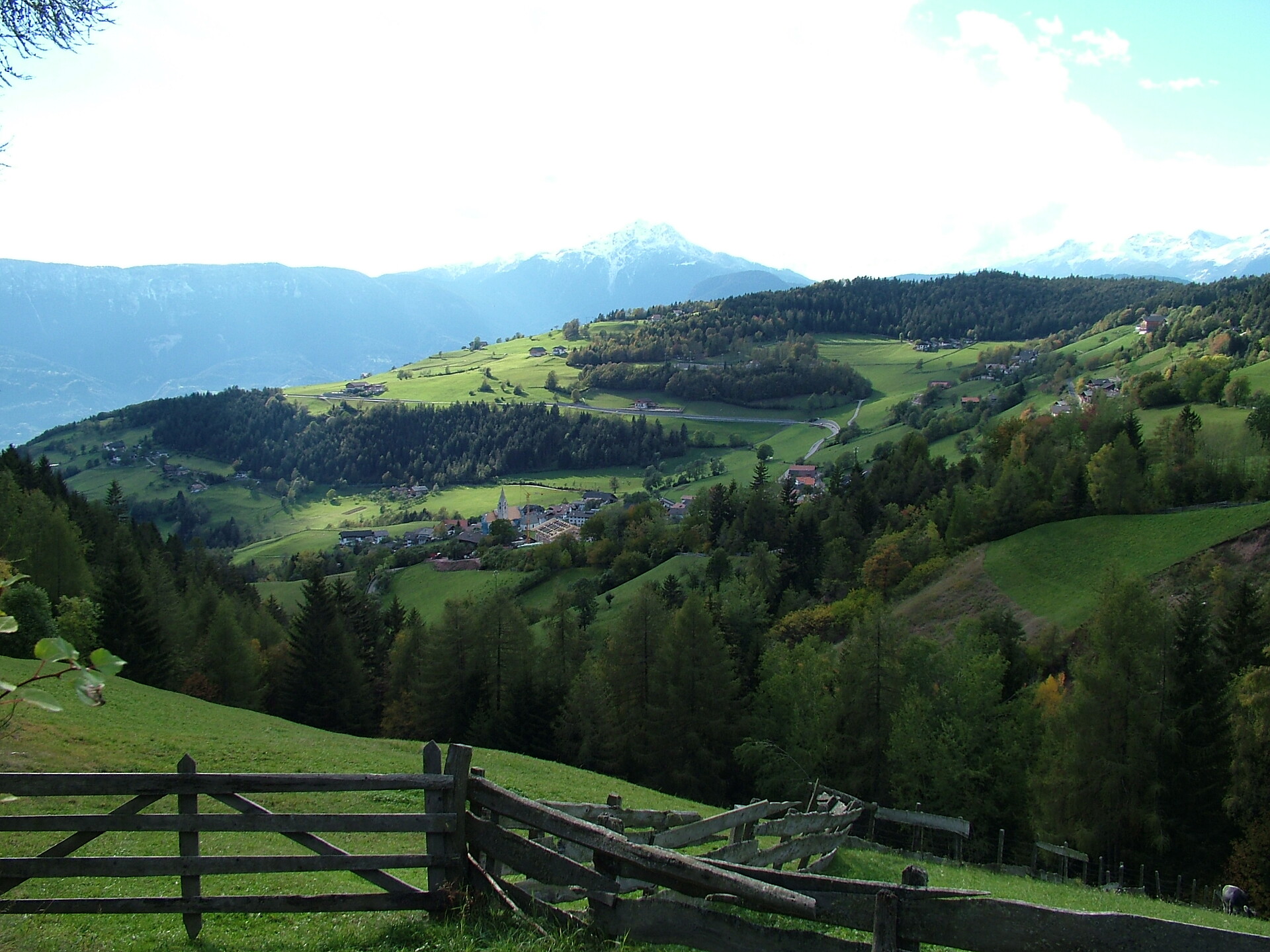
Rural tradition and stunning landscapes

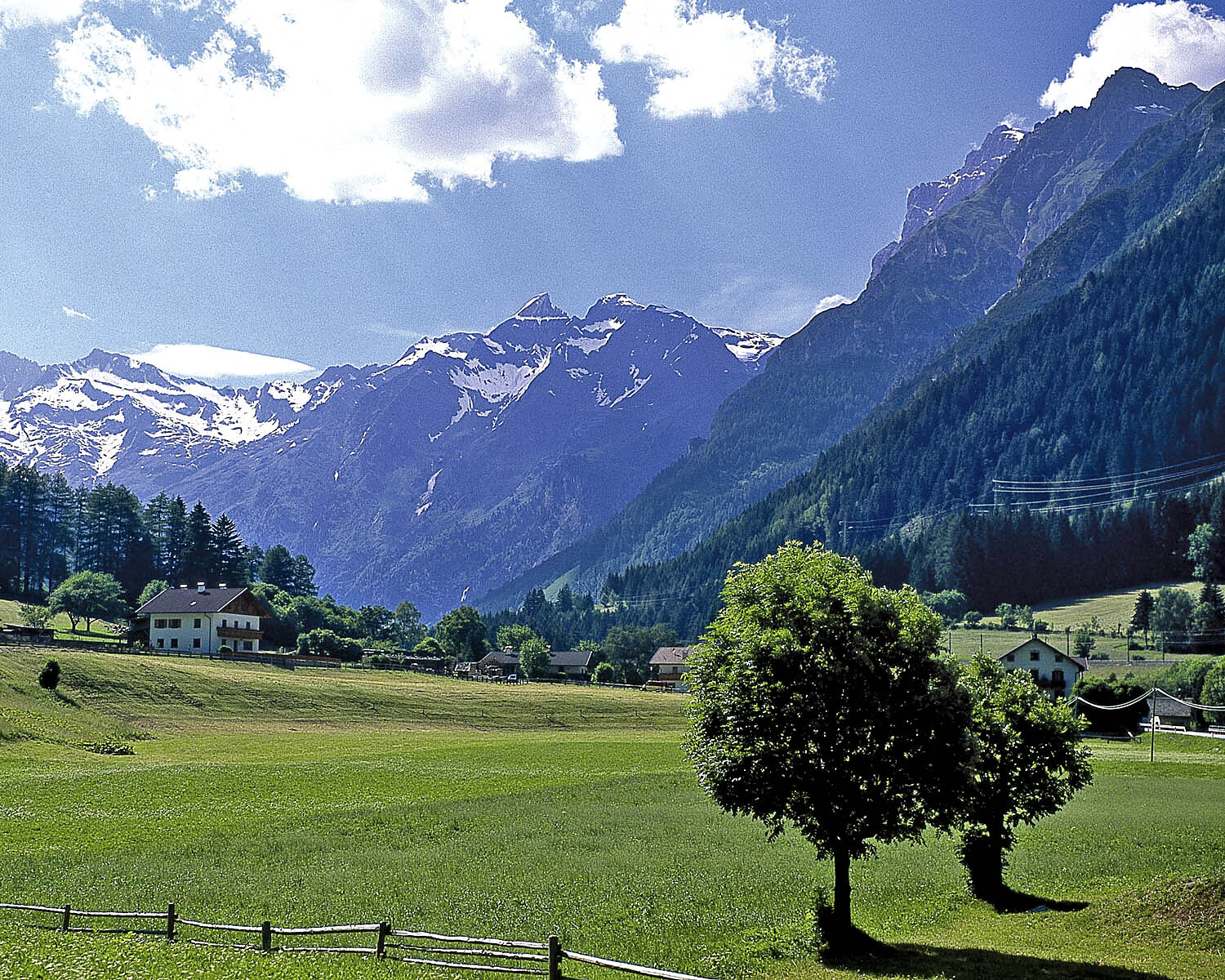
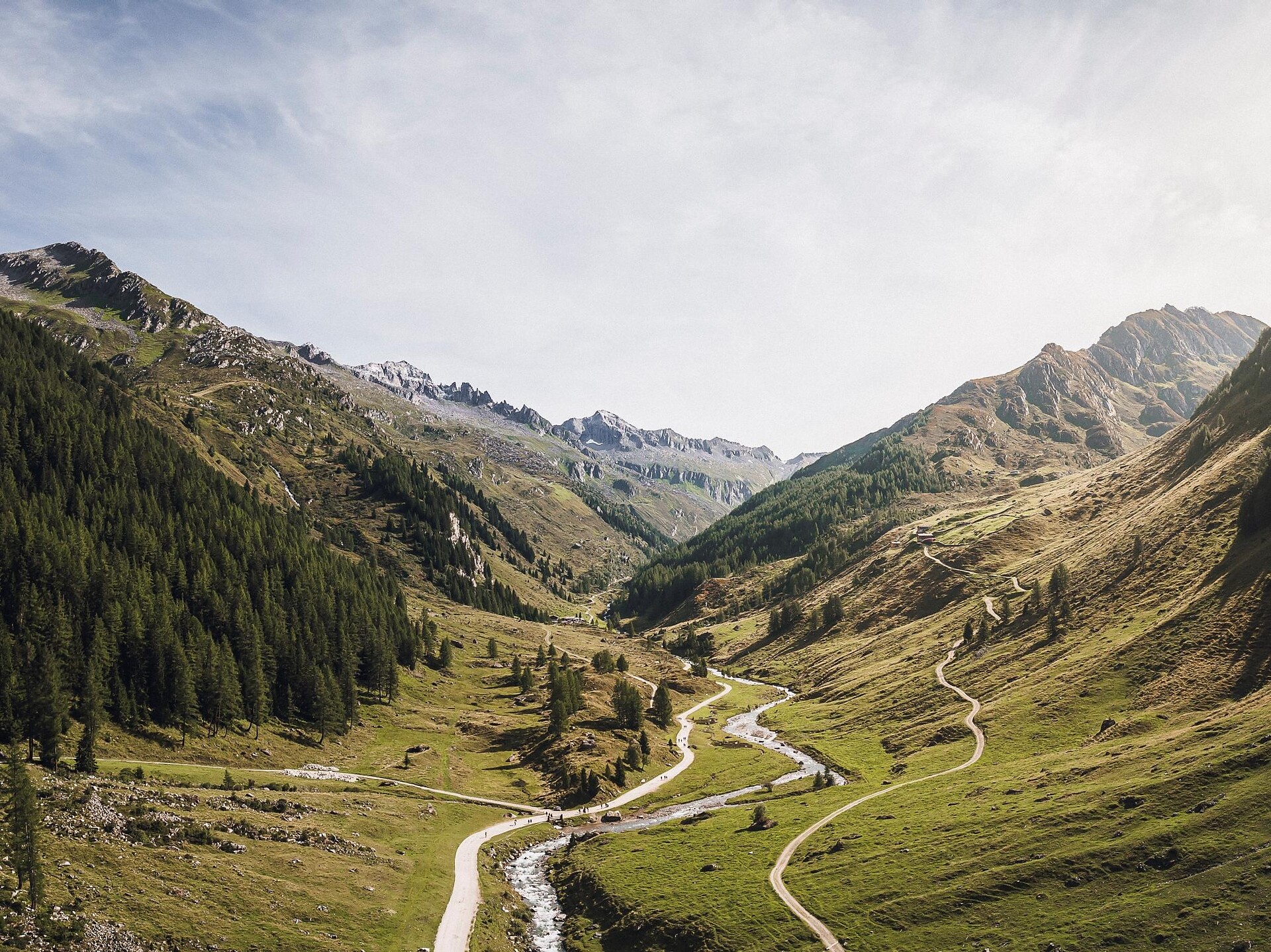
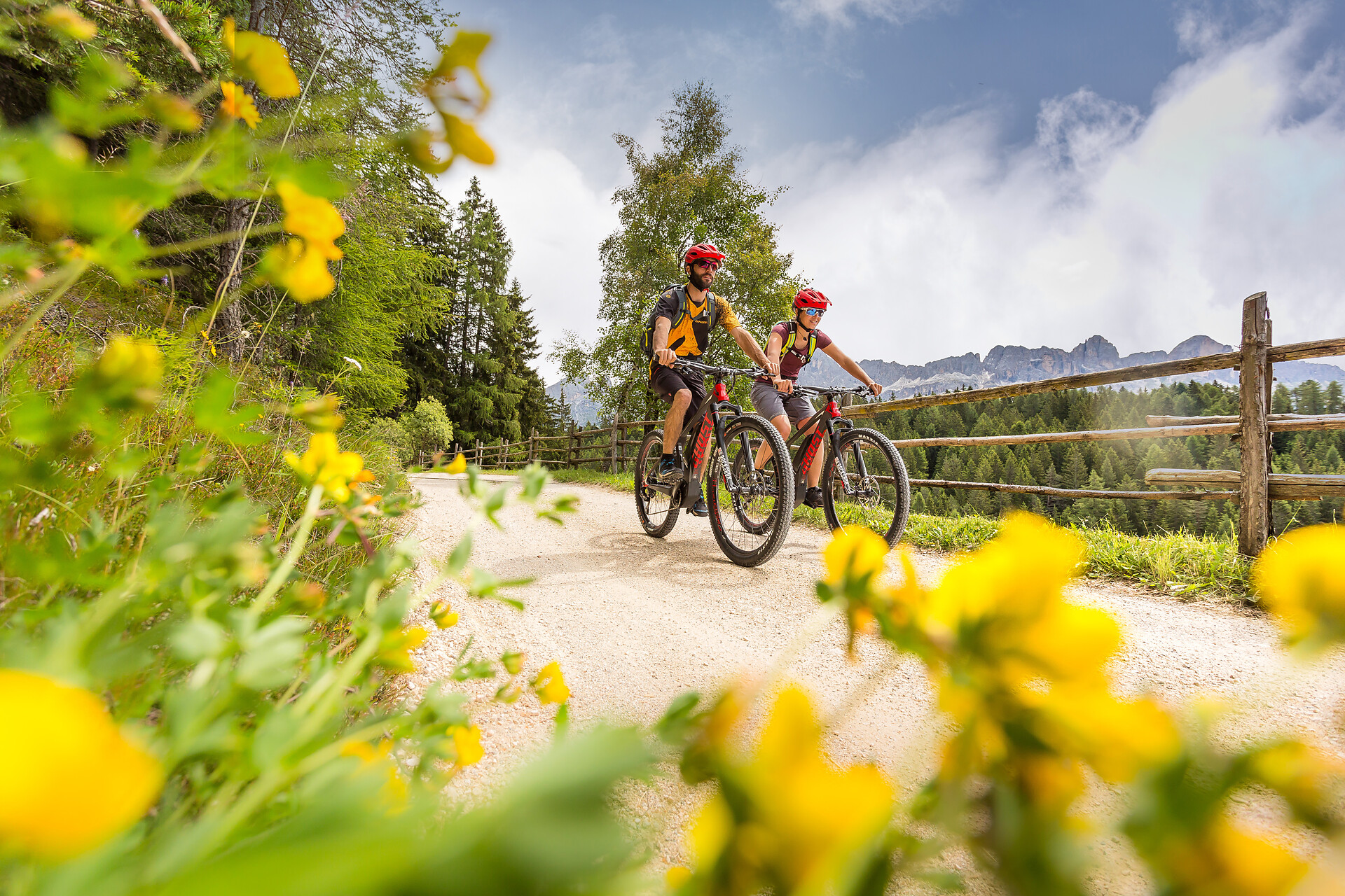
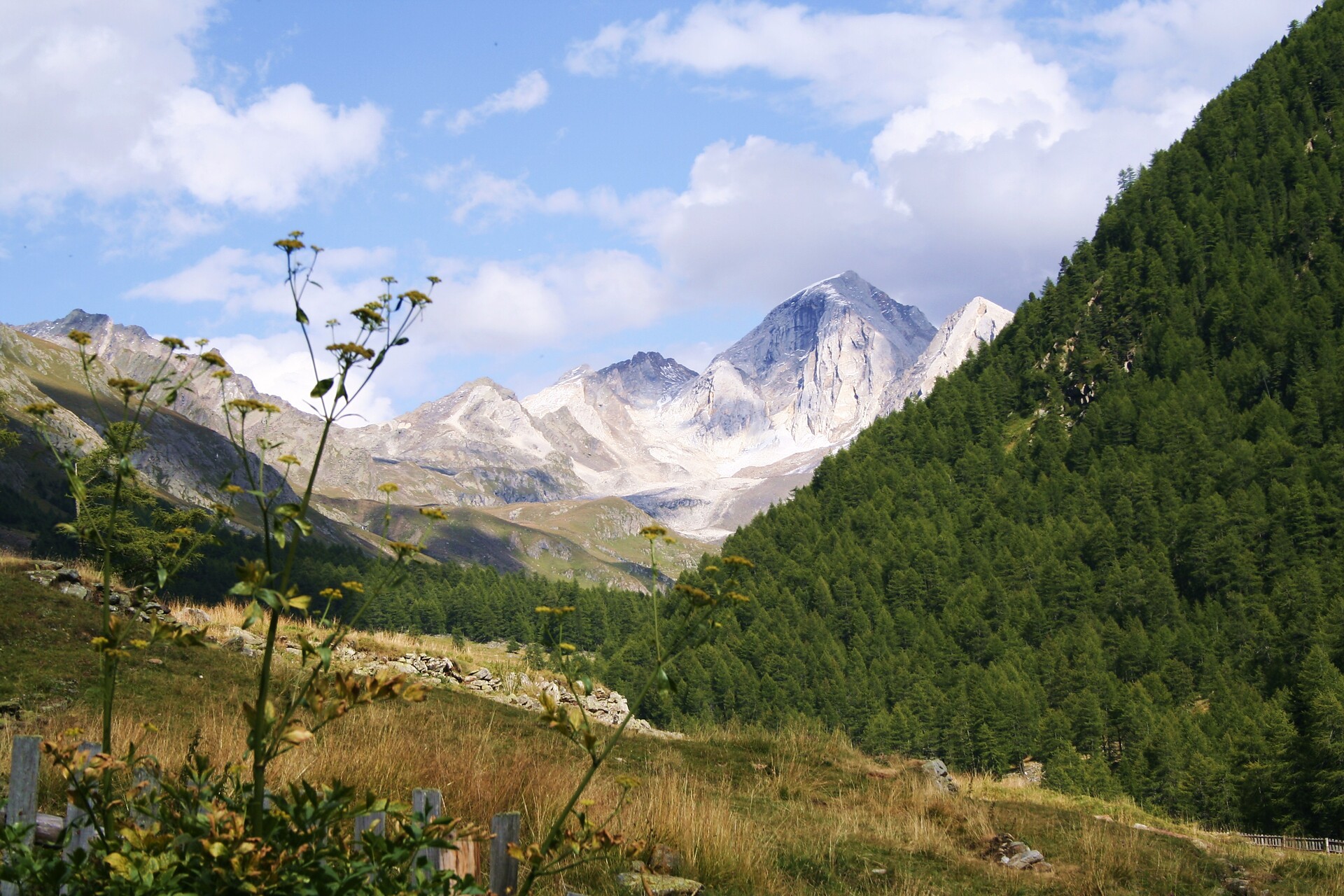
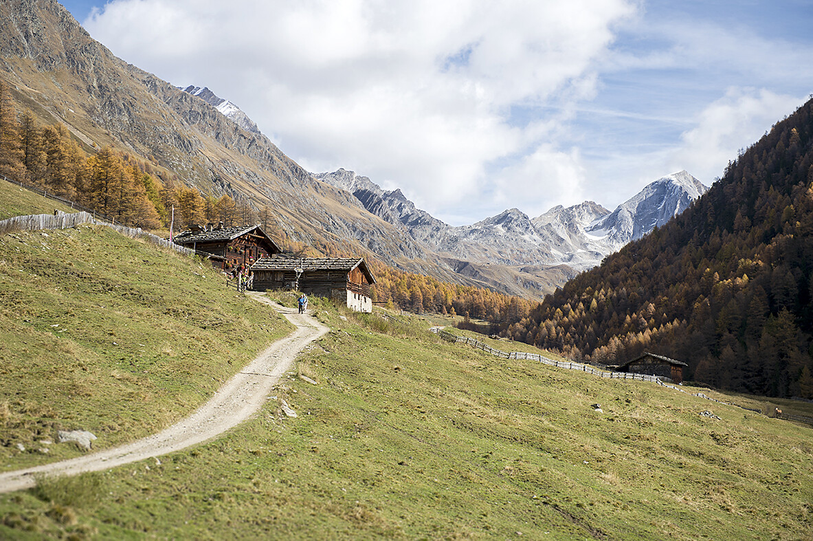
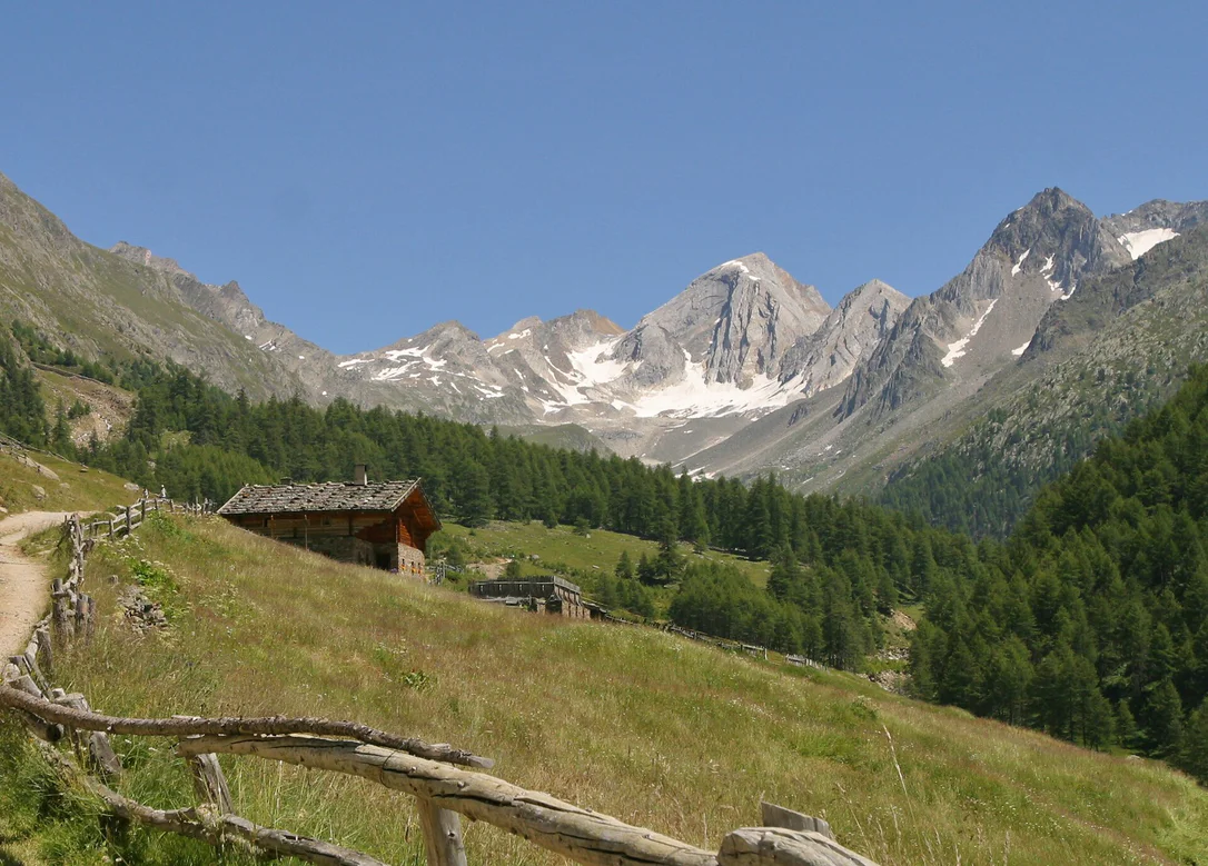
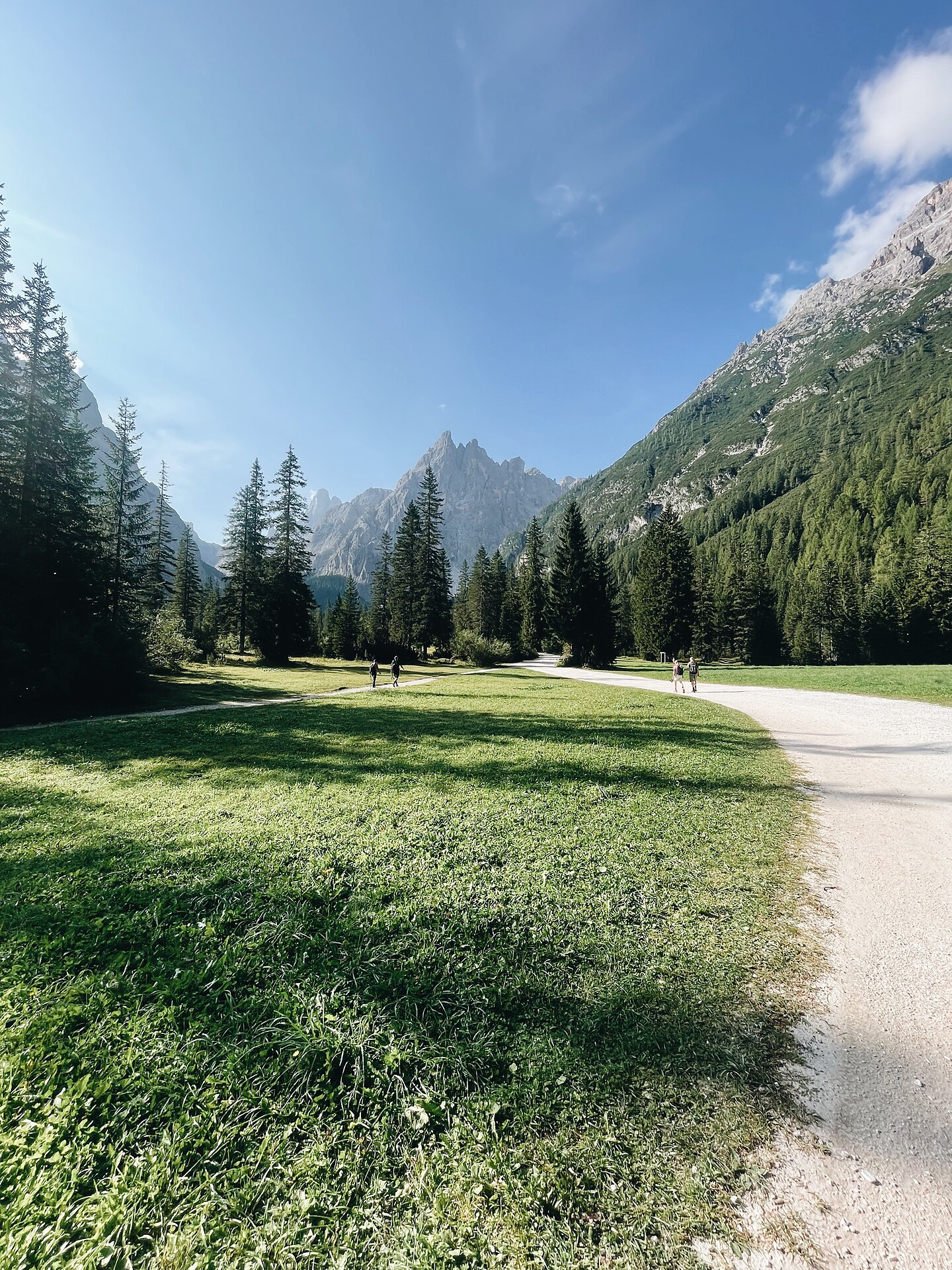
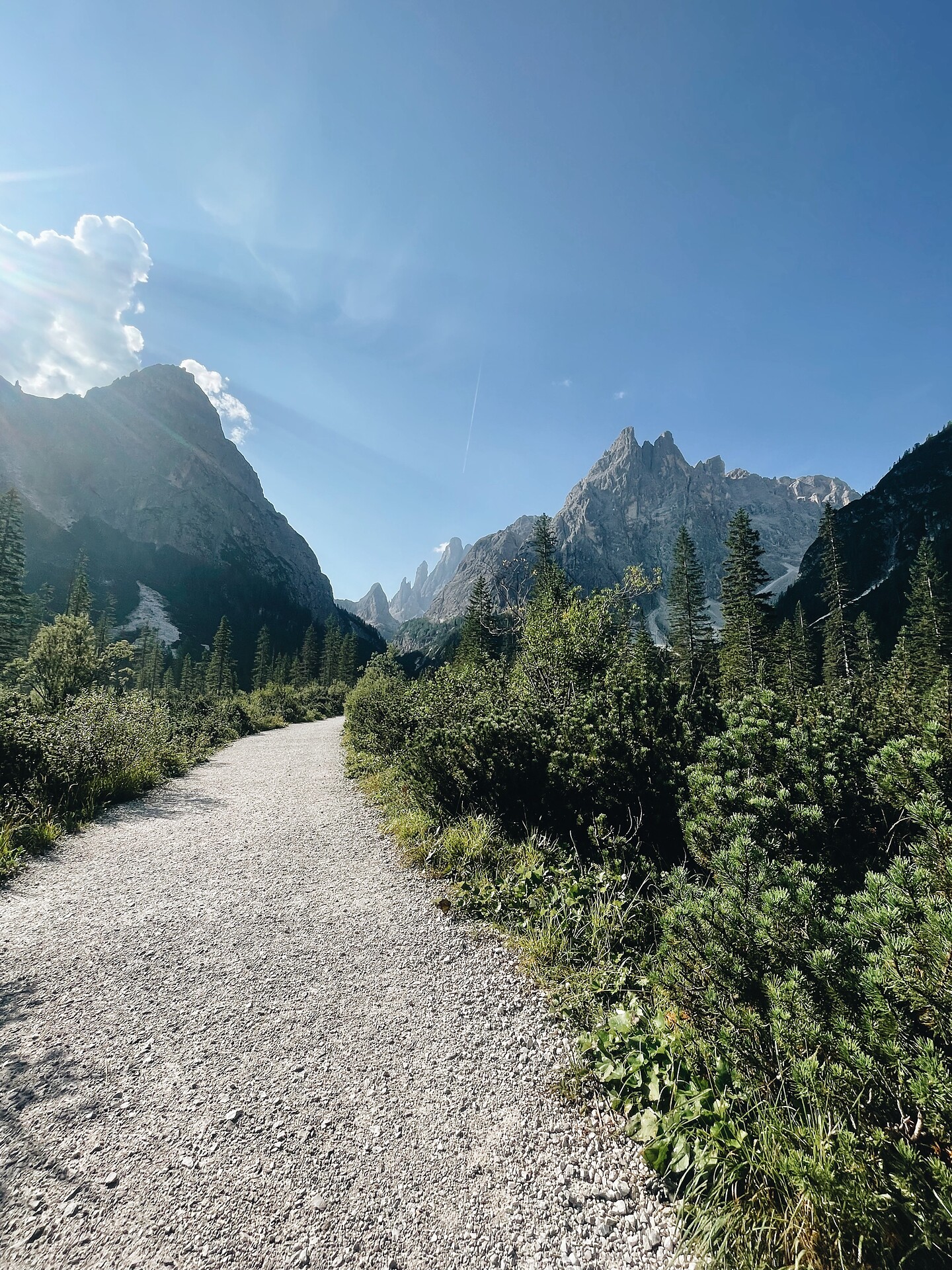
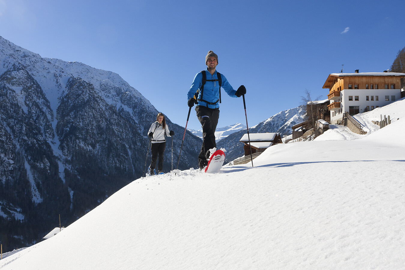
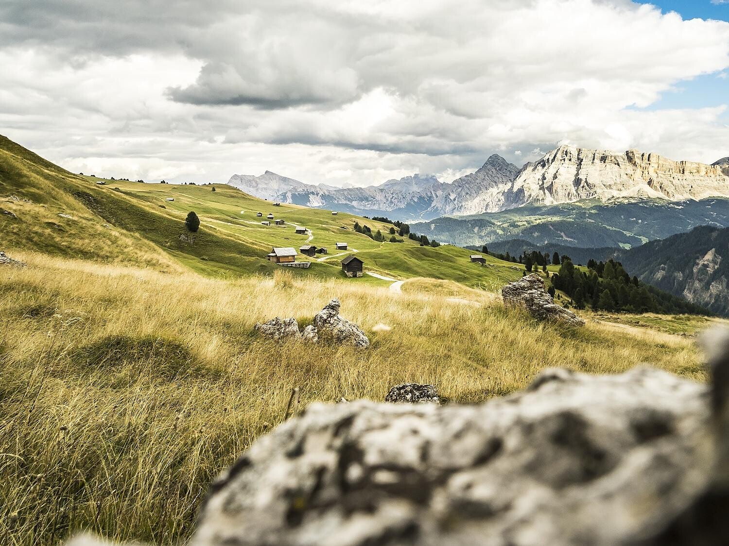
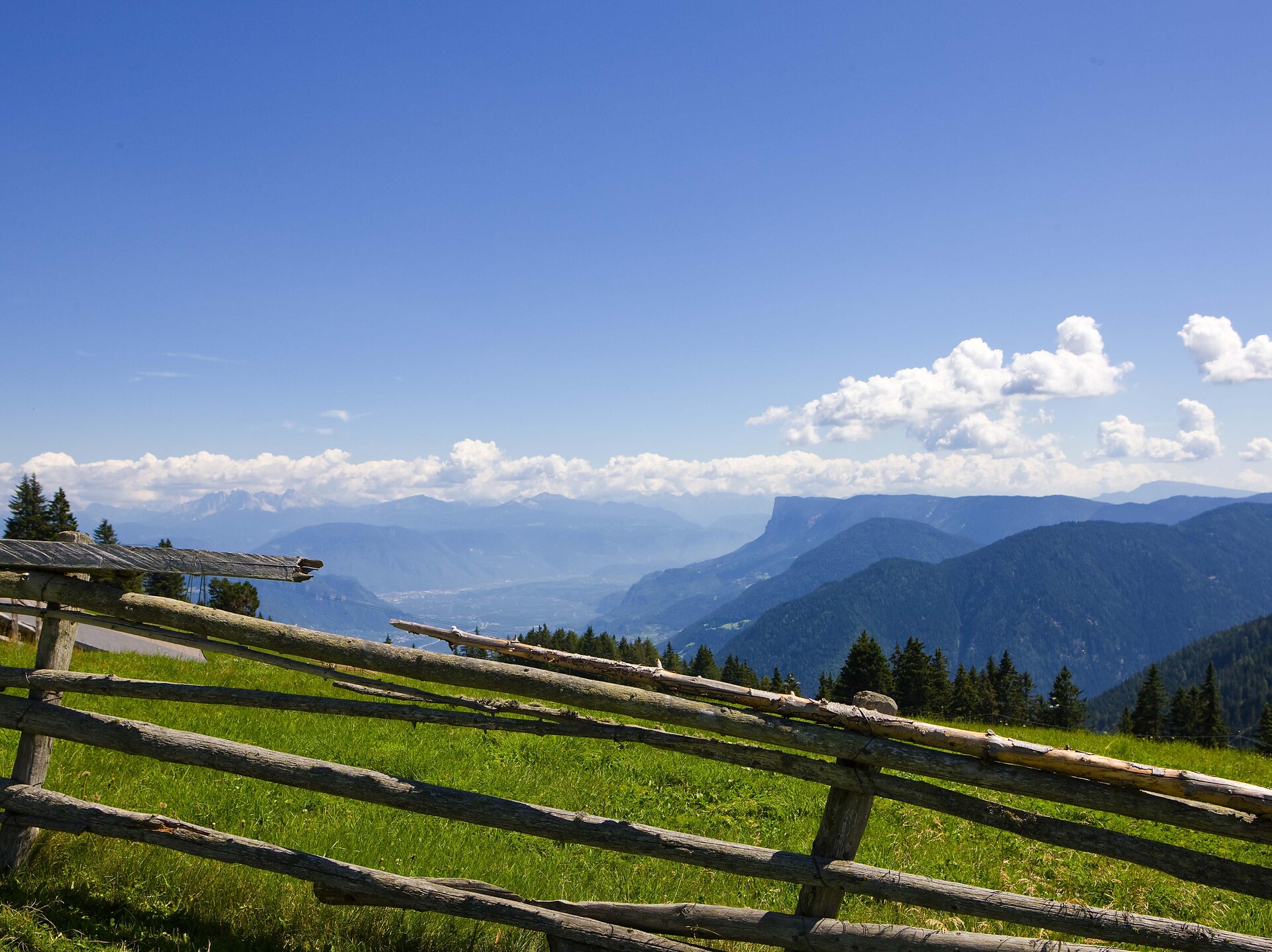
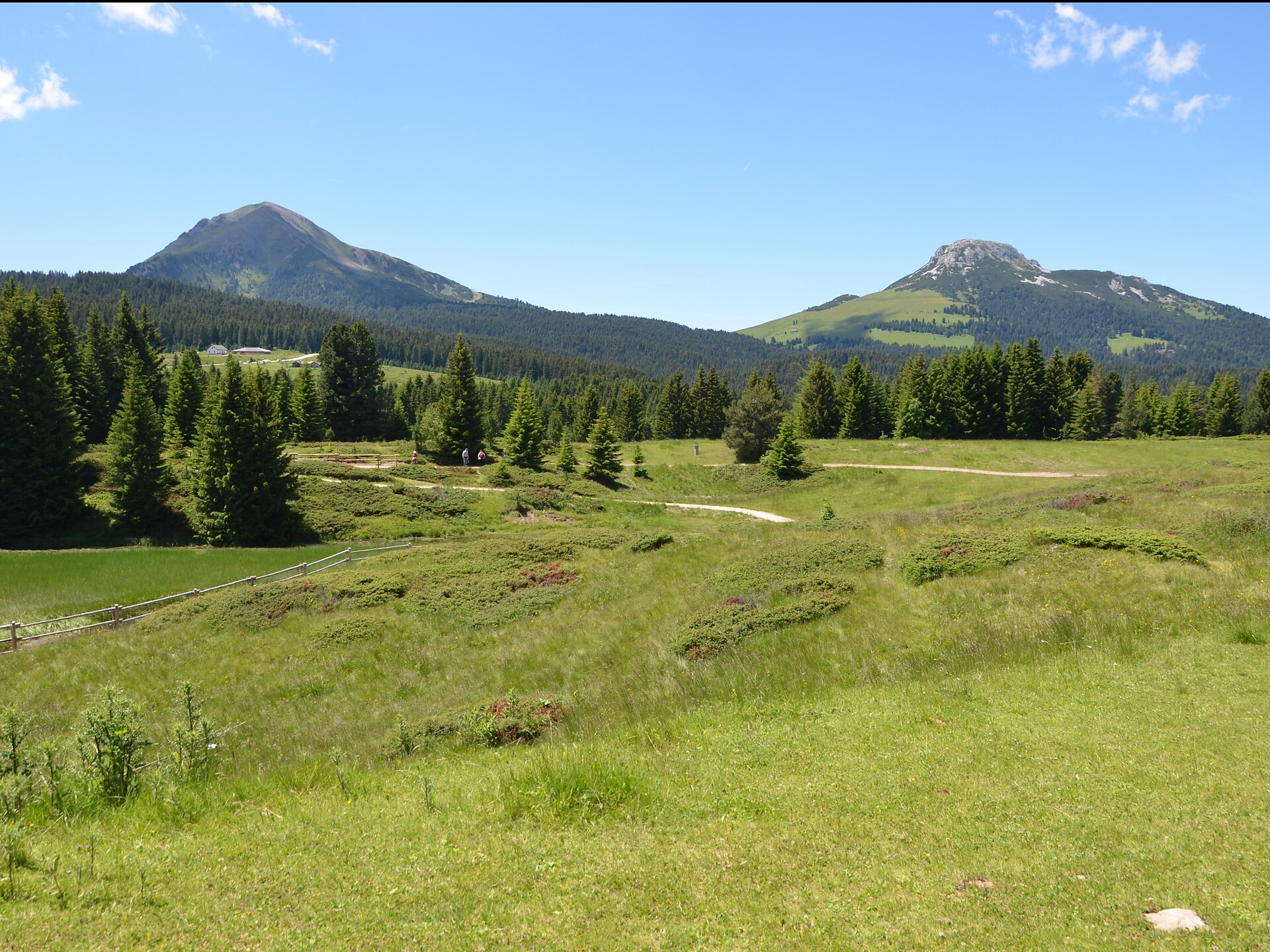
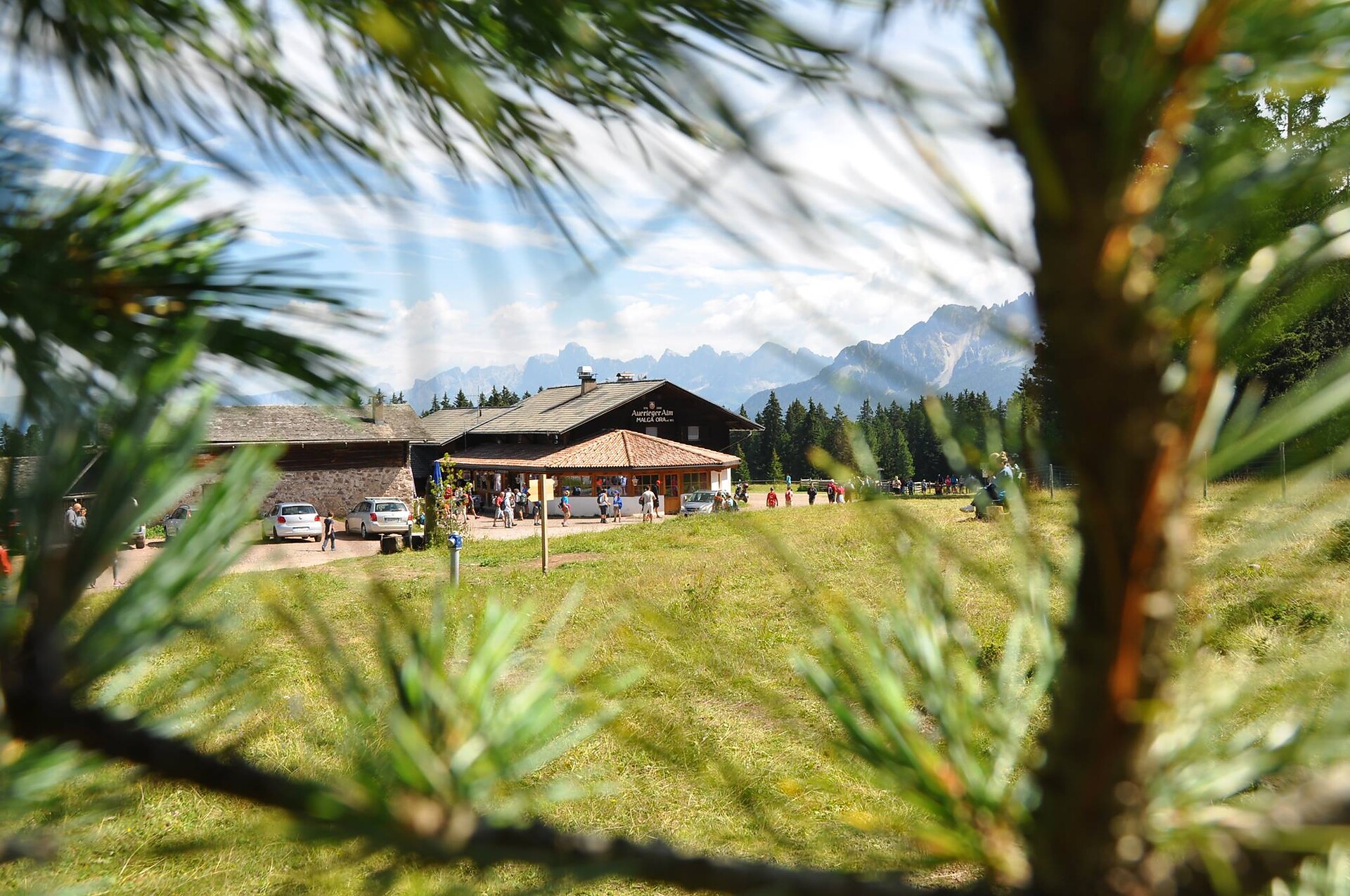
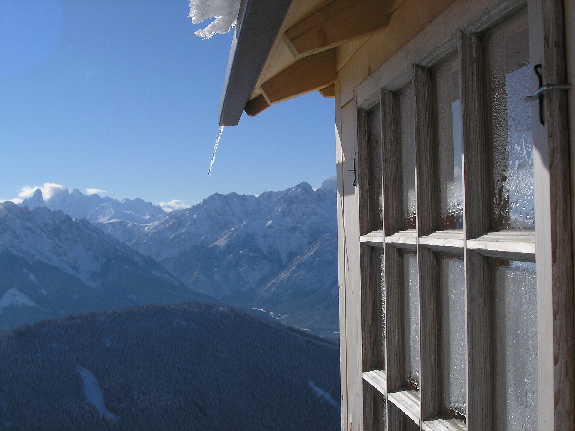
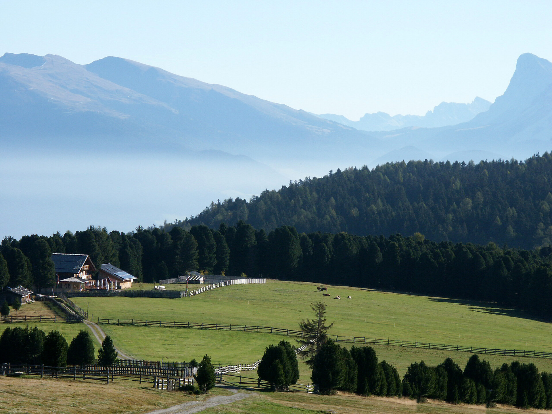
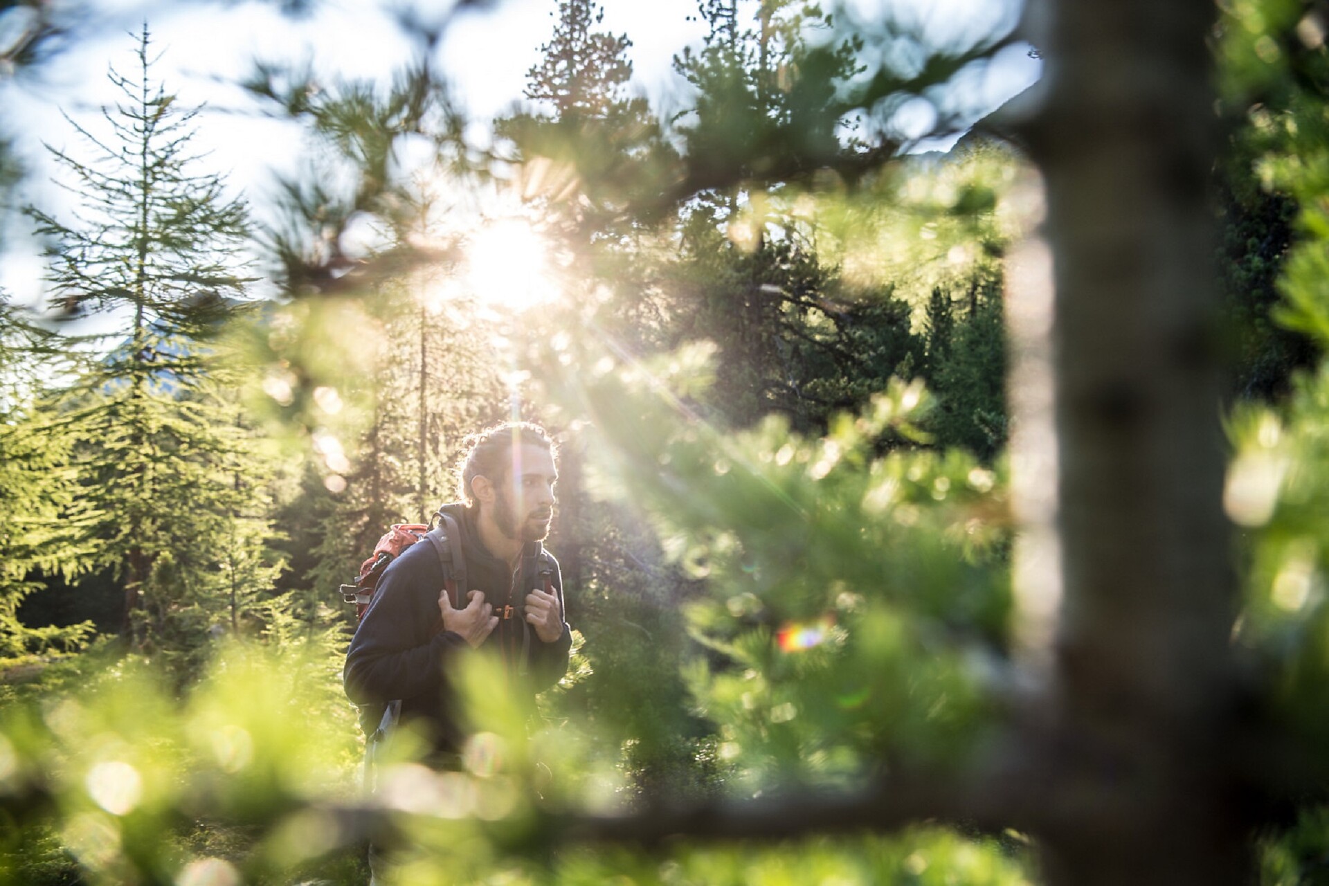
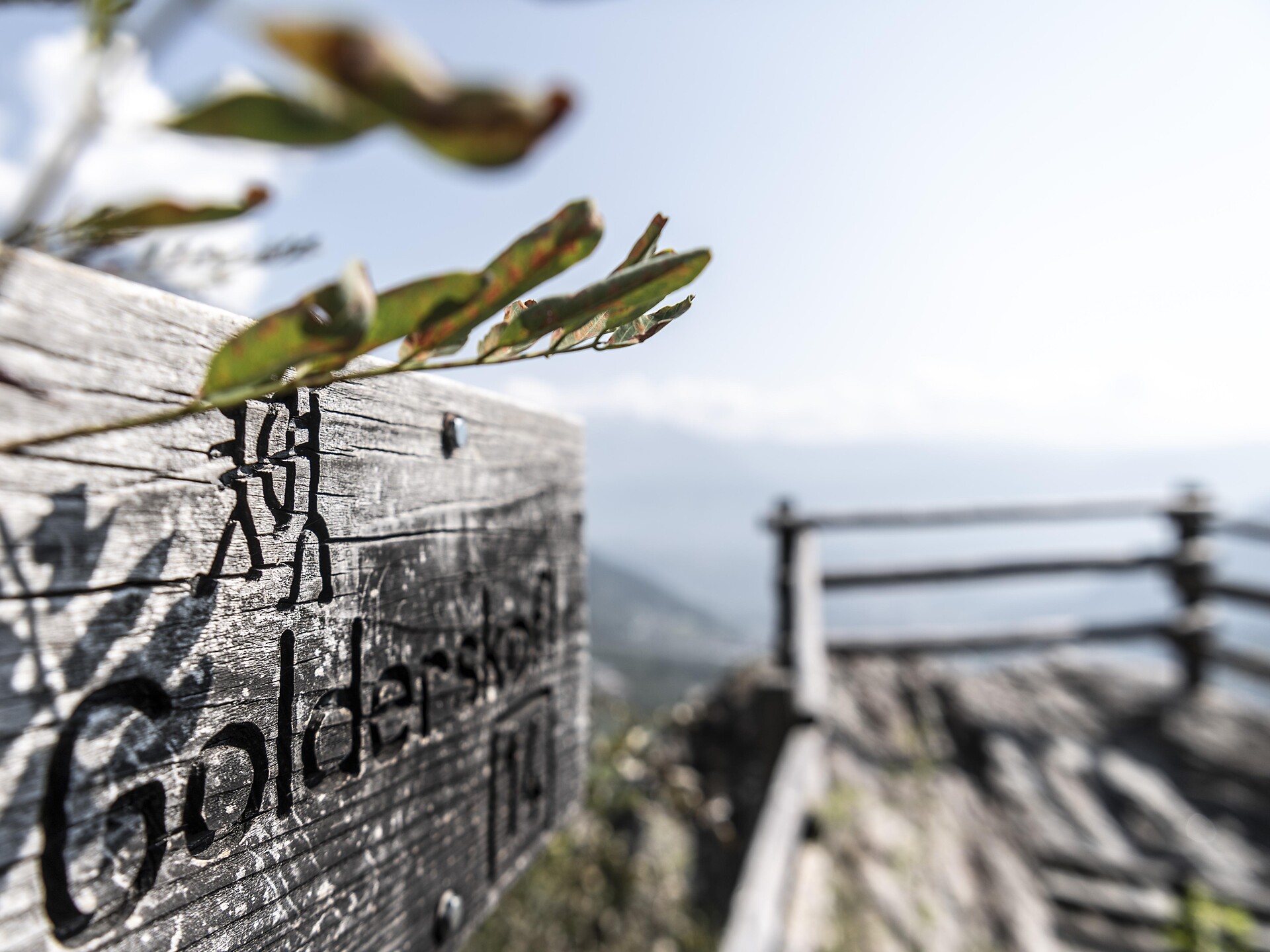
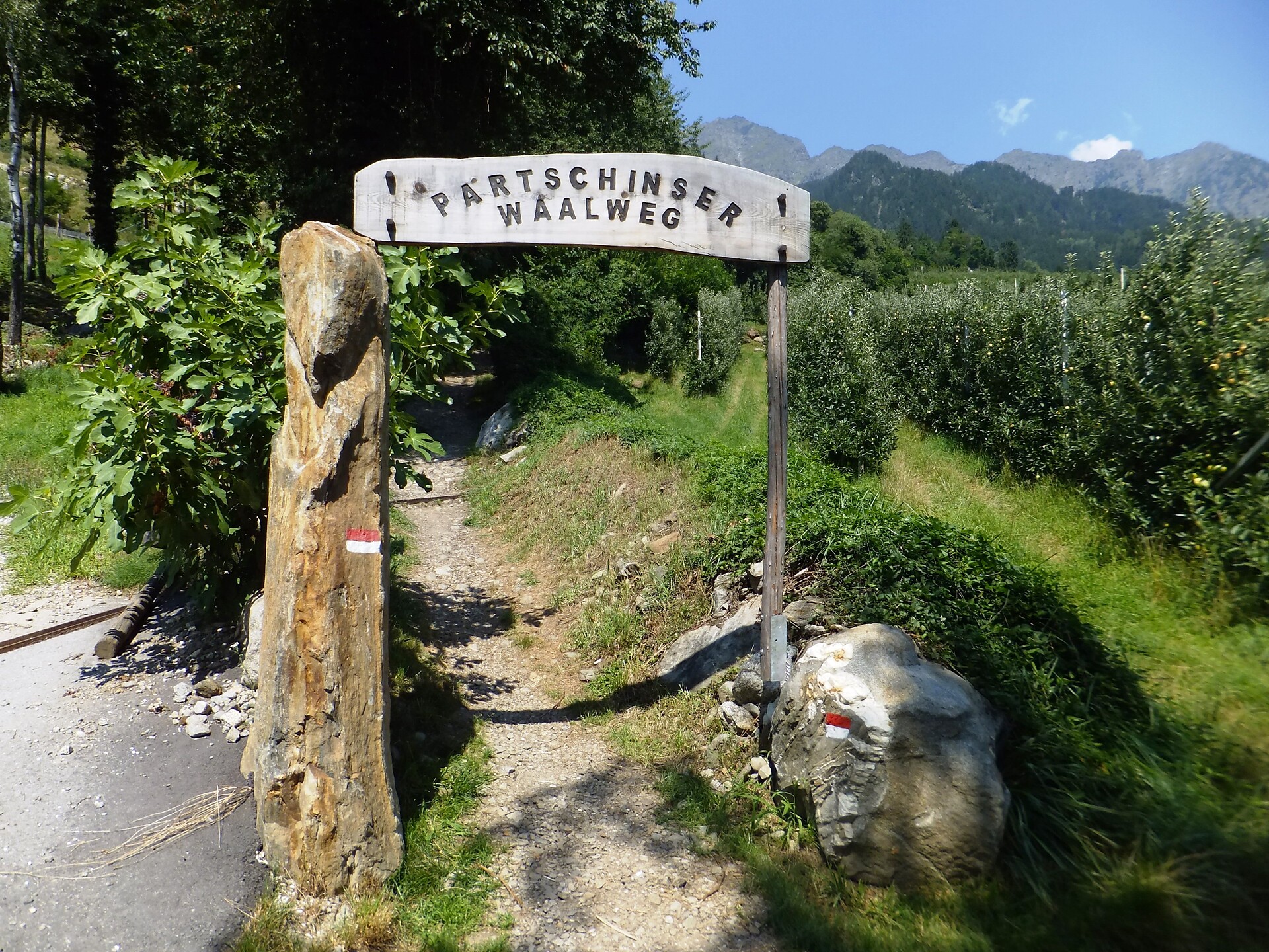
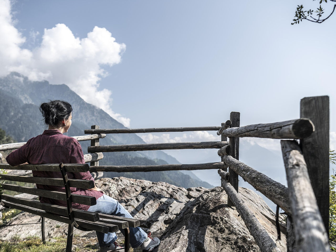
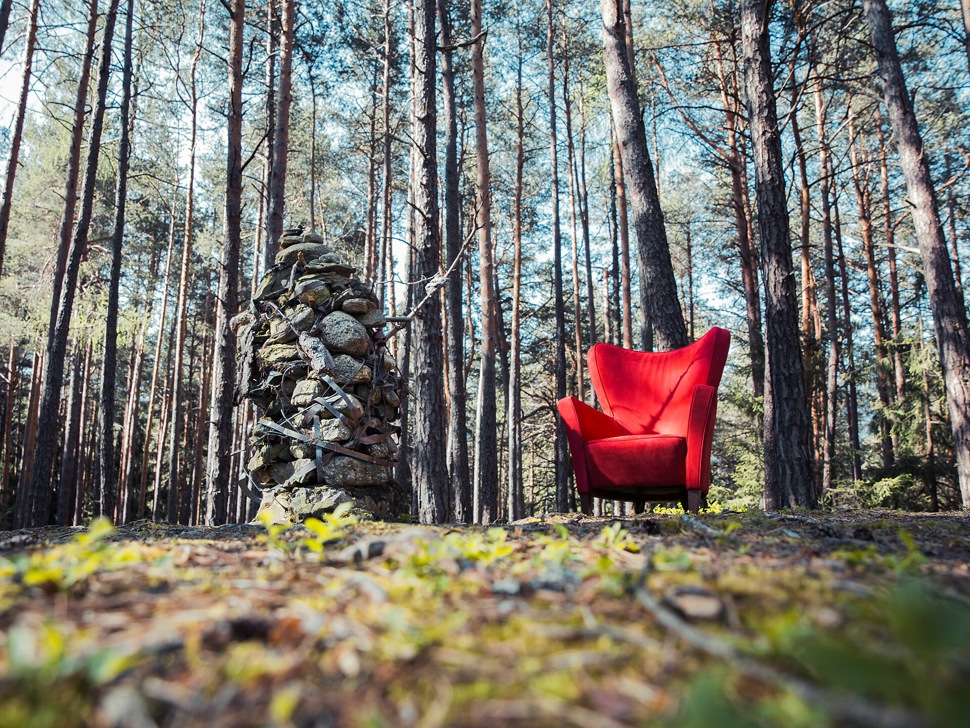
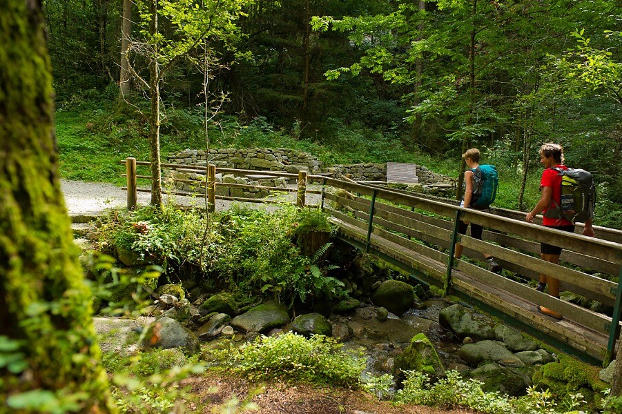
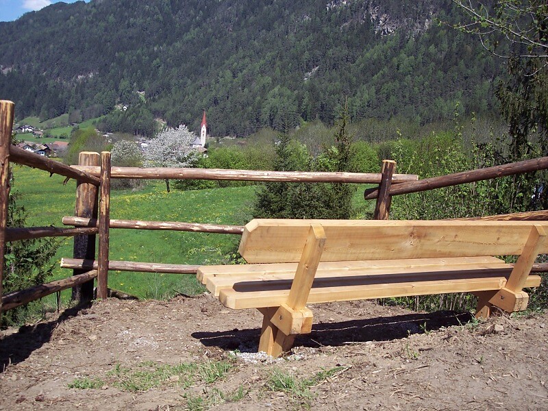
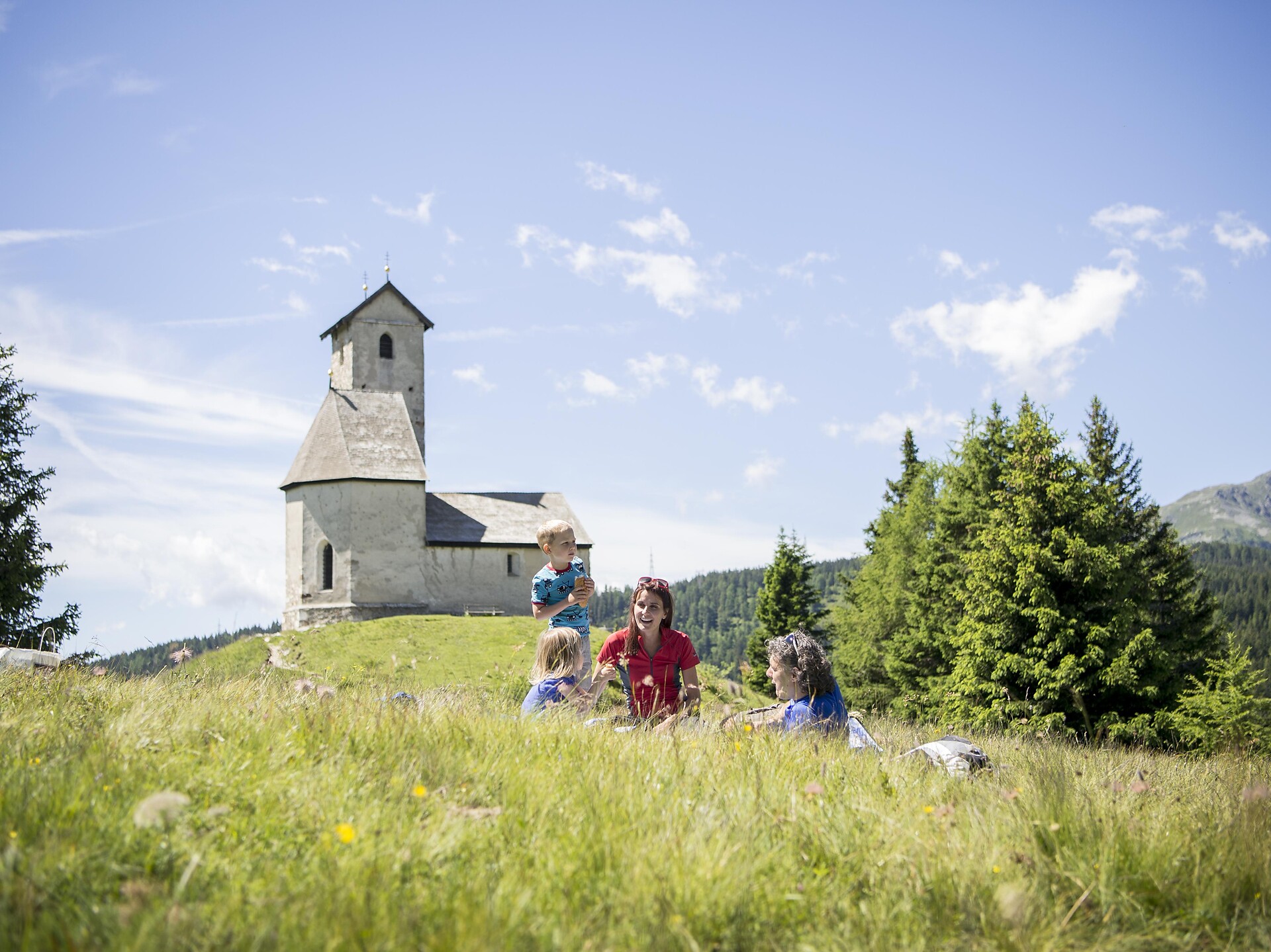
From Gisser Eck in San Sigismondo/St. Sigmund, this hike runs along a sun-spoilt hillside dotted with fascinating glimpses of farm life in the Pusteria/Pustertal valley. On a three-hour hike, this circular trail sets off from the valley bottom and leads through granite-ridden slopes to low mountain plateaus with spectacular views of dense pine forests firmly grappled into the hillside with their widely ramified, deep-reaching roots. Scattered across the glacier-shaped landscapes, quartz phyllite rocks and boulders stick out alongside a number of granite glacial erratics. Many lookout points offer inviting spots for a long break, admiring the panoramic views.
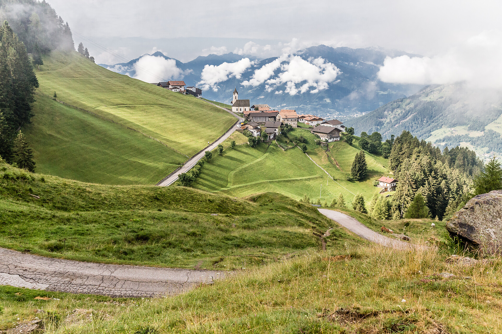
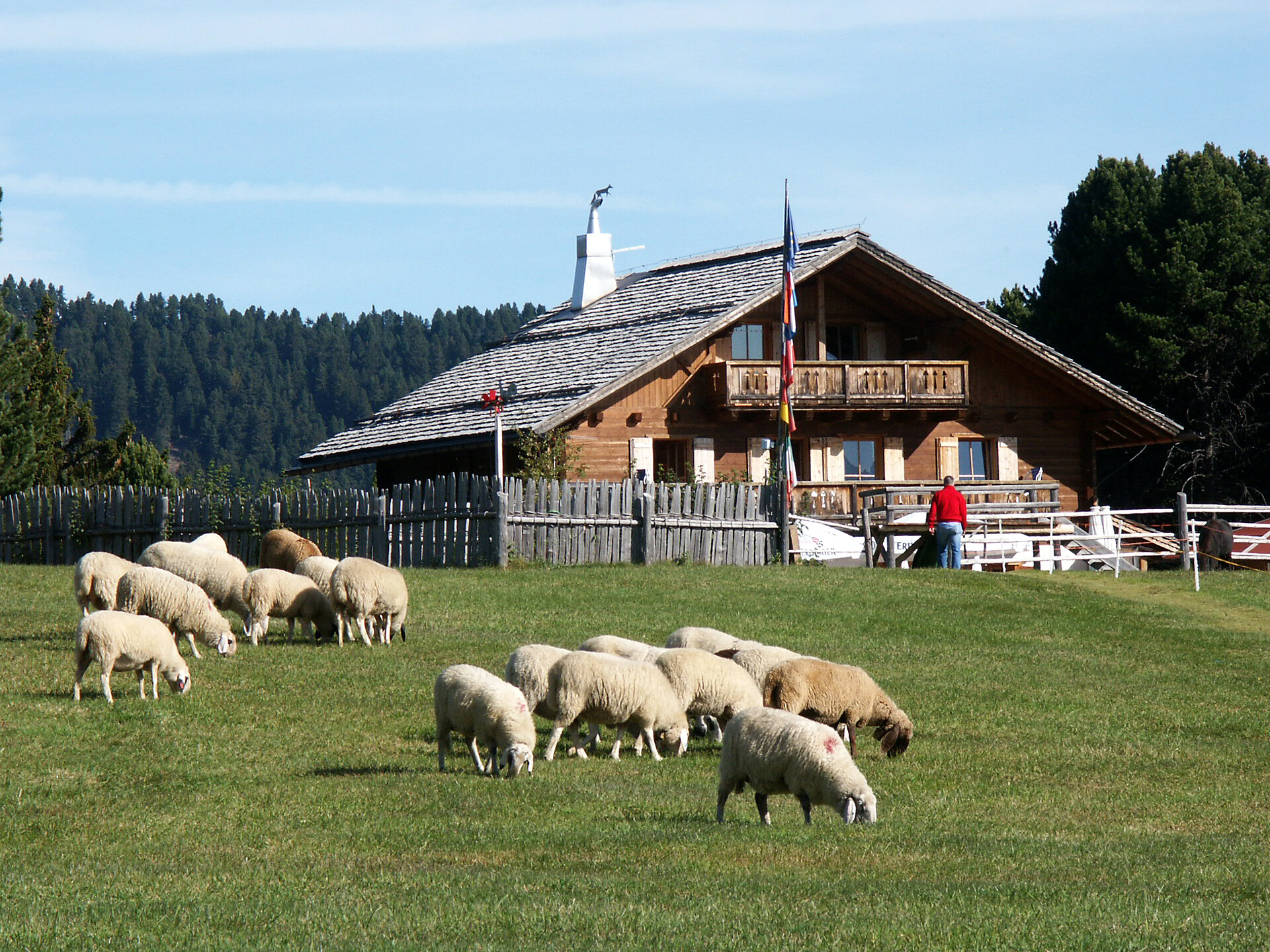
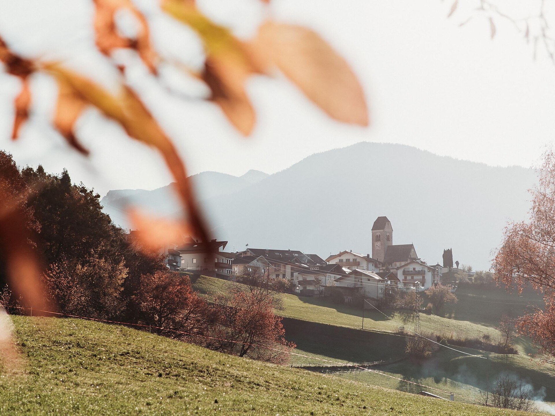
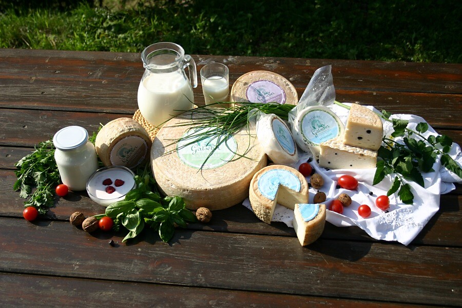
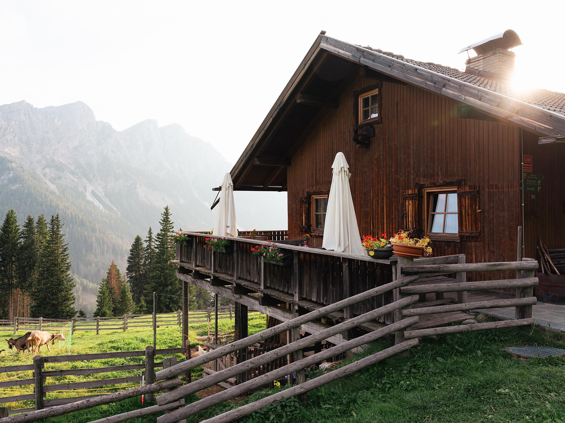
Chosen to describe the tradition each farmhouse was known for, the names of the many widely dispersed farmsteads tell an interesting tale: Decker-Hof is derived from Decke, the German word for blanket, while Perchner-Hof refers to a birch grove, Friesenbühel alludes to a frosty hill, Gatscher Hof describes a badly-cut forest clearance, Hitthaler-Hof is reminiscent of a valley of inns and mountain huts (Hüttental), and Neller-Hof is a shortened reference to the name Cornelius.
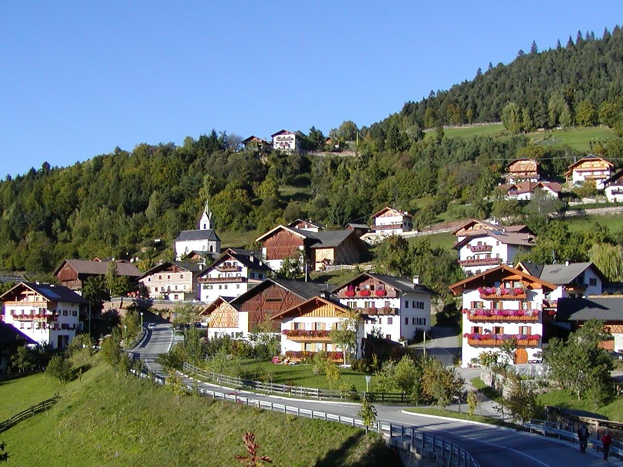
From Chienes/Kiens, the trail continues back to San Sigismondo/St. Sigmund through these quaint rural landscapes. There are a number of inns to take a well-deserved break at: Hotel Gassenwirt, Gasthof Pizzeria Petra, and Bonfanti Design Hotel.

Moeilijkheidsgraad: gemakkelijk
380 m Hoogtemeters
3h:00 min Duur
Hiking
Summer hike to Senes pastures an to the Biella hut
Al Plan/San Vigilio, Dolomites Region Kronplatz/Plan de Corones

PEDERÜ › FODARA VEDLA (1980 m, H: 1 hour) › SENES (2116m, H: 2 hours) › BIELLA/SEEKOFEL INN (2300 m, H: 3.5 hours)

From Pederü, walk on the access road to the pastures of Fodara Vedla and Senes; from Senes follow waymark No. 6; return is also possible via lake of Braies (Alta Via No.1  -  3 hours from the hut Rifugio Biella). 

Moeilijkheidsgraad: gemiddeld
865 m Hoogtemeters
3h:08 min Duur
Hiking
Through the Spring Valley
Kaltern an der Weinstraße/Caldaro sulla Strada del Vino, Bolzano/Bozen and environs

A nice hike through the Spring Valley to the town of Monticolo/Montiggl.
Change of path along the hike: 13, 20

Moeilijkheidsgraad: gemakkelijk
307 m Hoogtemeters
2h:38 min Duur
Hiking
Promenade to Rungg and S. Valentin
Tramin an der Weinstraße/Termeno sulla Strada del Vino, Alto Adige Wine Road

To "Rungg" and St. Valentin, duration: approx. 45 minutes, asphalt

Moeilijkheidsgraad: gemakkelijk
0 m Hoogtemeters
0h:45 min Duur
Snowshoe Hikes
On the sunny side
Lana, Meran/Merano and environs

Start: Bergstation Seilbahn Vigiljoch, 1.486 m
Gehzeit: ca. 1 Stunde 15 Minuten
Länge: 3.424 m, Aufstieg 322 m

Moeilijkheidsgraad: gemiddeld
371 m Hoogtemeters
1h:22 min Duur
Hiking
Lanzwiesen hut- Brunst hut
Welsberg-Taisten/Monguelfo-Tesido

A delightful alpine walk along the so-called “Almsteig”: Starting from the Lanzwiesen Alm, the trail leads gently across the mountain landscape to the Brunstalm, with hardly any elevation gain.
Both alpine huts are perfect places to stop for a bite to eat – making this an ideal, relaxed hike with scenic views and local flavors.

Moeilijkheidsgraad: gemakkelijk
272 m Hoogtemeters
1h:52 min Duur