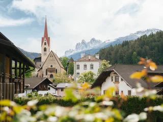
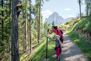
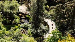
Südtirol Guide App Logo
Přeskočit na obsah

přidáno k oblíbeným

odebráno z oblíbených

Jejda! Došlo k problému, zkuste to prosím znovu

Vytváří se váš účet

Váš účet byl úspěšně vytvořen a nyní jste přihlášeni

Jste úspěšně přihlášeni!

Váš účet byl úspěšně vytvořen, ale nepodařilo se nám vás automaticky přihlásit

Jste odhlášeni

Filtr
Vybrané filtry
    Úroveň obtížnosti
    Doba trvání
    Vzdálenost v km

    Tematické procházky Jižním Tyrolskem

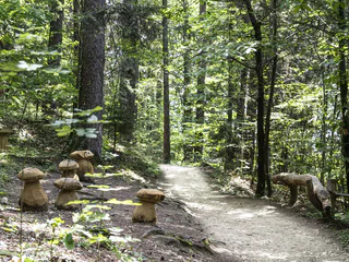
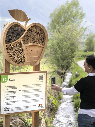
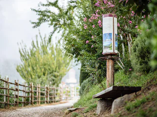
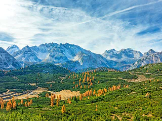
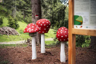
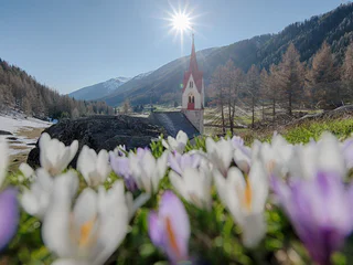
    Všude v prázdninových regionech Jižního Tyrolska jsou vyznačeny tematické procházky, speciální objevitelské trasy pro malé i velké. Například v jihotyrolském Unterlandu mohou návštěvníci na podzim zažít, jak se hrozny dostanou z vinné révy do sudu. V San Valentinu v Campo/Gummeru můžete prozkoumat vesmír a naši sluneční soustavu a v Terlanu/Terlanu pěstitelé chřestu předvedou, jak se na jaře získává ze země vzácný chřest. Celkem na návštěvníky Jižního Tyrolska čeká více než 150 značených a poučných tematických procházek.

    Výsledky
    Summer
    Hike: 1753, along the historical borderline
    Sexten/Sesto, Dolomites Region 3 Zinnen

    An impressive hike along the historic border between Tyrol and the Republic of Venice, marked in 1753. From Kartitsch via Comelico Superiore to Sexten - a trail that combines nature and over 2000 years of history.

    Obtížnost: střední
    1754 m nadmořská výška
    7h:28 min doba trvání
    Summer
    Health path Prettau/Predoi
    Prettau/Predoi, Ahrntal/Valle Aurina

    The Health Path Prettau/Predoi offers on 4 km a lot for the human well-being. Exercise in the wood, stunning views and much more. 

    Obtížnost: nízká
    365 m nadmořská výška
    1h:45 min doba trvání
    Long-Distance Hiking Paths
    360° Alta Val Venosta - The varied circular adventure trail in the Upper Venosta Valley
    Mals/Malles, Vinschgau/Val Venosta

    The 360° Upper Vinschgau Panorama Trail is an adventure circular hiking trail that connects eleven villages in eleven stages. It offers some of the most beautiful views of the Upper Vinschgau around Lake Reschen. In addition to a variety of scenic and cultural highlights, hikers will be surprised by individual, interactive nature installations at each stage.

    Obtížnost: střední
    5758 m nadmořská výška
    43h:40 min doba trvání
    Long-Distance Hiking Paths
    360° Alta Val Venosta: Tubre i.V.M./Taufers i.M. - Slingia/Schlinig
    Taufers im Münstertal/Tubre, Vinschgau/Val Venosta

    The tenth and most challenging stage of the 360° Obervinschgau circular hiking trail leads through impressive high alpine landscapes with magnificent views of the Sesvenna Group and the Obervinschgau valley basin, with a viewing platform as a special highlight.

    Obtížnost: vysoká
    1417 m nadmořská výška
    7h:30 min doba trvání
    Summer
    Hike: Meditation and Fairytale Path
    Sexten/Sesto, Dolomites Region 3 Zinnen

    Legends and stories about the Sextner Tal valley and the Alta Pusteria/Hochpustertal valley have been told and passed on here for years. Now these many fairytales and stories have been used to create a Fable Trail (Fabelweg) in Sesto. Figures depicting characters from all kinds of legends have been set up along the route, giving visitors an insight into a different world.

    Obtížnost: střední
    700 m nadmořská výška
    3h:00 min doba trvání
    Summer
    Jochgrimm Oclini - trail of alps
    Aldein/Aldino

    From the Jochgrimm parking lot, you proceed through the idyllic natural landscape of Jochgrimm. During this roundtrip tour, you will pass by several hosted alpine inns where you obtain refreshments and rest before continuing your hike.

    Obtížnost: nízká
    157 m nadmořská výška
    1h:25 min doba trvání
    Long-Distance Hiking Paths
    Trail e | Altrei - Truden
    Truden/Trodena

    On this segment, you will proceed through the Truden Horn Nature Park from the picturesque little village of Altrei to the multi-faceted alpine village of Truden. You will begin on an old cobblestone trail to the high-altitude bog of "Langes Moos." The trail continues upwards via the forest trail until you come to the Krabes-Alm at an elevation of 1,540 meters above sea-level. This is a good opportunity to stop for a rest. The trail continues through the Truden Horn Nature Park and then downhill to the village of Truden.

    Obtížnost: střední
    372 m nadmořská výška
    2h:51 min doba trvání
    Summer
    St. Johann's meditational Path
    Ahrntal/Valle Aurina, Ahrntal/Valle Aurina

    St. Johann‘s meditational trail was established in 1996 by the local parish council and St. Johann‘s Schützenkompanie (protection guards). Its creation commemorated the 200th anniversary of the Sacred Heart of Jesus pledge that was sworn in 1796 and remains part of the local tradition today. Walkers are invited to stop at each station along the path to be informed by the contemplative texts and images.

    Obtížnost: nízká
    128 m nadmořská výška
    0h:52 min doba trvání
    Long-Distance Hiking Paths
    Trail e | Truden - Altrei
    Altrei/Anterivo

    This route will lead you through the Truden Horn Nature Park from the multi-faceted alpine village of Truden all the way to the charming little village of Altrei. The trail is first uphill to the Krabes-Alm, at an elevation of 1,540 meters above sea-level; this is a good place to stop for a short rest. You will then proceed along a forest trail until you come to the high-altitude bog of "Langes Moos." Then you can return to Altrei via an old cobblestone path.

    Obtížnost: střední
    429 m nadmořská výška
    2h:55 min doba trvání
    Long-Distance Hiking Paths
    Trail c1 | Altrei - Montan
    Altrei/Anterivo

    This challenging segment leads from the alpine village of Altrei to the famed Pinot Noir village of Montan – from 1,200 meters down to 500 meters above sea-level. From Altrei, the route continues uphill via the Ziss Saddle all the way to the Horn-Alm (managed) with a wonderful view, at an altitude of more than 1,700 meters above sea-level – the highest point of this segment. From here, the trail is almost totally downhill. The next segment will take you to the Hackelboden forest hut (not managed!) and on to the hamlet of Gsteig (option for food/drink and overnight lodgings). You will then pass by the roaring Glen Waterfall via the former Fleims Valley railroad and on to Montan.

    Helpful hint for this route: Take the little side-trip from Gsteig to the impressive "Kanzel" looming high above the Unterland district. You'll be rewarded with a fantastic view!

    Obtížnost: střední
    641 m nadmořská výška
    4h:34 min doba trvání
    Summer
    Hike: From Sexten to the Waldkapelle chapel
    Sexten/Sesto, Dolomites Region 3 Zinnen

    This inspiring trail is very popular with guests and locals alike.
    The history of the forest chapel is interesting: the church, which is almost entirely made of wood, was built around 1917, as the parish church in Sesto was badly damaged during the First World War. For 14 days, the farmers and the priest at the time worked on the church from early in the morning until nightfall. The wood for this came from a hay barn that had been crushed by the snow. In 1917 and 1918, every church service was celebrated there and, especially during the fascist era, the forest chapel served as a hiding place to hold masses in German. Today, the chapel is also known as the Peace Chapel and was restored in 1974. In 1988, at the suggestion of the then parish priest Markus Küer and in collaboration with the Sesto woodcarver Georg Lanzinger, a path of reflection was laid out to the chapel. Near the chapel there are cup stones, which are among the oldest traces of settlement in Sesto and are also the last of the biblical stations along the path of reflection.

    Obtížnost: střední
    213 m nadmořská výška
    0h:49 min doba trvání
    Summer
    Aldein tour
    Aldein/Aldino

    The Aldein village tour will take you first to the valley and the Mill Museum and to the Maria Schnee Chapel. You can then stroll through a well-groomed cultural landscape over the porphyry plateau to Lake Göller. This is a great opportunity to stop for a pause before continuing the roundtrip tour via the Burgstallegg and then back to the village square. This charming landscape presents an inviting opportunity to relax and linger.

    Obtížnost: nízká
    391 m nadmořská výška
    3h:23 min doba trvání
    Summer
    Pinot Noir Walkway - alternative route: Montan/Montagna - Glen/Gleno - Montan/Montagna
    Montan/Montagna, Alto Adige Wine Road

    The Pinot Noir walkway leads through the Pinot Nor growing area along the Trudner Horn/Monte Corno Nature Park and the characteristic villages of Auer/Ora, Montan/Montagna and Neumarkt/Egna. The Pinot Noir growing area in Montan and Mazon/Mazzon is one of the most famous in Italy. Furthermore you walk through several monuments and historical places. The walkway is family-friendly and not dangerous.

    Obtížnost: nízká
    140 m nadmořská výška
    1h:10 min doba trvání
    Long-Distance Hiking Paths
    Trail c1 | Montan - Altrei
    Altrei/Anterivo

    This challenging segment leads from the famed Pinot Noir village of Montan all the way to Altrei. This alpine village is situated at an elevation of almost 1,200 meters above sea-level. From Montan, the route leads via the old railroad route of the former Fleims Valley railroad, on past the Glen Waterfall, up to the hamlet of Gsteig (option for food/drink and overnight lodgings). Then, from the Kalkofen parking lot, you will take the steep uphill route to the Hackelboden forest hut (not managed!) and on to the Horn-Alm (which is managed), the highest point of this segment. After a short pause (option for food/drink and overnight lodgings), you continue downhill along an easy path via the Ziss Saddle. You might want to stop at the Kneipp hydro-therapeutic station on your way to Altrei.

    Helpful hint for this route: Take the little side-trip from Gsteig to the impressive "Kanzel" looming high above the Unterland district. You'll be rewarded with a fantastic view!

    Obtížnost: vysoká
    1402 m nadmořská výška
    5h:31 min doba trvání
    Summer
    A pleasant stroll around the ruins of Castelfeder
    Auer/Ora, Alto Adige Wine Road

    The Castelfeder hill is an ancient cultural landscape with settlement remains dating back to the Stone Age and Bronze Age. The remains of the castle complex, the legendary “slide of fertility” and the Santa Barbara chapel walls are testament to its mystical past. The area is of particular importance not only from an archaeological and historical perspective but also from an ecological point of view as for years it has enjoyed the status of being a protected natural habitat (biotope).

    Obtížnost: nízká
    151 m nadmořská výška
    1h:42 min doba trvání
    Summer
    Pinot Noir Walkway - alternative route: Neumarkt/Egna - Mazon/Mazzon - Vill/Villa
    Neumarkt/Egna, Alto Adige Wine Road

    The Pinot Noir walkway leads through the Pinot Nor growing area along the Trudner Horn/Monte Corno Nature Park and the characteristic villages of Auer/Ora, Montan/Montagna and Neumarkt/Egna. The Pinot Noir growing area in Montan and Mazon/Mazzon is one of the most famous in Italy. Furthermore you walk through several monuments and historical places. The walkway is family-friendly and not dangerous.

    Obtížnost: nízká
    228 m nadmořská výška
    1h:33 min doba trvání
    Summer
    GEOPARC Bletterbach - Dolomiti UNESCO World Heritage site
    Aldein/Aldino

    At the Dolomites UNESCO World Heritage GEOPARC Bletterbach you can find adventure parks, learning center, nature monuments and an impressive Canyon with its geological treasures and diverse landscapes. Discover the history of earth in one of the most beautiful areas in the south of South Tyrol.

    Obtížnost: střední
    0 m nadmořská výška
    4h:00 min doba trvání
    Summer
    Pinot Noir Walkway - alternative route: Auer/Ora - Montan/Montagna - Auer/Ora
    Auer/Ora, Alto Adige Wine Road

    The Pinot Noir walkway leads through the Pinot Nor growing area along the Trudner Horn/Monte Corno Nature Park and the characteristic villages of Auer/Ora, Montan/Montagna and Neumarkt/Egna. The Pinot Noir growing area in Montan and Mazon/Mazzon is one of the most famous in Italy. Furthermore you walk through several monuments and historical places. The walkway is family-friendly and not dangerous.

    Obtížnost: nízká
    264 m nadmořská výška
    1h:57 min doba trvání
    Summer
    To the Redwitzplatz/Radura Redwitz
    Brenner/Brennero, Sterzing/Vipiteno and environs

    For those looking to explore a new, refreshing path, a visit to Redwitzplatz in Gossensass is perfect. The trail begins by crossing the river of Pflerscher at the sports field, then turning right into the wonderful river promenade. Right at the start of this promenade, a small path to the left leads you to Redwitzplatz, where the healing iron spring is located – a true gem for nature and health enthusiasts. From here, various routes open up, leading to Gottschalkweg trail, Vallmingalm hut, or back to the river promenade.

    To get there, you can park at the Gossensass train station parking lot, just 10 minutes away. From there, the path takes you through the pedestrian underpass, then turning right into the valley and left at the second side street, heading towards the forest. The football field is visible from a distance, serving as a landmark.

    A special highlight at Redwitzplatz is the new barefoot trail, allowing you to connect with the earth naturally – a refreshing and relaxing experience. The area is perfect for relaxation or enjoying a picnic surrounded by nature. If you’re looking for a varied outing in a beautiful setting, this is the place for you.

    Obtížnost: nízká
    67 m nadmořská výška
    0h:25 min doba trvání
    Summer
    Circular Hike in the Ridnauntal Valley
    Ratschings/Racines, Sterzing/Vipiteno and environs

    The trail starts from the mine at the top of the Ridnauntal valley and then continues across the Mareiterbach stream and down the valley to below Ridnaun/Ridanna. Then the trail takes you for about 20 minutes along marked route 7A up to the chapel. This can be visited every Monday at 4 pm from May to the end of October, and in July and August also on Fridays at 10 am.

    Obtížnost: nízká
    0 m nadmořská výška
    1h:30 min doba trvání
    Summer
    Hiking tour Ahrntal Sun Trail - Round trip to the waterfalls
    Ahrntal/Valle Aurina, Ahrntal/Valle Aurina

    A beautiful hiking trip near Luttach/Lutago and around the mysterious Schwarzbachklamm is the round trip to the waterfalls. Starting from the sculpture and water park, the route follows the 
    easy hiking trail no. 23 signposted “Wasserfall-Runde” (circular route to the waterfalls), which inclines slightly uphill. The trail leads past a former Waal irrigation channel, which was once used for irrigation. At the next crossroads, the route crosses over a small bridge on the left and then continues through the Schwarzbach Gorge until the hikers finally find themselves standing in front of the magnificent Schwarzbach waterfall.

    The return route first follows the same path until the first junction. The trail now climbs up to the left and leads to the intersection with the Brunnberg road. Here the route turns left again and then follows this road to the first bend where it continues straight ahead along the gravel path. Passing by the Schwarzbach stream, the trail now heads downhill, until, after a short time both the 2nd Schwarzbach waterfall and the 1st fall can be seen from only a short distance until finally the starting point is reached again.

    Obtížnost: střední
    258 m nadmořská výška
    1h:45 min doba trvání
    Barrier-Free
    Family hike to the Rocket Tree House in Steinegg|Collepietra
    Völs am Schlern/Fiè allo Sciliar, Dolomites Region Eggental
    Embark on a short, family-friendly hike to the unique Rocket Tree House near Steinegg|Collepietra. Starting from the village square, follow path no. 2 past Lex Market, and after about 20 minutes, you'll reach this impressive wooden structure resembling a rocket. The barrier-free and stroller-friendly trail leads you through the picturesque forest adventure zone called Öl. The Rocket Tree House is a highlight of the "Path of the Stars" and invites both young and old to explore and marvel. The return is via the same route, totaling approximately 40 to 45 minutes for the round trip.

    Important note: There are no refreshment stops at the Rocket Tree House. However, at the start and end point in Steinegg|Collepietra, you will find several restaurants, cafés, and two shops.
    Obtížnost: nízká
    38 m nadmořská výška
    0h:43 min doba trvání
    Summer
    Theme path: Source of the river Drava
    Innichen/San Candido, Dolomites Region 3 Zinnen

    In the larch between Toblach/Dobbiaco and Innichen/San Candido is the source of the Drau/Drava river situated. During its 750 km long journey to the Danube the Drava flows through 5 European countries to the Black Sea.

    Further information to the water treasures of Dobbiaco like the source of the Drava River: http://www.drei-zinnen.info/en/dobbiaco/dobbiaco/experiencing-dobbiaco/lago-di-dobbiaco-lago-di-landro-and-dobbiaco-water-treasures.html

    suitable for baby stroller

    Obtížnost: nízká
    13 m nadmořská výška
    1h:00 min doba trvání
    Summer
    360° Alta Val Venosta: San Valentino a.M. - Reschen
    Mals/Malles, Vinschgau/Val Venosta
    The hike begins in the idyllic village of St. Valentin, from there up to the Haideralm. From there, the easy and carefree high trail no. 14 unfolds, which is ideal for family hikes. The trail leads to Schöneben and from there via Rojen to the old village of Reschen and the source of the Adige river.
    Obtížnost: střední
    1010 m nadmořská výška
    5h:42 min doba trvání
    Summer
    Tourism Trail from Sand in Taufers/Campo Tures to Ahornach/Acereto
    Sand in Taufers/Campo Tures, Ahrntal/Valle Aurina

    Tourism is one of the most important sectors of the economy of the valley. Its history is closely linked to the flourishing of alpinism. For this reason, alpinism and tourism trails are interacted, both kinds of trails will result in a worthwhile day trip. The development of tourism was strongly influenced by Dr. Josef Daimer (1845-1909), the community of Sand in Taufer’s physician. He was co-founder of the village’s Improvement Society and saw to it that mountain trails and shelters were built. Another milestone was the art of healing by Dr. Anton Mutschlechner, who attracted many guests from all over the world to the area thus developing tourism and eventually leading to the construction of the lifts on Speikboden, which enhanced the development of winter tourism. Numerous infrastructures followed suit, the newest of which is the indoor and outdoor pools at the Cascade with its saunas and wonderful landscaped setting. The trail gives us insight into the development of tourism in the valley from the past to the present days with display boards and symbols along the way. Trail conditions : forest roads and paths. Difficulty: medium, walkable from spring to late autumn.


    Obtížnost: střední
    723 m nadmořská výška
    3h:30 min doba trvání
    Summer
    Path of the Stars from Gummer|San Valentino to Steinegg|Collepietra
    Karneid/Cornedo all'Isarco, Dolomites Region Eggental
    This theme trail connects the two star villages of Gummer | S. Valentino and Steinegg | Collepietra. On this varied hike, you can dive into the secrets of the starry sky and the universe together with our mascot LUXI at 7 different stations.
    Through an oversized old camera at the beginning of the trail, you start or zoom yourself directly into the universe, so to speak. On the way, you will test a date sundial and a rotating star map, pass the observatory and solar observatory, learn how to orientate yourself in the night sky, children can let off steam in the rocket tree house and finally you will end up at the Mini Star Trail in Steinegg | Collepietra, which is illuminated in the evening in the correct colours of the respective stars.

    Possibilities for a break:
    • at the farm Untereggerhof at the observatory after 3.5 km (approx. 1 1 /2 hours) from Gummer|S.Valentino
    • in the village of Steinegg|Collepietra at the end of the Path of the Stars you will find two local shops and various places to stop for a break:
      • Gasthof Pizzeria Unterwirt
      • Hotel Berghang
      • Hotel Steineggerhof
    Here is a little taster of what awaits you:
    Video Path of the stars
    Obtížnost: střední
    334 m nadmořská výška
    3h:27 min doba trvání
    1 2 3 4 5 6 7 8 9 10 11 12 13 14 15 16 17 18