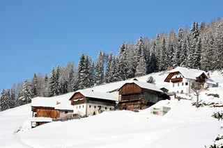
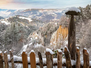
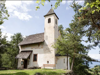
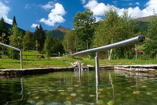
Přeskočit na obsah

přidáno k oblíbeným

odebráno z oblíbených

Jejda! Došlo k problému, zkuste to prosím znovu

Vytváří se váš účet

Váš účet byl úspěšně vytvořen a nyní jste přihlášeni

Jste úspěšně přihlášeni!

Váš účet byl úspěšně vytvořen, ale nepodařilo se nám vás automaticky přihlásit

Jste odhlášeni

Filtr
Vybrané filtry
    Úroveň obtížnosti
    Doba trvání
    Vzdálenost v km

    Tematické procházky Jižním Tyrolskem

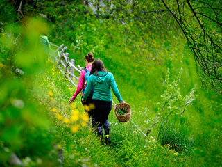
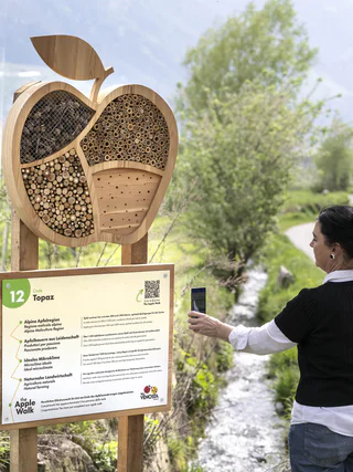
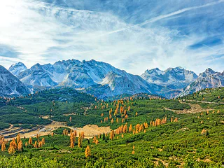
    Všude v prázdninových regionech Jižního Tyrolska jsou vyznačeny tematické procházky, speciální objevitelské trasy pro malé i velké. Například v jihotyrolském Unterlandu mohou návštěvníci na podzim zažít, jak se hrozny dostanou z vinné révy do sudu. V San Valentinu v Campo/Gummeru můžete prozkoumat vesmír a naši sluneční soustavu a v Terlanu/Terlanu pěstitelé chřestu předvedou, jak se na jaře získává ze země vzácný chřest. Celkem na návštěvníky Jižního Tyrolska čeká více než 150 značených a poučných tematických procházek.
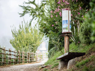
    Výsledky
    Themed Hikes
    The Pinot Noir Trail
    Auer/Ora, Alto Adige Wine Road

    The Pinot Noir Trail in the south of South Tyrol is a new educational path where you can learn more about our land’s culture and its wines. It winds through the famed Pinot Noir vineyards and along the Trudner Horn Nature Park. It starts at the quaint villages of Auer, Montan, and Neumarkt in the Unterland district and leads you through Italy’s best Pinot Noir terroirs in Mazon, Glen, and Pinzon. You can choose between a 16-km-long one-day outing or three half-day tours.
    Along the way, hikers and strollers will encounter various historical spots and cultural highlights – e.g., the significant archeological sites of Castelfeder, the oldest segment of the Fiemme Valley railway, St. Stephan’s Church in Pinzon with its late-Gothic Altar by the Master Hans Klocker, the idyllic St. Michael’s Church in Mazon, the ruins of Kaldiff, and the handsome Enn Castle. Along the way, information panels and interactive stations will help you learn more about this unique wine-growing area and its history. You’ll be rewarded with stunning views of the Unterland district. The differences in elevation shouldn’t be a problem as most of the route is relatively level. But there’s a lot to explore and discover, for young and old alike! It’s easy, comfortable, and suitable for
    families. The route is open 12 months a year. A red “B” will lead the way.

    Obtížnost: střední
    607 m nadmořská výška
    4h:49 min doba trvání
    Long-Distance Hiking Paths
    Trail d | Altrei - Gfrill
    Altrei/Anterivo

    You can proceed along this very easy segment from Altrei uphill via the Ziss Saddle – not far from there, you can admire the stunning "huckete Stoan," a free-standing erratic boulder made of porphyry the size of a house – until you come to the Horn-Alm (which is managed). From here, you will proceed slightly downhill until you come to the bogland "Schwarz" and "Weiss" lakes. It's now only a short stretch to Gfrill, the goal of this segment.

    Obtížnost: střední
    578 m nadmořská výška
    3h:49 min doba trvání
    Long-Distance Hiking Paths
    Trail e | Altrei - Truden
    Truden/Trodena

    On this segment, you will proceed through the Truden Horn Nature Park from the picturesque little village of Altrei to the multi-faceted alpine village of Truden. You will begin on an old cobblestone trail to the high-altitude bog of "Langes Moos." The trail continues upwards via the forest trail until you come to the Krabes-Alm at an elevation of 1,540 meters above sea-level. This is a good opportunity to stop for a rest. The trail continues through the Truden Horn Nature Park and then downhill to the village of Truden.

    Obtížnost: střední
    372 m nadmořská výška
    2h:51 min doba trvání
    Themed Hikes
    Pilgerweg von Aldein — Gampen nach Weißenstein
    Deutschnofen/Nova Ponente, Alto Adige Wine Road

    The road starts from the centre of Aldein next to the Church. We follow the instructions of the road nr. 10 and after 1 1/2 we reach the main street, which has to be crossed. The instructions show the way to farms and meadows. Soon we reach the first station of the cross, this one as well as the others are made by the Schützenkompanie Aldein. At the "Bacherhof" farm starts the "Long way", called by the inhabitants of Aldein, which goes into the woods with a slight raising. Walking from one station of the cross to the next we reach the "Woller"-shed in the middle of alp meadows with beautiful flowers. The forest road (Nr. 2-8-10) leads us to the largest place of pilgrimage of South Tyrol: Maria Weißenstein. Behind the Curch we find the restaurant and the bus parking place, where a bus drives to the Centre of Aldein too.

    Obtížnost: nízká
    449 m nadmořská výška
    2h:02 min doba trvání
    Themed Hikes
    Trodena Trail of Legends (Sagenweg Truden)
    Truden/Trodena

    Legends from Trodena/Truden include all sorts of mythical heroes whose stories have been passed down through generations, giving many people in Trodena the shivers. In order to give a brief insight of Trodena’s fabulous beings to interested parties, in 2009 the staff at the Trodena primary school decided to develop the "Trail of Legends". Pupils of the 4th and 5th grade worked on that, they recorded and treated all of the sagas.

    The 2 km long circular trail along the Forchwaldegg (trail no. 8) in Trodena proved to be a perfect spot for the Trail of Legends. It is set amidst larch, pine and spruce trees and is very easy to hike.

    Obtížnost: nízká
    0 m nadmořská výška
    1h:00 min doba trvání
    Themed Hikes
    Aldein tour
    Aldein/Aldino

    The Aldein village tour will take you first to the valley and the Mill Museum and to the Maria Schnee Chapel. You can then stroll through a well-groomed cultural landscape over the porphyry plateau to Lake Göller. This is a great opportunity to stop for a pause before continuing the roundtrip tour via the Burgstallegg and then back to the village square. This charming landscape presents an inviting opportunity to relax and linger.

    Obtížnost: nízká
    391 m nadmořská výška
    3h:23 min doba trvání
    Themed Hikes
    Pinot Noir Walkway - alternative route: Neumarkt/Egna - Mazon/Mazzon - Vill/Villa
    Neumarkt/Egna, Alto Adige Wine Road

    The Pinot Noir walkway leads through the Pinot Nor growing area along the Trudner Horn/Monte Corno Nature Park and the characteristic villages of Auer/Ora, Montan/Montagna and Neumarkt/Egna. The Pinot Noir growing area in Montan and Mazon/Mazzon is one of the most famous in Italy. Furthermore you walk through several monuments and historical places. The walkway is family-friendly and not dangerous.

    Obtížnost: nízká
    228 m nadmořská výška
    1h:33 min doba trvání
    Long-Distance Hiking Paths
    Trail c1 | Montan - Altrei
    Altrei/Anterivo

    This challenging segment leads from the famed Pinot Noir village of Montan all the way to Altrei. This alpine village is situated at an elevation of almost 1,200 meters above sea-level. From Montan, the route leads via the old railroad route of the former Fleims Valley railroad, on past the Glen Waterfall, up to the hamlet of Gsteig (option for food/drink and overnight lodgings). Then, from the Kalkofen parking lot, you will take the steep uphill route to the Hackelboden forest hut (not managed!) and on to the Horn-Alm (which is managed), the highest point of this segment. After a short pause (option for food/drink and overnight lodgings), you continue downhill along an easy path via the Ziss Saddle. You might want to stop at the Kneipp hydro-therapeutic station on your way to Altrei.

    Helpful hint for this route: Take the little side-trip from Gsteig to the impressive "Kanzel" looming high above the Unterland district. You'll be rewarded with a fantastic view!

    Obtížnost: vysoká
    1402 m nadmořská výška
    5h:31 min doba trvání
    Themed Hikes
    Around Trodena/Trodena
    Truden/Trodena
    Due to its isolated position, Trodena still retained many testimonies of what men have conceived, built and transformed here over the centuries. On the circular route of Trodena we will learn about the centuries-old urban culture. From the town square we move towards the upper part of the town, pass in front of a 700-year-old lime tree and walk along the paved road up to the entrance to the town. From there we follow trail marker 3 to a parking lot. From the panoramic road (3A) we come to a viewing platform, a sort of balcony. from which we can admire the "3 horns": Corno Nero, Corno Bianco and Monte Corno. This is where the geological "line" of Trodena develops. The view over the roofs of Trodena testifies to the division of the farms that has taken place for generations. We then walk until we reach the Via Cislon. From here we follow trail no. 1 to return to the starting point of Trodena, which we will reach through the historic center.
    Tip: take a walk in the village to discover the "The walls tell" project ... The brochure is available at the tourist office. Also discover the Monte Corno Visitor Center
    Obtížnost: nízká
    76 m nadmořská výška
    0h:31 min doba trvání
    Long-Distance Hiking Paths
    Trail f2 | Jochgrimm - Schwarzhorn - Radein
    Aldein/Aldino

    From Jochgrimm first up to the Schwarzhorn (2,439 m above sea-level), where you are immediately rewarded with a great panoramic view. From here it goes back again to Jochgrimm and then up to the magnificent Weisshorn (2,317 meters above sea-level), once again you can enjoy a splendid panoramic view. You will then proceed through increasingly dense vegetation downhill and along the Zirmersteig staircase until you reach Oberradein, an idyllic village surrounded by verdant meadows and lush forests.

    Obtížnost: střední
    814 m nadmořská výška
    3h:52 min doba trvání
    Themed Hikes
    Pinot Noir Walkway - alternative route: Auer/Ora - Montan/Montagna - Auer/Ora
    Auer/Ora, Alto Adige Wine Road

    The Pinot Noir walkway leads through the Pinot Nor growing area along the Trudner Horn/Monte Corno Nature Park and the characteristic villages of Auer/Ora, Montan/Montagna and Neumarkt/Egna. The Pinot Noir growing area in Montan and Mazon/Mazzon is one of the most famous in Italy. Furthermore you walk through several monuments and historical places. The walkway is family-friendly and not dangerous.

    Obtížnost: nízká
    264 m nadmořská výška
    1h:57 min doba trvání
    Long-Distance Hiking Paths
    Trail f1| Oberradein - Truden
    Truden/Trodena

    This pleasant segment leads from idyllic village of Oberradein all the way to Truden – from 1,500 meters to 1,100 meters above sea-level. At the start, you proceed downhill by way of Unterradein until you come to the famed "Ice Holes" of Kaltenbrunn; because of the cool air that streams out of the openings in the ground, it's pleasant here even in the summer. Kaltenbrunn offers refreshment options and connection to public transportation. From here, the route goes slightly uphill and then levels off as you continue to Truden.

    Obtížnost: střední
    200 m nadmořská výška
    2h:01 min doba trvání
    Long-Distance Hiking Paths
    Trail b1 | Cauria – Aldino
    Neumarkt/Egna, Alto Adige Wine Road

    This challenging segment leads from Gfrill / Cauria (1,330 meters above sea-level) via the hamlet of Gschnon / Casignano and the Cisloner Alm and to Aldein (1,200 meters above sea-level). At the beginning, the route is uphill via the Gfrill Saddle until you reach Gschnon (option for rest-stop, food/drink, and overnight lodgings). From there, you will continue over the asphalt road uphill until you come to Mühlen / Molini (again: option for food/drink and overnight lodgings). After that, it's a rather steep path up to the Cisloner Alm. From here, you will proceed downhill until you reach the Aldein Bridge (known as the "Little European Bridge" when built back in the 1960s). This is a good spot to make a rest-stop (lodgings also available). You can then continue via Holen / Olmi until your come to Aldein / Aldino.


    Obtížnost: vysoká
    1492 m nadmořská výška
    7h:49 min doba trvání
    Themed Hikes
    Pinot Noir Walkway - alternative route: Neumarkt/Egna - Mazon/Mazzon - Neumarkt/Egna
    Neumarkt/Egna, Alto Adige Wine Road
    The Pinot Noir walkway leads through the Pinot Nor growing area along the Trudner Horn/Monte Corno Nature Park and the characteristic villages of Auer/Ora, Montan/Montagna and Neumarkt/Egna. The Pinot Noir growing area in Montan and Mazon/Mazzon is one of the most famous in Italy. Furthermore you walk through several monuments and historical places. The walkway is family-friendly and not dangerous.
    Obtížnost: nízká
    228 m nadmořská výška
    1h:33 min doba trvání
    Long-Distance Hiking Paths
    Trail c | Montan - Gfrill
    Neumarkt/Egna, Alto Adige Wine Road

    This segment leads from the famed Pinot Noir village of Montan, situated at an elevation of 500 meters above sea-level, to Gfrill at more than 1,300 meters above sea-level. Proceed via the railroad line of the former Fleims Valley railroad until you come to the Glen Waterfall. From there, the trail is uphill via the hamlet of Gsteig (rest-stop, food/drink, and overnight lodgings) towards Gschnon, where there are additional lodging options. You will then take the last part of the route from the Kalkofen parking lot along forest paths and over the Gfrill Saddle until you arrive in Gfrill, the final destination of this segment.

    Helpful hint for this route: Take the little side-trip from Gsteig to the impressive "Kanzel" looming high above the Unterland. You'll be rewarded with a fantastic view!

    Obtížnost: střední
    1159 m nadmořská výška
    4h:28 min doba trvání
    Themed Hikes
    Mill walk
    Aldein/Aldino
    Hike through lush meadows and mixed forest to the Möserbiotop and the Aldein mills
    Obtížnost: nízká
    110 m nadmořská výška
    1h:00 min doba trvání
    Long-Distance Hiking Paths
    Trail f | Truden - Schwarzhorn - Jochgrimm
    Aldein/Aldino

    This challenging hike from Truden via the Schwarzhorn and all the way to the Jochgrimm is a unique adventure. From Truden, you'll first proceed uphill to Kaltenbrunn (refreshment stop and access to public transportation). From here, you can then proceed to the famous "Ice Holes" – an unusual phenomenon where cold air streams out of holes in the ground even on the hottest days of summer. You will then proceed steadily uphill via the challenging "Leitensteig" staircase until you come to the Kugeljoch; from this pass, you have a magnificent panoramic view of the Fleims Valley. From the Kugeljoch, you will continue to the Schwarzhorn (2,439 meters above sea-level). Finally, you follow the descending path to the Jochgrimm, the goal of this tour. This hike offers a wealth of unique natural beauty and is – in spite of the level of difficulty – an absolute "must" for ambitious hikers.

    Obtížnost: vysoká
    1716 m nadmořská výška
    6h:05 min doba trvání
    Long-Distance Hiking Paths
    Trail c1 | Altrei - Montan
    Altrei/Anterivo

    This challenging segment leads from the alpine village of Altrei to the famed Pinot Noir village of Montan – from 1,200 meters down to 500 meters above sea-level. From Altrei, the route continues uphill via the Ziss Saddle all the way to the Horn-Alm (managed) with a wonderful view, at an altitude of more than 1,700 meters above sea-level – the highest point of this segment. From here, the trail is almost totally downhill. The next segment will take you to the Hackelboden forest hut (not managed!) and on to the hamlet of Gsteig (option for food/drink and overnight lodgings). You will then pass by the roaring Glen Waterfall via the former Fleims Valley railroad and on to Montan.

    Helpful hint for this route: Take the little side-trip from Gsteig to the impressive "Kanzel" looming high above the Unterland district. You'll be rewarded with a fantastic view!

    Obtížnost: střední
    641 m nadmořská výška
    4h:34 min doba trvání
    Themed Hikes
    Saurian trail GEOPARC Bletterbach
    Aldein/Aldino
    The Saurian Trail takes you on a journey to the Permian, about 260 million years ago, a time during which the rocks and fossils of the Bletterbach Gorge and the Dolomites were formed.
    Families with children, senior citizens, individuals with disabilities, people out for an easy stroll, and also more adventurous hikers are invited to explore these footprints from the dim recesses of time and learn more about the creatures which created them.
    They can compare ancient plants with modern-day species, and even study micro-fossils.
    Obtížnost: nízká
    41 m nadmořská výška
    0h:19 min doba trvání
    Long-Distance Hiking Paths
    Trail d | Gfrill - Altrei
    Neumarkt/Egna, Alto Adige Wine Road

    On this segment, you will proceed first from Gfrill to the bogland lakes of the "Weiss" and the "Schwarz." From there, the route continues to the Horn-Alm, the highest point of the segment. Hikers can stop here for refreshments and then continue downhill via the Ziss Saddle – not far from there, you can admire the stunning "huckete Stoan," a free-standing erratic boulder made of porphyry the size of a house – until you come to Altrei.

    Obtížnost: střední
    467 m nadmořská výška
    3h:42 min doba trvání
    Themed Hikes
    Trail b | Montan – Aldein
    Montan/Montagna, Alto Adige Wine Road

    On this segment, you will proceed from the famed Pinot Noir village of Montan uphill to Aldein – from 500 meters up to 1,200 meters above sea-level. At the beginning of the segment, you will take the "Wine Forest Water" Trail and pass by the Enn Castle and the Elsenhof farmstead which belongs to it. You will then proceed along the old tracks and through the spruce forests (common here on the southwest flank of the Cislon) and farther to the Aldein Bridge (known as the "Little European Bridge" when first built in the 1960s). This is a good opportunity for hikers to make a rest-stop and/or get some refreshments. You will then proceed to the hamlet of Holen and on to Aldein.

    Obtížnost: střední
    980 m nadmořská výška
    3h:51 min doba trvání
    Themed Hikes
    Salorno/Salurn: The Chapel Circuit
    Salorno/Salurn, Alto Adige Wine Road

    7, 14, or 31: When the first Ways of the Cross were built, there was a varying number of stations. In some places there were seven; in other places, 31 stations. Later, there was an agreement to always have 14.

    Obtížnost: nízká
    194 m nadmořská výška
    1h:00 min doba trvání
    Long-Distance Hiking Paths
    Trail f1 | Truden - Oberradein
    Aldein/Aldino

    This segment will take you from Truden all the way to the idyllic village of Oberradein. The trail starts out downhill as you proceed towards Kaltenbrunn (lodging options and access to public transportation). You then pass by the famed "Ice Holes" of Kaltenbrunn and steadily uphill by way of Unterradein until you come to Oberradein. This village nestled in an unspoilt alpine landscape features stunning natural beauty, with numerous hiking options.

    Obtížnost: střední
    589 m nadmořská výška
    2h:30 min doba trvání
    Long-Distance Hiking Paths
    Dolomites World Heritage Geotrail II – Stage 1: from the Bletterbach to the Lavazèjoch pass- From land to sea
    Aldein/Aldino

    The first stage of the Geotrail climbs up from the Bletterbach gorge to the summit of the Weisshorn. We pass through stunning scenery that reveals various layers of rock with the oldest at the bottom, the most recent at the very top. Like a book, these layers tell a story – a story that has lasted 40 million years, with the transformation of the Dolomites of the time from a landmass into a sea.

    Obtížnost: střední
    1101 m nadmořská výška
    4h:37 min doba trvání
    Long-Distance Hiking Paths
    Trail f2 | Radein - Jochgrimm - Schwarzhorn
    Aldein/Aldino

    This segment begins in Oberradein. Follow the Zirmersteig staircase uphill through the increasingly sparce high-alpine vegetation until you come to the Weisshorn (2,317 meters above sea-level). Here you can enjoy the fabulous panoramic view before embarking on the return trip down to the Jochgrimm. There are various refreshment options as well as plenty of opportunity to admire the very diverse flora of the alpine meadows. After a short breather, the segment goes up to the Schwarzhorn (2,439 m above sea-level).

    Obtížnost: vysoká
    1263 m nadmořská výška
    4h:34 min doba trvání
    Long-Distance Hiking Paths
    Trail c | Gfrill - Montan
    Neumarkt/Egna, Alto Adige Wine Road

    This segment leads from the village of Gfrill (1,300 meters elevation) to Montan (500 meters above sea-level). At the beginning, the route is slightly uphill via the Gfrill Saddle and then downhill until you reach Gschnon (good place to stop for a rest). You will then ascend via Gsteig (option for refreshments and overnight lodgings) and down to the impressive Glen Waterfall. You will then take the last part along the old railroad route of the former Fleims Valley railroad to the famed Pinot Noir village of Montan.

    Helpful hint for this route: Take the little side-trip from Gsteig to the impressive "Kanzel" looming high above the Unterland district. You'll be rewarded with a fantastic view!


    Obtížnost: střední
    376 m nadmořská výška
    3h:28 min doba trvání
    Long-Distance Hiking Paths
    Trail e | Truden - Altrei
    Altrei/Anterivo

    This route will lead you through the Truden Horn Nature Park from the multi-faceted alpine village of Truden all the way to the charming little village of Altrei. The trail is first uphill to the Krabes-Alm, at an elevation of 1,540 meters above sea-level; this is a good place to stop for a short rest. You will then proceed along a forest trail until you come to the high-altitude bog of "Langes Moos." Then you can return to Altrei via an old cobblestone path.

    Obtížnost: střední
    429 m nadmořská výška
    2h:55 min doba trvání
    Long-Distance Hiking Paths
    Trail f | Jochgrimm - Schwarzhorn - Truden
    Aldein/Aldino

    This challenging hike begins from the Jochgrimm. You then have to master approx. 500 meters of altitude-differential until you come to the Schwarzhorn (2,439 meters above sea-level). The trail then leads you around and down the other side of the Schwarzhorn until you come to the Kugeljoch; from this pass, you have a magnificent panoramic view of the Fleims Valley. You can now proceed down the "Leitensteig" staircase until you reach the Kaltenbrunn "Ice Holes," where it's pleasantly cool even in the summertime. From Kaltenbrunn (where hikers will find a number of refreshment options and also access to public transportation), there is still a short segment slightly uphill to Truden. This is a uniquely beautiful hike and is – in spite of the level of difficulty – an absolute "must" for ambitious hikers.

    Obtížnost: vysoká
    892 m nadmořská výška
    4h:43 min doba trvání
    1 2 3 4 5 6 7 8 9 10 11 12 13 14 15 16 17 18