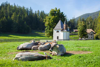
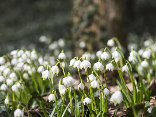
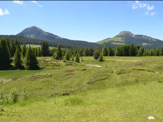
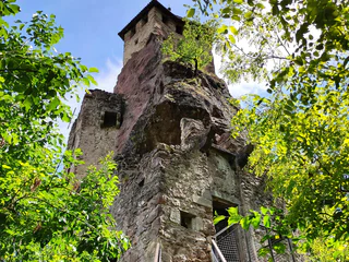
Südtirol Guide App Logo
Skip to content

added to favourites

removed from favourites

Oops! Something went wrong. Try again

Your account is being created

Your account has been successfully created and you are now logged in

You’ve been logged in successfully!

Your account was created successfully, but we couldn't log you in automatically

You are logged out.

Filter
Selected filters
    Level of difficulty
    Duration
    Distance in KM

    Walking on the Alto Adige Wine Road

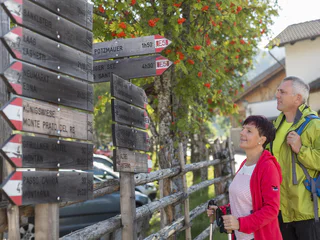
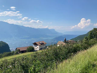
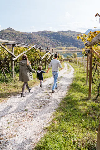
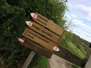
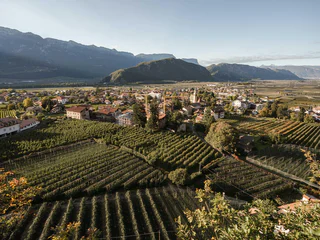
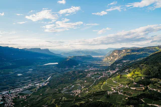
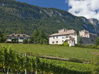
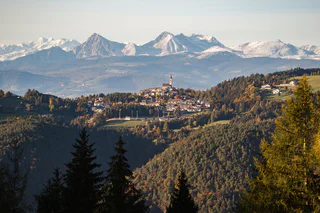
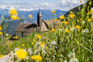
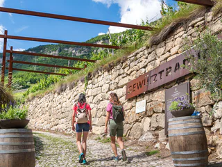
    Lace your hiking boots and start exploring the landscape along the Alto Adige Wine Road. By hitting one of these trails, you'll walk on winding paths, through picturesque vineyards and from quaint villages up to sweeping views. Whether you're looking for a leisurely or challenging trail, there are all difficulty levels. On the Alto Adige Wine Road you can experience the perfect blend between nature and culture, taste local wines at modern wineries, and enjoy the flair of an Alpine-Mediterranean atmosphere.


    Results
    Summer
    Pinot Noir Walkway - alternative route: Neumarkt/Egna - Mazon/Mazzon - Neumarkt/Egna
    Neumarkt/Egna, Alto Adige Wine Road
    The Pinot Noir walkway leads through the Pinot Nor growing area along the Trudner Horn/Monte Corno Nature Park and the characteristic villages of Auer/Ora, Montan/Montagna and Neumarkt/Egna. The Pinot Noir growing area in Montan and Mazon/Mazzon is one of the most famous in Italy. Furthermore you walk through several monuments and historical places. The walkway is family-friendly and not dangerous.
    Difficulty: easy
    228 m elevation gain
    1h:33 min duration
    Summer
    Lavazé - Malga Ora - 8km
    Deutschnofen/Nova Ponente, Alto Adige Wine Road
    Beautiful 8 km long round trip with about 150m altitude difference. Especially on the section at Guggenbichel has wonderful views of Catinaccio, Latemar, Corno Nero & Corno Bianco. Ideal for a stop at Malga Ora.
    Difficulty: medium
    160 m elevation gain
    2h:00 min duration
    Summer
    Natural and Wine Trail Cornaiano/Girlan
    Eppan an der Weinstaße/Appiano sulla Strada del Vino, Alto Adige Wine Road

    This educational nature and wine trail along Gschleier-Eck in Cornaiano opened in 2007.

    Difficulty: easy
    5 m elevation gain
    0h:22 min duration
    Hiking
    Circular Hike: Kalterer See Lake
    Kaltern an der Weinstraße/Caldaro sulla Strada del Vino, Alto Adige Wine Road

    Route: from the car park at Kalterer See lake, continue north to the Geier restaurant. Behind the restaurant, a narrow trail leads to the north into the orchards. Walk along these and turn off to the right in an easterly direction following the markers. At the slope on the eastern side of the valley, turn right, passing by the hotel on the left to the Klughammer road. First follow this road, then continue on a trail above the road.

    This trail ends at the southern end of the lake. Cross the road to join the Nature Discovery Trail (Naturerlebnisweg). At the end of this nature trail, turn right onto the so-called Kuchlweg trail, hiking to the vineyards on the western side of the valley. Just before the wine road, turn right into the trail through the field, following it until you reach the point where the wine road curves to the right. Cross over and now follow a trail through the field once more. Then follow the footpath next to the wine road to the church of San Giuseppe al Lago/St. Josef am See (Kirche St. Josef). Take the farm track to the right back to the starting point of the hike.

    Difficulty: easy
    0 m elevation gain
    2h:00 min duration
    Summer
    A wine and walkers’ paradise: from Auer/Ora to Montan/Montagna
    Auer/Ora, Alto Adige Wine Road

    This walk takes you from Ora, through an idyllic wood, to the wine village of Montagna. The mountainside along which the path winds is particularly famous for the typical vineyards where the best Pinot Noir grapes in South Tyrol grow. Montagna is also the ideal starting point for the magnificent panoramic trail that has been made from the old railway line that led all the way into the Val di Fiemme.

    Difficulty: easy
    0 m elevation gain
    1h:30 min duration
    Summer
    From Aldino to Pietralba
    Deutschnofen/Nova Ponente, Alto Adige Wine Road

    This beautiful hiking tour leads from Aldino to the place of pilgrimage "Maria Weissenstein/ Pietralba". We go past spectacular viewpoints and the mountain huts "Schmieder Alm" and "Schönrast Alm".

    Difficulty: easy
    630 m elevation gain
    2h:49 min duration
    Summer
    Lavazè - Oclini (round hike)
    Deutschnofen/Nova Ponente, Alto Adige Wine Road
    Beautiful circular hike between Oclini and Lavazè, return via the Malga Ora.
    Difficulty: medium
    231 m elevation gain
    2h:30 min duration
    Summer
    Hiking tour trought the gorge Rastenbach
    Kaltern an der Weinstraße/Caldaro sulla Strada del Vino, Alto Adige Wine Road

    Hiking tour through Rastenbach gorge with some stairs and bridges. Not difficult hiking tour, but with some upgrades. Duration of walking: about 1 ½ hour. Difference of altitude: about 160 meters.  

    Difficulty: medium
    248 m elevation gain
    1h:37 min duration
    Summer
    Hike tour Neuhaus Castle-Montigl-Helfenberg
    Eppan an der Weinstaße/Appiano sulla Strada del Vino, Alto Adige Wine Road

    The hike leads from Terlan via Neuhaus Castle up to the hamlet of Montigl. From the “Moarhof” farm a very steep path leads up to the Helfenberg ruins. From here you go back to Terlan via the same route. Or as an alternative for sure-footed and experienced hikes: path 9 A and path 11 A down to Siebeneich. From there you can take the bus back to Terlan.

    Difficulty: medium
    697 m elevation gain
    2h:34 min duration
    Summer
    Salorno/Salurn: The Chapel Circuit
    Salorno/Salurn, Alto Adige Wine Road

    7, 14, or 31: When the first Ways of the Cross were built, there was a varying number of stations. In some places there were seven; in other places, 31 stations. Later, there was an agreement to always have 14.

    Difficulty: easy
    194 m elevation gain
    1h:00 min duration
    Long-Distance Hiking Paths
    Trail c | Gfrill - Montan
    Neumarkt/Egna, Alto Adige Wine Road

    This segment leads from the village of Gfrill (1,300 meters elevation) to Montan (500 meters above sea-level). At the beginning, the route is slightly uphill via the Gfrill Saddle and then downhill until you reach Gschnon (good place to stop for a rest). You will then ascend via Gsteig (option for refreshments and overnight lodgings) and down to the impressive Glen Waterfall. You will then take the last part along the old railroad route of the former Fleims Valley railroad to the famed Pinot Noir village of Montan.

    Helpful hint for this route: Take the little side-trip from Gsteig to the impressive "Kanzel" looming high above the Unterland district. You'll be rewarded with a fantastic view!


    Difficulty: medium
    376 m elevation gain
    3h:28 min duration
    Hiking
    From Passo Mendola to Mezzavia Hut
    Kaltern an der Weinstraße/Caldaro sulla Strada del Vino, Alto Adige Wine Road
    Start: Begin your hike at the Mendel Pass, following the wide trail toward the Enzian Hut. The path is well-marked and easy to walk. After passing the Enzian Hut, the trail continues into the forest, where you’ll encounter a gentle uphill climb.
    The wide trail remains pleasant, offering beautiful views of the surroundings. After passing the chairlift, you’ll reach the Halbweghütte, your destination. The route is 3.5 km long, takes about 1 hour and 20 minutes, and includes an elevation gain of 240 meters. This hike is perfect for families
    Difficulty: easy
    241 m elevation gain
    1h:30 min duration
    Summer
    Lavazè - Baita Pozzi
    Deutschnofen/Nova Ponente, Alto Adige Wine Road
    Baita Pozzi is an ideal family destination. It can be reached by an easy walk through the woods bypassing Corno Nero, which leads to an extremely scenic natural saddle, overlooking the Lagorai chain and the Fiemme Valley.
    The Baita, surrounded by meadows, is ideal for children, who can play freely, and for adults, the perfect place to have a barbecue with friends.
    The hut is available to everyone, for cooking and for spending the night there; this is precisely why the utmost respect and care of the environment is essential.
    Tools are all available inside the lodge; however, it is recommended that you bring saucers and cutlery from home.
    Difficulty: medium
    454 m elevation gain
    3h:23 min duration
    Long-Distance Hiking Paths
    On the tracks of A. Dürer: The Dürer path
    Neumarkt/Egna, Alto Adige Wine Road

    This walk has been named after the important German painter Albrecht Dürer (1471-1528). During his first trip to Venice, in 1494, due to a flood in the Adige Valley, he had to make a detour through Pochi di Salorno to the Val di Cembra. It is delightful to follow the historical trail through these enchanted woods. We can walk past the Pochi di Salorno mill, past the earth pyramids and the Segonzano Castle, which Dürer immortalized in his paintings.

    Stages of the Route
    1. Klösterle St. Florian - hamlet of Laag/Laghetti (3.2 km; difference in altitude -20 m; duration 1 hour)
    2. Laag/Laghetti - Buchhol/Pochi di Salorno (4.4 km; Height difference + approx. 400 m; Time: 1 hour 40 min)
    3. Buchholz/Pochi di Salorno - Sauch Hut (6.3 km; Altitude difference + approx. 450 m; Duration 2 hrs. 20 min)
    4. Sauch Hut - Lago Santo/Heilgen See (3 km; Height difference +305 m; Time duration 1 hr. 10 min) 
    Alte Dürer-Route: (4.6 km; Height difference +292; 1 hr 45 min)
    5. Lago Santo - Cembra (4 km; Height difference -539 m; Duration 1 hr 20 min)
    6. Cembra - Cantilaga (4 km; Height difference -180 m; Duration 1 hour and 20 min)
    7. Cantilaga - Segonzano Castle - Segonzano Pyramids (2-4 km; Height difference +100 m; Duration 50 min)

    Difficulty: difficult
    1992 m elevation gain
    9h:31 min duration
    Summer
    Kurtatsch/Cortaccio – Penon/Penone - Kurtatsch/Cortaccio
    Margreid an der Weinstraße/Magrè sulla Strada del Vino, Alto Adige Wine Road

    From the main square, we follow the initially steep Obergasse. After traveling about 100 meters - at the little square – we turn to the right. At the next junction - the fountain – we take the Maria-Hilf Gasse to the left, passing by farms and tall old poplars until it meets the road to Graun. After about 100 meters turn left on a narrow side road - marking 2 - leading to the hamlet Hofstatt (608 m). Change to the Graun road until shortly after Gasthof Halbweg where the road leads left to an asphalt road at the Himmelspfort inn – with the possibility of a detour to the village center of Penon (605 m). To return, turn right just after the restaurant at the Himmelspfort. Over a narrow path leading through vineyards, the trail climbs down and soon reaches the paved road that leads to Kurtatsch.


    Difficulty: medium
    0 m elevation gain
    1h:30 min duration
    Summer
    Hike Gaid Festenstein Castle Gaid
    Andrian/Andriano, Alto Adige Wine Road

    Short hike to the Festenstein castle ruins. Check the opening days. Experience a moment of freedom in the historic buildings of Festenstein walls and enjoy a spectacular panoramic view of the Adige Valley there.

    Difficulty: medium
    205 m elevation gain
    0h:45 min duration
    Summer
    The Spring Promenade of Salorno/Salurn
    Salorno/Salurn, Alto Adige Wine Road

    The Spring Promenadeis a beautiful circular walk in Salurn. Several information boards raise awareness of the gold of the 21st century. The waterfall is the highlight of this walk.

    Difficulty: easy
    115 m elevation gain
    0h:30 min duration
    Summer
    The Pinot Noir Trail
    Auer/Ora, Alto Adige Wine Road

    The Pinot Noir Trail in the south of South Tyrol is a new educational path where you can learn more about our land’s culture and its wines. It winds through the famed Pinot Noir vineyards and along the Trudner Horn Nature Park. It starts at the quaint villages of Auer, Montan, and Neumarkt in the Unterland district and leads you through Italy’s best Pinot Noir terroirs in Mazon, Glen, and Pinzon. You can choose between a 16-km-long one-day outing or three half-day tours.
    Along the way, hikers and strollers will encounter various historical spots and cultural highlights – e.g., the significant archeological sites of Castelfeder, the oldest segment of the Fiemme Valley railway, St. Stephan’s Church in Pinzon with its late-Gothic Altar by the Master Hans Klocker, the idyllic St. Michael’s Church in Mazon, the ruins of Kaldiff, and the handsome Enn Castle. Along the way, information panels and interactive stations will help you learn more about this unique wine-growing area and its history. You’ll be rewarded with stunning views of the Unterland district. The differences in elevation shouldn’t be a problem as most of the route is relatively level. But there’s a lot to explore and discover, for young and old alike! It’s easy, comfortable, and suitable for
    families. The route is open 12 months a year. A red “B” will lead the way.

    Difficulty: medium
    607 m elevation gain
    4h:49 min duration
    Hiking
    St Peter's trail
    Kaltern an der Weinstraße/Caldaro sulla Strada del Vino, Alto Adige Wine Road

    The hike begins at the Altenburg Church above Kaltern. From there, a narrow but well-maintained forest path with a gentle incline leads first to a viewpoint offering a magnificent view over the Adige Valley. The trail is varied and winds through shady mixed forest – a head for heights is recommended in some sections.

    At the viewpoint, turn left onto the St. Peter Trail and follow trail marker No. 2. The path descends in switchbacks through a small gorge. Before long, you'll reach the ruins of the three-nave church of St. Peter, an important relic of early Christian architecture. It is considered possibly the oldest church in Tyrol and is said to have been founded in the 6th century by Saint Vigilius of Trento. The remaining wall paintings by Thomas Egnolt from around 1400 are only fragmentary, but still worth a brief stop.

    From the ruins, the trail continues to the suspension bridge – an exciting section of the tour with a fantastic view into the gorge. The path then climbs gently to a small hill. Soon you’ll reach the Rastenbach Gorge, where a turnoff leads into the gorge and the trail continues uphill. Good footwear is essential here, as the walkways can be damp and slippery in places.

    At the upper end of the gorge, you reach the Müllereck, cross the road, and follow the trail on the left back toward Altenburg. The path winds leisurely through meadows and forest, returning to the Altenburg Church – the starting point of this circular hike.

    Difficulty: medium
    67 m elevation gain
    0h:43 min duration
    Summer
    Lavazè - Pala di Santa
    Deutschnofen/Nova Ponente, Alto Adige Wine Road
    A hike leading from the open spaces of the Lavazè plateau to the panoramic peak of Pala di Santa.
    Difficulty: difficult
    701 m elevation gain
    3h:00 min duration
    Summer
    Nature Experience Trail Tramin
    Tramin an der Weinstraße/Termeno sulla Strada del Vino, Alto Adige Wine Road
    Family hike featuring beautiful views of the Lake Kaltern.
    The many display boards inform interested hikers about the diverse flora and fauna and the geological discoveries of the region, making the Nature Experience Trail in Tramin a special experience for young and old.

    From the Rathausplatz (town hall square), head along Hans-Feur-Staße street, the town’s main road, till you come to the fairground where you turn left into the Mühlgasse alley. Follow thus until turning right at a junction. After crossing over a bridge, you will see the Hotel Winzerhof.
    On the curve after the Hotel Winzerhof just follow the path 11 and walk straight ahead. The trail first leads through vineyards, then heads gently upwards through mediterranean mixed forest to the restaurant Plattenhof (closed on Monday) in Sella/Söll. On the way there are some small views on the Caldaro lake. At the Hotel Plattenhof, direction Caldaro lake, turn to the left and follow path 11A for approx 20 minutes and then leave the trail and turn to the right. After 50 minutes you will be back at Tramin.
    Difficulty: easy
    294 m elevation gain
    1h:55 min duration
    Summer
    Lake Kaltern hiking tour
    Kaltern an der Weinstraße/Caldaro sulla Strada del Vino, Alto Adige Wine Road
    This family-friendly circular hike is accessible all year round. Lake Kaltern, as the warmest bathing lake in the Alps, is a must for every South Tyrolean friend!
    Difficulty: medium
    32 m elevation gain
    1h:55 min duration
    Summer
    Caldaro Wine Trail (Weinweg Kaltern)
    Kaltern an der Weinstraße/Caldaro sulla Strada del Vino, Alto Adige Wine Road

    The Wine Trail is layed out in the form of an "8" and takes you from the village centre, down to the lake and back – past wine vineyards, farms and estates. Ground markings have been laid into the ground so that the hiker is aware of the various vineyard names as he passes by. You will see some of the age-old poetic vineyard names, which date back to either Rhaetian or Romantic origins: "Vial", "Prunar", "Puntara", "Palurisch" …

    Difficulty: medium
    0 m elevation gain
    4h:30 min duration
    Summer
    Brenntalweg to Kurtatsch
    Tramin an der Weinstraße/Termeno sulla Strada del Vino, Alto Adige Wine Road
    Through the vineyards to Kurtatsch

    We hike to the wine road - junction Neumarkt/Kurtatsch and after 30 m turn left into the Brenntalweg. Follow this asphalted road for about 3 km. Continue straight on and you will see signs for the "Millastiege". We follow these and climb up through the rocks to the wine road before the village of Kurtatsch.

    For the way back we take the hiking trail Kastelaz or the less frequented panoramic road via Rungg. You will find the corresponding signs in the village of Kurtatsch.
    Difficulty: easy
    434 m elevation gain
    2h:43 min duration
    Long-Distance Hiking Paths
    Trail c | Montan - Gfrill
    Neumarkt/Egna, Alto Adige Wine Road

    This segment leads from the famed Pinot Noir village of Montan, situated at an elevation of 500 meters above sea-level, to Gfrill at more than 1,300 meters above sea-level. Proceed via the railroad line of the former Fleims Valley railroad until you come to the Glen Waterfall. From there, the trail is uphill via the hamlet of Gsteig (rest-stop, food/drink, and overnight lodgings) towards Gschnon, where there are additional lodging options. You will then take the last part of the route from the Kalkofen parking lot along forest paths and over the Gfrill Saddle until you arrive in Gfrill, the final destination of this segment.

    Helpful hint for this route: Take the little side-trip from Gsteig to the impressive "Kanzel" looming high above the Unterland. You'll be rewarded with a fantastic view!

    Difficulty: medium
    1159 m elevation gain
    4h:28 min duration
    Summer
    Lavazé - Malga Costa
    Deutschnofen/Nova Ponente, Alto Adige Wine Road

    Our alpine hut is located at 1,750 m, surrounded by large alpine meadows and in the immediate vicinity of a beautiful pond. The view of the surrounding mountains, Latemar, Catinaccio, Sciliar, Corno Nero and Corno Bianco invites you to simply let your soul dangle. We will coddle you with local delicacies and seasonal specialties.

    Difficulty: easy
    77 m elevation gain
    1h:30 min duration
    Hiking
    Hiking tour "Tschirglhöfe"
    Terlan/Terlano, Alto Adige Wine Road

    You start your hike at the church in the center of Terlan. Via the Silberleitenweg you get to Oberkreuth, where you turn right at the fountain, walk 20 m further and then take the Vorbergweg/no°4A to the left up to the Tschirglhöfe. The first path is very steep. Further up the mountain you hike past "Mugger/Zilli" and "Bergrast". You will reach the Möltner road (please pay attention to the traffic), walk downwards for approx. 150 m and turn right onto hiking trail n°4. Where the hiking trail meets the road again, you walk downwards (attention to traffic) for a short while until you turn onto the hiking trail again. After the first 20 m descent, a detour to the left to the "Wetterkreuz" is worthwhile. It is a magnificent viewpoint with the ruins of the 14th-century St.Peter miners' chapel below. The path now leads steeply down to the "Klaus in der Mühl" farm and then leads into Kirchgasse, through which you return to the starting point.

    There is no rest stop on this hike.

    Difficulty: medium
    452 m elevation gain
    2h:17 min duration
    Summer
    Via Alta di Caldaro/Kalterer Höhenweg
    Kaltern an der Weinstraße/Caldaro sulla Strada del Vino, Alto Adige Wine Road

    The Kalterer Höhenweg runs almost constantly at about one third of the height of the Mendel slope and with only a few ascents from the Kalterer Höhe (northernmost point) to the Ziegelstadl above Altenburg and on to the Gummererhof above Tramin (southernmost point). Some of the access routes are difficult. Do not hike these in summer during the hot midday hours! The Kalterer Höhenwanderweg trail is connected to the Eppaner Höhenweg trail by the Matschatsch hiking trail (signpost no. 9). Shortly before the Gummererhof farm, the Traminer Höhenweg trail (marker no. 9) continues southwards.

    Follow the forest path that begins at the starting point, which is also the high trail, in a southerly direction (signpost ‘Altenburg’) (marker no. 9). Cross the funicular railway and continue along the forest road to the Ziegelstadl. There, immediately after the bridge, turn left down to Altenburg (signpost no. 9F). Alternative: From the Ziegelstadl, continue along the high-level trail to the Gummererhof (marker no. 9 G). From there, take the dirt track downhill and soon follow the signpost ‘Marking 4B’. Continue along a forest path to Altenburg (walking time for this variant approx. 1 ½ hours).

    Difficulty: medium
    457 m elevation gain
    3h:40 min duration
    Summer
    Rundwanderung Mazon - Kanzel - Mazon
    Neumarkt/Egna, Alto Adige Wine Road
    Circular hiking trail from the hamlet of Mazon above Neumarkt up to the Kanzel viewpoint at about 1000 metres above sea level. The hike is pleasant and particularly suitable for families. There are refreshment stops at the Gsteigerhof inn not far from the Kanzel. The way back is via the so-called Klopfsteig to the Kaldiff ruin and from there through Mazon's vineyards back to the parking lot.
    Difficulty: medium
    731 m elevation gain
    3h:10 min duration
    Summer
    Montan/Montagna - Glen/Gleno - Gschnon/Casignano - Gsteig - Montan/Montagna
    Montan/Montagna, Alto Adige Wine Road

    This hike goes through both the Monte Corno Natural Park, a scenic jewel rich in flora and fauna, and across the slopes of South Tyrol´s Bassa Atesina. This is where the idyllic villages of Gleno and Casignano can be found. You can enjoy a wonderful view of Castelfeder, the Adige Valley, the Mendola range of mountains and Lake Caldaro to as far away as the mountains above Merano.

    Difficulty: easy
    692 m elevation gain
    5h:00 min duration
    1 2 3 4