
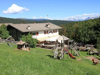
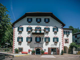
Inn Greif
Campolasta/Astfeld, Sarntal/Sarentino, Bolzano/Bozen and environs
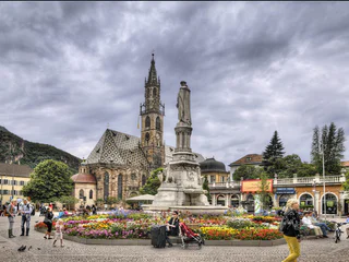
| Poznaj piękno Bozen i jego okolic. Ten region Południowego Tyrolu to doskonałe miejsce na aktywny wypoczynek, kulturalne odkrycia i relaks w otoczeniu przyrody. |
Campolasta/Astfeld, Sarntal/Sarentino, Bolzano/Bozen and environs
Pineta di Laives/Steinmannwald, Laives/Leifers, Bolzano/Bozen and environs
Virgolo/Virgl, Bolzano/Bozen, Bolzano/Bozen and environs
1/4
Vallesina/Versein, Mölten/Meltina, Bolzano/Bozen and environs
easy
Poziom trudności
422 m
Wzlot
1h:40 min
czas trwania
1/8
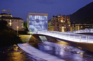
Bolzano Centro/Bozen Zentrum, Bolzano/Bozen, Bolzano/Bozen and environs
1/3
Bolzano Centro/Bozen Zentrum, Bolzano/Bozen, Bolzano/Bozen and environs
Valas/Flaas, Jenesien/San Genesio Atesino, Bolzano/Bozen and environs
Vallesina/Versein, Mölten/Meltina, Bolzano/Bozen and environs
medium
Poziom trudności
677 m
Wzlot
4h:43 min
czas trwania

1/3
Glaning/Cologna, Jenesien/San Genesio Atesino, Bolzano/Bozen and environs
Avigna/Afing, Jenesien/San Genesio Atesino, Bolzano/Bozen and environs

1/4
Laives/Leifers, Bolzano/Bozen, Bolzano/Bozen and environs
medium
Poziom trudności
1073 m
Wzlot
5h:31 min
czas trwania
1/5
Longomoso/Lengmoos, Ritten/Renon, Bolzano/Bozen and environs
Campitello/Kandelsberg, Sarntal/Sarentino, Bolzano/Bozen and environs
Auna di Sotto/Unterinn, Ritten/Renon, Bolzano/Bozen and environs
Ronco/Rungg, Sarntal/Sarentino, Bolzano/Bozen and environs
1/2
Vallesina/Versein, Mölten/Meltina, Bolzano/Bozen and environs
medium
Poziom trudności
181 m
Wzlot
0h:34 min
czas trwania
S. Osvaldo/St. Oswald - Bolzano/Bozen, Bolzano/Bozen, Bolzano/Bozen and environs
Collalbo/Klobenstein, Ritten/Renon, Bolzano/Bozen and environs
1/6
Prati/Auen, Sarntal/Sarentino, Bolzano/Bozen and environs

1/3
Soprabolzano/Oberbozen, Ritten/Renon, Bolzano/Bozen and environs
1/6
Soprabolzano/Oberbozen, Ritten/Renon, Bolzano/Bozen and environs
Bozner Boden/Piani di Bolzano, Bolzano/Bozen, Bolzano/Bozen and environs
Valdurna/Durnholz, Sarntal/Sarentino, Bolzano/Bozen and environs
1/15
Valas/Flaas, Jenesien/San Genesio Atesino, Bolzano/Bozen and environs
1/4
Longostagno/Lengstein, Ritten/Renon, Bolzano/Bozen and environs
Colle/Kohlern, Bolzano/Bozen, Bolzano/Bozen and environs
easy
Poziom trudności
374 m
Wzlot
2h:37 min
czas trwania

1/2
S.Antonio/St.Anton, Ritten/Renon, Bolzano/Bozen and environs
medium
Poziom trudności
689 m
Wzlot
19.9 Km
odległość
Soprabolzano/Oberbozen, Ritten/Renon, Bolzano/Bozen and environs
1/4
Vallesina/Versein, Mölten/Meltina, Bolzano/Bozen and environs
easy
Poziom trudności
202 m
Wzlot
0h:43 min
czas trwania
Vallesina/Versein, Mölten/Meltina, Bolzano/Bozen and environs
easy
Poziom trudności
405 m
Wzlot
1h:42 min
czas trwania
Dziękujemy za zapisanie się!
Subskrypcja jest już aktywna
Potwierdź rejestrację
Aby zakończyć rejestrację, otwórz e-mail, który właśnie wysłaliśmy, i kliknij link potwierdzający.
Nie widzisz wiadomości? Sprawdź folder spam.
Zauważyliśmy, że próbowałeś(-aś) zapisać się do newslettera, ale Twój adres e-mail jest już zarejestrowany. Nadal będziesz otrzymywać nasze oferty, wskazówki i inspiracje na Twój urlop.
Już próbowałeś zapisać się do naszego newslettera, ale nie potwierdziłeś rejestracji. Właśnie wysłaliśmy ci ponownie e‑mail. Sprawdź swoją skrzynkę odbiorczą i folder ze spamem i potwierdź teraz.


