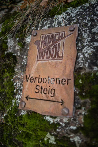
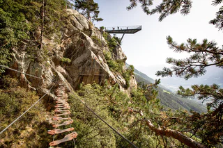
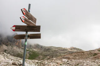
Suitable for enthusiastic newcomers, a welcoming side event for mountain lovers, exiting for sportive climbers. The via ferrata is of a medium degree of difficulty, starting right after the exit of the Speikboden gondola at 2.000m. You’ll overcome 350m of difference in altitude belayed and safe. On your first steps out of the gondola you will already get this pure feeling of summits surrounding you. Hold on for the stunning view across Valley Aurina, Zillertal Alps and the white peaks of Durreck. Walk on for the entrance of the via ferrata. Keep the feeling of touching mountains and sky while you step into the via ferrata. Get excited on the super long suspension bridge, get a grip on the edgy rocks of the mountains. You’ll arrive at the very peak of Speikboden. Heading towards a panoramic view you can only here enjoy: Dolomites, Tre Cime and Marmolata towards the glaciers of Valley Aurina. The tour is considered a circular route, for your way back you can either chose the chairlift Sonnklar or hike downwards the alpine paths of the Speikboden recreation area.
It is possible to rent the equipment for the Via Ferrata at the mountain station of the cablecar Speikboden.
A nice excursion in the mountains of the Natural Park of Fanes - Sennes - Braies an Pustertal Valley. The tour starts from the path n.20 of from the foresty road n. 20B up to the alpine refuge Brustalm, which is open for you in summer. From here go on on the path n. 20 in direction Franz Josefhöhe until the Kühwiesenkopf. Now an approvpriate mountain shoe is required to go through the way, that ends at the Kaserkopf. Reach the Hochalpenkopf across a glade toward sud.
Rifugio Auronzo – Rifugio Locatelli – Path of the ladders - Torre di Toblin – return Description: repaired via ferrata with a lot of ladders (17 ladders!) and a wonderful round from the top of the Torre di Toblin. Reachable also from the Val Fiscalina or Val Campo di Dentro. Indications: Access and return red triangles, path nr. 101 and 105 Highlights: the ladders and naturally the view to the Three Peaks (Tre Cime) Starting point: Rif. Auronzo (2320m) Duration: total from the Rif. Auronzo 4 ½ hours, ascent 2 ¾ hours, descent 1 ¾ hours Diffrence of altitude: ca. 300m
Only walkable if the current weather conditions are good. WARNING: The GPX data may differ from reality. For information your contact is the Alpinschule Sexten Drei Zinnen +39 0474 710375 info@alpinschule-dreizinnen.com
Before departure: check the equipment, the weather conditions and the accessibility
The first moments of the morning at the top of a peak, when the shy rays of the sun illuminate the surrounding rocks, making them glow a warm orange-gold colour: breathtaking moments that will remain engraved in your heart forever.
Just outside Colfosco, on the bends of the Gardena pass, you can enjoy the inimitable spectacle of the Dolomite sunrise as you climb the peaks of the Cir group. Of all the possible climbs, that to the summit of the Gran Cir is the least difficult.
The via ferrata „Stuller Wasserfall“ is a medium-difficulty-level climb with a very difficult variation in the middle part, which can be bypassed. This steep and exposed climb proceeds through a breathtaking setting in the immediate vicinity of the roaring waterfall.
The Stuller waterfall is a mighty height of 342 meters consisting of two cascades, and is the third highest in Europe.
About two thirds of the way through the climb there is the possibility to discontinue the ascent and take a footpath to Stuls or descend to Moos. The final section of the via ferrata can also be undertaken as a short journey from Stuls with access via said footpath.
The variants V1(E) and V2(F) are extremely difficult and heavily overhanging in many passages!
The 500 m long climb is perfectly secured with 1000 m of steel cable, is rated at medium difficulty (A - B – in some places B/C) and is suitable for the less strong alpinists or for families with enthusiastic young climbers (14 years and older). An early start, alpine experience and a good overall physical condition is a prerequisite for the ascent of the climbing route. Along the ascent, there is no water and no escape routes. A withdrawal is possible only by down-climbing. The via ferrata is fully secured with a steel cable and no passages have to be dealt with in unsecured terrain or by free climbing. Many steep and difficult sections have been mitigated with steel clamps, which function as steps. Nevertheless, the last part of the via ferrata, the so-called Angel’s edge, presents a very impressive rock passage. The orientation of the via ferrata to the southwest allows for an early ascent of the route, and the climbing season extends well into late autumn (total climbing time: 2-3 hours).
From the festival place the via Molino up, to the forest road. The wood sign “Gummererhof” points us the direction. Starting from the “Gummerhof” moving way nr. 10 to the steep “Weiße Rissen” and the “Kleinen Göller” (water place), left up to the marking T from Termeno, leads into our moving way. Through seal coniferous forest, way nr. 523, further, past at the hunter hut, up to the waterfall, then 20 min. laborious rise to the “Rifugio Oltradige – Überetscher Hütte” (mountain inn).
To reach the peak of Roen from the „Überetscher Hütte“ there exist two variants:
1) for those who are ambitious and doesn’t suffer from vertigo: via ferrata (marking 523), to the peak of Roen (2116m above sea level), then down through meadows (marking 500) to the mountain pasture of Roen, and again to the „Überetscher Hütte“.
2) The marking 10/560 in the northward direction until the mountain pasture of Roen and over the trail (marking 500) to the Roen. The way back to the Passo della Mendola or descend through the „Tauris“ (marking 10A) direct to Tramin.
Challenging hike in the Fanes group with start in San Cassiano. The Conturines peak is the highest peak of the Fanes group and offers a breathtaking view over the whole Val Badia valley.
The hike, perfect for keen mountaineers, requires safety, climbing skills and a good orientation skills.
Just below the skywalk you find the training- and family via ferrata “KNOTT”. The access and the descent are short, so the via ferrata is easy to reach. The via ferrata "KNOTT" has one short connector route,
a 20 m long suspended bridge, two steep ladders and four routes. The four routes "Sally", "Turtle", "Affele" and "Rocky" show simple routes, difficult passages, exposed tracks and technical sections.
The outstandingly beautiful Via Ferrata Santner is secured with steel ropes, iron hooks and ladders, it leads you through small gullies and narrow passes, the most challenging of which is the “Ice Gully”, a small gully which is often covered in hard-packed snow even in August. Due to risk of landslides, this route should only be climbed uphill and not downhill. After you leave the Ferrata at the Santnerpass mountain hut, the trail goes on to the refuge Gartlhütte Hut through the valley of Vajolettal and the Tschagerjoch back to the Kölnerhütte Hut.
Long but panoramic Alpine tour featuring an easy via ferrata between the Latemar towers.
The Via Ferrata Laurenzi passes over the Molignon ridge, and is one of the most difficult Via Ferrata routes in the Dolomites. A sure foot, a good head for heights and experience are an absolute must, as, in part, it crosses an exceptionally narrow, exposed ridge. From a scenery point of view, this route promises breathtaking views over the Langkofel range, the Sella massif, the Marmolada and down into the Duron Valley below.
An almost vertical chimney makes the beginning of the via ferrata found 3.8 km south of Margreid. This is followed by rock passageways with brackets, wire ropes and iron ladders. A partially exposed hiking trail leads through scrub forest to the last rock passage (summit book). Then follows a short secured route, until the trail merges into a forest path that leads to the first houses of Unterfennberg. After approx. 300 meters on a paved road, a forest path branches off to the left - marking 3 -. On this you reach the meadow and lake of Unterfennberg (1047 m), where there are two restaurants.
There are two options for the way back: on the "normal way" (signpost 3) to Margreid and from there either by taxi - taxi Boccher Tel. +39 3356142064 - or on foot about ¾ hour to the starting point. Or from Unterfennberg south following the mark 502 B to Aichholz (Roverè della Luna). From the center on asphalt in a northerly direction about 2 km to your starting point.
Tip: Do not start too late; the rock walls heat up very fast!
The fairly short yet busy via ferrata boasts a magnificent view of the north face of the Sella
Group, the Sassolungo and the Puez plateau.
This via ferrata is a classic in the Dolomites and is framed by rugged walls and towers with magnificent views. The via ferrata is relatively short with difficult Alpine passages that require Alpine experience.
Climbing Route | Sarner Scharte | Sarner Scharte rises to an elevation of 2,468 metres, directly above Val Sarentino/Sarntal Valley | Climb: Sarner Scharte | Starting point: Sarentino/Sarnthein
Gain your first experience on a Via Ferrata! The new Via Ferrata at Speikboden is specially designed for children between 6 and 12 years. Under the motto PIRATES the little ones can learn climbing on routes suitable for children.
It is possible to rent the equipment for the Via Ferrata at the mountain station of the cablecar Speikboden.
Highly recommendable fixed-cable climbing path for experienced via ferrata climbers Starting point: Locatelli/Drei Zinnen Hut
This via ferrata is only suitable for experienced via ferrata climbers who are sure-footed, have a good head for heights and a lot of stamina.
From the Drei Zinnen hut the trail takes towards the “Frankfurter" rock and then enters into the tunnel. At the end of the tunnel the fixed-cable trail takes to the Gamsscharte passage. From there, it goes steeply up to the summit. In the scree around the summit, you have to concentrate on your climbing – there are various places where you could get confused and go wrong. From the summit, returns to the Gamsscharte passage and from there it goes down a few metres in a rocky gully and further on at the wartime trail to the Forgella Paterno/Paternsattel.
The impressive tunnel passages, numerous openings in the rock and an interesting section where you have to crawl, just before the Paternsattel, make this via ferrata extremely exciting and highly recommended, both for its central location in the Sexten Dolomites and for its summit panoramas.
Only walkable if the current weather conditions are good. WARNING: The GPX data may differ from reality. For information your contact is the Alpinschule Sexten Drei Zinnen +39 0474 710375 info@alpinschule-dreizinnen.com
Before departure: check the equipment, the weather conditions and the accessibility
"DOLOMITES WITHOUT BORDERS" - The project was born out of the idea that the Dolomites should no longer be a barrier but a place of meeting and friendship. A high-altitude trekking route including 12 „via ferrata“ - each of them unique from alpine or historical points of view. They are interlinking Italy with Austria. The project extends over the areas of the Cadore and the Hochpustertal, area of the Drei Zinnen all the way to the Tiroler Gailtal. "DOLOMITES WITHOUT BORDERS" runs partly along ancient warpaths, trenches and galleries, a "peace path" on former war sites. An Alpine experience for all mountain enthusiasts!
This Via Ferrata has truely earned the name "Avventura"! Three-rope bridge, Burmabridge, plank bridge or chimes - these are just a few elements that await you on the new Via Ferrata at Speikboden! Beautifully laid out, with many steps and final summit cross, the trail offers a breathtaking view through the Ahrntal valley.
The wonderful adventure Via Ferrata with difficulty B rounds off the wide climbing offer at Speikboden, along with the Via Ferrata Speikboden (B/C) and the Via Ferrata Kids (A).
The starting point is at the Station Speikboden Alm at 2.000m, which can be reached by cablecar. After a 30-minute hike on the forest road in direction to Luttach, you reach the entrance of the Via Ferrata Avventura. A total of 10 sections have to be climbed before reaching the summit cross of the mountain "Kleiner Nock". The tour is designed as a circular route, the return path is on the hiking trail no. 18a, back to the starting point.
Tour details
Once past the metal suspension bridge, the climbing route leads on over ramps up to the “Hoachwool” where you will see the ancient larch wood channels and trenches of the historic irrigation canals. Then you come to an exposed wall which needs good technique and top physical condition. After this difficult part, an easier passage gives wonderful views of nearby, imposing Juval Castle and the lovely surrounding vegetation. Then, on up a ladder to reach the Wandbuch grotto and the final stretch just beneath the Hofl farmhouse. After reaching the top, follow the fence to the right as far as the railings. Then you have a choice of two ways down. If you want to stay high up and have excellent views of the Norderberg, walk on up to the Unterstell cable-car mountain station (20 min.) and take the cable-car back down into the valley or, if you prefer, walk back down along path no. 10 (1 hour) to the Unterstell cable-car car park.
From the passo Monte Croce 1.636m
450 m – 1,5 hrs
From the passo, take path no. 124 southwards until you reach Forcella Plan della Biscia (1,942 m) next to Cima Colesei. From there you continue along the old and wide road from the war. A few hundred meters after a prominent curve, you will find a sign and a small stone man. From there you turn left (2.010m) to arrive to the attack of the via ferrata. This climb is not yet well trodden on, but is marked with red dots. It is advisable to wear a helmet in advance, as in the last section you are just below the via ferrata and therefore exposed to a greater risk of falling rocks.
From the Lunelli hut 1.568m
510 m – 1,5 hrs
From the hut you climb up to the Forcella Plan della Biscia (1,942 m) via path no. 171 or alternatively via the wide path no. 155. From there you continue along the old and wide road from the war. A few hundred meters after a prominent curve, you will find a sign and a small stone man. From there you turn left (2.010m) to arrive to the attack of the via ferrata. This climb is not yet well trodden on, but is marked with red dots. It is advisable to wear a helmet in advance, as in the last section you are just below the via ferrata and therefore exposed to a greater risk of falling rocks.
Route description2,5 hrs – level C/D
The entrance is located in a small rubble chute in which the steel cable begins. The path starts off in the same demanding way (D) and then follows a steep rock pillar (C/D) with quite homogeneous difficulty.
After the first difficult third, it continues in easier terrain (A/B) until you reach the ridge of the Arzalpenturm after a traverse (C) and a steep step (C/D).
Crossing the ridge, one reaches a small saddle next to the actual summit of the Campanile Colesei. Here, there is a one-way regulation. The actual summit of the tower can only be reached with an additional variant. One climbs down from the saddle along the steel cable south (C). Soon one reaches a junction with the variant. If you like, you can climb the Campanile Colesei (C/D) and get back to this point in one round. From the junction, follow the path downwards to a saddle (C) from where the steel cable on the opposite side climbs up to the plateau of the Croda Sora I Colesei (C).
The 500 m long climb is perfectly secured with 1000 m of steel cable, is rated at medium difficulty (A - B – in some places B/C) and is suitable for the less strong alpinists or for families with enthusiastic young climbers (14 years and older). An early start, alpine experience and a good overall physical condition is a prerequisite for the ascent of the climbing route. Along the ascent, there is no water and no escape routes. A withdrawal is possible only by down-climbing. The via ferrata is fully secured with a steel cable and no passages have to be dealt with in unsecured terrain or by free climbing. Many steep and difficult sections have been mitigated with steel clamps, which function as steps. Nevertheless, the last part of the via ferrata, the so-called Angel’s edge, presents a very impressive rock passage. The orientation of the via ferrata to the southwest allows for an early ascent of the route, and the climbing season extends well into late autumn (total climbing time: 2-3 hours).
“Michl” is just waiting for a visit from leisure and beginner climbers. On an easy, B-difficulty course, it can offer a real climbing experience to any visitor with a half-good head for heights. After a little overhang, climbers pull themselves over rock bars that on average remain relatively low. Ideal for practising clicking and changing carabiners. A short hiking route shares the via ferrata in two sections. Small surprise: a stream provides refreshment and a place to rest and let you take in the natural surroundings. And not forgetting your own climbing performance too. After a further climb, at the exit of the via ferrata is one of the loveliest viewing points in the Speikboden area. The little Speikboden lake, a hidden gem, rewards all visitors with a natural spectacle at the conclusion of the climb.
Anyone who has got the bug for more climbing can hike down the mountain to the start of the Speikboden's “Genie in a Bottle” via ferrata. Climbers who have used “Michl” to warm up will manage well on the next via ferrata.
From the Molignon Pass/Grasleitenpass, the road up to the left leads to the Rosengarten Antermoia/Kesselkogel.
The Via Ferrata Maximilian is not technically demanding, although it is unsecured in places over a scree-ridge. Sure-footedness and a head for heights are a must. The Ferrata traverses the entire Rosszahnkamm ridge – from the summit of the Großer Rosszahn to the Roterdspitze – and boasts outstanding views over the Seiser Alm and the peaks of the Dolomites.
The fixed rope route Roen takes you along the mountain ridge from the Oltradige hut (1,773 m) to the Roen peak (2,116 m). This route features some particularly exposed passages, but is always well equipped and secured. The route leads through the Dolomite peaks and is characterized by breathtaking panoramic view. Equipment and helmets can be rent at the Oltradige hut.
One of the most beautiful hikes in Alta Badia and the Dolomites.
Untouched nature, vertical walls soaring skywards that turn red at sunset, and a breathtaking view extending over the green valley of Badia on one side and the legendary landscape of the Fanes Alp on the other. The characteristic Dolomite flora, along with marmots and chamois goats, all combine to make this a truly unforgettable walk.