
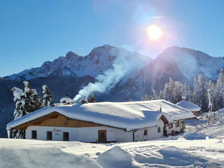
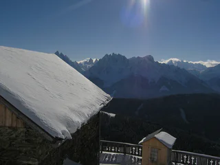
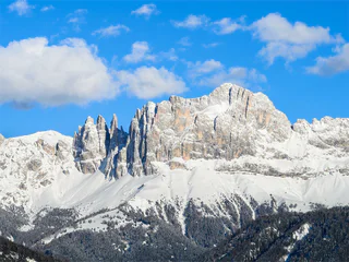
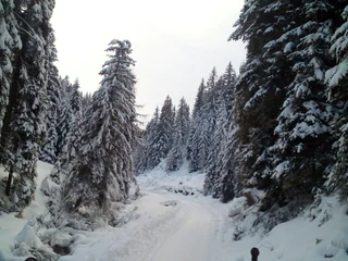
La Ferata – The old railway line featuring Bronze Sculptures and Snow Depths - Winter
Selva/Sëlva/Wolkenstein/Sëlva, Urtijëi/Ortisei, Dolomites Region Val Gardena
easy
Difficulty
61 m
Elevation gain
2h:31 min
duration
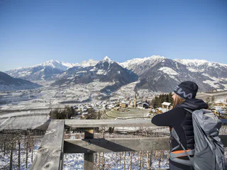
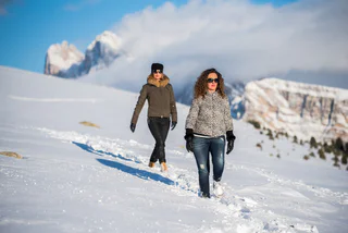
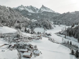
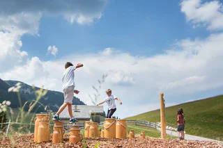
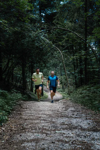
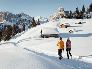
Hiking in winter in South Tyrol is a simple way to enjoy the mountains beyond ski slopes and lifts. Follow winter trails through snow-covered forests, take in wide-open views at the top, or head out for a peaceful walk in the snow. Whether you’re after an easy family-friendly winter hike or a more challenging snowy trek, you’ll find plenty of winter trails here, with all the details you need to plan ahead.
Selva/Sëlva/Wolkenstein/Sëlva, Urtijëi/Ortisei, Dolomites Region Val Gardena
easy
Difficulty
61 m
Elevation gain
2h:31 min
duration
1/4
Scena/Schenna, Schenna/Scena, Meran/Merano and environs
easy
Difficulty
320 m
Elevation gain
2h:00 min
duration
Ausserprags/Braies di Fuori, Prags/Braies, Dolomites Region 3 Zinnen
easy
Difficulty
47 m
Elevation gain
0h:40 min
duration
San Leonardo i.P./St. Leonhard i.P., St.Leonhard in Passeier/San Leonardo in Passiria, Meran/Merano and environs
medium
Difficulty
183 m
Elevation gain
1h:31 min
duration
Valgiovo/Jaufental, Ratschings/Racines, Sterzing/Vipiteno and environs
medium
Difficulty
569 m
Elevation gain
2h:31 min
duration
1/2
Ortisei/Urtijëi/St. Ulrich/Urtijëi, Urtijëi/Ortisei, Dolomites Region Val Gardena
easy
Difficulty
101 m
Elevation gain
0h:39 min
duration
1/2
Obereggen/Obereggen, Deutschnofen/Nova Ponente, Dolomites Region Eggental
easy
Difficulty
183 m
Elevation gain
1h:25 min
duration
1/11
Parcines/Partschins, Partschins/Parcines, Meran/Merano and environs
easy
Difficulty
118 m
Elevation gain
0h:58 min
duration
Monguelfo/Welsberg, Welsberg-Taisten/Monguelfo-Tesido
medium
Difficulty
144 m
Elevation gain
2h:00 min
duration
1/2
Obereggen/Obereggen, Deutschnofen/Nova Ponente, Dolomites Region Eggental
medium
Difficulty
454 m
Elevation gain
3h:30 min
duration
1/3
Mazzon/Mazon, Neumarkt/Egna, Alto Adige Wine Road
difficult
Difficulty
1408 m
Elevation gain
7h:00 min
duration
1/2
Valdaora di Sopra/Oberolang, Olang/Valdaora, Dolomites Region Kronplatz/Plan de Corones
easy
Difficulty
291 m
Elevation gain
1h:07 min
duration

1/2
Alpe di Rodengo/Rodenecker Alm, Lüsen/Luson, Dolomites Region Lüsen Villnöss
medium
Difficulty
0 m
Elevation gain
5h:00 min
duration
1/2
S. Candido/Innichen, Toblach/Dobbiaco, Dolomites Region 3 Zinnen
medium
Difficulty
715 m
Elevation gain
2h:30 min
duration
1/3
Nova Levante/Welschnofen, Welschnofen/Nova Levante, Dolomites Region Eggental
medium
Difficulty
429 m
Elevation gain
2h:34 min
duration
Obereggen/Obereggen, Deutschnofen/Nova Ponente, Dolomites Region Eggental
medium
Difficulty
519 m
Elevation gain
3h:00 min
duration
1/2
Maranza/Meransen, Mühlbach/Rio di Pusteria, Brixen/Bressanone and environs
medium
Difficulty
218 m
Elevation gain
1h:49 min
duration
1/3
Luson/Lüsen, Lüsen/Luson, Dolomites Region Lüsen Villnöss
medium
Difficulty
403 m
Elevation gain
2h:10 min
duration
1/2
Valdaora di Mezzo/Mitterolang, Welsberg-Taisten/Monguelfo-Tesido
easy
Difficulty
40 m
Elevation gain
1h:25 min
duration

1/2
Salorno/Salurn, Alto Adige Wine Road
easy
Difficulty
115 m
Elevation gain
0h:30 min
duration
1/2
S. Candido/Innichen, Toblach/Dobbiaco, Dolomites Region 3 Zinnen
easy
Difficulty
319 m
Elevation gain
2h:00 min
duration
1/2
San Cassiano/San Cassiano, Badia, Dolomites Region Alta Badia
easy
Difficulty
545 m
Elevation gain
2h:30 min
duration
Niederdorf/Villabassa, Dolomites Region 3 Zinnen
medium
Difficulty
416 m
Elevation gain
2h:06 min
duration
1/8
Montesole/Sonnenberg - Parcines/Partschins, Partschins/Parcines, Meran/Merano and environs
easy
Difficulty
155 m
Elevation gain
2h:04 min
duration
1/5
Longiarù/Campill, San Martin /San Martino, Dolomites Region Kronplatz/Plan de Corones
medium
Difficulty
284 m
Elevation gain
1h:40 min
duration
Ponticolo/Pontigl, Brenner/Brennero, Sterzing/Vipiteno and environs
medium
Difficulty
529 m
Elevation gain
1h:49 min
duration
1/5
Aldino/Aldein, Aldein/Aldino
medium
Difficulty
18 m
Elevation gain
1h:46 min
duration
S. Maddalena/St. Magdalena - Casies/Gsies, Gsies/Valle di Casies
medium
Difficulty
503 m
Elevation gain
2h:00 min
duration
Jaufental/Valgiovo, Ratschings/Racines, Sterzing/Vipiteno and environs
medium
Difficulty
211 m
Elevation gain
1h:23 min
duration
Colle/Pichl, Gsies/Valle di Casies
easy
Difficulty
200 m
Elevation gain
3h:00 min
duration
Thank you for signing up!
Your subscription is already active
Confirm your registration
To complete your subscription, open the email we just sent you and click on the confirmation link.
Can’t find it? Check your spam folder too.
We noticed that you tried to subscribe to the newsletter, but your email address is already registered. You will continue to receive our offers, tips and inspiration for your holiday.
We noticed that you already tried to subscribe to our Newsletter in the past but didn’t confirmed the subscription. We have resent you an email now, please check your inbox and spam folder to confirm.


