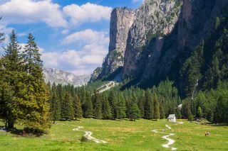
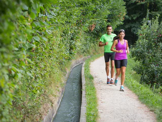
Skip to content

added to favourites

removed from favourites

Oops! Something went wrong. Try again

Your account is being created

Your account has been successfully created and you are now logged in

You’ve been logged in successfully!

Your account was created successfully, but we couldn't log you in automatically

You are logged out.

Filter
Selected filters
    Level of difficulty
    Duration
    Distance in KM

    Running routes through South Tyrol

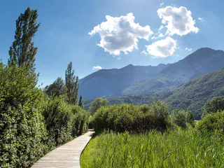
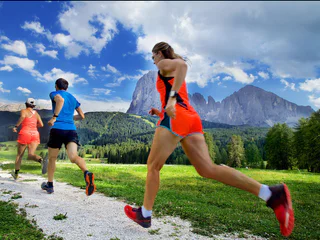
    South Tyrol is the varied Mecca for runners. Whether uphill, downhill, flat, on asphalt, in forests, on meadows or over hill and dale: every runner gets his money's worth in South Tyrol. The offer of signposted and well-maintained running trails is large and ranges from the running paradise at the Reschensee to the healthy altitude training on the Seiser Alm.

    Results
    Running & Fitness
    Speedhiking Schenna - Taser
    Schenna/Scena, Meran/Merano and environs
    This challenging speed hiking route starts at the valley station of the Taser cable car and runs partly steeply through the forest for about 3 kilometers to the mountain station of the Taser cable car.
    Difficulty: difficult
    630 m elevation gain
    0h:45 min duration
    Running & Fitness
    Elevation Trail Langtaufers
    Graun im Vinschgau/Curon Venosta, Vinschgau/Val Venosta
    A very long and challenging, but also very rewarding trail run high above the Langtauferer Valley. From Graun, the trail climbs steeply over the Rossböden Alm up to 2,700 m, where the high-altitude trail then leads partly inward. The path winds its way along the mountain ridge in a constant up and down. The views of the surrounding glaciers, especially the Ortler Group, are breathtaking! After about 20 km, there is the option to run to Melag if a storm is approaching or if you are already very tired. However, if the weather is good and you have enough energy reserves, you should definitely continue to the Weißkugelhütte, where you can replenish your energy stores before tackling the downhill.
    Be sure to pay attention to having enough provisions; there are many streams to refill water, but no managed hut until the Weißkugelhütte.
    Difficulty: difficult
    2331 m elevation gain
    11h:10 min duration
    Leisure & Experience
    Well-Fit-Parcour
    Plaus/Plaus, Meran/Merano and environs

    The 1,6 km long Alpine-Well-Fit-Parcour is composed of four stations with suggestions of stretching exercises, mobilization, strengthening- and relaxation exercises, all to help improve your well-being. The parkour runs from the original “well-fit” route between Plaus and Naturno along the bottom of Monte Tramontana. Starting point is at the “Gröbenweg” in Plaus.

    Difficulty: easy
    21 m elevation gain
    1h:49 min duration
    Running & Fitness
    Stocknertal Circular Trail in Terento – Enjoy Nature and Running
    Terenten/Terento, Brixen/Bressanone and environs

    The Stocknertal Circular Trail in Terento is a short and easy running trail through the charming woods near the village center. With a length of 3 km and a mix of asphalt and forest paths, it’s ideal for beginners and anyone looking to combine physical activity with a natural setting.

    Difficulty: easy
    104 m elevation gain
    0h:54 min duration
    Running & Fitness
    Path along the water channel at Morter
    Latsch/Laces, Vinschgau/Val Venosta

    A scenic and beautiful running route in Morter which leaves nothing to be desired. Flat passages changes with moderate increases, to sensational sleep tracks along the "Neuwaal" and the "Rautwaal".


    Difficulty: medium
    0 m elevation gain
    0h:40 min duration
    Running & Fitness
    Your Running Adventure to Jochtal
    Mühlbach/Rio di Pusteria, Brixen/Bressanone and environs

    Discover the breathtaking landscape around Spinges and Jochtal! This challenging running trail combines a sporty challenge with extraordinary natural experiences – perfect for adventure lovers.

    Difficulty: difficult
    519 m elevation gain
    1h:00 min duration
    Running & Fitness
    Around the lake San Valentino
    Graun im Vinschgau/Curon Venosta, Vinschgau/Val Venosta

    The lake Haidersee is a natural lake with a biotope areas, lead two boardwalks over which. Signs along the way describe the different bird and fish species in the region.

    Difficulty: easy
    0 m elevation gain
    0h:30 min duration
    Running & Fitness
    Sunny Loop in Meransen
    Mühlbach/Rio di Pusteria, Brixen/Bressanone and environs

    Experience the sunny and tranquil atmosphere of Meransen on this varied route. Medium difficulty with breathtaking views of the Pustertal and Eisacktal – perfect for runners with good fitness who love combining sport and nature.

    Difficulty: medium
    177 m elevation gain
    0h:49 min duration
    Running & Fitness
    Morterer-Waal-Round via variant Montani
    Latsch/Laces, Vinschgau/Val Venosta

    Beautiful scenic running track at the south of Morter with a great variation over the castle ruins of Montani.

    Difficulty: medium
    538 m elevation gain
    3h:34 min duration
    Running & Fitness
    Elevation Trail Nauders
    Graun im Vinschgau/Curon Venosta, Vinschgau/Val Venosta
    A top-class trail run! After a longer ascent, the high-altitude trail runs permanently along the forest border to Italy and Lake Reschen. From the starting point Parditsch in Nauders, you follow the trail to the inn of the same name and continue to the Labaunalm. Now you branch off to the south and follow the trail to the Labauner Köpfl. The long ascent is now overcome, and you can really enjoy the trails with a great view of Lake Reschen and the surrounding mountains. At the Piengalm, after about 14 km, you can stock up on food and drinks before the high-altitude trail climbs slightly again towards Bergkastel. Now you have almost completed all the altitude meters and continue across the border to Italy to the Plamort rock. The downhill is rewarded with a fantastic view of Lake Reschen. Soon the forest road is reached, along which you run the last kilometer to Reschen.
    Difficulty: difficult
    1344 m elevation gain
    7h:37 min duration
    Running & Fitness
    Running trail Taser
    Schenna/Scena, Meran/Merano and environs
    This challenging running trail route starts at the valley station of the Taser cable car and runs partly steeply through the forest for about 6 kilometers to the mountain station of the Taser cable car.
    Difficulty: difficult
    700 m elevation gain
    1h:00 min duration
    Leisure & Experience
    Ski World Cup Tour
    Sëlva/Selva, Dolomites Region Val Gardena
    We start in Selva at the “Kulturhaus Oswald von Wolkenstein” and follow path no. 30B in the direction of Monte Pana, where we also cross the Ciaslat meadow at the foot of the World Cup downhill route Saslong’s notorious “camel back”. Arriving at the Monte Pana road, we cross this and continue on the hiking trail to the next fork, there we bear right in the direction of S. Cristina and come by way of the Tervela Waterfall to the base station of the Monte Pana chair lift. Here we run directly towards Ruacia, right past the finish area of the Saslong downhill route, up the Ruacia road to the roundabout in the centre of S. Cristina and from there the Tieja Road uphill until we turn right on the old railway and head back to Selva.
    Difficulty: medium
    250 m elevation gain
    2h:17 min duration
    Running & Fitness
    Around the lake Resia
    Graun im Vinschgau/Curon Venosta, Vinschgau/Val Venosta

    The round of the Reschensee is a special experience for hikers and runners. The wonderful views of the Ortler is unique. The tower in the lake completes the picture. He is the last witness of the sunken village of Graun which can live the story.

    Difficulty: medium
    0 m elevation gain
    1h:45 min duration
    Running & Fitness
    To the Rescher Alm alpine pasture
    Graun im Vinschgau/Curon Venosta, Vinschgau/Val Venosta
    A popular running route starts from the northwestern edge of Reschen village towards the Rescher Alm. Always follow the signs for Rescher Alm and marker number 3 along the bike path, past the Mühlanderhof, across the meadows, and later on the forest path past Tendershof. After several switchbacks on trail number 3B, you reach the Rescher Alm, which is managed year-round and offers a unique view of the lake and surrounding villages. The return is via trail number 7, past Vallierteck.
    Difficulty: medium
    1001 m elevation gain
    2h:00 min duration
    Leisure & Experience
    Sassolungo circuit
    Sëlva/Selva, Dolomites Region Val Gardena
    This route circling the Sassolungo massif is a superlative trial run. The beautiful landscape and the breathtaking views will make you forget the physical exertion. The route runs mostly on a constant elevation between approx. 2,200 m and 2,300 m, so that you experience only small changes in elevation.
    Difficulty: difficult
    751 m elevation gain
    4h:52 min duration
    Running & Fitness
    The Vintl to Pfunders Run – Nature’s Challenge
    Vintl/Vandoies, Brixen/Bressanone and environs

    The Valley Trail to Pfunders is a challenging route, perfect for experienced runners. With its varied, mostly well-maintained paths and breathtaking natural scenery, this trail offers a unique experience – ideal for those seeking a physical challenge while enjoying the beauty of the surroundings.

    Difficulty: medium
    375 m elevation gain
    1h:16 min duration
    Running & Fitness
    Joggl Trail
    Graun im Vinschgau/Curon Venosta, Vinschgau/Val Venosta
    A great challenging round over several peaks, but requiring some surefootedness and good weather. From Graun, you first follow the Panorama Trail (R6), turn off after about 3 km, cross the main road, and follow the trail up to the Joggl (Endkopf). Now you continuously follow the ridge over several peaks, up to the 2,909 m high Mittereggspitze, which offers a magnificent view of the Ortler. The route continues along the ridge, mostly downhill and over a last ascent to the summit of the Großhorn. Now you follow the path down the north side, past the Grauner Alm, and back to Graun to the starting point.
    Difficulty: difficult
    1950 m elevation gain
    9h:01 min duration
    Running & Fitness
    Panoramatrail
    Graun im Vinschgau/Curon Venosta, Vinschgau/Val Venosta
    A wonderful training route on the south side of the Langtauferer Valley. Due to the orientation, this route, despite its altitude, is often runnable early in the year. From the starting point in Graun, the first kilometer leads somewhat steeper uphill. Soon, however, it becomes flatter, and you follow the trails and forest roads further into the valley. Most of the time, you head towards Melag on a comfortably runnable incline. Short sections also go downhill now and then, inviting you to catch your breath. Further into the valley, a fantastic view of the Weißkugel glaciers opens up. You can then conveniently return to Lake Reschen by bus.
    Difficulty: medium
    918 m elevation gain
    4h:19 min duration
    Running & Fitness
    Weisskugeltrail
    Graun im Vinschgau/Curon Venosta, Vinschgau/Val Venosta
    In the shadow of the Weißkugel, you head to the Weißkugel Hut and return to Melag via a small section of the Langtauferer High Trail. The first part is rather flat and perfect for warming up. From the Melager Alm, it gradually becomes steeper, and you follow the glacier educational trail towards the Weißkugel Hut – always with the best view of the glaciers of the Weißkugel group. Once you have reached the Weißkugel Hut, you follow the narrow high trail (some surefootedness required) downstream, with no more altitude meters to overcome. Soon you reach the stream coming from the Weißseejoch and first follow a trail, then a forest road back to the small mountain village of Melag.
    Difficulty: difficult
    756 m elevation gain
    5h:00 min duration
    Running & Fitness
    To the Melager Alm alpine pasture
    Graun im Vinschgau/Curon Venosta, Vinschgau/Val Venosta
    The running trail from Melag to the Melager Alm in Langtaufers is a scenic route for running enthusiasts. The run starts at the parking lot in the hamlet of Melag. From the parking lot, you run into the valley and turn right between the houses. Signs 2 and 5 mark the path, which is also clearly visible without markings. With a gentle incline, you jog to the Karlinbach, cross the bridge, and continue on a flat path to the alm. At the valley's end, there are impressive views of the snow-capped peaks surrounding the Weißkugel, with numerous three-thousanders flanking the valley to the north and south. The return is via the same route.
    As an alternative for runners, starting from the hamlet of Kappl at the former valley station of the Maseben lift is recommended, where you can follow the forest road to the Melager Alm
    Difficulty: easy
    146 m elevation gain
    0h:40 min duration
    Running & Fitness
    Trail Elfer peak
    Mals/Malles, Vinschgau/Val Venosta
    A very beautiful, alpine trail running loop with a magnificent view of Lake Reschen and the Ortler Group. The tour is signposted from Haideralm via the Elferspitze to the Schöneben cable car and, due to the moderate distances, is suitable for beginners as well. The ascent to the Elferspitze can be managed with some surefootedness. The route leads across simple block terrain over the Zwölferkopf down to the Schöneben hut. Afterwards, you can take the Schöneben cable car and bus back to the Haideralm valley station. If you want to extend the tour a bit, you can run the dreamy high-altitude trail from the Schöneben mountain station to the Haideralm mountain station. Of course, the tour can also be started from Schöneben
    Difficulty: difficult
    1120 m elevation gain
    4h:55 min duration
    Running & Fitness
    Your Run in Rodeneck
    Rodeneck/Rodengo, Brixen/Bressanone and environs

    Run peacefully through the idyllic landscape of Rodeneck! This short and easy route on the Ywein Trail is perfect for all fitness levels – ideal for recharging and enjoying nature.

    Difficulty: easy
    71 m elevation gain
    0h:15 min duration
    Running & Fitness
    Piz Lad Trail
    Graun im Vinschgau/Curon Venosta, Vinschgau/Val Venosta
    A route that has it all: a steep climb, flowing trails with some peaks, great downhills, and always a breathtaking view of Lake Reschen and the Ortler Group! From the Reschen Alm, it's first up to the Outer Nockenkopf. Then you follow the partly unmarked but easy and logical mountain ridge up to Piz Lad. This section definitely gets the trail running heart pumping. Fun trails and a unique view now lead back to the starting point at the Reschen Alm.
    Difficulty: difficult
    1146 m elevation gain
    5h:19 min duration
    Running & Fitness
    3-Country Elevation Path
    Graun im Vinschgau/Curon Venosta, Vinschgau/Val Venosta
    A long, challenging run that impresses with a fantastic natural experience and a magnificent view of Lake Reschen and the Ortler Group. The starting point is at the Mutzkopf lift valley station, and the run first leads to the Großmutzkopf and then to the Dreiländer Border Stone, where Austria, Italy, and Switzerland meet. The trail continues along the ridge to Rescher Alm, where you can refuel for the first time. Via flowy trails, you reach Schöneben, where more than half of the run is already completed. Over the gorgeous last part of the ridge trail, with constant views of Lake Reschen, the Ortler Group, and the Weißkugel, you finally reach Haideralm. From there, it's all downhill to St. Valentin.
    Difficulty: medium
    2424 m elevation gain
    6h:00 min duration
    Leisure & Experience
    From Terenten to Pein and Margen: Running with Scenic Views
    Terenten/Terento, Brixen/Bressanone and environs

    The route from Terenten to Pein and Margen combines varied terrain with beautiful views. It’s perfect for experienced runners seeking a balanced challenge and scenic enjoyment.

    Difficulty: medium
    279 m elevation gain
    2h:40 min duration
    Running & Fitness
    Nordic Walking: San Genesio - Montoppio
    Jenesien/San Genesio Atesino, Bolzano/Bozen and environs

    From the centre of the village, follow trail no. 33a until you reach the Locher restaurant. From here, walk on along trail nr. 2 until you come to your place of departure. Duration of the excursion: 1 hours and 50 minutes - Drop/rise: 330 m

    Difficulty: easy
    378 m elevation gain
    2h:38 min duration
    1 2 3 4 5 6 7