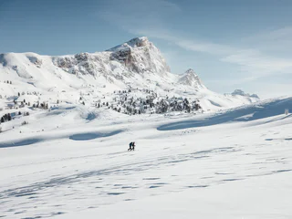
1/6
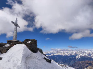
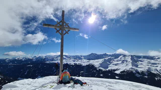
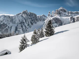
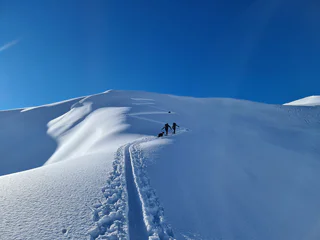
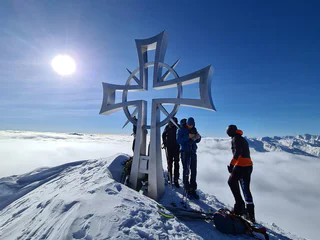
Wilde Kreuzspitze - Summit ski tour
S. Giacomo/St. Jakob - Val di Vizze/Pfitsch, Pfitsch/Val di Vizze, Sterzing/Vipiteno and environs
medium
Poziom trudności
1787 m
Wzlot
5h:34 min
czas trwania
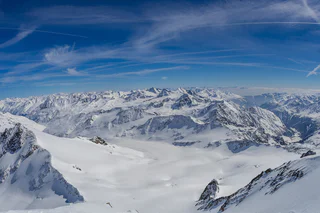
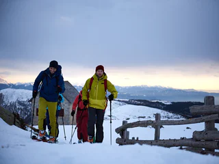
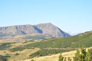
Dziewiczy krajobraz, spokój i cisza z dala od tras zjazdowych, zbocza pokryte głębokim puchem i firnem. Porywasz się na Dolomity? Wolisz łagodniejsze podejścia? Uwielbiasz dalekie panoramy? A może satysfakcjonują cię wyłącznie najwyższe osiągnięcia? Każdy wybór będzie dobry, bo skitury w Południowym Tyrolu oznaczają zawsze niesamowite wrażenia w zetknięciu z przyrodą oraz sportową przygodę.
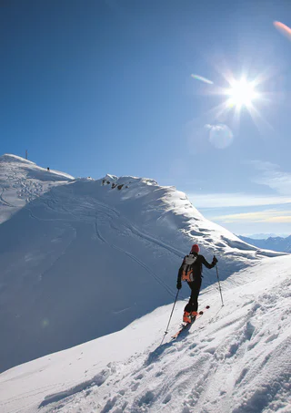
1/6
S. Giacomo/St. Jakob - Val di Vizze/Pfitsch, Pfitsch/Val di Vizze, Sterzing/Vipiteno and environs
medium
Poziom trudności
1787 m
Wzlot
5h:34 min
czas trwania
1/3
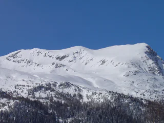
Maso Corto/Kurzras, Schnals/Senales, Vinschgau/Val Venosta
medium
Poziom trudności
1163 m
Wzlot
3h:42 min
czas trwania
1/2
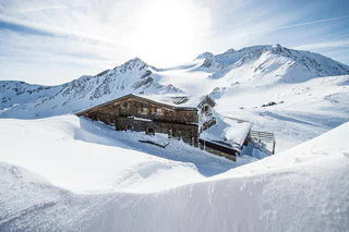
Valles/Vals, Mühlbach/Rio di Pusteria, Brixen/Bressanone and environs
medium
Poziom trudności
560 m
Wzlot
2h:00 min
czas trwania
1/2
Ridanna/Ridnaun, Ratschings/Racines, Sterzing/Vipiteno and environs
medium
Poziom trudności
1005 m
Wzlot
3h:16 min
czas trwania
1/3
Colfosco/Colfosco, Corvara, Dolomites Region Alta Badia
difficult
Poziom trudności
0 m
Wzlot
1h:45 min
czas trwania
1/3
Falzeben/Falzeben, Hafling/Avelengo, Meran/Merano and environs
difficult
Poziom trudności
752 m
Wzlot
2h:34 min
czas trwania

Tablà/Tabland - Parcines/Partschins, Moos in Passeier/Moso in Passiria, Meran/Merano and environs
difficult
Poziom trudności
1600 m
Wzlot
5h:00 min
czas trwania

1/3
Corvara/Corvara, Corvara, Dolomites Region Alta Badia
easy
Poziom trudności
286 m
Wzlot
1h:26 min
czas trwania
Stulles/Stuls, Moos in Passeier/Moso in Passiria, Meran/Merano and environs
medium
Poziom trudności
1152 m
Wzlot
3h:30 min
czas trwania
S. Giacomo/St. Jakob - Val di Vizze/Pfitsch, Pfitsch/Val di Vizze, Sterzing/Vipiteno and environs
difficult
Poziom trudności
1408 m
Wzlot
4h:46 min
czas trwania
1/2
Santa Gertrude/St. Gertraud, Ulten/Ultimo, Meran/Merano and environs
medium
Poziom trudności
1524 m
Wzlot
5h:49 min
czas trwania
1/4
S. Giacomo/St. Jakob - Val di Vizze/Pfitsch, Pfitsch/Val di Vizze, Sterzing/Vipiteno and environs
medium
Poziom trudności
1266 m
Wzlot
3h:58 min
czas trwania
Vipiteno/Sterzing, Sterzing/Vipiteno, Sterzing/Vipiteno and environs
difficult
Poziom trudności
980 m
Wzlot
3h:30 min
czas trwania
Resia/Reschen, Graun im Vinschgau/Curon Venosta, Vinschgau/Val Venosta
medium
Poziom trudności
964 m
Wzlot
3h:21 min
czas trwania
1/2
Ridanna/Ridnaun, Ratschings/Racines, Sterzing/Vipiteno and environs
medium
Poziom trudności
1019 m
Wzlot
2h:55 min
czas trwania
Casere/Kasern, Prettau/Predoi, Ahrntal/Valle Aurina
easy
Poziom trudności
1183 m
Wzlot
4h:00 min
czas trwania
1/5
Plata/Platt, Moos in Passeier/Moso in Passiria, Meran/Merano and environs
medium
Poziom trudności
1073 m
Wzlot
4h:00 min
czas trwania
Plan/Pfelders, Riffian/Rifiano, Meran/Merano and environs
difficult
Poziom trudności
1661 m
Wzlot
4h:00 min
czas trwania
1/2
Resia/Reschen, Graun im Vinschgau/Curon Venosta, Vinschgau/Val Venosta
medium
Poziom trudności
0 m
Wzlot
4h:00 min
czas trwania
Ponticolo/Pontigl, Brenner/Brennero, Sterzing/Vipiteno and environs
medium
Poziom trudności
1244 m
Wzlot
4h:13 min
czas trwania
1/2
Maso Corto/Kurzras, Schnals/Senales, Vinschgau/Val Venosta
medium
Poziom trudności
634 m
Wzlot
3h:16 min
czas trwania
San Vigilio, Al Plan/San Vigilio, Dolomites Region Kronplatz/Plan de Corones
medium
Poziom trudności
682 m
Wzlot
2h:28 min
czas trwania
1/4
Valgiovo/Jaufental, Ratschings/Racines, Sterzing/Vipiteno and environs
difficult
Poziom trudności
1294 m
Wzlot
3h:57 min
czas trwania
1/2
S.Martino/Reinswald, Klausen/Chiusa, Brixen/Bressanone and environs
medium
Poziom trudności
0 m
Wzlot
9h:48 min
czas trwania
1/3
Maso Corto/Kurzras, Schnals/Senales, Vinschgau/Val Venosta
difficult
Poziom trudności
1517 m
Wzlot
5h:24 min
czas trwania
Colle/Pichl, Gsies/Valle di Casies
medium
Poziom trudności
1400 m
Wzlot
5h:00 min
czas trwania
1/3
Plan/Pfelders, Moos in Passeier/Moso in Passiria, Meran/Merano and environs
easy
Poziom trudności
664 m
Wzlot
2h:30 min
czas trwania
1/3
San Cassiano/San Cassiano, Badia, Dolomites Region Alta Badia
easy
Poziom trudności
78 m
Wzlot
0h:45 min
czas trwania
1/3
Certosa/Karthaus, Schnals/Senales, Vinschgau/Val Venosta
medium
Poziom trudności
1600 m
Wzlot
5h:52 min
czas trwania
Valdaora di Mezzo/Mitterolang, Al Plan/San Vigilio, Dolomites Region Kronplatz/Plan de Corones
medium
Poziom trudności
1217 m
Wzlot
4h:37 min
czas trwania
Dziękujemy za zapisanie się!
Subskrypcja jest już aktywna
Potwierdź rejestrację
Aby zakończyć rejestrację, otwórz e-mail, który właśnie wysłaliśmy, i kliknij link potwierdzający.
Nie widzisz wiadomości? Sprawdź folder spam.
Zauważyliśmy, że próbowałeś(-aś) zapisać się do newslettera, ale Twój adres e-mail jest już zarejestrowany. Nadal będziesz otrzymywać nasze oferty, wskazówki i inspiracje na Twój urlop.
Już próbowałeś zapisać się do naszego newslettera, ale nie potwierdziłeś rejestracji. Właśnie wysłaliśmy ci ponownie e‑mail. Sprawdź swoją skrzynkę odbiorczą i folder ze spamem i potwierdź teraz.


