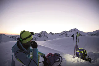
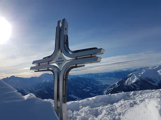
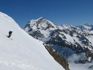
Difficult ski tourDifficult ski tour
Time of the year: ideal conditions in spring
Avalanche danger near the ridge
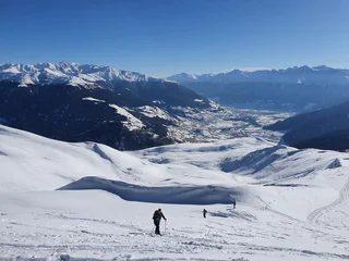
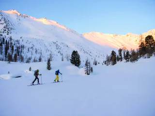
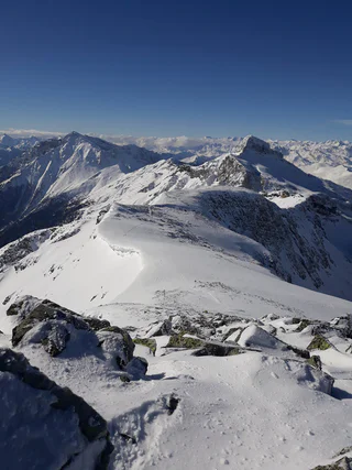
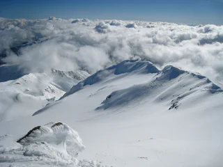
Dziewiczy krajobraz, spokój i cisza z dala od tras zjazdowych, zbocza pokryte głębokim puchem i firnem. Porywasz się na Dolomity? Wolisz łagodniejsze podejścia? Uwielbiasz dalekie panoramy? A może satysfakcjonują cię wyłącznie najwyższe osiągnięcia? Każdy wybór będzie dobry, bo skitury w Południowym Tyrolu oznaczają zawsze niesamowite wrażenia w zetknięciu z przyrodą oraz sportową przygodę.
Difficult ski tourDifficult ski tour
Time of the year: ideal conditions in spring
Avalanche danger near the ridge
Alpine ski tour in the valley end of Pflerschtal/Val di Fleres. The tour offers a beautifulg cirque, inviting ski slopes and great views on the South Tyrolean mountains in the south and the Tribulaun summit on the northern side. The exposure to north guarantees a good powder snow.
Technical skiing grade: easy.
Alpine grade: quite difficult.
Maps: Tabacco No. 038, Kompass No. 44.
Ski tour Prato Piazza/Plätzwiese – Monte Specie/Strudelkopf Tour description Moderately difficult ski tour starting from the Prato Piazza and going via the Vallandro/Dürrensteinhütte refuge to the Monte Specie. Unique view of the Croda Rossa/Hohe Gaisl, Tre Cime di Lavaredo/Drei Zinnen, Tofana and Monte Cristallo mountains. Slope orientation: diverse Starting point: Prato Piazza/Platzwiese Highest point: 2307
Attention: Please check the avalanche bulletin updated every day!
At the entrance to the Münstertal valley lies the Tellakopf, a pleasant hiking peak that is also ideal for an easy ski tour. This rewarding tour destination offers breathtaking views of the Vinschgau Valley, the Münstertal Valley, the Ötztal Alps and the Ortler Mountains.
Route: Right behind the Gasthof Bad Bergfall you go on on the on forestall way (path n. 32) for a little while over two hairpins (direction West), then the path turns toward Sud, in Langtal. From here you easily reach a bridge that leads right over a stream. Now you can either go on on the left side of the stream, or once crossed the bridge turn left so that you will find yourself on the right side of the stream. At an high of 1700 m the ditch divides. Now you go on on the right side of the valley uphill for a while through the forest. After a while the terrain becomes flat again and you can walk through a light section of forest and then arrive to the so-called Lapedurscharte (2200 m). Right before arriving to the path sign, you have to turn right and the toward West over a bump. After other bumps, you will reach without problems the crest – unfortunately you will loose 25 m of hight – without problems in the highest point with the cross. If you will not be satisfied, you can go on along the crest and reach the Piz da Peres (2057 m ).
Starting point: Certosa/Karthaus (1,327 m a.s.l.)
Ascent: 1,474 m elevation gain, 4 hours
Best time: winter and early spring
Uphill and downhill possible with skis from to Certosa/Karthaus if the snow conditions are good. Referred to as Gamseck on some maps. The ascent is from Certosa/Karthaus along the road to Farmstead Sennhof and then on the forest path to malga del convento, above Certosa/Karthaus, from there continue southwards to the highest and rather steep ascent to the secondary summit of the Trumserspitze.
Descent A: The same as the ascent route and the road to Certosa/Karthaus.
Descent B: Northwards to malga del convento and along the forest path as far as the viewing point for Certosa/Karthaus and then directly downhill to Certosa/Karthaus through the forest aisle.
For practised skiers
A true hidden gem for nature lovers is the ski touring and tobogganing trail to the Brunstalm, starting right at the Kids World in Oberolang. This enchanting path is groomed weekly with a snowcat and winds its way through the untouched beauty of the Dolomites UNESCO World Heritage site. The trail gently leads up to the Brunstalm, where you can warm up in a cozy room and take in the breathtaking views of the Olang Dolomites. Please note that the trail is closed in the evening due to grooming work.
Moderatly difficult ski tour
Time of the year: from high winter to spring
Refreshment stop: Schönau inn
This ski tour is a real Sarntal valley classic amongst high-winter tours in the Durnholztal valley and is popular with local mountaineers.
This tour leads from Sulden via the beautiful Zaytal valley to the Düsseldorfer Hütte mountain hut, located below a rock face at 2,721 m. Enjoy a stunning view of the Ortler’s classic three peaks from the sun terrace.
(Hut is closed in winter.)
From Gasthof Alpenfriede across meadows to the left onto a forest path. On this up to the level of a mountain barn, turn left there and follow the old military road until you cross the forest line. Caution is advised there. After that the terrain becomes pleasant and flat. Over wide hollows to the right of the saddle, Wetterkreuz, past and up to Wölfelesjoch. There the prominent south ridge begins, which is partly done on skis and on foot.
Start at Ranui, car park Waldschenke (1,370 m), in direction Weissbrunn and Brogles Alm and on the Laite Va Piz (2,284 m)
The entrance to the Langental valley is located in Selva Gardena and runs through a pleasant walking and hiking path with views of the Stevia massif and the walls of the Puezgruppe on the left, as well as the Chedul Mountains and Col Turond on the right. Along the path you can find the mystical Silester Chapel.
Starting point: Maso Corto/Kurzras, Masi Kofel/Koflhöfe (1,938 m a.s.l.)
Ascent: 949 m elevation gain, 3 hours
Best time: December to April
A pleasant tour and not too difficult; only the part through the woods, along the narrow Sommerweg is somewhat difficult, especially when descending. The ascent starts at Koflhof farm (0.7 km before Maso Corto/Kurzras), moving southwards through the Lagauntal Valley. Before the valley basin, go to the right up the slope north-westwards, arriving at Stotz, north of the Saldurkamm mountains. You can descend either by the same route or by going north via Lazaun Mountain hut to Maso Corto/Kurzras.
Also suitable for intermediate-level skiers.
The "Helltaler Schlechten" are a classical skitour in a sunny area out of the wood.
Attention: Please check the avalanche bulletin updated every day!
Ski touring friends will find a natural ascent path over hiking trails and forest roads to the mountain station Ladurns, which is ideal for practicing and training. The ascent slope is only open during the opening hours of the cable cars.
Technical skiing grade: easy.
Maps: Tabacco No. 038, Kompass No. 44.
The Skitour goes up to a wonderful mountain above the lake of Braies and offers a spectacular downhill run.
Attention: Please check the avalanche bulletin updated every day!
On a mountain range on the border between South Tyrol and Austria, the Rotbachspitze lies far above the Pfitchscherjoch and is in the catchment area of several classic ski tours.
Ski tour to Monte Cevedale, one of the best peaks for mountain views in the Ortler region.
This tour to Monte Cevedale is one of the top 10 ski tours in the Ortler region and is extremely popular among enthusiasts. After all, it’s an easy tour that rewards visitors with breathtaking Alpine panoramas.
Time of the year: Late winter/early spring
Avalanche risk: Exersise caution near the summit!
Refreshment stop: Schönau inn
Panorama hike: over the Lutter- and Durakopf
Starting point: parking area above the mountain restaurant Mudler Hof in Taisten 1584 m
Ascent: ca. 3 to 3 ½ hours
Descent: ca. 2 hours, toboggan run until mountain restaurant Mudler Hof
Level of difficulty: moderate – difficult; slightly steep ascent through the forest – unproblematic and fairly smooth alpine terrain – mostly gentle downhill run
Altitude difference: ca. 700 m
Toboggan run: easy
The ski tour to Langgrubjoch is still relatively popular. It is relatively easy and not as challenging as the tours on the high neighbouring peaks. However, it does rise to over 3,000 m and offers a good insight into the mountain world of Schnalstal Valley.
On Meran 2000 the back country skiers may ascend on the "Kuhleiten Route" to the Kuhleitenhütte Mountain Hut on 2,362 metres.
Open thursday till sunday from 9.00 a.m. - 05.00 p.m. and additionally every Thursday and Friday evening until 11 p.m.
The Äußerer Nockenkopf is famous for being a rather easy mountain to ski and also for its beautiful location above the highest hamlet in the eastern Alps. The ski tour begins at the end of the village of Resia/Reschen. Altitude gain: 1,250 m Time to ascend: roughly 4 hours Slope direction: east Skiing demands: medium Climbing demands: easy Note: exercise caution during the ascent after the Kalkwaldhütte mountain hut and on the summit slope! For the ascent to the peak, follow the route to the left at the end of the Pofel ski lift. Follow the groomed trail to the Vallierteck pilgrimage chapel. Above the chapel, turn right, following the signs to ‘Nockenkopf’ until you reach the road that leads to the Reschner Alm Alpine farm. From here bear left heading gently downhill and then right again along the trail following the signs to the ‘Kalkwaldhütte’ mountain hut. Here head rather carefully from left to right uphill over the moderately steep and wide ridge to the Stielegg cross. Traverse horizontally with caution to the left (west) into the large trough, continuing to ascend to the left toward the foot of the Nockenkopf’s southern slope. Keeping to the right, head up the rather steep slope and over the ridge to the peak. Those looking for a quicker ascent can drive to Roia/Rojen. Avalanche danger: minimal
Starting point: Kratzegg (Ulfas), at 1,504 m
Time of the year: Throughout winter
Moderately difficult ski tour
Time of the year: Throughout winter
Starting point: Maso Corto/Kurzras (2,011 m a.s.l)
Ascent: 646 m elevation gain, 3 hours, from the Giogo Alto/Hochjoch glacier (Refuge Bella Vista 2,842 m a.s.l)
Best time for departure A: December to May
Best time for departures B and C: March to May
This is a very pleasant tour on a mountain that is still very much glaciated on the north side but that is not without its risks in one part where the “icefall” east of the Giogo Alto/Hochjoch glacier is hazardous due to glacier crevasses. The ascent is from Maso Corto/Kurzras to the Bella Vista lodge or with the Schnalstal valley cable car to the Giogo Alto/Hochjoch glacier; you leave the east side by climbing through the icefall. Avoiding the crevasses, the trail rises steeply to the upper glacier terrace, and keeping to the west of the summit, very steeply to the ridge shoulder. Continue along the short but exposed ridge to the summit.
Descent A: go along the ascent route to the Giogo Alto/Hochjoch pass and descend to the valley as far as Maso Corto/Kurzras or take the Schnalstal Valley cable car.
Descent B: Taking the first steep slope down, then to the right/north-east and continue south-easterly and southwards to the Giogo Alto/Niederjoch pass and on to the Refuge Similaun.
Descent C: Northwards towards the Hochjoch-Hospiz hut and Vent (A)
For good skiers with Alpine experience