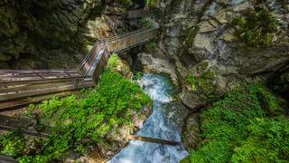
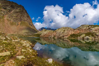
1/3
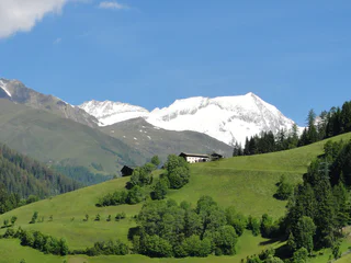
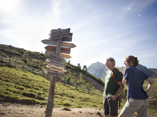
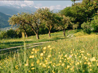
Hike along the sunny side of Mühlwald/Selva dei Molini
Selva die Molini/Mühlwald, Mühlwald/Selva dei Molini, Ahrntal/Valle Aurina
medium
Poziom trudności
1021 m
Wzlot
6h:00 min
czas trwania
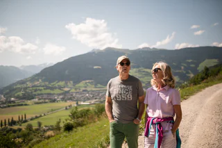
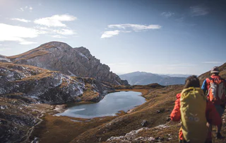
Panoramiczne szlaki z widokiem na imponujące górskie krajobrazy, spokojne rodzinne wędrówki lub szlaki tematyczne wzdłuż historycznego Waalwege. Na wakacje pociągiem lub relaksujące wakacje bez samochodu, Południowy Tyrol oferuje wiele wycieczek pieszych, do których można łatwo dojechać autobusem lub pociągiem. Wsiadasz, wędrujesz wzdłuż trasy i wracasz transportem publicznym po zakończeniu wycieczki. Krótsze etapy są również łatwe do zaplanowania. Możesz także łatwo dotrzeć transportem publicznym do popularnych punktów startowych, takich jak przełęcze Dolomitów. Dzięki temu możesz zachować elastyczność podczas podróży i bardziej świadomie doświadczać górskiego świata.
1/3
Selva die Molini/Mühlwald, Mühlwald/Selva dei Molini, Ahrntal/Valle Aurina
medium
Poziom trudności
1021 m
Wzlot
6h:00 min
czas trwania
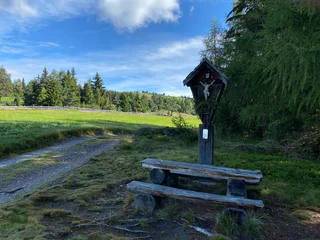
1/3
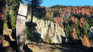
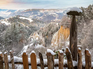
Percha/Perca, Dolomites Region Kronplatz/Plan de Corones
easy
Poziom trudności
620 m
Wzlot
2h:15 min
czas trwania
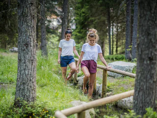
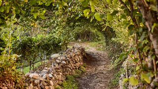
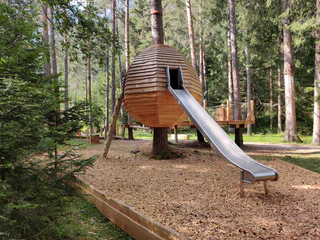
1/5
Casere/Kasern, Prettau/Predoi, Ahrntal/Valle Aurina
easy
Poziom trudności
365 m
Wzlot
1h:45 min
czas trwania

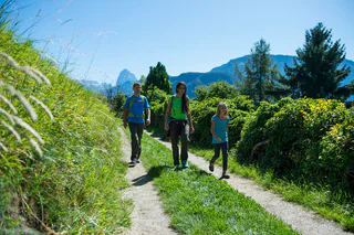
Valgiovo/Jaufental, Ratschings/Racines, Sterzing/Vipiteno and environs
easy
Poziom trudności
336 m
Wzlot
2h:34 min
czas trwania
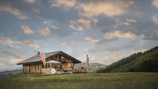
1/4
Albion/Albions, Lajen/Laion
easy
Poziom trudności
500 m
Wzlot
3h:36 min
czas trwania
1/7
Stanghe/Stange, Ratschings/Racines, Sterzing/Vipiteno and environs
easy
Poziom trudności
287 m
Wzlot
1h:03 min
czas trwania
Transacqua/Ennewasser, Martell/Martello, Vinschgau/Val Venosta
difficult
Poziom trudności
1331 m
Wzlot
5h:30 min
czas trwania
1/7
Collepietra/Steinegg, Karneid/Cornedo all'Isarco, Dolomites Region Eggental
medium
Poziom trudności
355 m
Wzlot
1h:52 min
czas trwania

1/3
Leifers/Laives, Laives/Leifers, Bolzano/Bozen and environs
medium
Poziom trudności
643 m
Wzlot
2h:31 min
czas trwania
Kaltern Dorf/Caldaro Paese, Kaltern an der Weinstraße/Caldaro sulla Strada del Vino, Alto Adige Wine Road
medium
Poziom trudności
508 m
Wzlot
4h:04 min
czas trwania
1/3
Brixen Stadt/Bressanone città, Brixen/Bressanone, Brixen/Bressanone and environs
easy
Poziom trudności
346 m
Wzlot
2h:31 min
czas trwania
1/4
Plose/Plose, Brixen/Bressanone, Brixen/Bressanone and environs
difficult
Poziom trudności
1083 m
Wzlot
4h:02 min
czas trwania
1/4
Falzeben/Falzeben, Hafling/Avelengo, Meran/Merano and environs
medium
Poziom trudności
369 m
Wzlot
2h:40 min
czas trwania
St. Walburg/Santa Valburga, Ulten/Ultimo, Meran/Merano and environs
medium
Poziom trudności
306 m
Wzlot
2h:49 min
czas trwania
Telves/Telfes, Sterzing/Vipiteno, Sterzing/Vipiteno and environs
medium
Poziom trudności
638 m
Wzlot
6h:00 min
czas trwania
1/6
Ceves/Tschöfs, Freienfeld/Campo di Trens, Sterzing/Vipiteno and environs
medium
Poziom trudności
285 m
Wzlot
2h:30 min
czas trwania
1/4
Völs/Fiè, Völs am Schlern/Fiè allo Sciliar, Dolomites Region Seiser Alm
difficult
Poziom trudności
953 m
Wzlot
3h:43 min
czas trwania
1/3
Taisten/Tesido, Welsberg-Taisten/Monguelfo-Tesido
medium
Poziom trudności
637 m
Wzlot
3h:23 min
czas trwania
1/4
Ridanna/Ridnaun, Ratschings/Racines, Sterzing/Vipiteno and environs
medium
Poziom trudności
1450 m
Wzlot
8h:00 min
czas trwania
Casateia/Gasteig, Ratschings/Racines, Sterzing/Vipiteno and environs
easy
Poziom trudności
520 m
Wzlot
2h:32 min
czas trwania
1/5
Luson/Lüsen, Lüsen/Luson, Dolomites Region Lüsen Villnöss
medium
Poziom trudności
460 m
Wzlot
2h:37 min
czas trwania
1/2
Fleres/Pflersch, Brenner/Brennero, Sterzing/Vipiteno and environs
easy
Poziom trudności
433 m
Wzlot
3h:40 min
czas trwania
Karthaus/Certosa, Schnals/Senales, Vinschgau/Val Venosta
medium
Poziom trudności
532 m
Wzlot
3h:25 min
czas trwania
1/3
Valdaora di Mezzo/Mitterolang, Olang/Valdaora, Dolomites Region Kronplatz/Plan de Corones
medium
Poziom trudności
1116 m
Wzlot
4h:13 min
czas trwania
Castelrotto/Kastelruth, Kastelruth/Castelrotto, Dolomites Region Seiser Alm
easy
Poziom trudności
528 m
Wzlot
3h:28 min
czas trwania
1/6
Velloi/Vellau, Algund/Lagundo, Meran/Merano and environs
medium
Poziom trudności
619 m
Wzlot
3h:08 min
czas trwania
1/2
Klobenstein/Collalbo, Ritten/Renon, Bolzano/Bozen and environs
medium
Poziom trudności
676 m
Wzlot
3h:46 min
czas trwania
1/4
Monte Scena/Schennaberg, Schenna/Scena, Meran/Merano and environs
medium
Poziom trudności
450 m
Wzlot
2h:30 min
czas trwania
1/5
Siusi/Seis, Kastelruth/Castelrotto, Dolomites Region Seiser Alm
easy
Poziom trudności
280 m
Wzlot
2h:00 min
czas trwania
Dziękujemy za zapisanie się!
Subskrypcja jest już aktywna
Potwierdź rejestrację
Aby zakończyć rejestrację, otwórz e-mail, który właśnie wysłaliśmy, i kliknij link potwierdzający.
Nie widzisz wiadomości? Sprawdź folder spam.
Zauważyliśmy, że próbowałeś(-aś) zapisać się do newslettera, ale Twój adres e-mail jest już zarejestrowany. Nadal będziesz otrzymywać nasze oferty, wskazówki i inspiracje na Twój urlop.
Już próbowałeś zapisać się do naszego newslettera, ale nie potwierdziłeś rejestracji. Właśnie wysłaliśmy ci ponownie e‑mail. Sprawdź swoją skrzynkę odbiorczą i folder ze spamem i potwierdź teraz.


