Skip to content
added to favourites
removed from favourites
Oops! Something went wrong. Try again
Your account is being created
Your account has been successfully created and you are now logged in
You are logged out.
Filter
Selected filters
    Level of difficulty
    Duration
    Distance in KM

    Themed Hikes across South Tyrol

    Located throughout South Tyrol’s holiday regions, sign-posted themed hikes are special journeys of discovery for young and old alike. In South Tyrol’s Unterland region, for example, visitors in autumn can experience how grapes go from the vine to the barrel. In San Valentino in Campo/Gummer you can explore the universe and our solar system. and in Terlano/Terlan in spring asparagus farmers demonstrate how the precious shoots are removed from the earth. In total more then 150 sign-posted and informative themed hikes await visitors to South Tyrol.

    Results
    Hiking
    Family hiking tour on the "Gumperle" path
    Prad am Stilfser Joch/Prato allo Stelvio, Vinschgau/Val Venosta

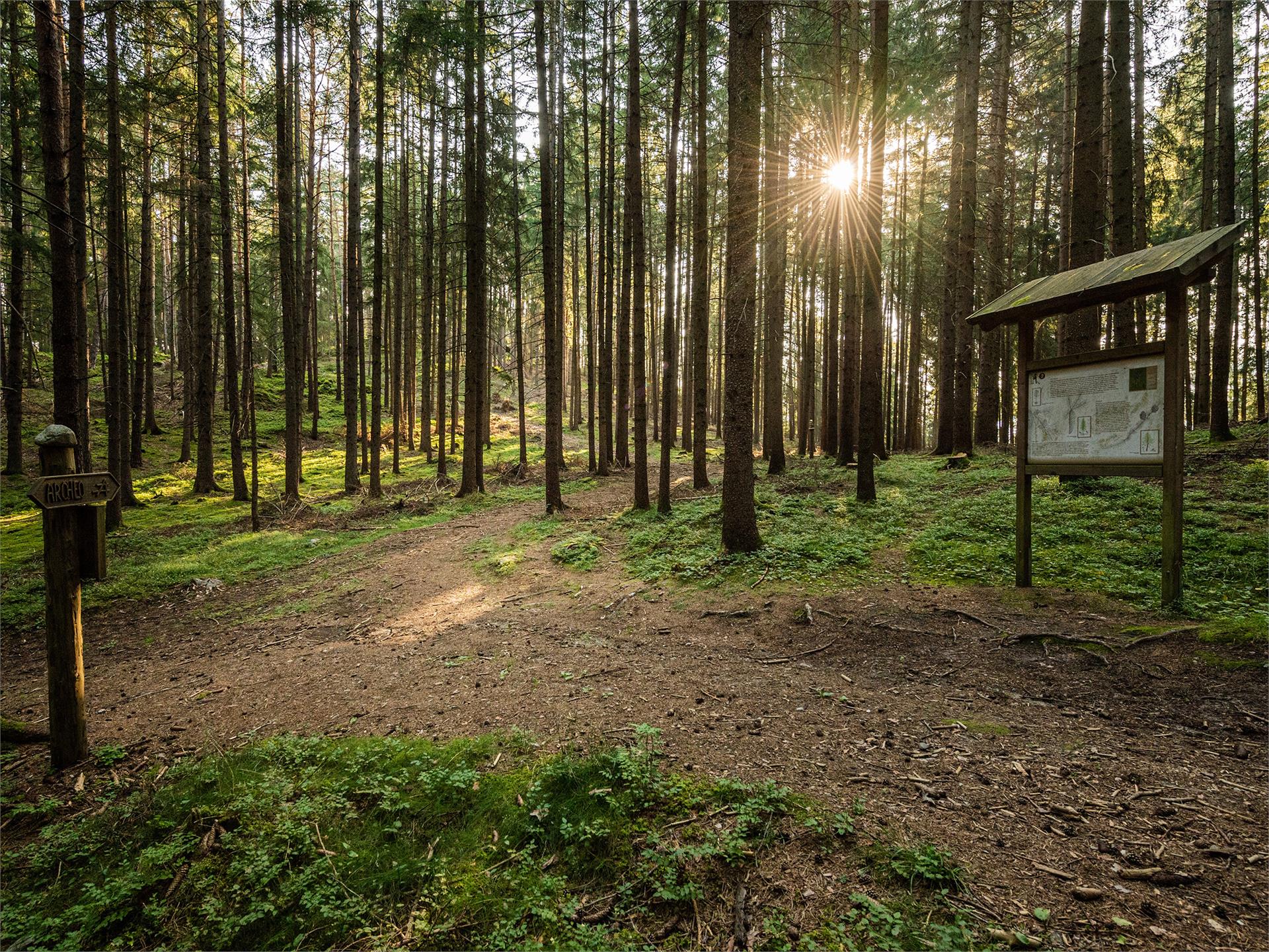
    In 15 interesting stations, many different games await the families. Together with the wood mouse Ferdinand, the parents and their kids search for animal tracks, listen to bird voices, lift up the horn of a deer, work themselves through a tunnel and climb up the pecker-hill.

    Difficulty: easy
    130 altitude up
    1h:30 min duration
    Hiking
    Caldaro Wine Trail (Weinweg Kaltern)
    Kaltern an der Weinstraße/Caldaro sulla Strada del Vino, The South Tyrolean Wine Road

    The Wine Trail is layed out in the form of an "8" and takes you from the village centre, down to the lake and back – past wine vineyards, farms and estates. Ground markings have been laid into the ground so that the hiker is aware of the various vineyard names as he passes by. You will see some of the age-old poetic vineyard names, which date back to either Rhaetian or Romantic origins: "Vial", "Prunar", "Puntara", "Palurisch" …

    Difficulty: medium
    0 altitude up
    4h:30 min duration
    Hiking
    Waterfalls of Barbiano/Barbian - Briol and Trechiese/Dreikirchen
    Barbian/Barbiano, Brixen/Bressanone and environs

    The trail to the Barbiano Waterfalls starts in the centre of the village of Barbiano/Barbian (refreshments available). The Waterfall Trail (Wasserfallweg) first goes to the lower falls and then to the upper falls. Then you follow trail no. 34 and 27 to the Briol inn (refreshments available). Continue to Tre Chiese (refreshments available) on trail no. 4. The route back to Barbiano takes you first along trail no. 6, which then branches off into trail no. 3. Follow the Dorfstraße road to where you started.

    It goes without saying that the highlight of this hike is the spectacular Barbiano waterfalls, which plunge in several cascades over a total drop of 200 m. But there are also other interesting things to see along the way, such as the leaning tower of the church in Barbiano.

    Anyone with an interest in architecture will love the Briol inn, which is an amazing example of Bauhaus style right in the heart of the Alps. The artist Hubert Lanzinger transformed a former refuge here into a complete work of art in which you can stay and dine.

    We must also mention Tre Chiese, a fascinating collection of buildings constructed on the site of an ancient sacred spring.

    Difficulty: medium
    746 altitude up
    3h:08 min duration
    Hiking
    Maiser Waalweg Trail
    St.Martin in Passeier/San Martino in Passiria, Meran/Merano and environs

    Waalwege are paths along the ancient irrigation channels. From the car park of the Hirzer cable car in Saltaus/Saltusio, head down to the Passerdammweg trail until reaching the Apfelhotel Torgglerhof hotel. From here, the canal trail leads into the centre of Scena/Schenna or after the Waalerhütte hut to Riffian/Rifiano and Meran/Merano.
    After a comfortable hike of approx. 1.5 hours, you reach the small city centre of Merano, where you can, for example, take the bus back to Saltusio.

    Difficulty: easy
    46 altitude up
    2h:30 min duration
    Hiking
    Farm Trail in Ulten Valley
    Ulten/Ultimo, Meran/Merano and environs

    The Ultner Höfeweg farms hiking trail  leads past ancient farmyards. Fantastic views of the surrounding mountains are available from here.

    Difficulty: easy
    0 altitude up
    5h:10 min duration
    Hiking
    Didactic path: Tru Vistles
    San Martin /San Martino, Dolomites Region Kronplatz/Plan de Corones

    Theme walk "Tru Vistles" - Culture, Tradition and Nature.
    This theme trail combines nature with culture and tradition with numerous games and information boards and is therefore particularly inviting for families. Start from the road opposite the Church gate and follow the "Tru Vistles" signs.

    Difficulty: easy
    64 altitude up
    0h:55 min duration
    Hiking
    Hike Along the Lasa Marble Trail – Schrägbahnsteig Trail
    Laas/Lasa, Vinschgau/Val Venosta

    The trail is located in the Stilfserjoch National Park and leads through a forest of spruce and larch.
    Five information boards provide information about the history of the inclined railway:

    the valley station and the construction of the incline railway from 1929
    technical data about the incline railway
    the St Martin church constructed in the 17th century, as well as marble transport in times before the construction of the incline railway when boulders were transported into the valley by means of brake slides,
    hemp-rope pulleys and flatbed wagons pulled by oxen 
    the mountain station with the machine house, the drive engine and the cylinder rope winch 
    a brief company profile of the marble works in Lasa and a list of the historical mining sites

    The hike can be done as a circular route, in combination with a visit to the “Gurgl” gorge in the lower Laaser Tal valley.
    This section of the hike is not recommended for those uncomfortable with heights. All others can go along the trail through the Laaser Tal valley.

    Difficulty: medium
    523 altitude up
    1h:49 min duration
    Hiking
    Hike to the Earth Pyramids on the Ritten
    Ritten/Renon, Bolzano/Bozen and environs

    The Renon/Ritten earth pyramids are a phenomenon caused by erosion, appearing where ice age moraine loam from glaciers collected in the valleys. When dry, the material is as hard as rock but, combined with water, it becomes a clay-like mush which flows into the valley. It remains protected from the rain under large stones so that columns of earth are built up becoming taller after each rainstorm.

    Route: the hike begins in Collalbo/Klobenstein, the main village on the Corno del Renon mountain. The trail leads through Collalbo to Longomoso/Lengmoos until to the hiking trail no 24 in the Erdpyramidental valley, which is so flat that it can be walked with any sort of shoe and with a buggy. View the earth pyramids against the backdrop of the imposing Dolomites from the viewing terraces. Return via the same route, through Longomoso to the beginning of trail no. 37, the von-Eyrl Promenade and the starting point at the railway station in Collalbo.

    Tip: the easy way to get from Bolzano/Bozen to Collalbo is on the Rittner Seilbahn cable car and Rittner Bahn narrow-gauge railway.

    Difficulty: easy
    0 altitude up
    1h:19 min duration
    Hiking
    Hike from the Gardena Pass to the Puez - Odle Nature Park
    Corvara, Dolomites Region Alta Badia

    The Puez-Odle Nature Park, a UNESCO World Heritage Site, is also known as "the witness to the geological history of the Dolomites". The natural park is particularly interesting from a geological and geomorphological point of view, with many typical rock formations and strata that are characteristic of the Dolomites.

    The hike in the south-eastern part of the Puez-Odle Nature Park presents no great technical difficulties for hikers.

    Difficulty: medium
    581 altitude up
    4h:32 min duration
    Hiking
    Hiking tour to the Earth pyramides
    Percha/Perca, Dolomites Region Kronplatz/Plan de Corones

    The walk to the earth pyramids of Plata is suitable for families and leads to a unique attraction in the Dolomites. 

    Difficulty: easy
    140 altitude up
    0h:34 min duration
    Hiking
    Oswald von Wolkenstein Path
    Kastelruth/Castelrotto, Dolomites Region Seiser Alm

    The Oswald von Wolkenstein trail is a loop trail that leads past the ruins of Salegg and Hauenstein, and features 15 stations where you can stop and play. There’s a lot to discover along this tour, including a knight’s table, a knight‘s sword and mystical animals.

    This hiking tour can be found in the family hiking booklet “Out and About with Nix the Witch”.

    Difficulty: easy
    280 altitude up
    2h:00 min duration
    Hiking
    Ruins Castle Altrasen
    Rasen-Antholz/Rasun Anterselva, Dolomites Region Kronplatz/Plan de Corones

    From Niederrasen (church) > from 500 m in direction > Oberstall (mark n. 20) > on the edge of the woods turn right > ruins of Altrasen.

    Difficulty: medium
    147 altitude up
    0h:30 min duration
    Hiking
    Excursion from San Cassiano to Badia through Santa Croce
    Badia, Dolomites Region Alta Badia

    This easy hike through flower-filled meadows, pastureland and woods between San Cassiano and Badia, passes along the feet of the Sas dla Crusc/Sasso di Santa Croce and presents wonderful views of the Marmolada, Sella massif, Puez and Sass de Pütia.

    The unspoiled scenery, unique flora of the Dolomites and glimpses of game such as chamois and roe deer make this hike an unforgettable experience.

    Difficulty: medium
    544 altitude up
    4h:30 min duration
    Hiking
    Walther v.d. Vogelweide Circular Hiking Tour
    Lajen/Laion

    This walk dedicated to the minstrel Walther von der Vogelweide runs between Laion, Novale and Albions. In the future there will be information board placed at specific points along the route, on the life and work of this minstrel, to pass on this information to those walking through this beatiful landscape. There are several places to stop for meal or a rest along the route.

    Difficulty: easy
    422 altitude up
    3h:00 min duration
    Hiking
    Hiking to the San Felice lake
    U.L.Frau i.W.-St. Felix/Senale-S.Felice, Meran/Merano and environs

    Enjoyble hiking tour through the forests and alpine pastures of Alta Val di Non, highly recommended over the late spring - early summer months because of the great variety of alpine flowers and in autumn due to its glowing larches. The hike starts at the parking area “Klammbrücke” just above the village of San Felice. From there the hiking trail no. 9 leads you directly to the San Felice lake (called also Felixer Weiher or Lago di Tret) in about 1 hour. The hike takes you through rough forests and mountain grassland whit panoramic views to the Val di Non and the Brenta Dolomites. The swimming lake (1604 m) has preserved itself as a natural biotope and has been rewarded for its excellent water quality. Not far from the lake there is the Felixer Alm - Malga di San Felice where you can rest end enjoy local dishes. The forest road from the Felixer Alm brings you back to the parking area. This hiking is also recommended for families with children.

    Difficulty: easy
    0 altitude up
    1h:10 min duration
    Hiking
    The Chestnut Trail from the Neustift monastery near Brixen to Terlan
    Natz-Schabs/Naz-Sciaves, Brixen/Bressanone and environs

    The Keschtnweg Chestnut Trail from the Neustift Monastery (560 m) to Terlan/Terlano (250 m) runs along the right bank of the Eisacktal Valley. It is in autumn, at the time of the Törggelen, that the trail is at its most eye-catching and many taverns and inns along the way offer traditional Törggelen dishes. The lush, diverse vegetation and simple, rural way of life also attracts visitors in spring and early summer.

    Difficulty: easy
    4050 altitude up
    28h:00 min duration
    Hiking
    Trail to the mills in Bulla
    Urtijëi/Ortisei, Dolomites Region Val Gardena

    The old mills of Bulla, a hamlet situated above Ortisei, were built in the 18th-19th century and were used to grind the locally grown cereals. The hike starts from the bus stop in Bulla and follows the steep street to the farmhouses Tuene and Kontot, follow the trail 3A until you get to a street. Take the street upward for 300 meters and then turn left downhill along the rill to the mills. The path continues in direction of the church and brings you again to the bus stop.

    Difficulty: medium
    0 altitude up
    2h:00 min duration
    Hiking
    From La Villa to Badia on the Tru dles viles/farmhouses trail
    Badia, Dolomites Region Alta Badia

    This walk starts and ends in La Villa and leads through panoramic trails, just a little above the valley bottom, crossing meadows and woods with a wonderful view out over the landscape of the Val Badia valley.

    Difficulty: easy
    282 altitude up
    2h:40 min duration
    Hiking
    Hike from San Cassiano to the Fanes Plateau
    La Val, Dolomites Region Kronplatz/Plan de Corones

    The Fanes-Sennes-Prags Nature Park has been included in the list of UNESCO World Heritage Sites on account of its distinctive natural features. The unique, legendary atmosphere of Fanes, the flora and fauna of the Dolomites and the stunning scenery all make this hike an unforgettable experience.
    From our area, Fanes is reachable from Sciaré/San Cassiano.

    Difficulty: medium
    563 altitude up
    5h:30 min duration
    Hiking
    Riffianer Waalweg Trail
    Riffian/Rifiano, Meran/Merano and environs

    Waalwege are paths along the ancient irrigation channels. Ascend to the canal trail via the Kirchweg or Rösslweg streets. After approx. 300 m the Rösslweg branches to the left from the Kirchweg and rises gently to the shooting range where the Riffianer Waalweg trail begins. It runs between forest edge and meadows as far as Kuens/Caines and ends in the Kuensertal valley. Return either via the Kuenserstraße street, the Valtmaunweg trail or via the Hohlgasse street. If you wish, you can drive to the starting point in the Kuensertal valley by car, park there and then hike as far as Rifiano/Riffian (approx. 45 min).

    The path is not suitable for pushchairs or strollers.

    Difficulty: easy
    157 altitude up
    1h:30 min duration
    Hiking
    On the tracks of A. Dürer: The Dürer path
    Neumarkt/Egna, The South Tyrolean Wine Road

    This walk has been named after the important German painter Albrecht Dürer (1471-1528). During his first trip to Venice, in 1494, due to a flood in the Adige Valley, he had to make a detour through Pochi di Salorno to the Val di Cembra. It is delightful to follow the historical trail through these enchanted woods. We can walk past the Pochi di Salorno mill, past the earth pyramids and the Segonzano Castle, which Dürer immortalized in his paintings.

    Stages of the Route
    1. Klösterle St. Florian - hamlet of Laag/Laghetti (3.2 km; difference in altitude -20 m; duration 1 hour)
    2. Laag/Laghetti - Buchhol/Pochi di Salorno (4.4 km; Height difference + approx. 400 m; Time: 1 hour 40 min)
    3. Buchholz/Pochi di Salorno - Sauch Hut (6.3 km; Altitude difference + approx. 450 m; Duration 2 hrs. 20 min)
    4. Sauch Hut - Lago Santo/Heilgen See (3 km; Height difference +305 m; Time duration 1 hr. 10 min) 
    Alte Dürer-Route: (4.6 km; Height difference +292; 1 hr 45 min)
    5. Lago Santo - Cembra (4 km; Height difference -539 m; Duration 1 hr 20 min)
    6. Cembra - Cantilaga (4 km; Height difference -180 m; Duration 1 hour and 20 min)
    7. Cantilaga - Segonzano Castle - Segonzano Pyramids (2-4 km; Height difference +100 m; Duration 50 min)

    Difficulty: difficult
    1992 altitude up
    9h:31 min duration
    Hiking
    Geotrail Passo Pinei - Bulla
    Urtijëi/Ortisei, Dolomites Region Val Gardena
    Along the geological trail between Passo Pinei and Bulla, you can find interesting information panels explaining the evolution of the world-renowned Dolomites. The path leads through geological highlights on the margin of the UNESCO World Heritage Site and offers fantastic panoramic views on the mountains of Val Gardena. The highlight of the trail is marked by panel No. 2; here the excursionist physically passes through the Permian-Triassic boundary, which marks one of the greatest changes in the development of life on earth. In fact, 250 million years ago, more than 90% of all species, plants and animals in water, land and air became extinct due to enormous volcanic eruptions.
    Difficulty: medium
    330 altitude up
    1h:30 min duration
    Hiking
    Archaeological Panoramic Trail
    St.Lorenzen/San Lorenzo di Sebato, Dolomites Region Kronplatz/Plan de Corones

    Archaeological thematic hike in St. Lorenzen/San Lorenzo, around the hill "Sonnenburger Kopf". 

    Difficulty: easy
    65 altitude up
    1h:45 min duration
    Hiking
    The Geologist's Trail
    Kastelruth/Castelrotto, Dolomites Region Seiser Alm

    The Geologists’ Trail takes you on a journey through the history of the Earth. Over millions of years waters of the Frötschbach stream have eroded the rock strata, revealing how the Dolomites came into being. With spectacular waterfalls en-route, this trail offers hikers and amateur geologists a beautiful hike and a fascinating insight into the Earth’s history.

    Difficulty: medium
    613 altitude up
    4h:10 min duration
    Hiking
    Milk trail
    Mühlbach/Rio di Pusteria, Brixen/Bressanone and environs

    From the end of the Valler Tal valley, take a left at the Kurzkofelhütte hut over the bridge and on mountain trail no. 17, the Milk Trail, uphill to Fane Alm Alpine farm. All the way along the trail are interesting information panels explaining all about the dairy industry in South Tyrol.

    Difficulty: medium
    359 altitude up
    1h:15 min duration
    Hiking
    LandArt trail
    Pfalzen/Falzes, Dolomites Region Kronplatz/Plan de Corones

    The walk through the LandArt path is a simple, family-friendly hike through the forests of Falzes/Pfalzen. LandArt is art in nature and with nature - nature is its space. With various materials and techniques the artists create their unique works using what nature offers and integrating artistic notes. This art is temporary, exposed to the weather conditions and changes along with nature.

    Difficulty: easy
    49 altitude up
    1h:00 min duration
    Hiking
    “Karlspromenade“ Circular Hiking Trail
    Brixen/Bressanone, Brixen/Bressanone and environs

    This hiking trail was created to commemorate the visit of Archduke Karl, the last Emperor of Austria (1887–1922).

    Difficulty: easy
    0 altitude up
    2h:15 min duration
    Hiking
    Pflersch/Fleres river boardwalk
    Brenner/Brennero, Sterzing/Vipiteno and environs

    The promenade walk starts by the football ground Gossensass/Colle Isarco and follows the river to the valley bottom. It ends in Außerpflersch/Fleres di Fuori. Suitable for strollers.

    Difficulty: easy
    36 altitude up
    1h:01 min duration
    Hiking
    Pfunders Farm trail
    Vintl/Vandoies, Brixen/Bressanone and environs

    The farm trail leads from the village of Fundres/Pfunders by the Parthof farm to the viewing platform overlooking the Pichlerhof farm, then on down through the woods and for a short distance along the Pfundererbach stream. From here the trail leads over a bridge, past the Obergasserhof farm and, after the Wieserhof farm, down to the road, over the bridge and through the fields and meadows back to the starting point. There are frequent information boards to stop and read.

    Difficulty: medium
    0 altitude up
    3h:30 min duration
    1 2 3 4 5 6 7 8 9 10 11 12 13 14 15 16 17