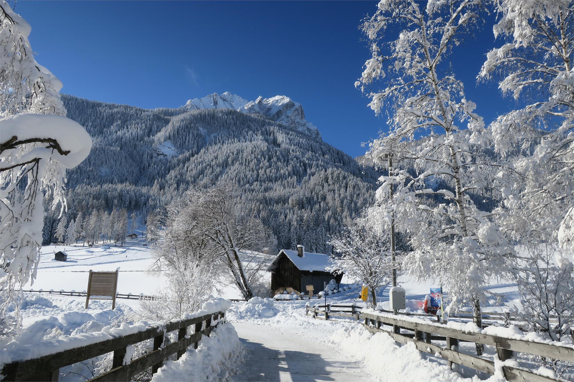
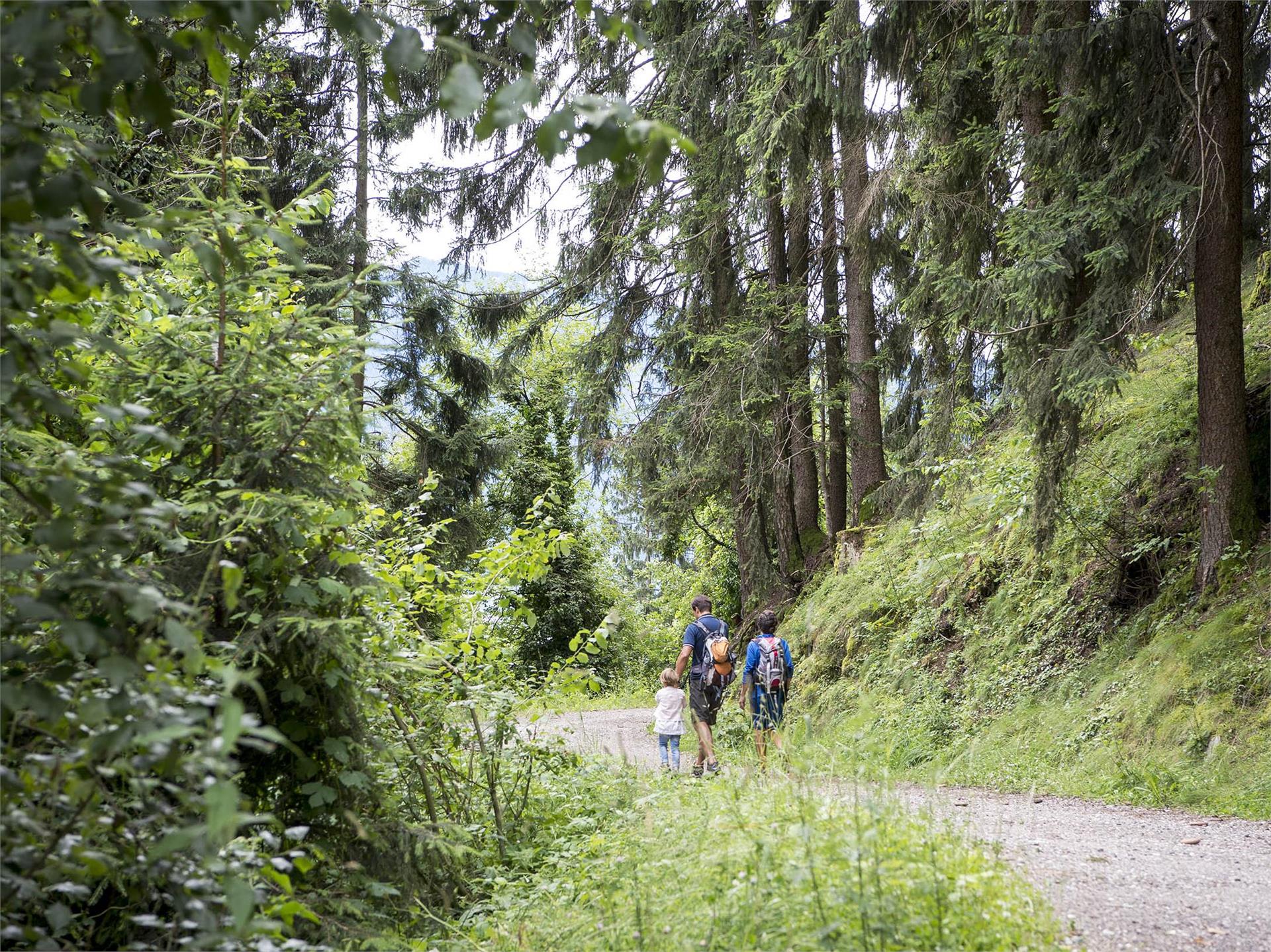
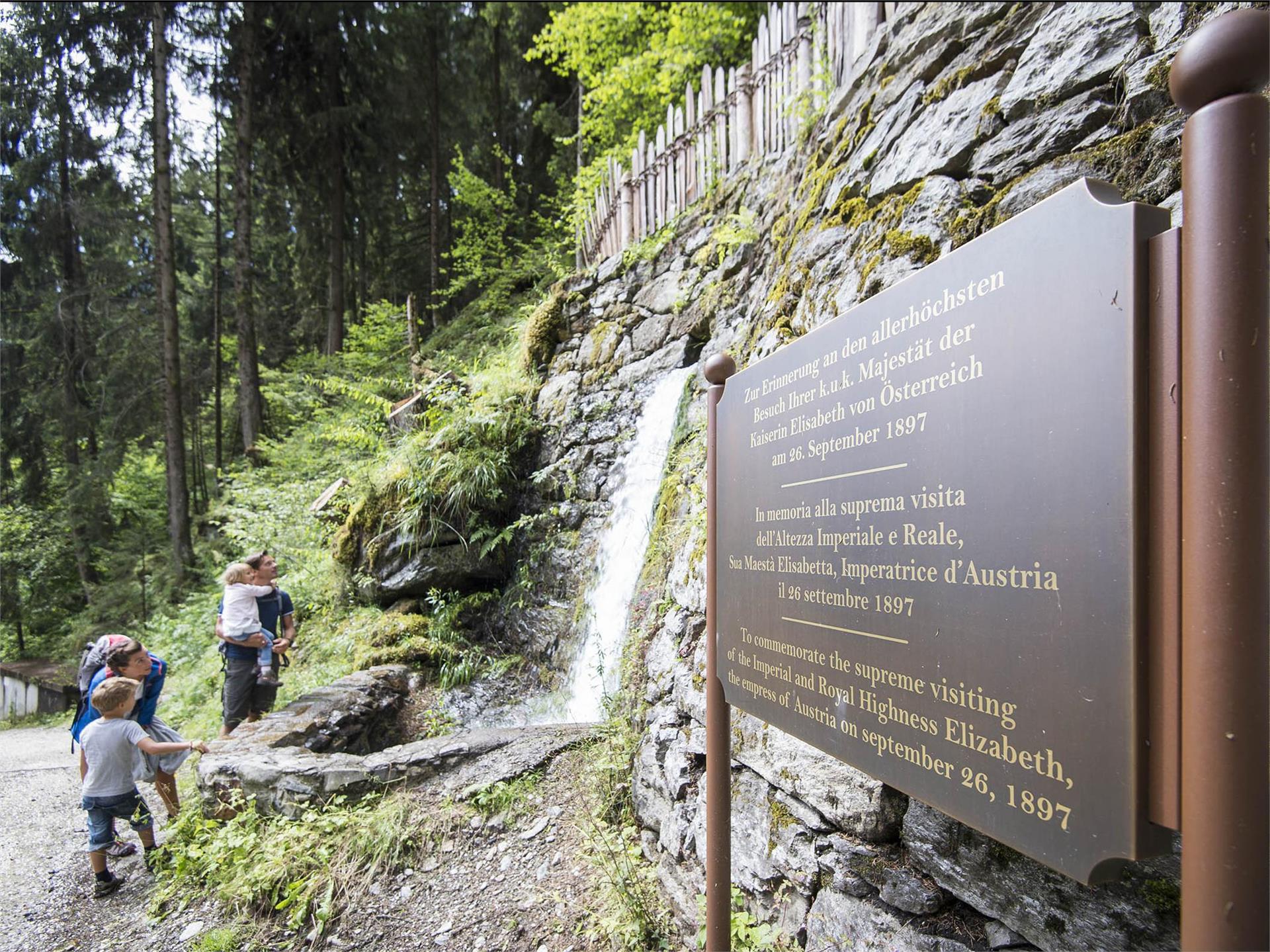
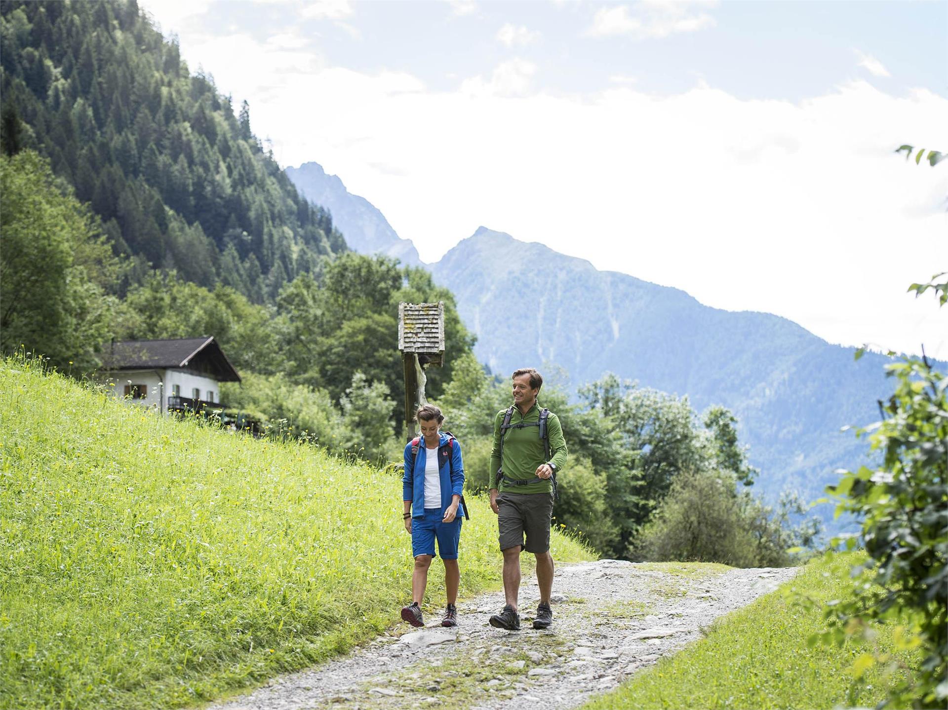
Skip to content
added to favourites
removed from favourites
Oops! Something went wrong. Try again
Your account is being created
Your account has been successfully created and you are now logged in
You are logged out.
Filter
Selected filters
    Level of difficulty
    Duration
    Distance in KM

    Family hikes in South Tyrol

    Waterfall, cave or petting zoo. Children need motivation to hike. These family hikes are packed with experiences for all family members.


    Results
    Hiking
    The Archeopfad Archaeological Trail in Brixen
    Brixen/Bressanone, Brixen/Bressanone and environs

    The Archeopfad Trail leads to the old Roman tower in Stufels/Stufles, the historical quarter in Brixen/Bressanone. From up there, a wonderful view opens out on the “Land an der Etsch” (the lands of the River Etsch), as this southern part of Tyrol was once known. The trail, retracing the old Roman paths, leads to historical monuments and ancient places of worship.

    This hike offers both novel as well as tried and tested attractions even for seasoned visitors to South Tyrol.

    Difficulty: easy
    286 altitude up
    1h:37 min duration
    Hiking
    Hike: Meditation and Fairytale Path
    Sexten/Sesto, Dolomites Region 3 Zinnen

    Legends and stories about the Sextner Tal valley and the Alta Pusteria/Hochpustertal valley have been told and passed on here for years. Now these many fairytales and stories have been used to create a Fable Trail (Fabelweg) in Sesto. Figures depicting characters from all kinds of legends have been set up along the route, giving visitors an insight into a different world.

    Difficulty: medium
    700 altitude up
    3h:00 min duration
    Hiking
    Hike on the Adventure Path
    Sand in Taufers/Campo Tures, Ahrntal/Valle Aurina

    Bringing people close to nature...this is the aim of the nature experience path in Sand in Taufers. The circular path is about 3 to 4 miles long and was partially financed by the village of Sand in Taufers and the Department for Natural Parks.Its logo is a squirrel, which accompanies the hiker from one station to the next. Many themes are touched upon: nature, fauna, flora, geology, mythology, legends, myths….. Interesting ideas such as a look-out platform make this round-trip trail even more attractive. The Adventure Path for a Healthy Community will be built or accordingly expanded as part of a theme trails’ project in the autumn of 2015.


    Difficulty: medium
    201 altitude up
    3h:00 min duration
    Hiking
    Compatsch - Panorama Saddle - Compatsch
    Kastelruth/Castelrotto, Dolomites Region Seiser Alm
    Relaxed family and circular hike to the Panoramajoch and back to the starting point.
    Despite fewer metres of altitude covered, you are offered a breathtaking view once you reach the Joch.
    Difficulty: medium
    223 altitude up
    2h:15 min duration
    Hiking
    Trail for the familiy Kastelaz (Termeno-Cortaccia)
    Tramin an der Weinstraße/Termeno sulla Strada del Vino, The South Tyrolean Wine Road

    Walking time: about 2.5 hours

    Starting point: Town Hall Square. Via Schneckenthaler Straße to St. Anna Nursing Home. Immediately after, turn left following the sign "Hiking Trail Kastelaz" up to the forest road. This leads first slightly uphill and then gently downhill through sparse mixed forest for 3 km to the neighboring village of Kurtatsch. In 2024, 5 new play stations for children were built. Right at the beginning of the hiking trail, children can now whizz down a rapid slide. A few steps ahead, a wooden snake invites balancing. Followed by a swing, a climbing igloo, and at the rest area "Bödala," a cable car. Right at the first houses of Kurtatsch, we reach via the less traveled panoramic road above the Wine Road via Rungg back to Tramin. (Opportunities to stop for food in Kurtatsch and at the Hofschank zur Pergola in Rungg, closed on Wednesdays).

    Difficulty: easy
    261 altitude up
    2h:30 min duration
    Hiking
    Theme path: mountain station Monte Elmo – Baita del Cacciatore hut – Gasthof Waldruhe - Sesto
    Sexten/Sesto, Dolomites Region 3 Zinnen

    Legends and stories about the Sextner Tal valley and the Alta Pusteria/Hochpustertal valley have been told and passed on here for years. Now these many fairytales and stories have been used to create a Fable Trail (Fabelweg) in Sesto. Figures depicting characters from all kinds of legends have been set up along the route, giving visitors an insight into a different world.

    Difficulty: medium
    740 altitude up
    2h:15 min duration
    Hiking
    Hiking path: Padola - Kreuzbergpass
    Sexten/Sesto, Dolomites Region 3 Zinnen
    Beautiful, less strenuous hike from Padola to the Kreuzberg Pass with wonderful views of the mountain landscape of the Sextnen Dolomites.
    Difficulty: medium
    979 altitude up
    4h:10 min duration
    Hiking
    Family path: Olperl alpine circuit for families
    Sexten/Sesto, Dolomites Region 3 Zinnen

    An entertaining alpine circuit for the entire family!                                                             

    Difficulty: easy
    242 altitude up
    1h:00 min duration
    Hiking
    Hiking path: Into the Innerfeldtal/ Val Campo di Dentro
    Sexten/Sesto, Dolomites Region 3 Zinnen

    Comfortable hike through the beautiful and scenic valley Innerfeldtal. A special feature is the view of the mighty rocky backdrop of the Dreischusterspitze/Punta dei Tre Scarperi.

    Difficulty: medium
    408 altitude up
    2h:15 min duration
    Hiking
    Vineyards Route near Bressanone/Brixen
    Brixen/Bressanone, Brixen/Bressanone and environs

    The starting point for the vineyard trail is in the center of Bressanone/Brixen (refreshments available) at the Adlerbrücke. Follow trail no. 1 through the Stufels district, first via Kranebitt (refreshments available) up to Elvas (refreshments available). Here continue through the Mooswald forest to the Raiermoos biotope and on trail no. 6 via Hochrain to the Strasserhof farm (refreshments available in autumn). Continue on trail no. 4 between vineyards and the typical dry stone walls down to the well-known Neustift monastery (refreshments available). From here head south on trail no. 16 back to Bressanone/Brixen. There is no shortage of places to stop along the way, especially in the fall it is charming to visit one of the rustic Buschenschänke.

    The vineyard path is easy to walk and also brisk, much worth seeing transforms this hike, but without further ado into a day trip. Already at the starting point, the narrow medieval streets of Stufels are fascinating. Once you have conquered the first meters of altitude, you can enjoy a magnificent view over the Bressanone basin from the Wetterkreuz near Elvas. Nature lovers will be delighted by the diversity of the Raiermoos biotope, as well as the centuries-old vineyards on the slopes above Neustift. Wines from these same vineyards can also be tasted directly at the Neustift monastery before heading back towards Brixen.

    Difficulty: easy
    0 altitude up
    3h:30 min duration
    Hiking
    Theme path: Contemplation Trail and Fable & Fairytale Trail
    Sexten/Sesto, Dolomites Region 3 Zinnen

    Legends and stories about the Sextner Tal valley and the Alta Pusteria/Hochpustertal valley have been told and passed on here for years. Now these many fairytales and stories have been used to create a Fable Trail (Fabelweg) in Sesto. Figures depicting characters from all kinds of legends have been set up along the route, giving visitors an insight into a different world.

    Difficulty: medium
    525 altitude up
    1h:19 min duration
    Hiking
    Theme path: The Milk Mile at Sexten/Sesto
    Sexten/Sesto, Dolomites Region 3 Zinnen

    How is tasty mountain cheese made?

    The ‘Milk Mile’ at Sesto/Sexten provide answers to questions like this. The local Alpine dairy farming world is explained along an interactive woodland trail. Interested visitors can try their hand at milking using a wooden cow and read how the various cheese types are made.

    Difficulty: easy
    30 altitude up
    1h:00 min duration
    Hiking
    Hiking path: Moos - Kreuzbergpass
    Sexten/Sesto, Dolomites Region 3 Zinnen
    Beautiful, less strenuous hike from Moos to the Kreuzberg Pass with wonderful views of the Sexten Dolomites.
    Difficulty: easy
    296 altitude up
    2h:00 min duration
    Hiking
    Hiking path: From the meadows of the Croda Rossa to the Passo Monte Croce
    Sexten/Sesto, Dolomites Region 3 Zinnen

    An extremely scenic, six-kilometre high-altitude trail that follows old war trails and can also be recommended to less experienced mountain hikers, especially as the ascent can be done by lift and the way back by bus. The good trail leads from the Rotwand meadows, partly at the tree line, partly above it at the foot of vertical rockfalls, almost flat to the Kreuzberg Pass. From the path there are beautiful views of the Carnic ridge and the ice peaks of the Rieserferner group to the north. 

    Difficulty: medium
    270 altitude up
    1h:30 min duration
    Hiking
    Hike on the Power of Water Trail
    Sand in Taufers/Campo Tures, Ahrntal/Valle Aurina

    The Power of Water is the theme of four trails in Valle di Selva dei Molini that await hikers with a thirst for knowledge about nature. Each one has its very own unique charm.

    Difficulty: medium
    893 altitude up
    6h:00 min duration
    Hiking
    To the Melager Alm alpine pasture
    Graun im Vinschgau/Curon Venosta, Vinschgau/Val Venosta
    The route from Melag/Melago to the Melager Alm alpine pasture in Langtaufers valley is a beautiful family hike, which is also suitable for buggies. The hike starts from the car park in the hamlet Melag, the highest hamlet in Langtaufers valley at 1,915m, which is inhabited all year round. From the car park walk to the right between the houses. Signpost numbers 2 and 5 indicate the path, but it is impossible to miss even without the directions. In a very gentle ascent walk towards to the bridge over the Karlinbach river. Cross the bridge and continue on the flat path towards the alpine pasture. At the end of the valley, the snow-covered peaks around the Weißkugel rise up; to the north and south, a whole series of three thousand metre peaks flank the valley. The way back follows the same route as the one going there.
    Note: As an alternative you can start this hike from the hamlet of Kappl at the out of service Maseben ski-lift station and follow the forest road to the Melager Alm alpine pasture.
    Difficulty: easy
    135 altitude up
    1h:30 min duration
    Hiking
    Hiking path: Sesto - "Alte Säge"
    Sexten/Sesto, Dolomites Region 3 Zinnen

    Pleasant walk from Sesto, along the river (on the cycle path) to the Restaurant "Alte Säge"

    Difficulty: easy
    40 altitude up
    0h:34 min duration
    Hiking
    Circular Hike: Kalterer See Lake
    Kaltern an der Weinstraße/Caldaro sulla Strada del Vino, The South Tyrolean Wine Road

    Route: from the car park at Kalterer See lake, continue north to the Geier restaurant. Behind the restaurant, a narrow trail leads to the north into the orchards. Walk along these and turn off to the right in an easterly direction following the markers. At the slope on the eastern side of the valley, turn right, passing by the hotel on the left to the Klughammer road. First follow this road, then continue on a trail above the road.

    This trail ends at the southern end of the lake. Cross the road to join the Nature Discovery Trail (Naturerlebnisweg). At the end of this nature trail, turn right onto the so-called Kuchlweg trail, hiking to the vineyards on the western side of the valley. Just before the wine road, turn right into the trail through the field, following it until you reach the point where the wine road curves to the right. Cross over and now follow a trail through the field once more. Then follow the footpath next to the wine road to the church of San Giuseppe al Lago/St. Josef am See (Kirche St. Josef). Take the farm track to the right back to the starting point of the hike.

    Difficulty: easy
    0 altitude up
    2h:00 min duration
    Hiking
    “Castle triangle” walk Appiano/Eppan
    Eppan an der Weinstaße/Appiano sulla Strada del Vino, The South Tyrolean Wine Road

    At the bottom of the Gantkofel the Eppaner Castle triangle is located. On the art-historic walking tour you get an impression of the mediaeval South Tyrol. The walking tour to the castles takes you to the Castle Triangle. First you reach the Castle Hocheppan, which is one of the most important fortifications of SouthTyrol. After a visit as well as refreshment at the Castle tavern the hike continues to the ruin Boymont. A little bit underneath Castle Korb is located, which derived from the Roman époque and is now a hotel.

    Difficulty: medium
    373 altitude up
    1h:45 min duration
    Hiking
    Hiking to the Lercher Alp Hut
    Rasen-Antholz/Rasun Anterselva, Dolomites Region Kronplatz/Plan de Corones

    An easy hiking of 2,5 km, in the Wielental/Valle di Vila, which presents no difficulties and is therefore well suited for families and children.

    Difficulty: easy
    243 altitude up
    1h:00 min duration
    Hiking
    Hiking in the winter on the panorama way
    Ritten/Renon, Bolzano/Bozen and environs

    From the vally station cablecar Corno del Renon, the parking area in “Pemmern” (1.541 m) we take the cable car to the Schwarzseespitze (2.070 m). There we follow the indication “Panoramaweg” beginning on the right. The famous “Round Table” an the "Dolomitoskop" are created by the artist “Franz Messner”. You will enjoy the fantastic panorama to the Dolomites (UNESCO–world natural heritage).

    Difficulty: easy
    112 altitude up
    1h:43 min duration
    Hiking
    adventure trail Talai
    Graun im Vinschgau/Curon Venosta, Vinschgau/Val Venosta

    In the about 3 kilometers long loop road, twelve stations invite young and old to play and discover. Zipf and Zapf go along with the little natural scientists on their walk and narrate them interesting facts about the forest and its inhabitanst. At the same time the children have to crack several riddles to find the mysterious treasure at the end of the road. The trail is positioned amid of the talai forest in San Valentino. Don't forget to take paper and pencil to note the answers. Preprints also available at the Tourist Information.

    Difficulty: easy
    0 altitude up
    2h:30 min duration
    Hiking
    Rodenecker-Lüsner Alm
    Rodeneck/Rodengo, Brixen/Bressanone and environs

    The beautiful panorama is normally the reward once you've climbed up to the highest point of a tour. But not on this hike to the Astjoch ridge: here there is a viewing platform right where you start at the Zumis car park. But don't let this hold you back from the hike itself, as a wealth of wonderful routes await you, crossing wide open meadows and pastures before finally reaching the Astjoch ridge itself. High above the Lüsner valley, it boasts exceptionally wide views of the Alps, over the Pustertal valley and the Dolomites. To help you get your bearings, the names of the countless mountain ranges and peaks that you can see have been engraved into a stone slab in the ground. A large part of the hike passes through nature conservation areas, where farmed mountain pastures alternate with upland moors and little marshy valley cuttings. The route also promises a number of curiosities to enjoy on the way, such as the little Alpine chapel Pianer Kreuz.

    Difficulty: easy
    0 altitude up
    5h:00 min duration

      The journey is the destination for children. From strolls through a strech of apple blossoms in Bolzano/Bozen, Meran/Merano and Brixen/Bressanne surroundings to an unforgettable overnight stay at a mountain refuge in the Dolomites region like in Kronplatz : the many destinations and tours in South Tyrol will delight adults and children alike.