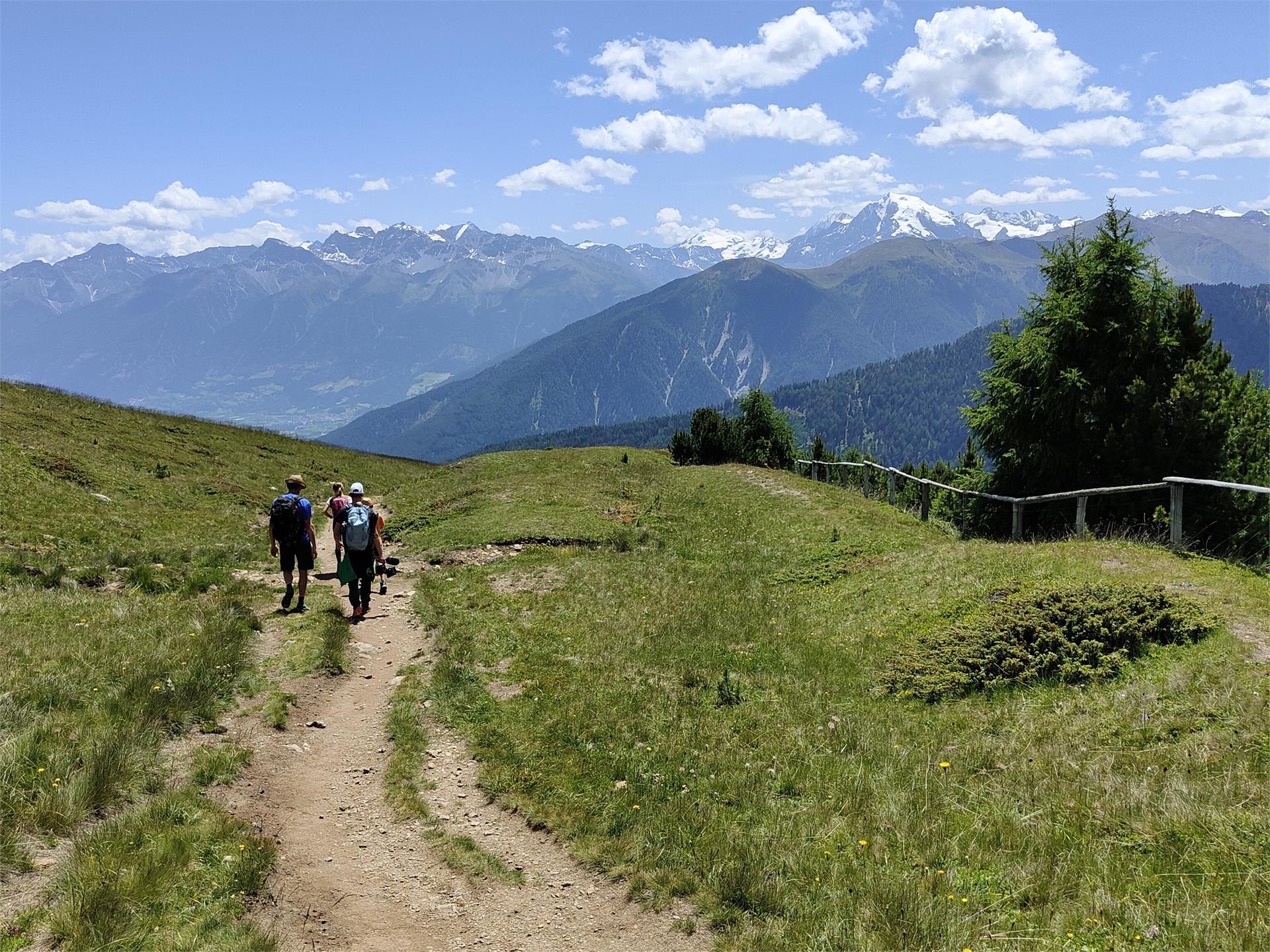
Skip to content
added to favourites
removed from favourites
Oops! Something went wrong. Try again
Your account is being created
Your account has been successfully created and you are now logged in
You are logged out.
Filter
Selected filters
    Level of difficulty
    Duration
    Distance in KM

    Family hikes in South Tyrol

    Waterfall, cave or petting zoo. Children need motivation to hike. These family hikes are packed with experiences for all family members.


    Results
    Hiking
    Circular hike Maistatt
    Niederdorf/Villabassa, Dolomites Region 3 Zinnen
    Start and finish: Elementary School
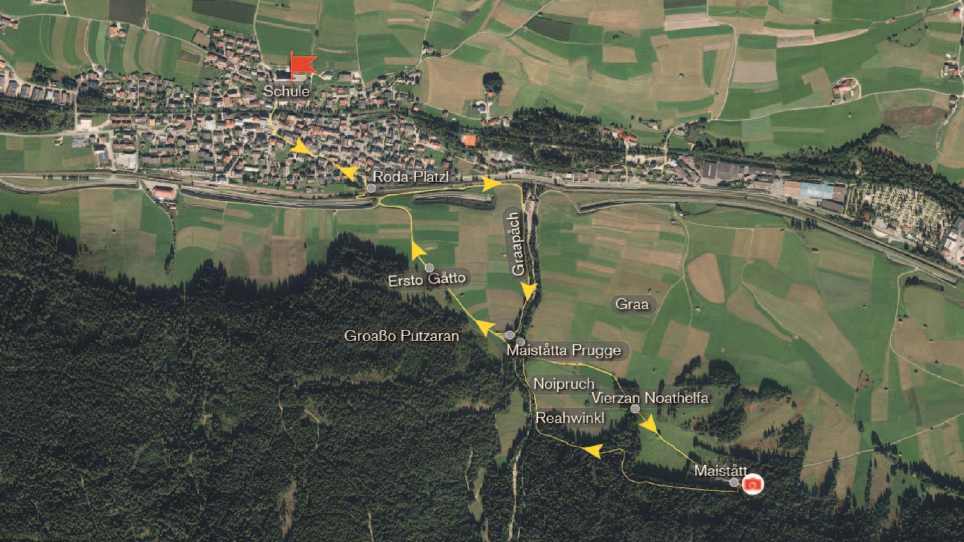
    Route: Starting from the school, we cross the square bridge and arrive at Von Kurz Square. In front of the City Hall, we take Jakob-Traunsteiner Street to the east, walking along it and also a short section of Johann-Jaeger Street to the "Roda-Platzl," the little "Roda" square.
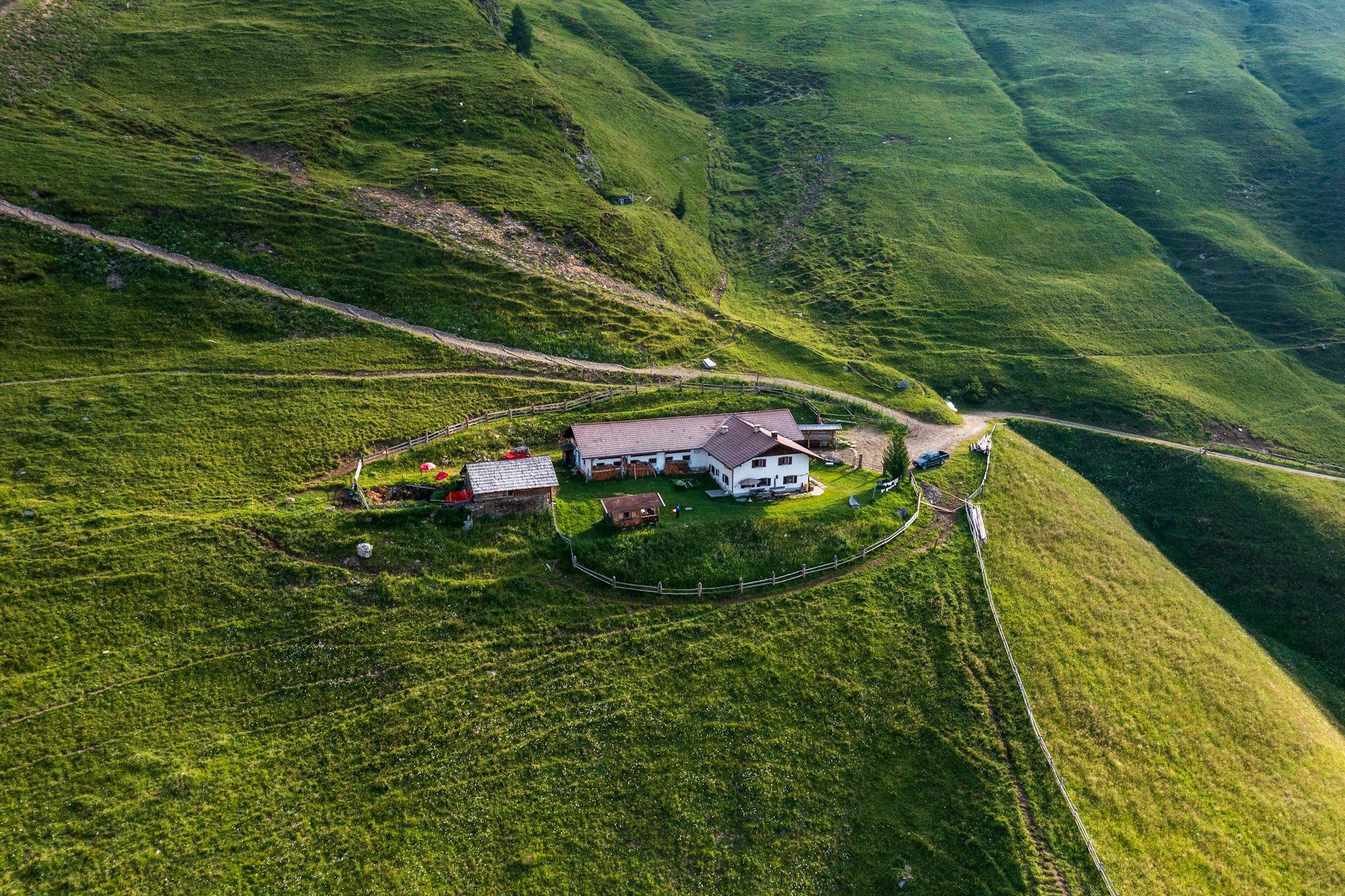
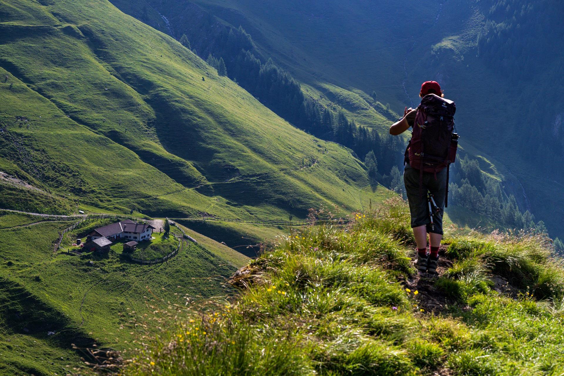
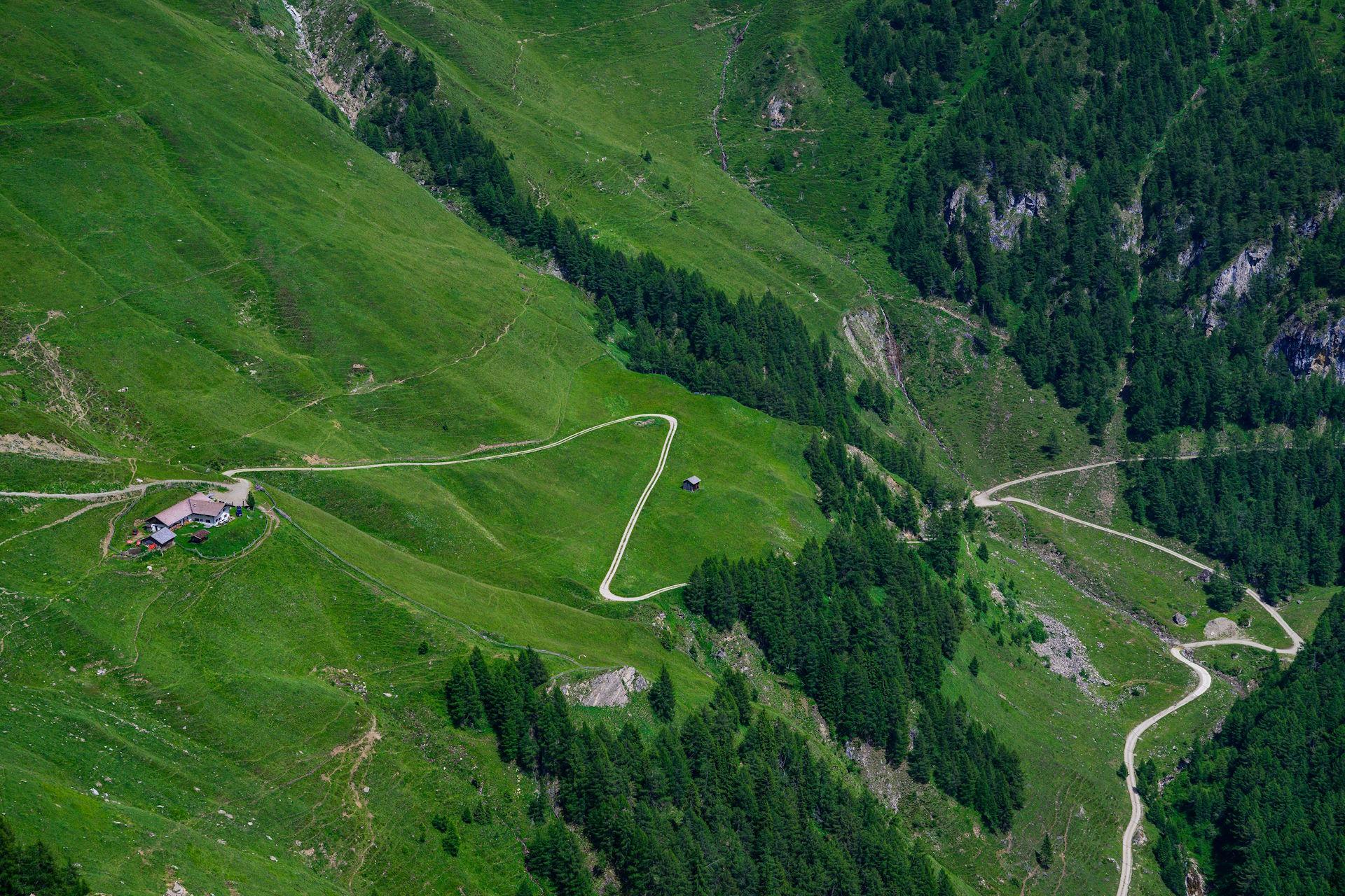
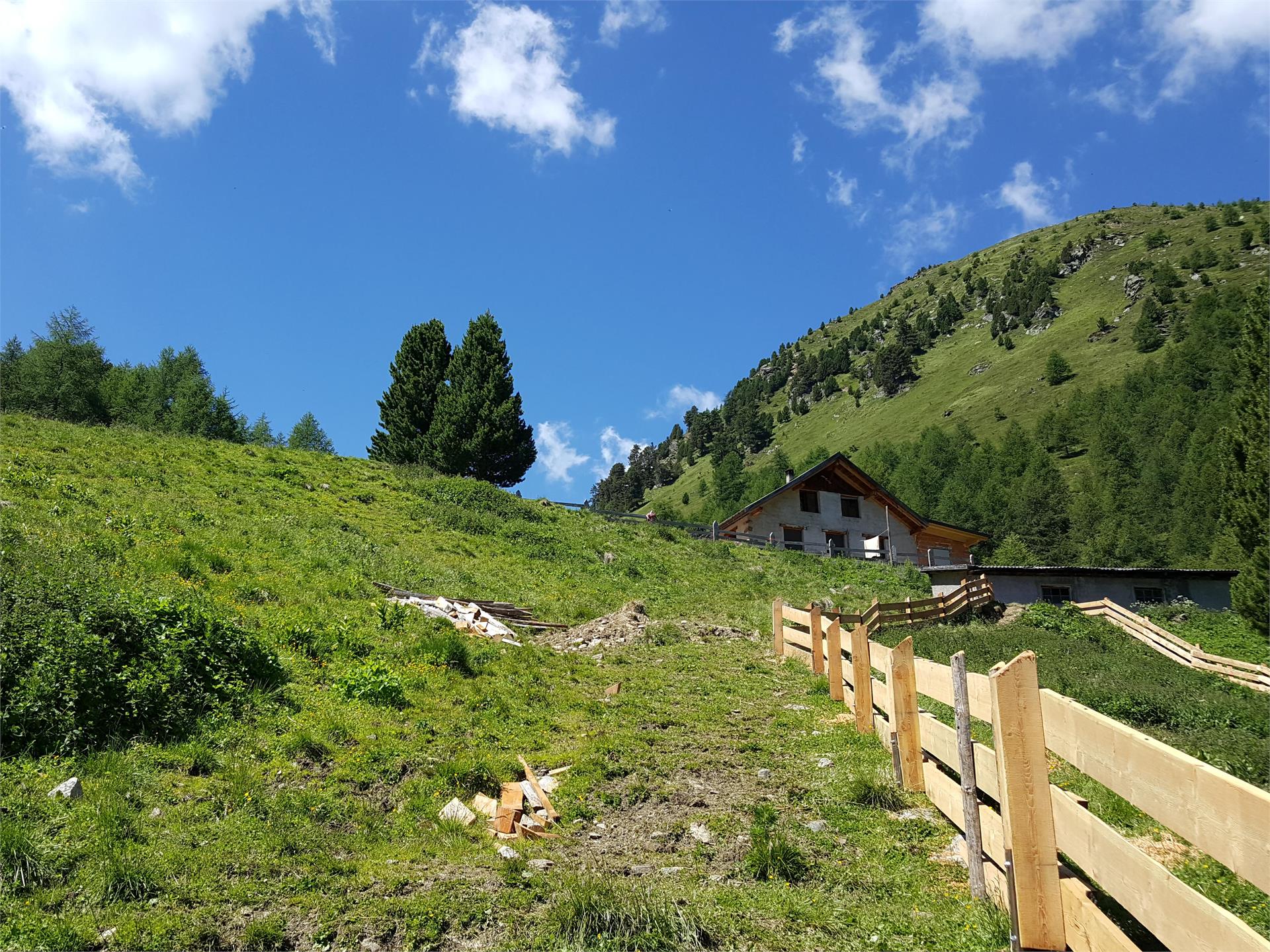
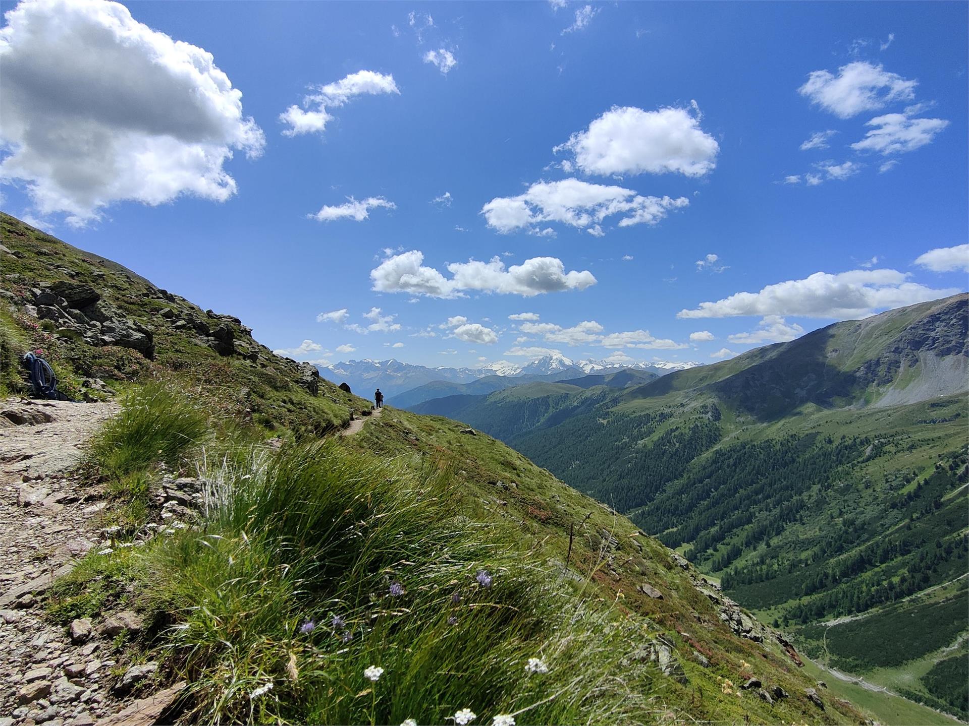
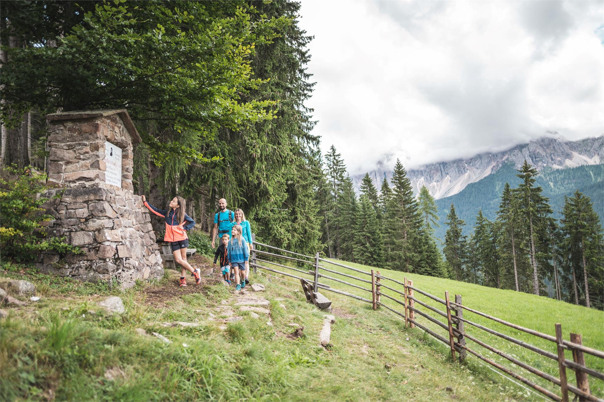
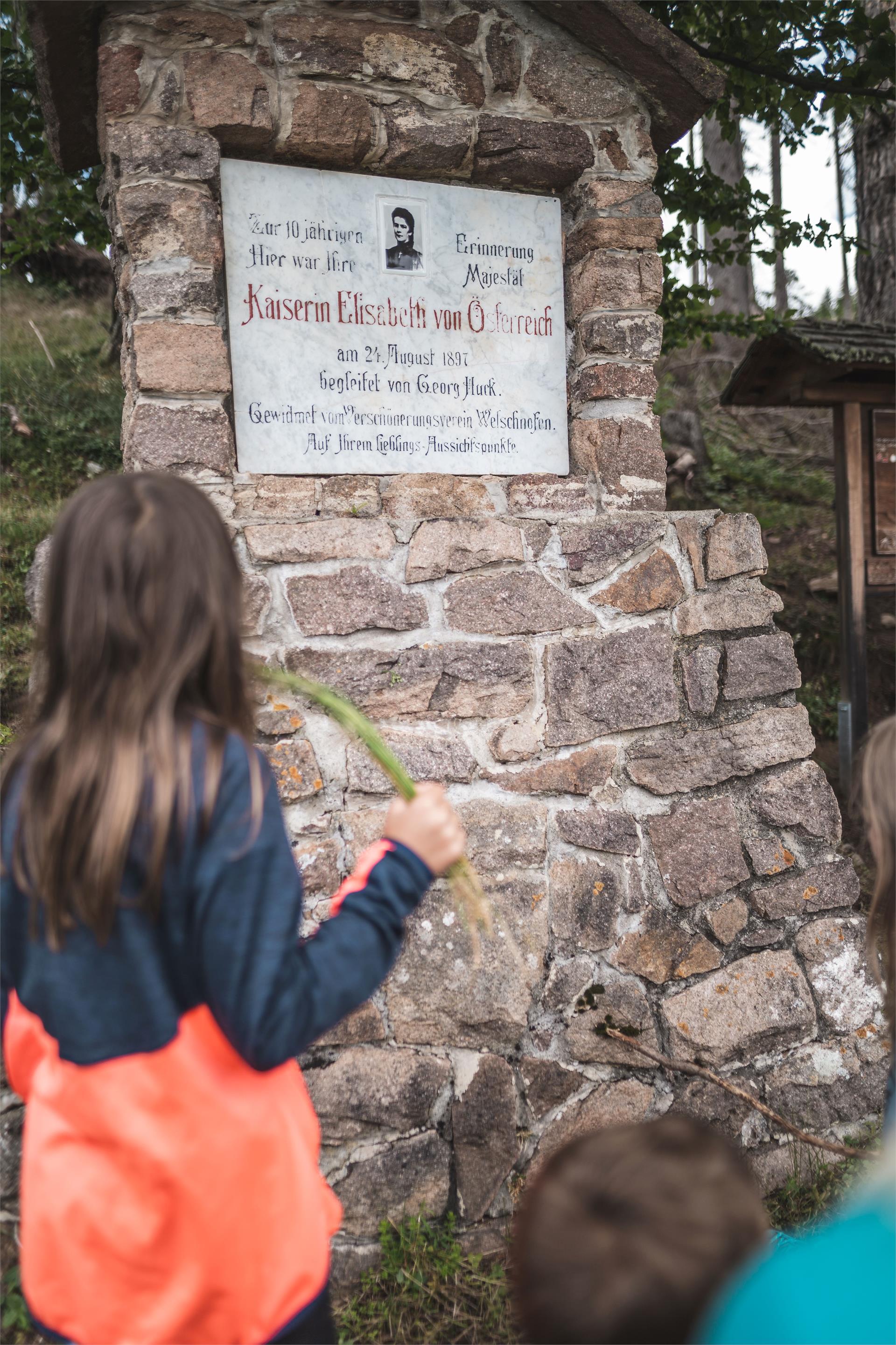
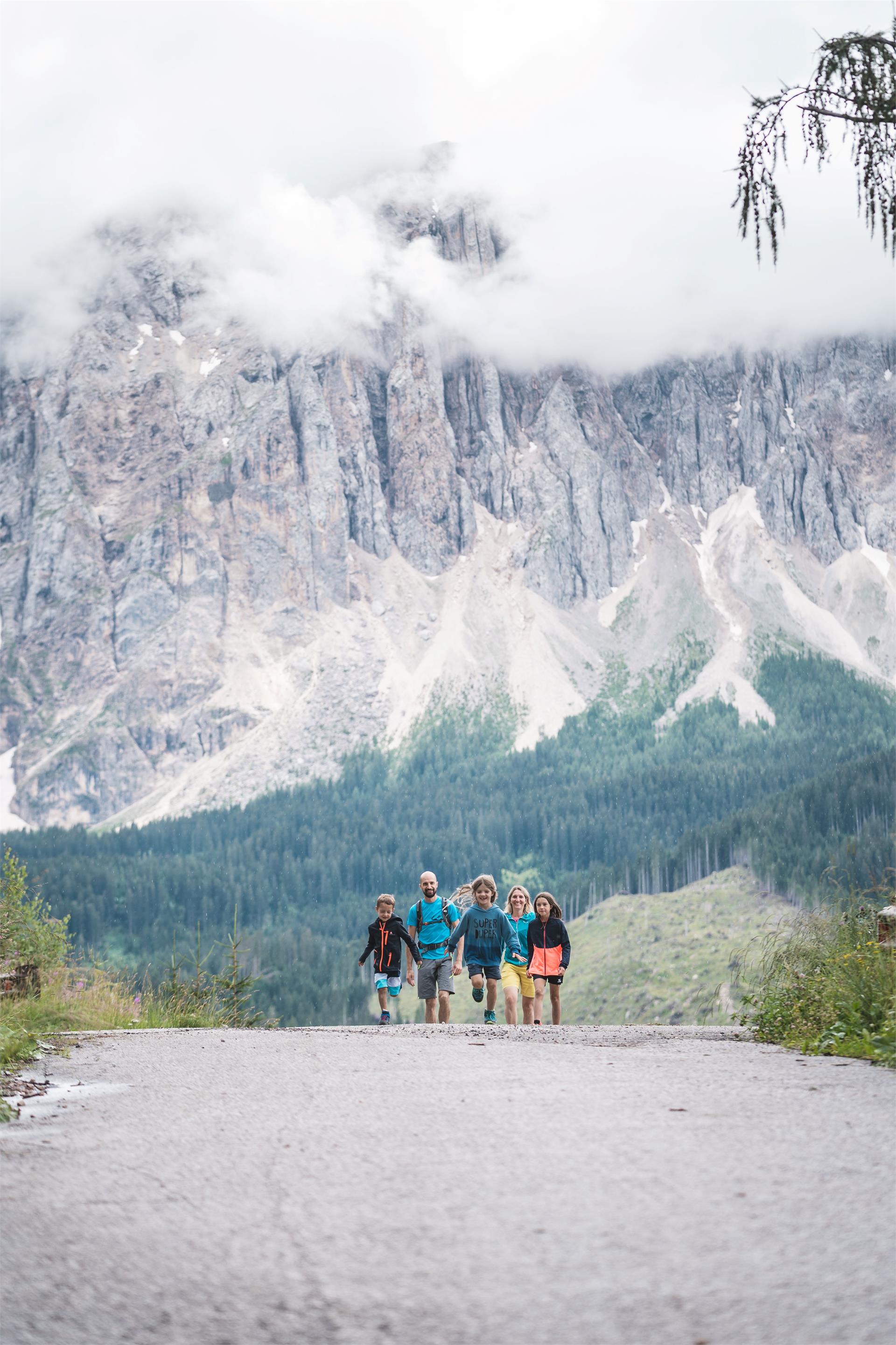
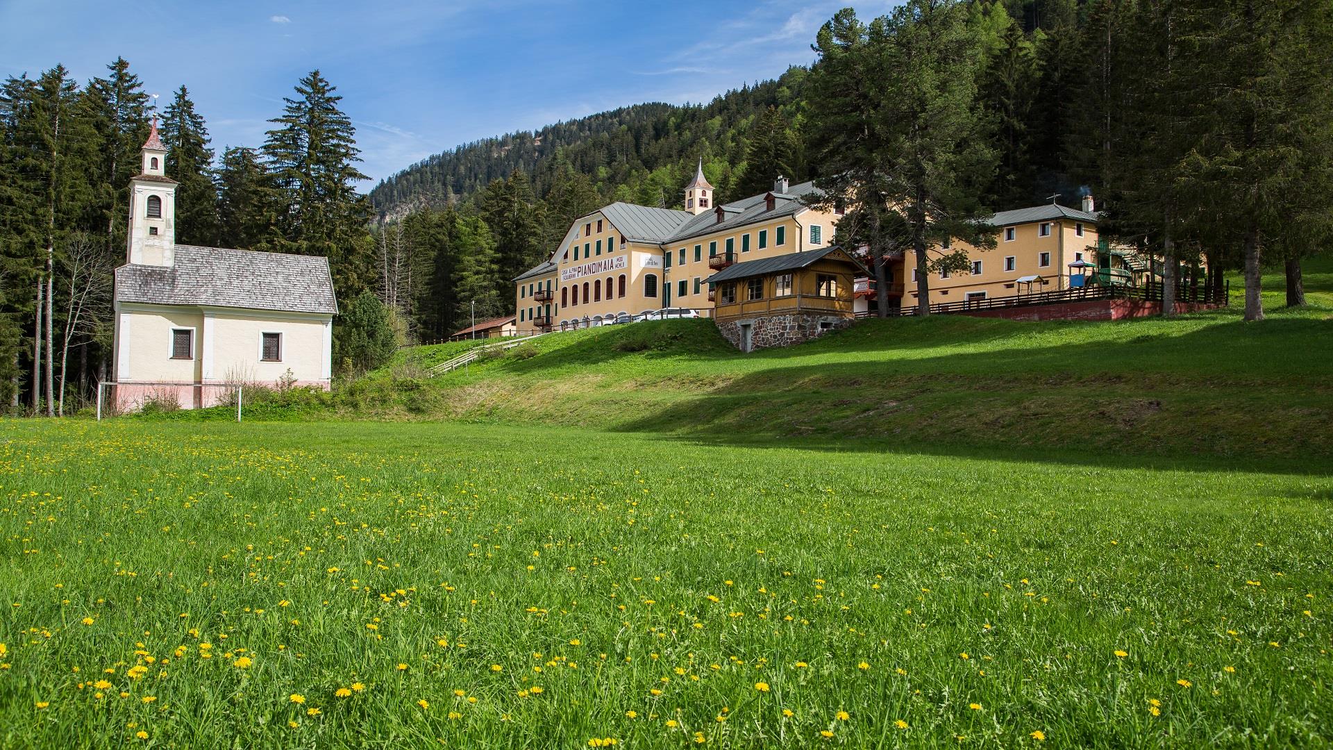
    We pass the railroad underpass to the first knoll of the road "Maistatt" (Maia Plain). We turn left, descend on the road skirting the railway eastward, cross the railway underpass to the "Graapach". Just before the bridge we go up on the right, still heading south to the road "Maistatt" and the bridge "Maiståtta Prugge"-on the left along the road the Holy Nepomuk pillar. Continuing along the road to Pian di Maia - to the right the "Noipruch" fields, to the left the "Graa" fields - eastward at first on a level path, then slightly uphill to the votive capital of the "Vierzan Noathelfa" and onward to "Maistått"- Pian di Maia. Beautiful historic building, and below the chapel of St. Nepomuk-behind the house the spring of the hot spring. Starting from it, westward the narrow forest path along the spring, past the manger and finally left on the forest path to the forest road at the "Reahwinkl". Beautiful view of the "Ratsberg" (Mount Rota) and St. Mary's, a place of pilgrimage. From the "Reahwinkl" we descend to the "Maiståtta-Prugge" bridge. From there on the left we follow the road "Maistatt" in the direction of the village - on the left the forest "Groaße Putzaran" to the "Ersto Gåtto/Kiagåtto" (Cat = fence).
    We continue on the road past the railroad underpass to the "Roda-Platzl" and from there later back to the school.
    Difficulty: easy
    133 altitude up
    1h:21 min duration
    Hiking
    Family hike Watles
    Mals/Malles, Vinschgau/Val Venosta

    A leisurely hike on the Watles adventure mountain. Perfect for families, this tour leads from the Plantapatsch mountain hut through the picturesque forests of Watles.

    Difficulty: easy
    132 altitude up
    1h:19 min duration
    Hiking
    Winter hiking trail to the Prantneralm
    Pfitsch/Val di Vizze, Sterzing/Vipiteno and environs

    Easy winter hiking trail for the whole Family in Wiesen newar Sterzing / Vipiteno with a wonderful panoramic view.

    Difficulty: easy
    481 altitude up
    1h:25 min duration
    Hiking
    Family hike Panorama way Valdaora/Olang - Brunico/Bruneck
    Bruneck/Brunico, Dolomites Region Kronplatz/Plan de Corones

    Directions: From the parish church in Valdaora di Sotto/Niederolang it goes (Nr. 15.) towards the Riedlerhöfe to the Ried forest. The path leads up to the Lamprechtsburg and further (Nr. 14) to Brunico. The return to Valdaora can be done by public transport.

    Starting point: Valdaora/Olang
    End point: Brunico/Bruneck
    Mark: 15, 14
    Total length: 8,5 km
    Total walking time: about 2 hours
    Difference in altitude: 200 m
    Difficulty: Easy

    Difficulty: easy
    226 altitude up
    2h:08 min duration
    Hiking
    Excursion to the Simile Mahd Alm
    Freienfeld/Campo di Trens, Sterzing/Vipiteno and environs

    By car, it is best reached over Valgenäun to Niederflans (1.289m) and then forward on unpaved and not locked road to the Flaner Säge at the Senges valley; there you find a little natural park area (1.390m). From there continue on a forest path (no. 2A and 2) to the end of the valley and after a left bend upwards to the mountain pasture Simile-Mahd-Alm. Alternative: also reachable over the Pfunderer Höhenweg.
    Tip: grey cheese and alpine butter

    Difficulty: easy
    651 altitude up
    2h:49 min duration
    Hiking
    From Schwemmalm at Weißbrunn
    Ulten/Ultimo, Meran/Merano and environs

    Long mountain hike with wonderful panoramic views and several places to stop, but which requires good physical condition.

    Difficulty: medium
    0 altitude up
    5h:00 min duration
    Hiking
    Seppele Tour
    Mals/Malles, Vinschgau/Val Venosta

    The Seppelesteig tour is a leisurely circular hike where you can enjoy the idyllic scenery of Slingia and the green forests of Watles.

    Difficulty: medium
    320 altitude up
    2h:49 min duration
    Hiking
    Hiking path: Sexten/Sesto - Innichen/San Candido
    Innichen/San Candido, Dolomites Region 3 Zinnen

    It is a forest path of cosiness, no altitude difference and no special impulses. You will always have the village of Sesto on your left and pass the famous Sexten cemetery. From the reservoir through the forest to San Candido.

    Difficulty: easy
    150 altitude up
    2h:10 min duration
    Hiking
    Nature Trail Zans
    Villnöss/Funes, Dolomites Region Villnösstal

    The Nature Trail Zans is accessible for wheelchairs. Fourteen sections give an insight in the flora and fauna of the Nature Park Puez-Geisler.

    Hiking time: 1h 

    Difficulty: easy
    90 altitude up
    0h:51 min duration
    Hiking
    ...
    Ulten/Ultimo, Meran/Merano and environs

    This mountain hike leads from the mountain station to the Kuppelwieser Alm and from there descending to the mountain restaurant Steinrast. Here the counter ascent begins over the Kühberg Alm to the Riemer Bergl Alm

    Difficulty: medium
    610 altitude up
    5h:31 min duration
    Hiking
    Kaiserwarte
    Bruneck/Brunico, Dolomites Region Kronplatz/Plan de Corones

    Easy walk from Bruneck/Brunico to "Kaiserwarte" and Reischach/Riscone.

    Around 1903, on the highest point of "Kühbergl/Monte Spalliera", a 18 meters high observation tower was built, which allowed the Emperor Franz Joseph I to observe the artillery movements in Brunico and surroundings. This tower and the hill were named "Kaiserwarte". Later the tower became a popular scenic spot, but over the years it suffered natural damages and in 1950 it had to be removed for safety reasons. Currently a small stone column can be seen where once the tower stood.

    Difficulty: easy
    166 altitude up
    0h:43 min duration
    Hiking
    Excursions with buggy: The meditation path
    Sexten/Sesto, Dolomites Region 3 Zinnen

    Along the way, 14 stations with various texts from the Bible and matching relief carvings invite you to pause for a moment. Both the Lordesstöckl on the way to the forest chapel and the clear fountain at the 9th station of the contemplation trail are always popular with visitors and locals alike.
    The history of the forest chapel is interesting: the church, which is almost entirely made of wood, was built around 1917, as the parish church in Sesto was badly damaged during the First World War. For 14 days, the farmers and the priest at the time worked on the church from early in the morning until nightfall. The wood for this came from a hay barn that had been crushed by the snow. In 1917 and 1918, every church service was celebrated there and, especially during the fascist era, the forest chapel served as a hiding place to hold masses in German. Today, the chapel is also known as the Peace Chapel and was restored in 1974. In 1988, at the suggestion of the then parish priest Markus Küer and in collaboration with the Sesto woodcarver Georg Lanzinger, a path of reflection was laid out to the chapel. Near the chapel there are cup stones, which are among the oldest traces of settlement in Sesto and are also the last of the biblical stations along the path of reflection.

    Difficulty: easy
    213 altitude up
    1h:01 min duration
    Hiking
    Hiking path: Sexten - Kreuzbergpass
    Sexten/Sesto, Dolomites Region 3 Zinnen
    Beautiful, less strenuous hike from Sexten to the Kreuzberg Pass with wonderful views of the mountain landscape of the Sexten Dolomites.
    Difficulty: medium
    355 altitude up
    2h:25 min duration
    Hiking
    Watles panorama tour
    Mals/Malles, Vinschgau/Val Venosta

    The Watles Panorama Tour is, as the name suggests, a beautiful panoramic circular hike that gives you a special all-round view of the Watles adventure mountain, including breathtaking views.

    Difficulty: medium
    530 altitude up
    3h:45 min duration
    Hiking
    Mountain farmer trail
    Martell/Martello, Vinschgau/Val Venosta

    The trail passes through the varied natural and cultural landscape of the district Waldberg, courts and private land, where people get an insight into the work and the life of the inhabitants.

    The walk starts at the "Niederhof", from there follow the forest road to the "Oberhof", where the path no.26 leads uphill through the forest. This path leads up to the crossing path no.24A, where the family hike continues left to the "Suachbichl". Now it goes on at the path no.15A back to the path no.15, this path leads to an unlabeled but highly visible way again down to the trail no.15.
    You walk past the "Stallwies- and Greithof" and from there follow the marking 15A. Once the path leads out of the forest, the trek continues left and returns through the forest path no.8 back to "Niederhof".

    Difficulty: easy
    430 altitude up
    3h:00 min duration
    Hiking
    Zans - Kirchwiesl - Kaserillalm
    Villnöss/Funes, Dolomites Region Villnösstal

    A short hike ideal for families alongside the stream Kaserillbach. At the end, you will be awarded with an amazing view and fresh cheese of own production.

    Difficulty: easy
    247 altitude up
    1h:22 min duration
    Hiking
    Hiking to the San Felice Waterfalls
    U.L.Frau i.W.-St. Felix/Senale-S.Felice, Meran/Merano and environs

    Family-friendly hike in the Novella Canyon between the villages of St. Felice and Tret in Val di Non on the border between South Tyrol and Trentino.

    Between high walls of Dolomites the impressive waterfall of San Felice delights visitors. Beginning from the center of the village, by following the signs “Wasserfallweg” the tour leads across meadows, along farmer houses, walking down 170 steps in a pine forest to a panoramic pulpit on the bottom of the waterfall “Bus dal Pis”. Crossing the river and following the path on the opposite site of the canyon the tour brings back to San Felice. For those who cannot walk down the rough stairs in the forest there is a panoramic platform above the Waterfall directly accessible from the forest road.

    Difficulty: easy
    200 altitude up
    2h:00 min duration
    Hiking
    New Lake Trail
    Ulten/Ultimo, Meran/Merano and environs
    The newly created lake trail runs along the lakeshore at the Zoggler Reservoir. Ideal for a leisurely walk with child and four-legged friend, for jogging and Nordic walking. The lake path is suitable for baby carriages. If you want, you can also walk around the lake.
    Difficulty: easy
    38 altitude up
    1h:58 min duration
    Hiking
    Family hike from Carezza to the monument Sissi
    Welschnofen/Nova Levante, Dolomites Region Eggental

    Empress Elisabeth of Austria and Queen of Hungary, also known as Sissi, stayed in August 1897 for a long relaxing holiday at the Grand Hotel Carezza. She undertook extensive excursions through the surrounding area. This walk was one of her favorites. In her honor, this walk today is called "Elisabethpromenade". 

    Difficulty: easy
    219 altitude up
    2h:58 min duration
    Hiking
    Alpine pastures panorama tour
    Mals/Malles, Vinschgau/Val Venosta

    The fantastic Alpine pasture panorama tour starts in the Slingia Valley and continues via the Sesvenna refuge to the Planatapatsch hut on the Watles adventure mountain. Constantly accompanied by a marvellous panorama, this tour is a real treasure for all hiking and nature enthusiasts.

    Difficulty: medium
    665 altitude up
    5h:00 min duration
    Hiking
    Winter hike to the Stadlalm in the Ridnauntal Valley
    Ratschings/Racines, Sterzing/Vipiteno and environs

    From the Ridnauntal valley exit (1400 m) always follow the signs "Stadlalm" and the mark 28 a paved trail, first in the area of the ore Lazzach valley to the clearing turn right and continue along a wide path (M 28 A) and continue straight to the Stadlalm (about 1620 m, just under 1:00 hrs). Descent as ascent.

    Difficulty: easy
    205 altitude up
    1h:11 min duration
    Hiking
    From the Schwemmalm to the Kuppelwieser Alm
    Ulten/Ultimo, Meran/Merano and environs

    Easy and peaceful mountain hike with an imposing view along the way to the High Dieb, the 3,257 m high Hasenohr and the Arzkar Lake.

    Difficulty: medium
    86 altitude up
    1h:01 min duration
    Hiking
    Schneeberg Mountain Hike
    Moos in Passeier/Moso in Passiria, Meran/Merano and environs

    At an altitude of 2,355 m, the mining village on Schneeberg/Monte Neve is easily accessible – but only on foot. With its 800-year history, a unique landscape and gastronomic delights, the Schneeberg remains a highly-frequented tourist destination. In fact, the "Schneeberg" doesn't refer to a "mountain" as such – but rather to the whole mining complex. To the locals in the Passeiertal Valley, "Schneeberg" mainly refers to St. Martin/S. Martino's mining village that includes a mountain refuge with a restaurant and the Adventure mine; now a tourist attraction.

    Difficulty: medium
    1215 altitude up
    6h:39 min duration
    Hiking
    St. Lorenzen/San Lorenzo – Maria Saalen/Maria Sares
    St.Lorenzen/San Lorenzo di Sebato, Dolomites Region Kronplatz/Plan de Corones

    Easy hike to one of the most important places of pilgrimage in the Pustertal valley, whose little church " Unserer Lieben Frau von Loreto" was built around the middle of the 17th century.

    Difficulty: easy
    170 altitude up
    1h:00 min duration
    Hiking
    From Schwemmalm at Rifugio Canziani/Höchsterhütte
    Ulten/Ultimo, Meran/Merano and environs

    Extremely long tour that brings the hiker to the edge of the high mountains. Although the route runs on good roads, mountain experience and good condition are required.

    Difficulty: medium
    1258 altitude up
    6h:16 min duration
    Hiking
    From Schwemmalm at St. Gertraud/S. Geltrude
    Ulten/Ultimo, Meran/Merano and environs

    This easy and relatively leisurely mountain hike always leads in descent to St. Gertraud/S. Geltrude without any significant ascent, whereby in the lower part of the hike an original mountain farming landscape is roamed.

    Difficulty: medium
    198 altitude up
    2h:47 min duration
    Hiking
    Hiking path: Restaurant Monte Elmo – Gallo Cedrone hut
    Sexten/Sesto, Dolomites Region 3 Zinnen
    Hiking on Sesto's sunny side
    The Carnic Ridge and the Dolomites - two mountain ranges with contrasts that attract in Sesto. Walking along the Helm/ Monte Elmo means experiencing the day with the most beautiful panoramic views. Short and also extensive hikes are offered by the Helm, which is a destination for the whole family thanks to the Helmjet cable car.
    Difficulty: medium
    99 altitude up
    0h:25 min duration

      The journey is the destination for children. From strolls through a strech of apple blossoms in Bolzano/Bozen, Meran/Merano and Brixen/Bressanne surroundings to an unforgettable overnight stay at a mountain refuge in the Dolomites region like in Kronplatz : the many destinations and tours in South Tyrol will delight adults and children alike.