Přeskočit na obsah

přidáno k oblíbeným

odebráno z oblíbených

Jejda! Došlo k problému, zkuste to prosím znovu

Vytváří se váš účet

Váš účet byl úspěšně vytvořen a nyní jste přihlášeni

Jste úspěšně přihlášeni!

Váš účet byl úspěšně vytvořen, ale nepodařilo se nám vás automaticky přihlásit

Jste odhlášeni

Filtr
Vybrané filtry
    Úroveň obtížnosti
    Doba trvání
    Vzdálenost v km

    Zvláštní aktivity regionů v Jižním Tyrolsku

    Objevte všechny zajímavosti jednotlivých regionů a naplánujte si svůj pobyt v Jižním Tyrolsku.
    Výsledky
    Themed Hikes
    The Archeopfad Archaeological Trail in Brixen
    Brixen/Bressanone, Brixen/Bressanone and environs

    The Archeopfad Trail leads to the old Roman tower in Stufels/Stufles, the historical quarter in Brixen/Bressanone. From up there, a wonderful view opens out on the “Land an der Etsch” (the lands of the River Etsch), as this southern part of Tyrol was once known. The trail, retracing the old Roman paths, leads to historical monuments and ancient places of worship.

    This hike offers both novel as well as tried and tested attractions even for seasoned visitors to South Tyrol.

    Obtížnost: nízká
    286 m nadmořská výška
    1h:37 min doba trvání
    Classic and skating
    Lupicino/Wölfl
    Deutschnofen/Nova Ponente, Dolomites Region Eggental

    Cross-country trail with a spectacular panoramic view at the Latemar and Rosengarten.


    Obtížnost: střední
    190 m nadmořská výška
    0h:00 min doba trvání
    Long-Distance Hiking Paths
    Ortler High Mountain Trail
    Stilfs/Stelvio, Vinschgau/Val Venosta

    The new Ortler High Mountain Trail extends around the Stelvio National Park, from Venosta Valley in South Tyrol to Valtellina in Lombardy. With an altitude performance of 8,126 m across the entire route, this high Alpine hike circumnavigates the Ortler Group, in sections running at over 3,000 m altitude, and is one of the most demanding high-altitude routes in the Alpine region. Here, everything is demanded of even the most experienced mountain hikers: surefootedness, good fitness and suitable equipment are basic requirements for the seven-day tour, as one section runs over glacial terrain. The company of a mountain guide is recommended. 

    The Ortler High Mountain Trail is approximately 119.5 km long, and offers a highly unique experience in nature. It is divided into seven daily stages, each of which can be completed in six to eight hours. The individual stages of the circular hike can also be undertaken as eventful single-day hikes exploring the wide variety of local fauna and flora in the Stelvio National Park. The ideal time for all experienced mountain hikers is between June to September, with mild temperatures and clear visibility offering a unique panoramic view of the Ortler Group glaciers. Each stage of this high Alpine circular hiking trail offers its own special scenic highlights in the truest sense of the word.

    The designated Alpine pastures and mountain huts along this high Alpine route are working farms and offer both food and accommodation to hikers.

    Obtížnost: vysoká
    8126 m nadmořská výška
    55h:15 min doba trvání
    Hiking
    Winter hike to the Tuff and Hofer Alpl mountain hut
    Völs am Schlern/Fiè allo Sciliar, Dolomites Region Seiser Alm

    This beautiful winter’s walk leads up through snowy woods from the Völser Weiher Lake to the Tuff and Hofer Alpl mountain hut. Given that the walk begins at the Völser Weiher Lake, you can also make the most of the opportunity to strap on your skates and take a spin around the lake.

    Obtížnost: střední
    566 m nadmořská výška
    3h:40 min doba trvání
    Long-Distance Hiking Paths
    Legend trail
    Jenesien/San Genesio Atesino, Bolzano/Bozen and environs

    Trail of Legends: San Genesio Atesino/Jenesien Remarkably, it was 132 students from the municipality of San Genesio Atesino who are responsible for the creation of this fabulous Trail of Legends, which they based on 14 myths from their community. Trail of Legends: San Genesio Atesino/Jenesien Starting point: Salto Parking Area (sports fields in San Genesio Atesino) Highest point: 1.500

    Obtížnost: nízká
    466 m nadmořská výška
    4h:10 min doba trvání
    Themed Hikes
    Family hiking tour on the "Gumperle" path
    Prad am Stilfser Joch/Prato allo Stelvio, Vinschgau/Val Venosta

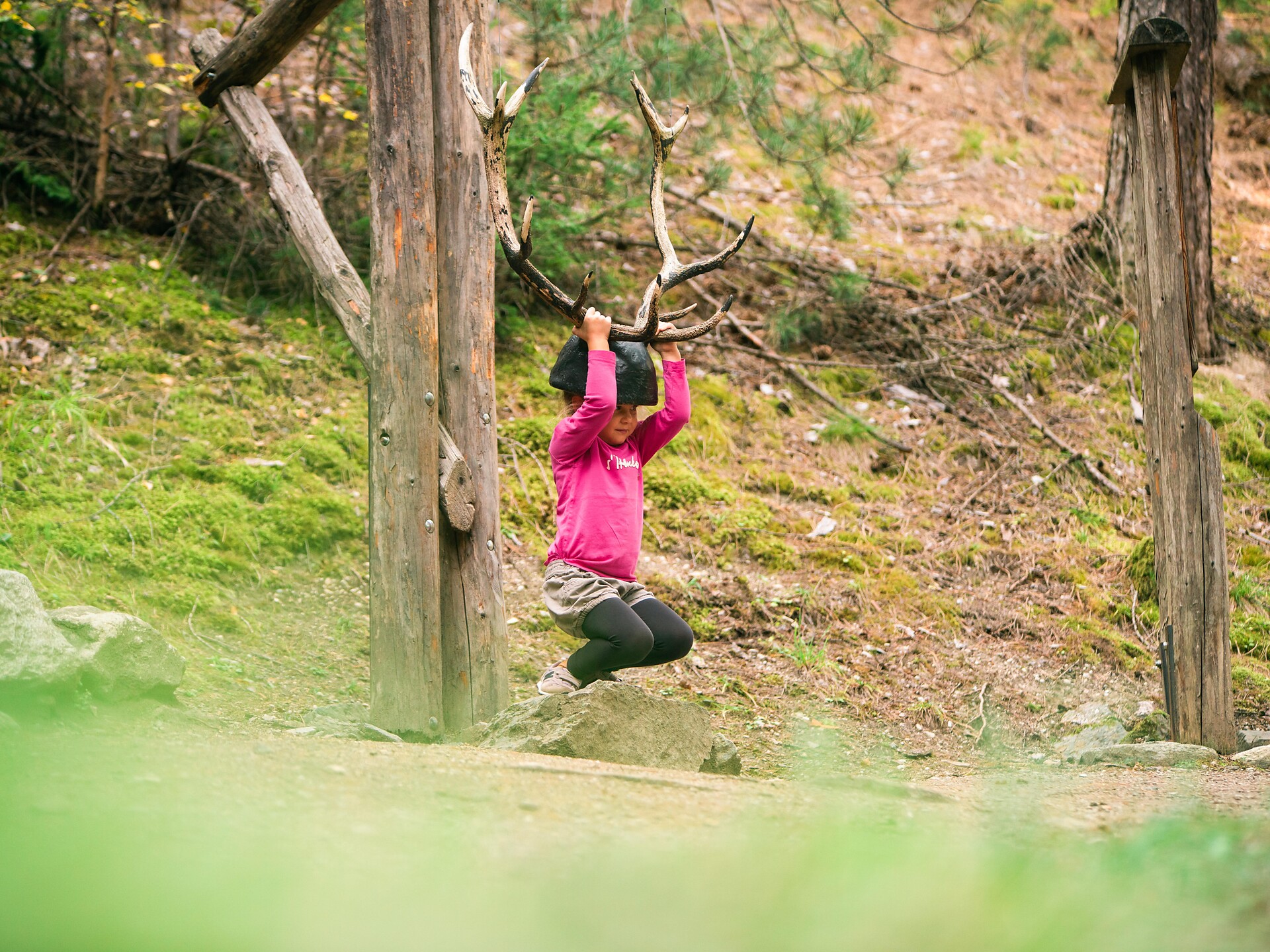
    In 15 interesting stations, many different games await the families. Together with the wood mouse Ferdinand, the parents and their kids search for animal tracks, listen to bird voices, lift up the horn of a deer, work themselves through a tunnel and climb up the pecker-hill.

    Obtížnost: nízká
    130 m nadmořská výška
    1h:30 min doba trvání
    Hiking
    Monte Sole mountain Laas
    Laas/Lasa, Vinschgau/Val Venosta

    Spring and autumn are the ideal times for this hike. From the sports ground in Lasa/Laas, walk along the dry Lasa Leitenwaal canals (Laaser Leiten) to the mountain village of Tanas. From here hikers can enjoy unique panoramic views of the valley basin and the Ortler range on the opposite side.

    This hike is normally snow-free, with gorgeous views of the Laaser Tal valley, the marble quarry and the incline railway.

    Obtížnost: nízká
    453 m nadmořská výška
    2h:10 min doba trvání
    Hiking
    Winter hike on the Völser Aicha farm trail
    Völs am Schlern/Fiè allo Sciliar, Dolomites Region Seiser Alm
    The path leads past farms and through private properties.  The people who live here are happy to show you an insight into their way of life and work.
    Obtížnost: střední
    421 m nadmořská výška
    2h:38 min doba trvání
    Hiking
    From Brixen to the Neustift Monastery
    Brixen/Bressanone, Brixen/Bressanone and environs

    This scenic and interesting walk leads from the centre of Brixen/Bressanone to the Neustift Monastery, one of the largest abbeys in South Tyrol. With its cloister and important library, the monastery complex of the Augustinian canons is most certainly worth a visit.

    Obtížnost: nízká
    41 m nadmořská výška
    1h:49 min doba trvání
    Hiking
    Panoramic Trail on the Plose Mountain
    Brixen/Bressanone, Brixen/Bressanone and environs

    The Dolomiten Panoramaweg Trail on the Plose offers magnificent views of the western Dolomites.

    Obtížnost: střední
    625 m nadmořská výška
    4h:37 min doba trvání
    Themed Hikes
    Wine trail Rebe
    Ritten/Renon, Bolzano/Bozen and environs
    The sunny mountain slope from Bozen up to the Ritten is one of the finest wine-growing areas in South Tyrol. Along the wine steps, the 10 artistic installations offer a fascinating glimpse into the
    culture of wine production. From Signat the trail leads downhill through the gently rolling vineyards to the viewing platform with its magnificent views of Bozen, then on to the Loosmannhof, to the settlement of St. Justina and down to Rentsch in the historic wine-growing estate of Ansitz Waldgries. The same route leads back uphill from Bozen to Signat.
    Obtížnost: střední
    524 m nadmořská výška
    1h:45 min doba trvání
    Themed Hikes
    St. Martin trail
    Jenesien/San Genesio Atesino, Bolzano/Bozen and environs

    This about 3 km long round trail is a child-friendly, creative and near-naturally designed contemplation trail!

    The visitors, especially children, receive in this wonderfull calming landscape the opportunity, to experience the nature and his creator understanding the God's message to us with all senses…

    The famous St. Martin is the patron of Glaning. The design of the round trail is based on his life and model.

    With the helpful elements like footprints, stone bench, labyrinth, „Our-Father“ rock or splendid viewpoints, can both children and adults comprehend the life of the Saint Martin learning also more about themselves…

    Obtížnost: nízká
    164 m nadmořská výška
    1h:18 min doba trvání
    Hiking
    Sonnenberger Panoramaweg path
    Naturns/Naturno, Meran/Merano and environs

    The view looks out on the the Hirzer and Inger peaks of the Sarntal Alps, the fertile valley, the wooded slopes and the Nörderberg Mountain with the Vigiljoch plateau, the mountains of the Ultental Valley and the Vinschgau Valley, with the snow-capped 3,000 m
    peaks of the Ortler Mountain. The best times of the year for hiking along the slopes of the Sonnenberg is in spring and autumn.

    Obtížnost: nízká
    414 m nadmořská výška
    2h:55 min doba trvání
    Climbing
    Via Ferrata Santnerpass
    Tiers am Rosengarten/Tires al Catinaccio, Dolomites Region Seiser Alm

    The outstandingly beautiful Via Ferrata Santner is secured with steel ropes, iron hooks and ladders, it leads you through small gullies and narrow passes, the most challenging of which is the “Ice Gully”, a small gully which is often covered in hard-packed snow even in August. Due to risk of landslides, this route should only be climbed uphill and not downhill. After you leave the Ferrata at the Santnerpass mountain hut, the trail goes on to the refuge Gartlhütte Hut through the valley of Vajolettal and the Tschagerjoch back to the Kölnerhütte Hut.

    Obtížnost: vysoká
    957 m nadmořská výška
    3h:49 min doba trvání
    Themed Hikes
    Vorbichl Adventure Trail
    Tisens/Tesimo, Meran/Merano and environs

    The "Vorbichl" Adventure Trail is located in Prissiano. This path is ideal for children and adults. 

    Obtížnost: nízká
    162 m nadmořská výška
    1h:13 min doba trvání
    Themed Hikes
    Hike to the Earth Pyramids on the Ritten
    Ritten/Renon, Bolzano/Bozen and environs

    The Renon/Ritten earth pyramids are a phenomenon caused by erosion, appearing where ice age moraine loam from glaciers collected in the valleys. When dry, the material is as hard as rock but, combined with water, it becomes a clay-like mush which flows into the valley. It remains protected from the rain under large stones so that columns of earth are built up becoming taller after each rainstorm.

    Route: the hike begins in Collalbo/Klobenstein, the main village on the Corno del Renon mountain. The trail leads through Collalbo to Longomoso/Lengmoos until to the hiking trail no 24 in the Erdpyramidental valley, which is so flat that it can be walked with any sort of shoe and with a buggy. View the earth pyramids against the backdrop of the imposing Dolomites from the viewing terraces. Return via the same route, through Longomoso to the beginning of trail no. 37, the von-Eyrl Promenade and the starting point at the railway station in Collalbo.

    Tip: the easy way to get from Bolzano/Bozen to Collalbo is on the Rittner Seilbahn cable car and Rittner Bahn narrow-gauge railway.

    Obtížnost: nízká
    0 m nadmořská výška
    1h:19 min doba trvání
    Hiking
    A Hike along the Promenade in Brixen
    Brixen/Bressanone, Brixen/Bressanone and environs

    Starting from the center of Brixen/Bressanone, this leisurely hike follows the river and ascends to the Karlspromenade trail above the town. From the Sanctuary of Maria am Sand it leads back through Kranebitt to the old quarter of Stufels/Stufles.

    Obtížnost: nízká
    273 m nadmořská výška
    2h:15 min doba trvání
    Themed Hikes
    Natural and Wine Trail Cornaiano/Girlan
    Eppan an der Weinstaße/Appiano sulla Strada del Vino, Alto Adige Wine Road

    This educational nature and wine trail along Gschleier-Eck in Cornaiano opened in 2007.

    Obtížnost: nízká
    5 m nadmořská výška
    0h:22 min doba trvání
    Hiking
    Traminer altitude trail
    Tramin an der Weinstraße/Termeno sulla Strada del Vino, Alto Adige Wine Road

    Beautiful hike with a lot of views. The first and the last part of this hike is dominated by beech and mixed forest. Douring the middle part you will find various ditches.

    Obtížnost: vysoká
    786 m nadmořská výška
    4h:30 min doba trvání
    Themed Hikes
    Freud Promenade
    Ritten/Renon, Bolzano/Bozen and environs
    Freud Promenade: named after its most famous guest, the founder of psychoanalysis Dr Sigmund Freud, the promenade is ideal for a leisurely walk from Oberbozen to Lichtenstern and Klobenstein.
    Obtížnost: nízká
    123 m nadmořská výška
    1h:13 min doba trvání
    Running & Fitness
    Nordic Walking: Jenesien - Vorderafing
    Jenesien/San Genesio Atesino, Bolzano/Bozen and environs

    Leave from the local tourist office, follow trail no. 3a until you reach the Unterweg restaurant anf walk the same way to come back. Duration of the excursion: 45 min - Drop/rise: 290 m

    Obtížnost: střední
    460 m nadmořská výška
    2h:07 min doba trvání
    Themed Hikes
    “Castle triangle” walk Appiano/Eppan
    Eppan an der Weinstaße/Appiano sulla Strada del Vino, Alto Adige Wine Road

    At the bottom of the Gantkofel the Eppaner Castle triangle is located. On the art-historic walking tour you get an impression of the mediaeval South Tyrol. The walking tour to the castles takes you to the Castle Triangle. First you reach the Castle Hocheppan, which is one of the most important fortifications of SouthTyrol. After a visit as well as refreshment at the Castle tavern the hike continues to the ruin Boymont. A little bit underneath Castle Korb is located, which derived from the Roman époque and is now a hotel.

    Obtížnost: střední
    373 m nadmořská výška
    1h:45 min doba trvání
    Themed Hikes
    Adventure trail "Avia" - The Lumberjack-Trail
    Jenesien/San Genesio Atesino, Bolzano/Bozen and environs
    AVIA – Lumberjack Trail from San Genesio village centre to Avigna, and on to the Mezzavia in the Sarentino Valley.
    9 interactive stations themed around timber felling and wood processing and the prehistory of the village of Afing will be inviting visitors of all ages to embark on an enthralling journey
    of discovery.
    Obtížnost: střední
    401 m nadmořská výška
    3h:01 min doba trvání
    Themed Hikes
    Geologic route "Höllental"
    Tramin an der Weinstraße/Termeno sulla Strada del Vino, Alto Adige Wine Road

    Along the geological path you will find a lot of signs and stations that shows the geology and the connected relations. The main attraction of the trail is the "Höllenbach" catastrophe of 1986. Following the path you will arrive on a big rock of tufa and the S. Nepomuk santuary. This rock last a violent mudslud and reminds the power of nature. The next sign reminds the mudslide of 1986. Just a short look to the panorama shows the different layers of rock from Montan to Weis and Schwarzhorn. Nearby you will find another rock. That's a Voltago conglomerate who resisted a mudslide 245 millions of years ago. After it there's the possibility to take a little break on a quiet island with 5 columns and a little bench with some small different rockets from the sourroundings. On the dam of the river a sign will explane you the different layers of the rock infront of you. The last sign indicate some fossils which where found in the river bed and with a bit of luck also you could find one. 

    Obtížnost: nízká
    135 m nadmořská výška
    0h:30 min doba trvání
    Long-Distance Hiking Paths
    Hiking on the "Keschtnweg
    Ritten/Renon, Bolzano/Bozen and environs

    Hiking & "törggelen": This ancient South Tyrolean custom alone is worth a trip. From October to the beginning of the Advent season, you meet the "törggelen" in the Renon inns and taverns with young wine, sweet cider and hearty delicacies. When the chestnuts are roasted over the "Keschtnfeuer", you feel as if you have travelled back in time. One-time quaint!

    Obtížnost: střední
    707 m nadmořská výška
    4h:46 min doba trvání
    Lifts
    Plose
    Brixen/Bressanone, Brixen/Bressanone and environs
    Welcome to Mount Plose

    I love Skking

    Obtížnost: nízká
    0 m nadmořská výška
    0h:00 min doba trvání
    Climbing
    Gran Cir (Gran Cir Peak)
    Corvara, Dolomites Region Val Gardena

    The fairly short yet busy via ferrata boasts a magnificent view of the north face of the Sella
    Group, the Sassolungo and the Puez plateau.


    Obtížnost: nízká
    461 m nadmořská výška
    1h:30 min doba trvání
    Long-Distance Hiking Paths
    Venosta Valley High Mountain Trail
    Schlanders/Silandro, Vinschgau/Val Venosta

    The Val Venosta Alpine Ridgeway (Vinschger Höhenweg) in the Lower Vinschgau valley, from Stava/Staben to the source of the Etsch river at the Reschen Pass where three countries meet, is a true experience for passionate hikers. The stretch totals 108 km and follows existing and new footpaths, paths alongside "Waale" (historic irrigation canals) and connecting roads between farms.

    The Alpine Ridgeway unites various stages that can be hiked as part of a multi-day tour or as a one-day excursion. The individual stages are easily accessible via access points in the villages in the valley. In order to help hikers keep their bearings, the entire Alpine Ridgeway is marked with a uniform red logo.

    It is a truly remarkable experience to hike through the species-rich vegetation and impressive world of nature that could not be more filled with contrast. The trails on the Sonnenberg mountain feature diverse vegetation such as steppe grass and herbs. They also offer exciting views of the highest mountains in South Tyrol and the fertile valley below.

    The best time for the hike is from April to October, although one should be aware that it can be very hot in summer.

    Tip: special rates for the Val Venosta Alpine Ridgeway are available (B&B including luggage transport, hiking map of the ridgeway, return transport to the starting point).

    Obtížnost: vysoká
    4852 m nadmořská výška
    33h:34 min doba trvání
    Sledging Trail
    Toboggan run in Spiluck
    Vahrn/Varna, Brixen/Bressanone and environs

    The village Spiluck above Brixen is known for its numerous hiking trails and lonely peaks especially in Summer. In Winter you find Spiluck as a cozy place for a trip in the snow. Spiluck offers snowy forests with beautiful mountain scenery. Whether by toboggan or on foot, the toboggan run in Spiluck guarantees a great day out. Especially in the early morning the sun shines through the forest and until midday it warms not only the body but also the mind.

    This idyllic winter hike starts at the hikers' parking lot at the end of Spiluck Street. From the parking lot above the Gostnerhof Inn, you start along trail no. 2 through the forest. You will immediately notice that the winter hiking trail is also wonderfully suitable for a toboggan run due to its perfectly maintained condition. Again and again you catch fantastic views of the Plose, the Geisler peaks and even the Langkofel and Plattkofel peaks. After about one and a half to two hours you reach the end of the trail below the Scheibenberg mountain, where the peak of the Karspitz towers above the woods in its white dress.

    After a well-deserved break with your own snack, you can look forward to an exciting but above all rewarding descent on the toboggan. Always leisurely downhill, but also with faster sections, nothing stands in the way of fun on the toboggan. Of course, you can also walk back to the starting point. Directly at the parking lot, the Gostnerhof Inn invites you to stop and reward yourself with a hot tea, a typical “Marende” or lunch. There are other places to stop in the village center of Spiluck.

    Obtížnost: nízká
    0 m nadmořská výška
    1h:16 min doba trvání
    1 2 3 4 5 6 7 8 9 10 11 12 13 14 15 16 17