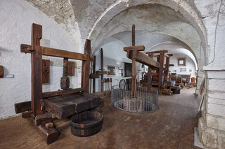
1/8
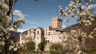
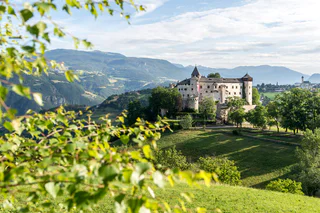
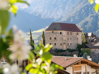
Churburg Castle
Sluderno/Schluderns, Schluderns/Sluderno, Vinschgau/Val Venosta
1/8
Sluderno/Schluderns, Schluderns/Sluderno, Vinschgau/Val Venosta

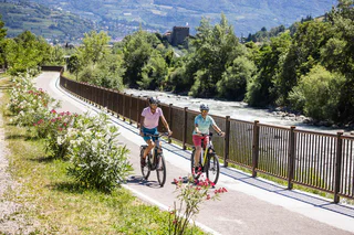
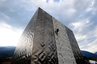
Bressanone città/Brixen Stadt, Brixen/Bressanone, Brixen/Bressanone and environs
easy
Poziom trudności
286 m
Wzlot
1h:37 min
czas trwania
1/3
Nova Ponente Centro/Deutschnofen Dorf, Deutschnofen/Nova Ponente, Dolomites Region Eggental
1/4
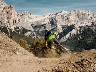
Colfosco/Colfosco, Corvara, Dolomites Region Alta Badia
1/4
Aquaviva/Ackpfeif, Lana, Meran/Merano and environs
1/4
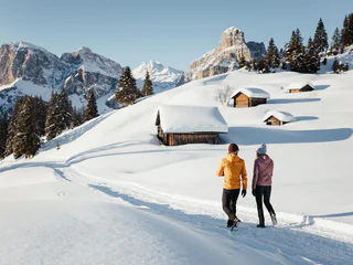
Montesole/Sonnenberg - Parcines/Partschins, Graun im Vinschgau/Curon Venosta, Vinschgau/Val Venosta
difficult
Poziom trudności
1432 m
Wzlot
79.1 Km
odległość
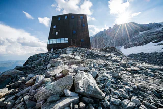
1/9
Presule/Prösels, Völs am Schlern/Fiè allo Sciliar, Dolomites Region Seiser Alm
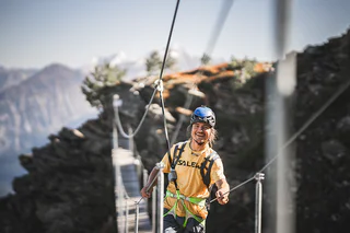
1/8
Corvara/Corvara, Corvara, Dolomites Region Alta Badia
0 m
Wzlot
0.0 m
odległość
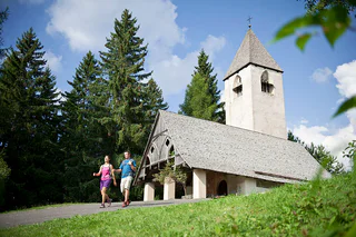
S. Pietro/St. Peter - Funes/Villnöss, Villnöss/Funes, Dolomites Region Lüsen Villnöss
1/15
Ortisei/Urtijëi/St. Ulrich/Urtijëi, Urtijëi/Ortisei, Dolomites Region Val Gardena
1/3
Nova Levante/Welschnofen, Welschnofen/Nova Levante, Dolomites Region Eggental
medium
Poziom trudności
0 m
Wzlot
4.5 Km
odległość
1/3
Corvara/Corvara, Corvara, Dolomites Region Alta Badia
1/5
Fiè/Völs, Völs am Schlern/Fiè allo Sciliar, Dolomites Region Seiser Alm
difficult
Poziom trudności
1673 m
Wzlot
6h:02 min
czas trwania
1/3
S. Pietro/St. Peter - Funes/Villnöss, Villnöss/Funes, Dolomites Region Lüsen Villnöss
1/10
Caldaro Paese/Kaltern Dorf, Kaltern an der Weinstraße/Caldaro sulla Strada del Vino, Alto Adige Wine Road
Fleres/Pflersch, Brenner/Brennero, Sterzing/Vipiteno and environs
easy
Poziom trudności
93 m
Wzlot
0h:21 min
czas trwania
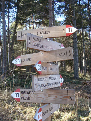
Cologna/Glaning, Jenesien/San Genesio Atesino, Bolzano/Bozen and environs
medium
Poziom trudności
460 m
Wzlot
2h:07 min
czas trwania
1/2
San Cassiano/San Cassiano, Badia, Dolomites Region Alta Badia
easy
Poziom trudności
545 m
Wzlot
2h:30 min
czas trwania
1/2
S. Pietro/St. Peter - Valle Aurina/Ahrntal, Ahrntal/Valle Aurina, Ahrntal/Valle Aurina
difficult
Poziom trudności
1959 m
Wzlot
7h:00 min
czas trwania
Bressanone città/Brixen Stadt, Brixen/Bressanone, Brixen/Bressanone and environs
easy
Poziom trudności
41 m
Wzlot
1h:49 min
czas trwania
1/6
Lutago/Luttach, Ahrntal/Valle Aurina, Ahrntal/Valle Aurina
medium
Poziom trudności
350 m
Wzlot
2h:00 min
czas trwania
1/2
Nobls/Nobls, Jenesien/San Genesio Atesino, Bolzano/Bozen and environs
easy
Poziom trudności
378 m
Wzlot
2h:38 min
czas trwania
1/3
Nova Levante/Welschnofen, Welschnofen/Nova Levante, Dolomites Region Eggental
easy
Poziom trudności
100 m
Wzlot
3h:40 min
czas trwania
1/3
La Villa/La Villa, Badia, Dolomites Region Alta Badia
La Villa/La Villa, Badia, Dolomites Region Alta Badia
Braies di Fuori/Ausserprags, Prags/Braies, Dolomites Region 3 Zinnen
difficult
Poziom trudności
0 m
Wzlot
3h:30 min
czas trwania
1/5
Collepietra/Steinegg, Karneid/Cornedo all'Isarco, Dolomites Region Eggental
easy
Poziom trudności
221 m
Wzlot
1h:28 min
czas trwania

1/3
Carezza/Karersee, Welschnofen/Nova Levante, Dolomites Region Eggental
1/2
Bressanone città/Brixen Stadt, Brixen/Bressanone, Brixen/Bressanone and environs
1/4
Scena/Schenna, Schenna/Scena, Meran/Merano and environs
Dziękujemy za zapisanie się!
Subskrypcja jest już aktywna
Potwierdź rejestrację
Aby zakończyć rejestrację, otwórz e-mail, który właśnie wysłaliśmy, i kliknij link potwierdzający.
Nie widzisz wiadomości? Sprawdź folder spam.
Zauważyliśmy, że próbowałeś(-aś) zapisać się do newslettera, ale Twój adres e-mail jest już zarejestrowany. Nadal będziesz otrzymywać nasze oferty, wskazówki i inspiracje na Twój urlop.
Już próbowałeś zapisać się do naszego newslettera, ale nie potwierdziłeś rejestracji. Właśnie wysłaliśmy ci ponownie e‑mail. Sprawdź swoją skrzynkę odbiorczą i folder ze spamem i potwierdź teraz.


