Přeskočit na obsah

přidáno k oblíbeným

odebráno z oblíbených

Jejda! Došlo k problému, zkuste to prosím znovu

Vytváří se váš účet

Váš účet byl úspěšně vytvořen a nyní jste přihlášeni

Jste úspěšně přihlášeni!

Váš účet byl úspěšně vytvořen, ale nepodařilo se nám vás automaticky přihlásit

Jste odhlášeni

Filtr
Vybrané filtry
    Úroveň obtížnosti
    Doba trvání
    Vzdálenost v km

    Horolezectví

    Sportovní výzva, dechberoucí výhled a pocit svobody: jaké to je stát na vrcholu? Najděte nejlepší trek ve svém okolí zde.
    Výsledky
    Mountaineering
    Lakes hike in the Ultental Valley
    Ulten/Ultimo, Meran/Merano and environs

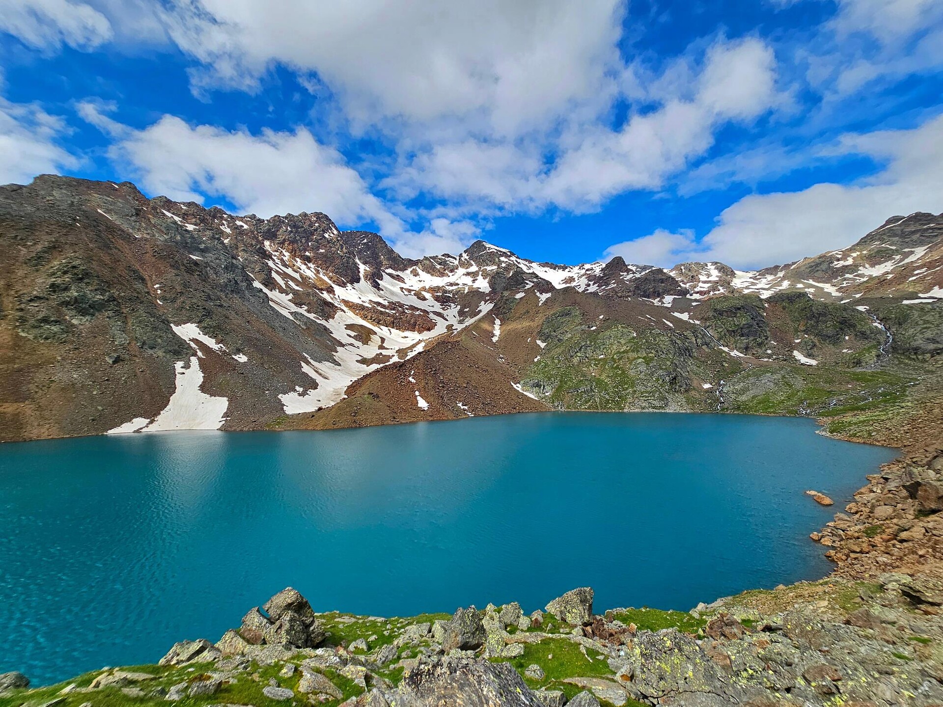
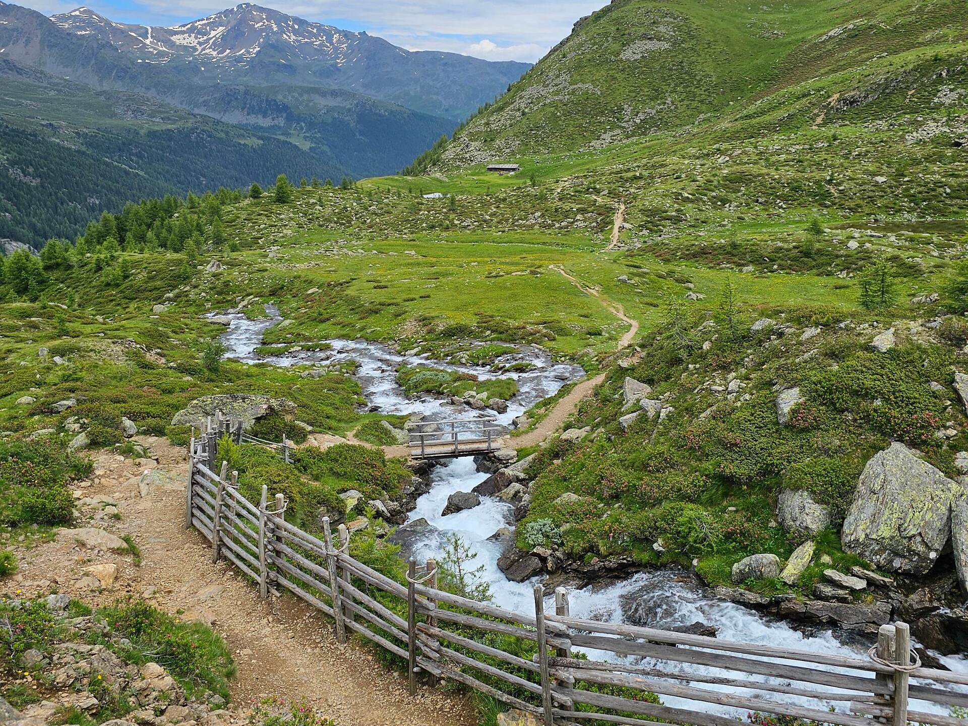
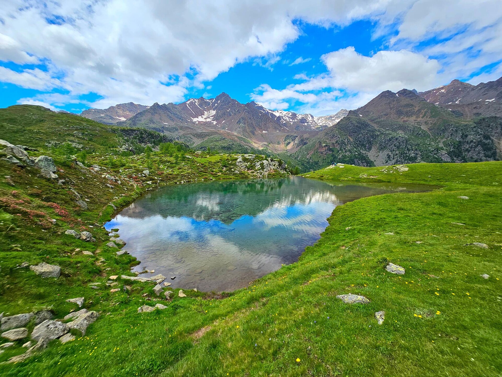
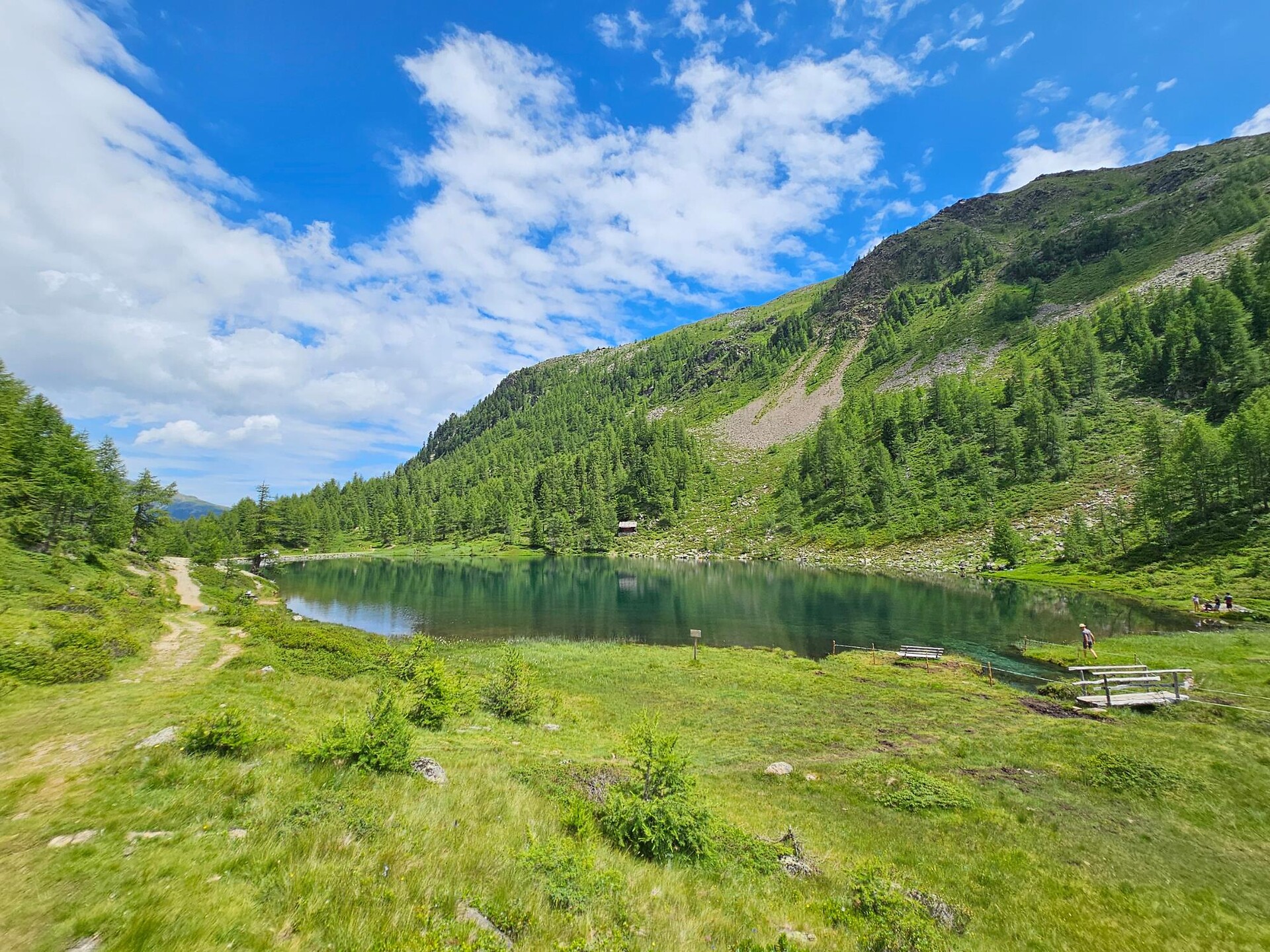
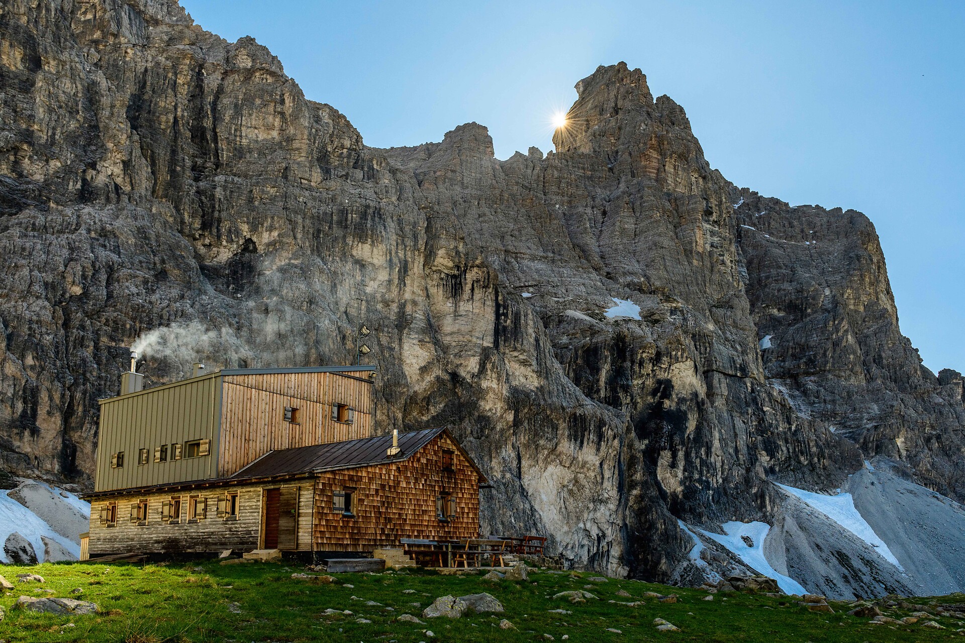
    The nearly 11 km long 4-Lakes Hike is a true experience. You start at the Weißbrunnsee lake and hike steeply along Trail 140 to the Höchsterhütte. After about 2 hours, you reach the Höchsterhütte at the Grünsee lake, the highest point of the tour, where you can enjoy a breathtaking view of the highest mountains in the Ultental valley. Afterwards, the path leads you along the Ultner Höhenweg No. 12 to the Langsee lake and continues down Trail 107 to the Oberweißbrunnsee lake. After another half hour, you arrive at the Fischersee lake before returning to the starting point via Trail 103.

    Obtížnost: střední
    710 m nadmořská výška
    4h:19 min doba trvání
    Mountaineering
    Climb to the "Ciaval" peak on the Sas dla Crusc/Santa Croce
    Badia, Dolomites Region Alta Badia

    One of the most beautiful hikes in Alta Badia and the Dolomites.

    Untouched nature, vertical walls soaring skywards that turn red at sunset, and a breathtaking view extending over the green valley of Badia on one side and the legendary landscape of the Fanes Alp on the other. The characteristic Dolomite flora, along with marmots and chamois goats, all combine to make this a truly unforgettable walk.

    Obtížnost: vysoká
    985 m nadmořská výška
    6h:00 min doba trvání
    Mountaineering
    Hiking trail to the place of discovery of Ötzi
    Schnals/Senales, Vinschgau/Val Venosta

    Challenging Alpine tour, which leads via the Similaunhütte mountain hut to the discovery site of the famous “iceman”.

    Obtížnost: střední
    1607 m nadmořská výška
    8h:00 min doba trvání
    Mountaineering
    Lampskopf - climbing crag to the Tribulaun hut
    Brenner/Brennero, Sterzing/Vipiteno and environs

    The via ferrata climbs over the rocky slopes and exposed grassy hills of Lampskopf and Gogelberg to the base of the Pflerscher Tribulaun. It is perfect for climbers who appreciate a combination of nature enjoyment and easy climbing. However, the ascent is physically demanding. Due to the southern exposure, the tour is very sweaty (bring drinks). On the other hand, after rainy days, it is advisable to wait—there is a high risk of slipping!

    Start: Parking lot at the bridge after Hinterstein (1380m). From the easternmost farmhouse (signpost for via ferrata), the trail winds uphill to the start of the steel cable (45min). The climb to Lampskopf (1995m; 1.5 hours; approx. 400m elevation) is varied. The ascent continues "via ferrata-free" over steep meadows to Gogelberg (2276m), where another steel cable awaits in the summit area. Shortly after the summit, you will join trail no. 7/32A, which leads you to the Tribulaunhütte (2368m, 1.5 hours from Lampskopf). Descent via the hut approach, trail no. 8 in approx. 2 hours.

    Difficulty: A to B; short sections C;
    Length: Total ascent 1000m, of which 400m + 100m via ferrata
    Time: 3.5 - 4 hours.

    Obtížnost: vysoká
    1053 m nadmořská výška
    3h:30 min doba trvání
    Mountaineering
    Ascent of Mt. Conturines
    Badia, Dolomites Region Alta Badia

    Challenging hike in the Fanes group with start in San Cassiano. The Conturines peak is the highest peak of the Fanes group and offers a breathtaking view over the whole Val Badia valley.

    The hike, perfect for keen mountaineers, requires safety, climbing skills and a good orientation skills.

    Obtížnost: vysoká
    1460 m nadmořská výška
    6h:15 min doba trvání
    Mountaineering
    Climbing the Gran Cir peak at sunrise
    Corvara, Dolomites Region Alta Badia

    The first moments of the morning at the top of a peak, when the shy rays of the sun illuminate the surrounding rocks, making them glow a warm orange-gold colour: breathtaking moments that will remain engraved in your heart forever.
    Just outside Colfosco, on the bends of the Gardena pass, you can enjoy the inimitable spectacle of the Dolomite sunrise as you climb the peaks of the Cir group. Of all the possible climbs, that to the summit of the Gran Cir is the least difficult.

    Obtížnost: střední
    0 m nadmořská výška
    2h:04 min doba trvání
    1 2 3 4 5 6 7 8 9 10 11 12 13

      Pokud jste někdy vylezli na vrchol, znáte ten pocit svobody. Ten přichází, když dosáhnete vrcholu a užíváte si výhled z něj. Dáváte přednost šturmování Dolomit? Dáváte přednost mírnějším horským vrcholům? Milujete široké výhledy? Nebo se spokojíte pouze s nejvyššími vrcholy? Jižní Tyrolsko s více než 100 třítisícovými vrcholy a vrcholy, z nichž údajně dohlédnete až do Benátek, nabízí mnoho vrcholových zážitků.