1/10
Circular summit hike to Sattelspitze (2,428 m)
Partschins/Parcines, Meran/Merano and environs
difficult
Poziom trudności
1320 m
Wzlot
8h:45 min
czas trwania

1/10
Partschins/Parcines, Meran/Merano and environs
difficult
Poziom trudności
1320 m
Wzlot
8h:45 min
czas trwania

Stelvio/Stilfs, Stilfs/Stelvio, Vinschgau/Val Venosta
medium
Poziom trudności
1026 m
Wzlot
5h:40 min
czas trwania
1/5
Monte Scena/Schennaberg, Schenna/Scena, Meran/Merano and environs
difficult
Poziom trudności
1110 m
Wzlot
4h:00 min
czas trwania
1/3
Corvara/Corvara, Corvara, Dolomites Region Alta Badia
medium
Poziom trudności
180 m
Wzlot
2h:30 min
czas trwania
Anterselva di Sotto/Antholz-Niedertal, Gais, Dolomites Region Kronplatz/Plan de Corones
medium
Poziom trudności
995 m
Wzlot
4h:05 min
czas trwania
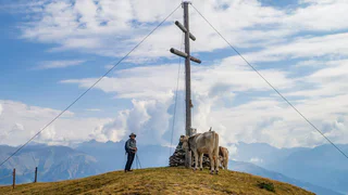
1/4
Tubre/Taufers i. M., Taufers im Münstertal/Tubre, Vinschgau/Val Venosta
medium
Poziom trudności
791 m
Wzlot
2h:28 min
czas trwania
Valdaora di Mezzo/Mitterolang, Olang/Valdaora, Dolomites Region Kronplatz/Plan de Corones
difficult
Poziom trudności
1034 m
Wzlot
4h:05 min
czas trwania
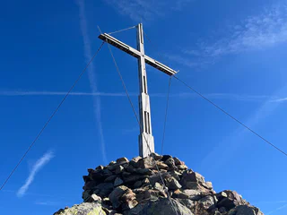
1/4
Proveis/Proves, Meran/Merano and environs
medium
Poziom trudności
836 m
Wzlot
4h:15 min
czas trwania
Sesto/Sexten, Sexten/Sesto, Dolomites Region 3 Zinnen
difficult
Poziom trudności
1198 m
Wzlot
6h:45 min
czas trwania
S. Martino/St. Martin - Casies/Gsies, Gsies/Valle di Casies
difficult
Poziom trudności
1682 m
Wzlot
8h:13 min
czas trwania
Issengo/Issing, Pfalzen/Falzes, Dolomites Region Kronplatz/Plan de Corones
medium
Poziom trudności
835 m
Wzlot
4h:30 min
czas trwania
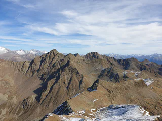
1/6
Terento/Terenten, Terenten/Terento, Brixen/Bressanone and environs
difficult
Poziom trudności
1588 m
Wzlot
5h:55 min
czas trwania
S. Candido/Innichen, Innichen/San Candido, Dolomites Region 3 Zinnen
medium
Poziom trudności
12000 m
Wzlot
10h:00 min
czas trwania
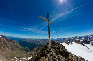
1/3
Maso Corto/Kurzras, Schnals/Senales, Vinschgau/Val Venosta
difficult
Poziom trudności
1925 m
Wzlot
6h:01 min
czas trwania
Plan/Pfelders, Moos in Passeier/Moso in Passiria, Meran/Merano and environs
difficult
Poziom trudności
961 m
Wzlot
7h:00 min
czas trwania
Sesto/Sexten, Innichen/San Candido, Dolomites Region 3 Zinnen
medium
Poziom trudności
1238 m
Wzlot
7h:45 min
czas trwania
Ciardes/Tschars, Kastelbell-Tschars/Castelbello-Ciardes, Vinschgau/Val Venosta
difficult
Poziom trudności
1210 m
Wzlot
5h:00 min
czas trwania
Juvale/Juval, Kastelbell-Tschars/Castelbello-Ciardes, Vinschgau/Val Venosta
difficult
Poziom trudności
1631 m
Wzlot
4h:50 min
czas trwania
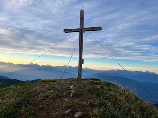
1/5
Terento/Terenten, Terenten/Terento, Brixen/Bressanone and environs
difficult
Poziom trudności
1306 m
Wzlot
5h:50 min
czas trwania
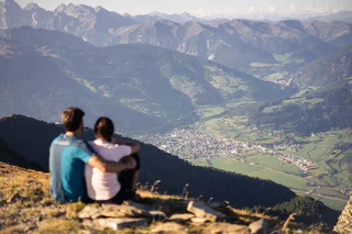
1/6
Pennes di Fuori/Ausserpens, Sarntal/Sarentino, Sterzing/Vipiteno and environs
easy
Poziom trudności
376 m
Wzlot
1h:30 min
czas trwania
Flanes/Flans, Freienfeld/Campo di Trens, Sterzing/Vipiteno and environs
medium
Poziom trudności
1678 m
Wzlot
7h:30 min
czas trwania
Ridanna/Ridnaun, Ratschings/Racines, Sterzing/Vipiteno and environs
medium
Poziom trudności
1053 m
Wzlot
4h:55 min
czas trwania
Fundres/Pfunders, Mühlwald/Selva dei Molini, Ahrntal/Valle Aurina
medium
Poziom trudności
542 m
Wzlot
2h:04 min
czas trwania
Sasso/Stein, Pfitsch/Val di Vizze, Sterzing/Vipiteno and environs
difficult
Poziom trudności
1662 m
Wzlot
7h:00 min
czas trwania
S. Martino/St. Martin - Casies/Gsies, Welsberg-Taisten/Monguelfo-Tesido
medium
Poziom trudności
1201 m
Wzlot
8h:00 min
czas trwania
Valdaora di Mezzo/Mitterolang, Olang/Valdaora, Dolomites Region Kronplatz/Plan de Corones
medium
Poziom trudności
1116 m
Wzlot
4h:13 min
czas trwania
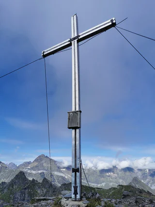
1/3
Plan/Pfelders, Moos in Passeier/Moso in Passiria, Meran/Merano and environs
medium
Poziom trudności
1378 m
Wzlot
8h:28 min
czas trwania
Fundres/Pfunders, Vintl/Vandoies, Sterzing/Vipiteno and environs
medium
Poziom trudności
1094 m
Wzlot
4h:30 min
czas trwania
Resia/Reschen, Graun im Vinschgau/Curon Venosta, Vinschgau/Val Venosta
medium
Poziom trudności
1091 m
Wzlot
5h:30 min
czas trwania
Solda/Sulden, Stilfs/Stelvio, Vinschgau/Val Venosta
difficult
Poziom trudności
900 m
Wzlot
4h:30 min
czas trwania
Dziękujemy za zapisanie się!
Rejestracja już aktywna
Potwierdź rejestrację
Aby zakończyć rejestrację, otwórz e-mail, który właśnie wysłaliśmy, i kliknij link potwierdzający.
Nie widzisz wiadomości? Sprawdź folder spam.
Otrzymujesz już nasze wyjątkowe oferty, przydatne wskazówki i specjalne propozycje, aby w pełni cieszyć się wakacjami.
Już próbowałeś zapisać się do naszego newslettera, ale nie potwierdziłeś rejestracji. Właśnie wysłaliśmy ci ponownie e‑mail. Sprawdź swoją skrzynkę odbiorczą i folder ze spamem i potwierdź teraz.