1/2
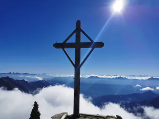
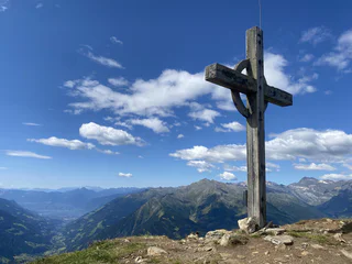
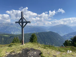
Mountain tour to "Rauhjoch" Peak (2,926 m)
Plan/Pfelders, Moos in Passeier/Moso in Passiria, Meran/Merano and environs
medium
Poziom trudności
1492 m
Wzlot
5h:43 min
czas trwania

1/2
Plan/Pfelders, Moos in Passeier/Moso in Passiria, Meran/Merano and environs
medium
Poziom trudności
1492 m
Wzlot
5h:43 min
czas trwania
1/3
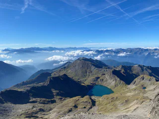
Valles/Vals, Mühlbach/Rio di Pusteria, Brixen/Bressanone and environs
difficult
Poziom trudności
1484 m
Wzlot
6h:15 min
czas trwania

1/5
Chienes/Kiens, Kiens/Chienes, Dolomites Region Kronplatz/Plan de Corones
medium
Poziom trudności
870 m
Wzlot
4h:10 min
czas trwania
1/4
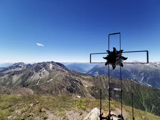
Cresta/Christl, St.Leonhard in Passeier/San Leonardo in Passiria, Meran/Merano and environs
medium
Poziom trudności
1773 m
Wzlot
6h:02 min
czas trwania

1/6
S. Martino/St. Martin - Casies/Gsies, Gsies/Valle di Casies
difficult
Poziom trudności
1214 m
Wzlot
7h:16 min
czas trwania

S. Maddalena/St. Magdalena - Funes/Villnöss, Villnöss/Funes, Dolomites Region Lüsen Villnöss
difficult
Poziom trudności
1491 m
Wzlot
7h:01 min
czas trwania

1/11
Anterselva di Sopra/Antholz-Obertal, Rasen-Antholz/Rasun Anterselva, Dolomites Region Kronplatz/Plan de Corones
difficult
Poziom trudności
787 m
Wzlot
2h:38 min
czas trwania
1/10
Stange/Stanghe, Ratschings/Racines, Sterzing/Vipiteno and environs
medium
Poziom trudności
883 m
Wzlot
4h:25 min
czas trwania
Sesto/Sexten, Sexten/Sesto, Dolomites Region 3 Zinnen
medium
Poziom trudności
957 m
Wzlot
6h:04 min
czas trwania
Ridnaun/Ridanna, Ratschings/Racines, Sterzing/Vipiteno and environs
difficult
Poziom trudności
1275 m
Wzlot
7h:19 min
czas trwania

1/2
Planol/Planeil, Mals/Malles, Vinschgau/Val Venosta
medium
Poziom trudności
1299 m
Wzlot
3h:49 min
czas trwania

1/3
Plata/Platt, Moos in Passeier/Moso in Passiria, Meran/Merano and environs
medium
Poziom trudności
1208 m
Wzlot
4h:43 min
czas trwania
1/2
Plan/Pfelders, Moos in Passeier/Moso in Passiria, Meran/Merano and environs
difficult
Poziom trudności
1881 m
Wzlot
6h:22 min
czas trwania
Stange/Stanghe, Ratschings/Racines, Sterzing/Vipiteno and environs
medium
Poziom trudności
521 m
Wzlot
3h:10 min
czas trwania
Tarres/Tarsch, Latsch/Laces, Vinschgau/Val Venosta
difficult
Poziom trudności
1362 m
Wzlot
5h:05 min
czas trwania
Flanes/Flans, Freienfeld/Campo di Trens, Sterzing/Vipiteno and environs
medium
Poziom trudności
1678 m
Wzlot
7h:30 min
czas trwania

1/5
Tirolo/Tirol, Tirol/Tirolo, Meran/Merano and environs
medium
Poziom trudności
1052 m
Wzlot
3h:58 min
czas trwania
1/5
Valgiovo/Jaufental, St.Leonhard in Passeier/San Leonardo in Passiria, Meran/Merano and environs
medium
Poziom trudności
371 m
Wzlot
2h:15 min
czas trwania
S. Martino al Monte/St. Martin - Laces/Latsch, Latsch/Laces, Vinschgau/Val Venosta
difficult
Poziom trudności
1191 m
Wzlot
3h:58 min
czas trwania
Solda/Sulden, Stilfs/Stelvio, Vinschgau/Val Venosta
difficult
Poziom trudności
900 m
Wzlot
4h:30 min
czas trwania

1/4
Monte Scena/Schennaberg, Schenna/Scena, Meran/Merano and environs
difficult
Poziom trudności
800 m
Wzlot
3h:30 min
czas trwania

1/3
Naturns/Naturno, Meran/Merano and environs
difficult
Poziom trudności
1086 m
Wzlot
3h:36 min
czas trwania
1/3
Vipiteno/Sterzing, Sterzing/Vipiteno, Sterzing/Vipiteno and environs
easy
Poziom trudności
350 m
Wzlot
2h:00 min
czas trwania

1/2
La Val/La Val, La Val, Dolomites Region Alta Badia
medium
Poziom trudności
894 m
Wzlot
3h:19 min
czas trwania

1/5
Sasso/Stein, Pfitsch/Val di Vizze, Sterzing/Vipiteno and environs
difficult
Poziom trudności
2089 m
Wzlot
9h:00 min
czas trwania
S. Giacomo/St. Jakob - Val di Vizze/Pfitsch, Pfitsch/Val di Vizze, Sterzing/Vipiteno and environs
difficult
Poziom trudności
1514 m
Wzlot
6h:00 min
czas trwania
Maso Corto/Kurzras, Schnals/Senales, Vinschgau/Val Venosta
difficult
Poziom trudności
1186 m
Wzlot
4h:00 min
czas trwania
1/11
Stange/Stanghe, Ratschings/Racines, Sterzing/Vipiteno and environs
medium
Poziom trudności
550 m
Wzlot
2h:30 min
czas trwania
Solda/Sulden, Stilfs/Stelvio, Vinschgau/Val Venosta
medium
Poziom trudności
1164 m
Wzlot
3h:42 min
czas trwania
Graun/Curon, Graun im Vinschgau/Curon Venosta, Vinschgau/Val Venosta
medium
Poziom trudności
930 m
Wzlot
2h:49 min
czas trwania
Dziękujemy za zapisanie się!
Subskrypcja jest już aktywna
Potwierdź rejestrację
Aby zakończyć rejestrację, otwórz e-mail, który właśnie wysłaliśmy, i kliknij link potwierdzający.
Nie widzisz wiadomości? Sprawdź folder spam.
Zauważyliśmy, że próbowałeś(-aś) zapisać się do newslettera, ale Twój adres e-mail jest już zarejestrowany. Nadal będziesz otrzymywać nasze oferty, wskazówki i inspiracje na Twój urlop.
Już próbowałeś zapisać się do naszego newslettera, ale nie potwierdziłeś rejestracji. Właśnie wysłaliśmy ci ponownie e‑mail. Sprawdź swoją skrzynkę odbiorczą i folder ze spamem i potwierdź teraz.