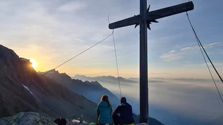
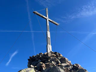
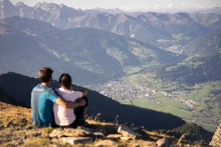
The route on the sunny side is mostly snow-free and offers special mountain experiences, especially in early summer and autumn.
Start by the Penserjoch joke and take the trail 14B along the crest. After the Astenberg summits follow the trail 14A to the junction Tatschspitze and Tagewaldhorn. Take the trail 13A first and pass down the Traminner Scharte and the Tagewaldhorn on trail 13. You will arrive to the Flagger lake (2473m) and the Marburger mountain hut. Here starts the ascent to the summit (2.739m) on trail 13B on steepy terrain and scree underground. One steep climb is secured with a steel rope. Lunch possibility: Marburger Hütte, Penserjoch Alm, Gasthof Alpenrosenhof
The panoramic trail of the Ultental valley, trail Mark 12, is a spectacular circular hike in the Ultental valley. With a total length of almost 50 kilometers, the route can be completed in two to three days (approximately 20 hours of walking) and offers diverse and captivating landscapes.
Starting in Kuppelwies, the trail traverses the sunlit side, passing numerous rustic alpine huts of the Ultental valley until reaching the Höchsterhütte at the Grünsee lake, where you can enjoy breathtaking views of the highest peaks in the Ultental valley. Situated in the heart of the Stilfserjoch National Park, the path continues to the Haselgruber Hut and the Haselgruber Lakes, which provide a picturesque setting.
The next section leads to the Peak of Karspitze, the highest point of the hike at over 2,700 m, before heading towards the Alplahner See lake. From there, the trail winds through the Klapfberg Valley, passing the Bichl Alm down to the Auerbergalm, where you can experience the beautiful surroundings and typical landscapes of the Ultental valley.
A ROUTE ON HISTORICAL PATHS FROM THE AHRNTAL VALLEY IN SOUTH TYROL TO MAYRHOFEN IN TYROL AND BACK AGAIN
Route: Steinhaus/Cadipietra - Kasern/Casere - Plauener Hütte - Mayrhofen - Kasseler Hütte - Steinhaus/Cadipietra
5 days - 4 nights
The mountain tour is classified as moderately difficult - difficult and offers unforgettable moments. Sure-footedness, good physical condition, experience and good equipment are required.
The yoke crossings are known as the old paths of smugglers between the Ahrntal valley and Austria. Especially the Keilbachjoch. This prompted the Kassel section of the German Alpine Club and Martin Gamper, hut keeper of the Kasseler Hütte, to call this tour "Ahrntaler smuggler paths".
An easily accessible three-thousand-metre peak in the Matscher Valley that offers views in all directions.
HISTORICAL PATHS BETWEEN SOUTH TYROL AND SALZBURG REGION
Tour: Kasern/Casere – Krimmler Tauernhaus mountain refuge – Warnsdorfer Hütte mountain refuge – Birnlücken Hütte mountain refuge Kasern/Casere
4 days – 3 overnight stays
The hike is rated intermediate-high for level of difficulty and offers unforgettable moments. The tour requires experience, not to suffer from vertigo, sure-footedness, physical fitness as well as suitable equipment.
The Sella group is the massive which divides and at the same time joins togheter four valleys: Val Gardena, Val Badia, Val di Fassa and Arabba. The Sella group is composed of two large platforms, imposing walls and towers that rise high towards the sky. Starting from one end the excursion will lead you to the other end. You will reach the highest point called Piz Boè from where you will be amazed of the view.
By the Prantneralm parking lot following the forestal road (mark 3) to the Riedberg mountain hut. Furterhon on the wide mountain trail 11 to the Hühnerspielhütte mountain hut. Here turn right and follow upwards trail 22, which will bring you to the Amthorspitze summit (2753m). Lunch possibilities: Riedbergalm, Hühnerspielhütte, Prantneralm.
Sarner Scharte, Sarentino/Sarnthein’s local mountain, is a ridge which extends from the frazione of Ponticino/Bundschen to the frazione of San Martino/Reinswald.
The popular Tschigat summit (Tschigot) is one of the 13 peaks in Partschins/Parcines rising above 3,000 meters.
This hike at the foot of the southern Stubai Alps is less visited even though it has a very attractive landscape and leads through an untouched mountain world. From the parking area at the Mining World Museum walk on path no. 28 up to the managed mountain pasture Moarerbergalm (Poschhaus). Leave the path no. 28 at the foot of the rock face towards St. Martin at the Schneeberg and walk at the right side, where you reach path no. 33 to the Moarer Eget lakes in about 1 ½ hours. At the pass Egetjoch (2639m) you reach the highest point of this hike and walk downhill either left past the Eget lakes (no. 33a) or directly down to the lake Trüber See. You need approx. 2 hours for the descent down to the valley. Condition and surefootedness necessary! (There is also the possibility to go up to the Moarerbergalm by bus.)
The “Sesvennascharte” is located in the middle of a beautiful landscape, surrounded by fascinating mountain scenery.
Follow the trail 14B along the crest by the Penserjoch pass. Passing the Astenberg and along trail 14A to the junction to the Tatschspitze. Take the trail 13A in direction Tagewaldhorn. Passing down the summit on trail 13 and follow the trail to the Flagger lake and the Flaggerscharte mountain hut (2482m, also called Marburger Hütte). Lunch possibility: Marburger Hütte, Penserjoch Alm, Gasthof Alpenrosenhof
The Seebodenspitze peak rises above Haidersee Lake in the upper Venosta valley. The mountain is particularly popular as it is not necessary to start the hike in the valley but from the Haideralm/Malga S. Valentino at 2,100m, which can be reached by cable car from St. Valentin. Walk from the Haideralm through the pine forest and across grazing grounds on the gently rising, then steepening climb signposted no. 10 up to the “Schwarzer Kofel”. Cross large rocks on the ridge and from there walk to the summit. From the summit enjoy the far-reaching mountain landscape of the upper Inntal valley and upper Vinschgau valley. Descend via a small detour (“Three Lakes”) back to the Haideralm.
SOUTH TYROL – SALZBURG – TYROL: 3 REGIONS AND 5 MONTAIN REFUGES IN 6 DAYS
Tour: Kasern/Casere – Birnlücken Hütte mountain refuge – Krimmler Tauernhaus mountain refuge– Zittauer Hütte mountain refuge – Richterhütte mountain refuge – Plauener Hütte mountain refuge – Kasern/Casere
The hike is rated intermediate-high for level of difficulty and offers unforgettable moments. The tour requires experience, not to suffer from vertigo, sure-footedness, physical fitness as well as suitable equipment.
Following the trail 14B in Elzenbaum/Pruno upwards through the forest, passing by some farms and a fountain until arriving to the trail junction 14. Upwards on trail 14 to the Mandelseitenjoch (2114m) and further along the crest to the Zinseler summit (2421m).
From the top station of Ladurns to the mountain hut Edelweiß/Stella Alpina and from here the trail nr. 34A to the Lotterscharte. Then on the trails nr. 24 and nr. 23 to the peaks Telfer Weißen/Cime Bianche di Telves. Back on the same trail.
CIRCULAR ROUTE IN THE AHRNTAL MOUNTAINS AND THE RIESERFERNER GROUP
Route: St. Georgen/Bruneck - Tiefrastenhütte - Edelrauthütte - Chemnitzerhütte - Schwarzensteinhütte - Holzerbödenalm - Waldneralm - Kasern - Durraalm - Kasselerhütte - Rieserfernerhütte - Lercheralm - Bruneck
9 days - 8 overnight stays
The mountain tour is categorised as difficult and offers unforgettable moments. Sure-footedness, very good physical condition, a great deal of experience (= high mountain experience) and good equipment are required.
The Ahrner high trail offers great scenic variety and mountaineering challenges with its multi-day high-altitude tour through the Pustertal, the Pfunderer mountains, the Ahrntal and the Rieserferner group.
You can find more accommodation in the villages here: www.ahrntal.com
Publisher: Club Alpino Italiano Section Bruneck, APS, Alte Straße 6/39031 Bruneck, www.caibrunico.it
Map: Kompass hiking map "Ahrntaler Berge" no. 16, scale 1:25,000
Start by the Penserjoch pass and along trail 14B along the crest, over the Astberg summit and further on 14A to the junction to the Tatschspitze summit. Stay on trail 14A and follow the ascent to the Puntleider joke (2465m). Steep descent to the lake (1850m). Along trail 14 to the Puntleidersee pasture and descent to valley to the Le Cave/Grasstein hamlet (return with bus 310 to Vipiteno/Sterzing).
From the mountain hut Edelweiß/Stella Alpina on the trail nr. 34 to the yoke Teissljöchl. From here to the Valley Toffring (Toffringtal) and from here under the mountainsides of the Peak Wetterspitze/Cima del Tempo. Then to the peak. Possibility to descend to the pasture Allriss and on the "Sogeweg" back to Ladurns.
Not difficult hiking tour from the Mendel pass up to mount Penegal with gentle gradients and a beautiful panoramic view at the endpoint. Starting point: mountain station of the Mendel Cable Car/Mendel pass. Endpoint: Mount Penegal. Walking time: about 1.5 hours. Difference in altitude: about 380 meters.
The trail starts by the mountain station and goes in direction Edelweißhütte mountain hut. Just before the hut tunr left on the steep trail (34) and along the scree upwards to the Lotterscharte joke (2258m). Afterwards take the mountain trail 24 on the right to the Ochsenscharte joke. Here on the trail 23 on the crest to the eastern Telfer Weißen summit. The western main peak (2591m) is recommended only for expert alpinists.
This hike takes you past Totenkirchl Chapel and picturesque Totensee Lake to the peaks of Villandro (Villanderer) Mountain.
The view from the Tschars weather cross into the Vinschgau and into the Martelltal Valley is wonderful.
By the parking lot in Kematen in the Pfitsch Valley along the street in direction West passing by the Parrish church and before the villlage end along the trail 4 on the right side upwards to the Schlüsseljoch joke. After arriving to the forestal road along the road to the joke (2192m) and here at the right on trail 3 along the crest to the Flatschspitze summit (2566m). Along the trail 3 we will reach the Flatschjoch joke, where the desent to valley begins: on trail 5 we arrive to Kematen. Lunch possibilities: Gasthof Alpenrose, Restaurant Kranebitt.