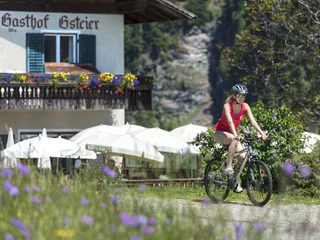
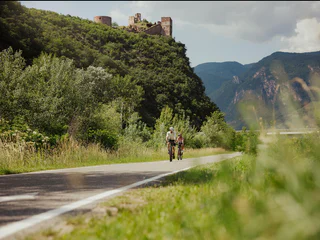
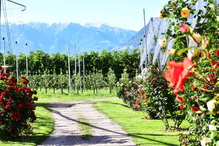
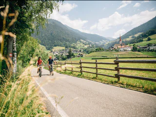
Skip to content

added to favourites

removed from favourites

Oops! Something went wrong. Try again

Your account is being created

Your account has been successfully created and you are now logged in

You’ve been logged in successfully!

Your account was created successfully, but we couldn't log you in automatically

You are logged out.

Filter
Selected filters
    Level of difficulty
    Duration
    Distance in KM

    Cycle routes in Meran/Merano and environs

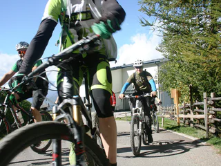
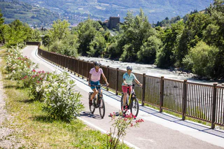
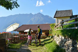
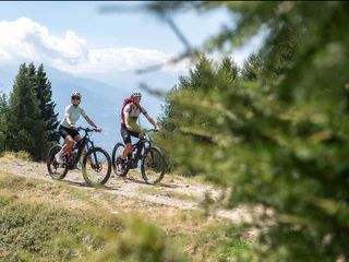
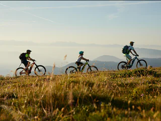
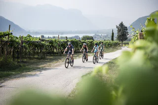
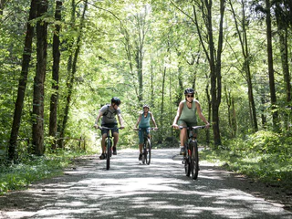
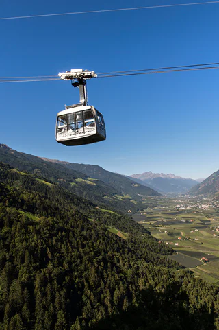
    You can travel long distances on a bike, feel a sense of freedom and warm up for the best adventures. Experience the thrill of discovering new places on two wheels in South Tyrol, where the cycling season starts as early as March. If you are a hardened cyclist, you’ll have your best time cycling on pass roads and on the valley cycle route. You’ll surely find a wealth of family-friendly excursions through South Tyrol’s unique cultural landscape and if you hop on the e-bike, you’ll probably travel even further.

    Results
    Mountain bike
    Bike-Highline-Meran/o
    Meran/Merano, Meran/Merano and environs

    One reaches the Bike Highline Meran/o through various Uphills, or by utilizing either the Aschbach cableway or the shuttle service. From the Bike Highline Meran/o there are various single and also forest trails returning back down into the valley. The stretch between the Tablanderalm and Mauslochalm mountain pastures is technically challenging. All other routes are generally accessible & do not present complications.

    Difficulty: difficult
    840 m elevation gain
    18.4 Km distance
    E-Bikes
    Algund - Meran - Passeier Valley
    Algund/Lagundo, Meran/Merano and environs

    From Algund to Meran in the direction of the Passeier Valley. Before you come to the Zenoberg bridge, which leads across the Gilf canyon, turn right uphill to the Passer dam. The cycle path leads you mostly on gravelled road along the river Passer, which you must cross (bridges) several times. Passing the villages of Riffian, Saltaus and St. Martin. The road is well marked and without extended uphill runs until St. Leonhard.

    Difficulty: easy
    488 m elevation gain
    42.2 Km distance
    E-MTB
    Naurnser Alm mountain hut - Rio lagundo - Lagundo
    Algund/Lagundo, Meran/Merano and environs


    Start at the outdoor pool in Algund/Lagundo and turn right to take the cycle path to Naturns/Naturno. In Naturns/Naturno, cross the bridge and continue until the sports field, where the ascent to the Naturnser Nörderberg mountain begins. Passing by a few mountain farms, you continue uphill until you reach the forest road leading to the Kreuzbrünnl car park and to the Naturnser Alm mountain hut. Proceed along trail no. 9A branching off to the right directly behind the mountain hut (Please note: We recommend against taking trail no. 30!). After a short ascent, an old cart path leads along the high plateau to the junction with trail no. 9. Follow this partly steep trail until Vigiljoch/Monte San Vigilio. Take the forest road at the small church to descend towards Aschbach/Rio Lagundo and continue along the asphalt road down to Töll/Tel and back to Algund/Lagundo.
    Difficulty: difficult
    1706 m elevation gain
    47.6 Km distance
    Downhills
    Mausloch Panorama Flow Trail
    Naturns/Naturno, Meran/Merano and environs

    The Mausloch Panorama Flow Trail is ideal for beginners and starts at the rustic Mausloch Alm. It winds its way 900 metres down the Merano Highline to the start of the Ötzi Trail in a flowing and varied landscape, thus creating the connection to the challenging Ötzi Trail.

    Difficulty: easy
    0 m elevation gain
    745.0 m distance
    E-Bikes
    From Naturno to the lake of Caldaro
    Naturns/Naturno, Meran/Merano and environs

    Lago di Caldaro Tour
    Naturno – Marlengo – Lana – Riva di Sotto – San Paolo –
    Lago di Caldaro – Ora – Lana – Naturno

    Difficulty: medium
    280 m elevation gain
    56.9 Km distance
    E-Bikes
    Tour to the Gardens of Trauttmansdorff Castle
    Nals/Nalles, Meran/Merano and environs

    The tour leads you from the Town Hall Square in Nalles to the Apple-cycle-path along the golf course in Lana. It continues through Lana, after Sinigo and then it goes up to the Gardens of Trauttmansdorff Castle (visitation possible). It goes back through the beautiful spa town of Merano. Along the apple trees, the tour leads you back to Nalles.

    • Total length: 36 km
    • Driving time: 3 hours
    • Difference in altitude: 260 m
    Difficulty: easy
    179 m elevation gain
    36 Km distance
    Downhills
    Giro di Naturno
    Naturns/Naturno, Meran/Merano and environs

    Circuito di Naturno (Naturno – Plon – Kreuzbrünnl lungo la Bike Highline Meran/o fino a Ötzi trail – Platzgumm – Ötzi Flow Trai - Naturno)

    Difficulty: easy
    1250 m elevation gain
    23.9 Km distance
    E-MTB
    Uphill Aschbach
    Partschins/Parcines, Meran/Merano and environs

    Starting point: Töll Etschbrücke bridge (525m)
    Destination point: Aschbach cableway mountain station (1,342m)


    Difficulty: medium
    903 m elevation gain
    10.3 Km distance
    Downhills
    Naturno Bike Highline Meran/o Tour
    Naturns/Naturno, Meran/Merano and environs

    Naturno – Kreuzbrünnl – Bike Highline Meran/o verso ovest – Malga Marzoner – rientro lungo la Highline fino al Lupo trail – Naturno (variante Fontana trail – Ciardes – Naturno)

    Difficulty: difficult
    1679 m elevation gain
    37.0 Km distance
    E-MTB
    Uphill Vigiljoch Mountain
    Partschins/Parcines, Meran/Merano and environs

    Starting point: Aschbach cableway mountain station (1,342 m)
    Destination point: Vigiljoch mountain (1,743m)

    Difficulty: easy
    425 m elevation gain
    5.1 Km distance
    E-MTB
    Uphill Leiter Alm hut
    Algund/Lagundo, Meran/Merano and environs
    Centre of Lagundo to Velloi along the main street to the restaurant  Oberplatzer and along a path to Leiter Alm
    Difficulty: medium
    1227 m elevation gain
    13.4 Km distance
    E-MTB
    Sümpf-Tour
    Partschins/Parcines, Meran/Merano and environs

    Route length in km: 36,4
    Vertical climb: ascent 1.552m – descent 1.521m (the ascent with the cableway Aschbach/Riolagundo helps you saving 800 m of altitude difference in the ascent)
    Surface: asphalt, forest path, cart path
    Required technical skills: S0/S1/S2 – easy with 2 short Single-Trail-Sections S1/S2

    Difficulty: easy
    1601 m elevation gain
    34.6 Km distance
    E-MTB
    Uphill Seespitz
    Partschins/Parcines, Meran/Merano and environs

    Starting point: Töll Etschbrücke bridge (525 m)
    Destination point: Seespitz mountain inn (1,750m)

    Difficulty: easy
    1251 m elevation gain
    13.6 Km distance
    E-MTB
    Uphill Naturnser Alm
    Naturns/Naturno, Meran/Merano and environs

    From the Etschbrücke bridge in Naturns, this classic Transalpine route leads along a pleasant slope with a moderate climb. The first 7.3 km are set on a paved road, and from there, a gravel path leads up to the Kreuzbrünnl parking lot (1,570m) and up to the Naturnser Alm mountain pasture (1,910m). After 7.6 km and 710m gain, there is also the opportunity to bike to the Platzgummhof farm and enter from there halfway up along the crossing Ötzi Trail. Shuttle services to the Kreuzbrünnl parking lot are offered on different days. Information is available at the Naturns Information Office.

    Difficulty: medium
    1452 m elevation gain
    18.5 Km distance
    E-MTB
    MTB tour to the Kirchberg Valley
    Ulten/Ultimo, Meran/Merano and environs
    The route starts in St. Gertraud (bus stop) and leads along a forest road to the Kirchberg Alm (1,887 m), which is managed from mid-June to early September and continues to Bärhapp (2,296 m). There the forest road ends and the route continues via hiking trail no. 108 to Rabbijoch.
    Difficulty: medium
    1071 m elevation gain
    8.5 Km distance
    E-MTB
    MTB tour to the Spitzen Alpine hut
    Ulten/Ultimo, Meran/Merano and environs
    The route starts at the Zoggler reservoir in St. Walburg (dam wall) and leads along a forest road to the Spitzen alpine hut (1.856 m), which is open from mid-June to early September.
    Difficulty: medium
    714 m elevation gain
    7.4 Km distance
    E-Bikes
    Bike-Highline-Meran/o starting point Partschins/Parcines
    Algund/Lagundo, Meran/Merano and environs

    One reaches the Bike Highline Meran/o through various Uphills, or by utilizing either the Aschbach cableway or the shuttle service. From the Bike Highline Meran there are various single and also forest trails returning back down into the valley.
    The stretch between the Tablanderalm and Mauslochalm mountain pastures is technically challenging. All other routes are generally accessible & do not present complications.

    Difficulty: difficult
    1098 m elevation gain
    44.7 Km distance
    Downhills
    Tour Monte Tramontana Naturno
    Naturns/Naturno, Meran/Merano and environs

    Con la navetta bike-shuttle al parcheggio Kreuzbrünnl – uphill malga Naturno fino al crocevia per la discesa Brand trail – maso Brand – Plon – Platzgumm – Ötzi trail - Ötzi flow trail -Naturno

    Difficulty: medium
    426 m elevation gain
    18.4 Km distance
    E-Bikes
    Val d’Adige cycling track Algund - Bozen
    Algund/Lagundo, Meran/Merano and environs
    The train of the Bozen-Meran line is ideal for enhancing your cycling experience in South Tyrol. There is one bike hire service at the train station Merano and another one at the Messe railway station Bozen Sud, both being available from mid June to mid September.

    Bikes can be borrowed and returned at different stations. The borrow service includes a cycling helmet. For our little guests who are still too small to cycle by themselves there are children’s seats available. In addition, there are special tandems and multi-purpose trailers (also for dogs).

    The price of transporting a bike & a person is the same as the price per person, which is EURO 7. A day ticket can be bought at the ticket office.

    Bikemobil Card:   This combi ticket can be used for all public transport (bus, train, lift facilities) in all of South Tyrol. In addition, on one day of your choice, you can also borrow a bike at one of the numerous borrow-a-bike stations with the ‘Südtirol Rad’ symbol (Bike South Tyrol). Borrowed bikes can be returned at any of the ‘Südtirol Rad’ hire stations. A fabulous way to discover South Tyrol!
    • 7 day ticket Bikemobilcard: Adults/€ 35,00 - Junior (6 to 14 yrs.) € 17,50
    • 3 day ticket Bikemobilcard: Adults/€ 30,00 - Junior (6 to 14 yrs.) € 15,00
    • 1 day ticket Bikemobilcard: Adults/€ 25,00 - Junior (6 to 14 yrs.) € 12,50
    Difficulty: easy
    60 m elevation gain
    36.8 Km distance
    E-MTB
    Stuanbruch-Trail
    Partschins/Parcines, Meran/Merano and environs
    Route length in km: 10,9
    Vertical climb: ascent 100m – descent 1.260m
    Surface: forest path, root passages, stones, loose stones, steep to very steep, cart path, loose stones, no banister or railings, fencing
    Required technical skills: S1/S2 – moderately difficult with some difficult sections
    Difficulty: medium
    100 m elevation gain
    9.9 Km distance
    E-Bikes
    Uphill Tablander Alm
    Naturns/Naturno, Meran/Merano and environs

    From the Etschbrücke bridge in Tschars (Winkler Inn) the trail leads along a slight climb past various farms up to Tomberg and from there to the Schartegg parking lot (1,460m). The last stretch from the parking lot to the pasture requires a little stamina, as the trail becomes steeper. The first 8.3 km are on a paved road and the rest of the route on a gravel path. The trail to the Tablander Alm mountain pasture offers various opportunities to enter the Lupo and Fontana trails. After 6.7 km and 570m gain it is possible to take the crossing Fontana Trail, and after 4.3 km and 360m gain the crossing Lupo Trail.

    Difficulty: difficult
    1208 m elevation gain
    12.8 Km distance
    1 2 3