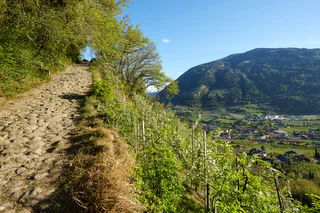
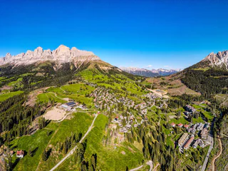
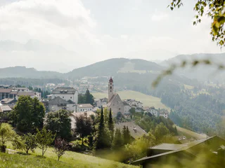
Südtirol Guide App Logo
Přeskočit na obsah

přidáno k oblíbeným

odebráno z oblíbených

Jejda! Došlo k problému, zkuste to prosím znovu

Vytváří se váš účet

Váš účet byl úspěšně vytvořen a nyní jste přihlášeni

Jste úspěšně přihlášeni!

Váš účet byl úspěšně vytvořen, ale nepodařilo se nám vás automaticky přihlásit

Jste odhlášeni

Filtr
Vybrané filtry
    Úroveň obtížnosti
    Doba trvání
    Vzdálenost v km
    Aktivity

    Všechny vysoké a dálkové turistické trasy

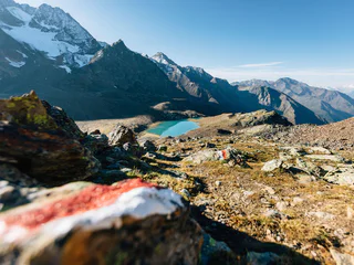
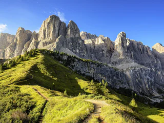
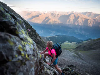
    Ať už vás zajímá úchvatný národní park Stilfser Joch, Dolomity zapsané na seznamu světového dědictví UNESCO nebo odlehlé Pfunderer Berge, vysokohorské a dálkové turistické trasy v regionu nabízejí možnost vícedenních túr, které vás zavedou od jedné horské chaty ke druhé úchvatnou krajinou. Tyto delší horské túry nabízejí ideální únik od nároků každodenního života a umožňují vám skutečně se odpojit a ponořit se do přírody.

    Výsledky
    Long-Distance Hiking Paths
    Multi-Day hike from the Catinaccio to the Sciliar - 2. Stage

    The second stage of the multi-day hike starts with the ascent to the Passo Cigolade. The descent from the pass leads to the Rif. Vajolet, the second accommodation. After the check-in an ascent to the Passo Santner is possible.


    Obtížnost: vysoká
    909 m nadmořská výška
    4h:04 min doba trvání
    Long-Distance Hiking Paths
    Dolomite Alpine Ridgeway No.1
    Prags/Braies, Dolomites Region 3 Zinnen
    This alpine path leads along the north - south route through the eastern Dolomites. During the course of the hike you will get to know interesting areas of the eastern Dolomites. The main route leads along an average height of 2.000m - so you have to expect high - alpine conditions. With the exception of the last sections, which can be bypassed on an easier path, experienced hikers will have no difficulties.

    Stages: 8 -12 days
    Obtížnost: vysoká
    6820 m nadmořská výška
    17h:00 min doba trvání
    Long-Distance Hiking Paths
    Multi-Day hike from the Catinaccio to the Sciliar - 3. Stage
    Völs am Schlern/Fiè allo Sciliar, Dolomites Region Seiser Alm

    The third stage starts with the crossing of the Passo Principe to the Alpe di Tires and to the Rif. Bolzano. The final effort to reach the peak of the Sciliar, the Monte Petz opens up a beautiful panorama to the surrounding mountains.


    Obtížnost: vysoká
    1038 m nadmořská výška
    4h:22 min doba trvání
    Long-Distance Hiking Paths
    European Long-Distance Trail E5, Meran 2000 to Jenesien
    Hafling/Avelengo, Meran/Merano and environs

    The European Long-Distance Hiking Trail E5 leads from the Atlantic Coast to the Adriatic Sea. One of the safest and most beautiful sections is from Meran 2000 to Jenesien/San Genesio.

    Obtížnost: střední
    473 m nadmořská výška
    5h:45 min doba trvání
    Long-Distance Hiking Paths
    European E5 long-distance trail: Hirzer Hut - Meraner Hut
    Hafling/Avelengo, Meran/Merano and environs

    The European hiking trail E5 is 3,200 kilometres long and leads from the Atlantic coast of France across the Alps to Venice. A highlight of the entire trail leads through the hiking area of Schenna, via the Hirzer Hut to the Meraner Hut on Meran 2000.

    The European long-distance hiking trail E5 is 3,200 kilometers long and leads from the Atlantic coast of France, over the Alps, to Venice. A section of the long-distance hiking trail number 5 runs through South Tyrol in four stages, one of which goes through the Hirzer hiking area. From the Hirzerhütte hut (1,980 m), which was inaugurated in 1874 as the first Alpine Club hut in South Tyrol, it goes over the Hirzerscharte to the Kratzberger See at 2,128 m and further to the Meraner Hütte hut.

    Obtížnost: vysoká
    1300 m nadmořská výška
    5h:30 min doba trvání
    Long-Distance Hiking Paths
    Romedius Pilgrim’s Trail in the Passeiertal Valley
    Moos in Passeier/Moso in Passiria, Meran/Merano and environs

    >> It's great to be walking, especially when swapping the daily grind for a holy place. <<

    From Thaur to San Romedio, on the Pilgrims' trail, one cannot but marvel at the spectacle of sanctuaries, wayside shrines, breath-taking landscapes, pastures and mountain crossings. Along its 180 km length with a difference in altitude of 9,800 m, the trail leads to the sanctuary of San Romedio in Trentino, with two stages passing through the Passeiertal Valley.

    Obtížnost: vysoká
    1900 m nadmořská výška
    14h:30 min doba trvání
    Long-Distance Hiking Paths
    Dolomites World Heritage Geotrail II - Stage 9: from the Plätzwiese High Plateau to the Dreizinnenhütte Hut
    Prags/Braies, Dolomites Region 3 Zinnen
    The ninth stage of the Dolomites World Heritage Geotrail II leads up the Rienztal valley to the Dreizinnenhütte hut in the shadow of the Three Peaks. This stage takes in a precise moment in the geological history of the Dolomites, namely when, 235 million years ago, after a period of intense volcanic activity, new reefs of algae, sponges and corals took root on the cores of the previous tropical atolls.

    More information: https://www.dolomitiunesco.info/attivita/dolomites-world-heritage-geotrail/?lang=en
    Obtížnost: střední
    1387 m nadmořská výška
    6h:04 min doba trvání
    Long-Distance Hiking Paths
    Dolomites High Route no. 2
    Brixen/Bressanone, Brixen/Bressanone and environs

    The Dolomites High Route no. 2 was among the first of 10 “official” Dolomites High Routes to be described and signposted. The High Route is also known as the "way of the legends" as it passes through Dolomites mountains and valleys rich in myths and legends: for example the Odle group and the Sella group with the legends of the Ladin people or Feltre with the tales of ogres and witches. The multi-day excursion can be completed in several stages going from north to south. Starting point is Bressanone/Brixen, the quaint town of South Tyrol, rich in history. Arrival is the town of Feltre with the river Piave, witness of some of the tragic events of World War I. The route crosses three provinces, Bolzano, Trento and Belluno and 10 mountain groups (Plose, Pütia/Peitlerkofel, Odle/Geisler, Puez, Sella, Padon, Marmolada, Bocche, Pala, Feltre group), among which Plose, Padon and the Lusia-Bocche group are not part of the Dolomites. The Dolomites High Route no. 2 offers a nice variety of hiking and climbing and the chance to discover art and culture. So, for example, it is worth a visit the city of Bressanone with its museums and works of art and, not to forget, the many historical sites of World War I that you meet along the way.

    Obtížnost: vysoká
    11723 m nadmořská výška
    11h:30 min doba trvání
    Long-Distance Hiking Paths
    Multi-Day hike from the Catinaccio to the Sciliar - 4. Stage
    Völs am Schlern/Fiè allo Sciliar, Dolomites Region Seiser Alm

    The fourth day begins with the descent from the sella Cavaccio trough the Orsara to San Cipriano. The valle Nigra path brings to the Passo Nigra and also back to the starting point Nova Levante.

    Obtížnost: vysoká
    772 m nadmořská výška
    6h:24 min doba trvání
    Long-Distance Hiking Paths
    Excursion Selva - Ciampinoi - Passo Sella
    Sëlva/Selva di Val Gardena, Dolomites Region Val Gardena
    From Selva you go up on path no. 27 to Ciampinoi, from where you then descend on path no. 21A towards the Comici hut. From there it goes through the Stone City on path no. 526 to the Sella Pass.
    Obtížnost: střední
    878 m nadmořská výška
    3h:37 min doba trvání
    Long-Distance Hiking Paths
    Excursion Selva - Passo Gardena
    Sëlva/Selva di Val Gardena, Dolomites Region Val Gardena
    From Selva / Plan path no. 654 starts in the direction of Passo Gardena via the beautiful Plans de Frea.
    Obtížnost: střední
    611 m nadmořská výška
    3h:28 min doba trvání
    Long-Distance Hiking Paths
    Multi-Day hike Rosegarden/Sciliar - 1. Stage
    Welschnofen/Nova Levante, Dolomites Region Eggental

    The first stage of the multi-day tour leads from Nova Levante to the sentiero Masarè/Hirzelsteig trail to the first night quarter, the Rif. Roda di Vael.

    Obtížnost: vysoká
    1221 m nadmořská výška
    5h:30 min doba trvání
    Long-Distance Hiking Paths
    Tirolo High Mountain Trail in the Passeiertal Valley
    Moos in Passeier/Moso in Passiria, Meran/Merano and environs

    The Alta Via Tirolo starts and ends in the tourist centres of Mayrhofen and Meran. Between the two, there are 130 km of hiking paths with ascents of 9000 m in total and descents of 10,000 m in total. It is possible to do this tour in 11 to 13 days.

    You are rewarded with breathtaking views of the impressive mountains of various characteristics. The ice giants of the Ziller Alps, the dark mountains of the main Alps, the pale Dolomite peaks of the Tribulaune, the high peaks of the Passeier Valley as well as the largest high Alpine group of lakes in South Tyrol and then of course, the apple orchards of Meran.

    The Tiroler Höhenweg/Alta Via Tirolo … Discover pure nature!

    Obtížnost: vysoká
    4105 m nadmořská výška
    23h:00 min doba trvání
    Long-Distance Hiking Paths
    Hoch Tirol Trail
    Prettau/Predoi, Ahrntal/Valle Aurina
    The Hoch-Tirol long-distance trail consists of three stages. It joins Prettau/Predoi, located at the end of the Ahrntal valley, with Prägraten am Großvendiger in Eastern Tirol. The South Tyrolean part of the trail crosses the Rieserferner-Ahrn Nature Park, while the East Tirolean stretch crosses the Hohe Tauern National Park. The 27,9-km trail boasts 1490 hm ascent and 1000 hm descent in South Tyrol.  
    Obtížnost: vysoká
    1659 m nadmořská výška
    9h:09 min doba trvání
    Long-Distance Hiking Paths
    Sellaronda Hike Tour
    Sëlva/Selva di Val Gardena, Dolomites Region Val Gardena
    With the Dolomiti SuperSummer Card, the famous Sellaronda ski tour is also walkable in July and August. The Sellaronda HIKE tour is fascinating because of the unique panorama of the four Ladin valleys and three Italian provinces around the Sella massif. Be aware, the tour is very long and requires good physical condition. Start early in the morning with the first lift and take a packed lunch with you.
    Not suitable for families.
    Obtížnost: vysoká
    3627 m nadmořská výška
    8h:00 min doba trvání
    1 2 3 4 5 6