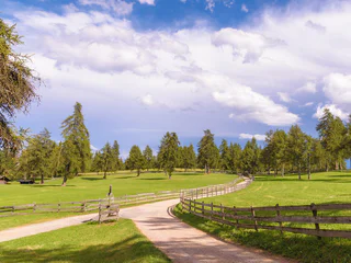
At every turn along the old railway path, you climb up to 2,000 metres in altitude.
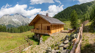
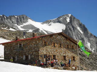
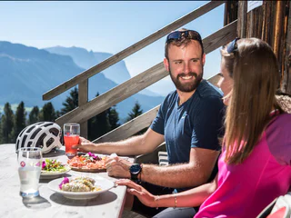
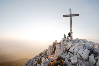
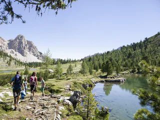
Whether you're interested in the breathtaking Stilfser Joch National Park, the UNESCO World Heritage Dolomites, or the secluded Pfunderer Berge mountains, the region's high-altitude and long-distance hiking trails provide an opportunity for multi-day hikes that take you through stunning landscapes from one mountain hut to another. These extended hikes in the mountains offer an ideal escape from the demands of everyday life, allowing you to truly disconnect and immerse yourself in nature.
Trail no.1- Suitable for pushchairs. Jenesien, departure from the sportsground on trail no. 33 or trail no.1. Walk along trail no. 1 or the E5 European long-distance walking trail trough the hilly landscape offered by the Salten, to then reach the little church of St. Jacob and Langfenn. Our Hikers' bus can drive xou back to Jenesien. Duration of the excursion: 2 hours and 30 minutes - Drop/rise: 440 m
The third stage of the circular hiking trail 360° Upper Vinschgau Valley trumps with unique views from the giant swing.
From Resia to Planol/Planeil:
Difference in height: 956 hm
Descent: 920 hm
Length: 20,5 km
Duration: 6 - 6,5h
In winter some sections of the route may be covered in snow or ice.
The path is not suitable for pushchairs.
Explore nature in the Val Casies Valles – a variant of the trail “Almweg 2000”
In the Val Casies Valley you find many beautiful alps, of which some also offer comfortable refreshment facilities. As the name "Almweg 2000" suggests, the trail leads on average about 2000 meters above sea level from hut to hut. Of the various access options, we recommend here the high-altitude hike with the most beautiful panorama and particularly rewarding flora from the Tscharnietalm alpine pasture in the south to the Uwald Alm hut in the north, which together with the ascent and descent form a closed circular hike, which of course can also be hiked in the opposite direction.
Starting point: Val Casies Valley / S. Maddalena
Distance: 15 km
Descent: circular hike
Walking time: 05:00 h
Difficulty: medium
Difference in altitude: 650m
Information: *alternative routes are possible www.suedtirolmobil.info - Lin. 441
The shortened variant of the eighth stage of the circular hiking trail 360° Upper Vinschgau Valley leads to the Tellajoch with a typical 360° panoramic view to the mountain peaks of the Ortler group and the Sesvenna group. The 360° viewing platform titles the mountainous panorama.
From there it continues with insights into the Upper Vinschgau Valleys alpine pasture to Schlinig/Slingia.
From the Glieshöfe farms to Tanas:
Difference in height: 780 hm
Descent: 1.060 hm
Length: 21,7 km
Duration: 6 - 6,5 h
The Hintereggalm forms part of the Tall pastures and has been used as a summer meadow for rearing local agricultural animals for generations. The area has been popular with the many hikers that visit it from an early stage, meaning that food and drink have been available at the Hinteregger Alm hut since the 1970s.
Along the way there are 12 stations, which were designed by the pupils of the local primary school. There are lots of small master pieces which were smoothly integrated into the landscape of the Salten high plateau. Each station tells you about a local fairy tale from the area of San Genesio. The stories and fairy tales about witches and similar legendary creatures have always excited the fantasy of children and adults alike. Examples of the many exciting stories are the explanation why the Castle Greifenstein is always called ”Sauerschloss“, the fairy tale of the sunken city, the endless ball of threads, the butter witch of Afing, how the Castle of Greifenstein got its name, the captured mermaid, and many more. Duration: approx. 2 hours Length: 7 km Starting point: Parking space Schermoos Destination: bus stop Straße Jenesien - Mölten
Idyllic mountain villages with a unique charm is what the second stage of the circular hiking trail 360° Upper Vinschgau Valley has to offer.
This three-day excursion takes you to the most fascinating places in the nature park Fanes-Senes-Braies. During this tour we also pass close to some mountain lakes such as the Fojedöra, Limo and Parom.
The eighth stage is the most demanding tour of the circular hiking trail 360° Upper Vinschgau Valley. The Tellajoch surprises with a typical 360° panoramic view to the mountain peaks of the Ortler group and the Sesvenna group. The 360° viewing platform titles the mountainous panorama.
From there it continues with insights into the Upper Vinschgau Valleys alpine pasture to Schlinig/ Slingia.
The newly created 360° Upper Vinschgau Valley is an adventure-packed circular hiking trail through the villages of the Upper Vinschgau Valley. For families and pleasure hikers the nine stages can be seen as individual hiking tips for day tours. Experienced hikers looking for a challenge can plan a hiking tour consisting of several stages.
At each stage interactive nature installations from local larch await young and grown-up hikers.
Along alpine meadows to the waterfall below the alpine hut Sesvenna leads the first part of the ninth stage of the circular hiking trail 360° Upper Vinschgau Valley. It continues on the high mountain trail to the mountain restaurant Plantapatsch and along the “Almenweg” path to Prämajur.
The High Route no. 1 winds along a route of approximately 125 km and 7,300 m of ascent, divided into 12 stages, connecting Lake Braies with Belluno. Here, ere two stages pass through the municipality of Marebbe
Stage no. 2 goes from the Biella hut to the one in Fanes. Exploring the pastures of Senes, Fodara and Fanes, it is often possible to see animals grazing. The stage can be walked in 3 hours.
Stage no. 3 goes from Fanes hut to Rifugio Lagazuoi.
Especially inviting for a break are the various mountain lakes that are encountered along the route. Crossing the plateau of Fanes is a unique experience that, during the hikes, brings to life the legend of the Kingdom of the Fanes. The third stage can be walked in 5 hours.
The High Route no. 2 consists of a distance of 180 km, divided into 13 stages, which connects Bressanone to Feltre. The itinerary touches the three provinces of Bolzano, Trento and Belluno.
Stage 2 goes from the Plose hut to Rifugio Genova, allowing trekkers to discover the wonders of the Puez-Odle Natural Park, often referred to as "Earth’s history book" due to its geological significance. Along the walk, the majestic Sasso Putia remains always in sight and offers many chances for a souvenir photo.
Stage 3 connects the Rifugio Genova to the Rifugio Puez. With an additional half an hour walk it is possible to climb to the top of Piz Duleda (2.909m), which offers a stunning view. Due to the multitude of rocks and interesting geological creations, the plateau of Puez is often compared to a moonscape.
On the Merano High Mountain Trail (trail n° 24), the entire Texel Group Nature Park can be circumnavigated in a hiking tour of four to six days. The best time to hike the Merano High Mountain Trail (trail n° 24) is: The northern part is a summer tour, walkable from the end of June to the beginning of October (depending on snow conditions). The southern and eastern sections can often be walked all year round and are suitable for one-day tours. The numerous typical South Tyrolean mountain inns and refuges inviting you to rest and have a snack, the varied world of peaks and the magnificent mountain lake landscape of the Spronserseen lakes make the Merano High Mountain Trail in the Texel Group Nature Park a unique hiking area!
The first part of the sixth stage of the circular hiking trail 360° Upper Vinschgau Valley runs along the animal forest path “Gumperle”. From there it goes past the Lichtenberg Castle to the medieval town of Glurns/ Gorenza.
Follow the E5 European long-distance trail or trail no. 1 and stop at the Gschnofer Stall restaurant. From here, walk along to Tomanegger and come back to the point of departure. Duration of the excursion: 3 hours - Drop/rise: 360 m
From San Martino in Monte to Stava/Staben:
Difference in height: 290 hm
Descent: 1.400 hm
Length: 13 km
Duration: 4 - 4,5 h
The eighth stage of the Dolomites World Heritage Geotrail II crosses the Senes plateau and reaches Prato Piazza along the northern side of the Croda Rossa d'Ampezzo. This stage invites you to observe the different forms that the relief takes around us: the peaks, the ridges, the valleys, the plateaus, the gorges, are all traces of the balance between erosion and tectonic uplift, which has been shaping the Dolomites for 30 million years.
Discover more: https://www.dolomitiunesco.info/attivita/dolomites-world-heritage-geotrail/
The Dolomites UNESCO Geotrail consists of 10 daily stages, focussing particularly on the Dolomites’ geological history.
The start of the fourth stage of the circular hiking trail 360° Upper Vinschgau Valley is the mountaineering village Matsch/ Mazia. Along this stretch, you will experience the numerous cultural highlights of the Upper Vinschgau Valley.
The Val Casies Valley especially has many beautiful alps, some of which also offer comfortable refreshment facilities. As the name "Almweg 2000" suggests, the route leads on average about 2,000 meters above sea level from the Hörneckele in S. Martino to the Tscharnietalm hut in S. Maddalena.
Total length: 26 km
Total hiking time: 10 hrs.
It is recommended to divide your hike along the trail in several stages and not walk the whole trail in one day. There are several access and descent options for the Almweg 2000.
The Val Venosta Alpine Ridgeway (Vinschger Höhenweg) in the Lower Vinschgau valley, from Stava/Staben to the source of the Etsch river at the Reschen Pass where three countries meet, is a true experience for passionate hikers. The stretch totals 108 km and follows existing and new footpaths, paths alongside "Waale" (historic irrigation canals) and connecting roads between farms.
The Alpine Ridgeway unites various stages that can be hiked as part of a multi-day tour or as a one-day excursion. The individual stages are easily accessible via access points in the villages in the valley. In order to help hikers keep their bearings, the entire Alpine Ridgeway is marked with a uniform red logo.
It is a truly remarkable experience to hike through the species-rich vegetation and impressive world of nature that could not be more filled with contrast. The trails on the Sonnenberg mountain feature diverse vegetation such as steppe grass and herbs. They also offer exciting views of the highest mountains in South Tyrol and the fertile valley below.
The best time for the hike is from April to October, although one should be aware that it can be very hot in summer.
Tip: special rates for the Val Venosta Alpine Ridgeway are available (B&B including luggage transport, hiking map of the ridgeway, return transport to the starting point).