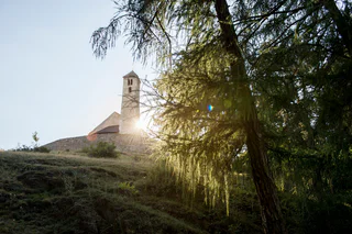
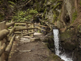
Skip to content

added to favourites

removed from favourites

Oops! Something went wrong. Try again

Your account is being created

Your account has been successfully created and you are now logged in

You’ve been logged in successfully!

Your account was created successfully, but we couldn't log you in automatically

You are logged out.

Filter
Selected filters
    Level of difficulty
    Duration
    Distance in KM

    Hiking trails in Vinschgau/Val Venosta

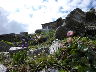
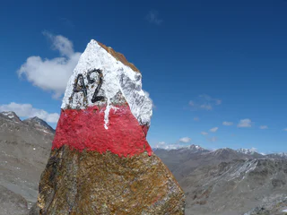
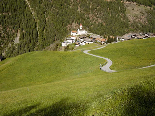
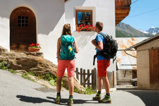
    Walking is the best way to enjoy wonderful stretches of greenery. During your spring in South Tyrol, you can witness the awakening of nature in the valley and on the alpine meadows in bloom. Midsummer days are equally surprising:  people are lured to mountain peaks, marvel at sweeping views and indulge in the traditional dishes served in quaint mountain huts. Go on a hike to watch the spectacle of autumn’s glorious colours and relax in nature.

    Results
    Summer
    "Turnaunawaal" irrigation channel path
    Taufers im Münstertal/Tubre, Vinschgau/Val Venosta

    Enjoy the serenity and spectacular views on this sunny trail in Taufers im Münstertal near Italy’s border with Switzerland and explore castle ruins, Romanesque buildings, and sacrificial stones.

    Water flow: from May
    Refreshment stop: in the inns in Taufers im Münstertal

    Difficulty: medium
    290 m elevation gain
    2h:10 min duration
    Long-Distance Hiking Paths
    Venosta Valley High Mountain Trail
    Schlanders/Silandro, Vinschgau/Val Venosta

    The Val Venosta Alpine Ridgeway (Vinschger Höhenweg) in the Lower Vinschgau valley, from Stava/Staben to the source of the Etsch river at the Reschen Pass where three countries meet, is a true experience for passionate hikers. The stretch totals 108 km and follows existing and new footpaths, paths alongside "Waale" (historic irrigation canals) and connecting roads between farms.

    The Alpine Ridgeway unites various stages that can be hiked as part of a multi-day tour or as a one-day excursion. The individual stages are easily accessible via access points in the villages in the valley. In order to help hikers keep their bearings, the entire Alpine Ridgeway is marked with a uniform red logo.

    It is a truly remarkable experience to hike through the species-rich vegetation and impressive world of nature that could not be more filled with contrast. The trails on the Sonnenberg mountain feature diverse vegetation such as steppe grass and herbs. They also offer exciting views of the highest mountains in South Tyrol and the fertile valley below.

    The best time for the hike is from April to October, although one should be aware that it can be very hot in summer.

    Tip: special rates for the Val Venosta Alpine Ridgeway are available (B&B including luggage transport, hiking map of the ridgeway, return transport to the starting point).

    Difficulty: difficult
    4852 m elevation gain
    33h:34 min duration
    Summer
    Almenweg trail
    Kastelbell-Tschars/Castelbello-Ciardes, Vinschgau/Val Venosta
    Circular hike to Freiberger Mahd and Marzoner Alm and back to the ‘Alte Säge’ car park.
    Difficulty: medium
    230 m elevation gain
    2h:45 min duration
    Summer
    Uina Gorge
    Mals/Malles, Vinschgau/Val Venosta

    Fascinating hike on the High Alpine Trail of Schlinig/ Slingia to Uina Gorge, unique 900 m long high route cut into the rock in 1908-1910.

    Difficulty: medium
    832 m elevation gain
    7h:00 min duration
    Summer
    Madonna di Senales - Lafetz Alm Hut
    Schnals/Senales, Vinschgau/Val Venosta
    Surrounded by a beautiful larch and Swiss stone pine forest, the 2019 new construated Lafetzalm hut lies at 2,015 m above sea level. After the ascent through the idyllic natural landscape, you will experience breathtaking views on the Similaun, the Ötztal Alps and the place of discovery of Ötzi, the Iceman.
    Difficulty: easy
    500 m elevation gain
    1h:48 min duration
    Summer
    Walking the path "Lottersteig"
    Prad am Stilfser Joch/Prato allo Stelvio, Vinschgau/Val Venosta

    This trail wanders through a well established path network through the meadows and forests above Prato. This hike offers an impressive view of the village of Prato as well as the of the whole upper and lower Venosta valley.

    Difficulty: medium
    397 m elevation gain
    2h:45 min duration
    Summer
    Tschengls Valley
    Prad am Stilfser Joch/Prato allo Stelvio, Vinschgau/Val Venosta

    Hike in the Stelvio national park with panoramic view of the opposite arid Monte Sole mountain.

    Difficulty: medium
    642 m elevation gain
    3h:19 min duration
    Summer
    Over Kreuzjöchl
    Martell/Martello, Vinschgau/Val Venosta

    This National Park hike starts in Göflan until the farm Haslhof. Enjoy the panoramic view of Val Martell, Lower Venosta Valley and Venosta Valley's Monte Sole mountain above the timberline.

    Difficulty: difficult
    1331 m elevation gain
    5h:30 min duration
    Summer
    Malga di Tarres
    Latsch/Laces, Vinschgau/Val Venosta

    Above Tarres you find the hike- & bikeparadise Tarres Alp. Hiker, extreme hiker or mountain biker are there in good hands. On the Laces Alp, Tarres Alp and the Mountain Restaurant Tarres Alp are served local specialities.

    Difficulty: easy
    0 m elevation gain
    2h:00 min duration
    Summer
    Urfichten circular hike
    Taufers im Münstertal/Tubre, Vinschgau/Val Venosta

    Family hike in a spruce wood, 3 ancient 400-500 year old spruces, 40 metres high, with a diameter of 175 cm and a circumference of 550 cm.

    Half a century ago, a dozen spruce patriarchs watched over Rifair. Now there are only 3 spruces that have "survived". However, the tranquillity of this natural oasis is still a delight. 

    Difficulty: easy
    96 m elevation gain
    1h:00 min duration
    Summer
    Lake Tarres tour
    Latsch/Laces, Vinschgau/Val Venosta

    From the parking area at the chair lift station Tarres on steep paths to the wonderful Lake Tarres.

    Difficulty: medium
    824 m elevation gain
    3h:19 min duration
    Summer
    Hike Along the Lasa Marble Trail – Schrägbahnsteig Trail
    Laas/Lasa, Vinschgau/Val Venosta

    The trail is located in the Stilfserjoch National Park and leads through a forest of spruce and larch.
    Five information boards provide information about the history of the inclined railway:

    the valley station and the construction of the incline railway from 1929
    technical data about the incline railway
    the St Martin church constructed in the 17th century, as well as marble transport in times before the construction of the incline railway when boulders were transported into the valley by means of brake slides,
    hemp-rope pulleys and flatbed wagons pulled by oxen 
    the mountain station with the machine house, the drive engine and the cylinder rope winch 
    a brief company profile of the marble works in Lasa and a list of the historical mining sites

    The hike can be done as a circular route, in combination with a visit to the “Gurgl” gorge in the lower Laaser Tal valley.
    This section of the hike is not recommended for those uncomfortable with heights. All others can go along the trail through the Laaser Tal valley.

    Difficulty: medium
    523 m elevation gain
    1h:49 min duration
    Summer
    Burgenweg trail
    Kastelbell-Tschars/Castelbello-Ciardes, Vinschgau/Val Venosta
    Circular hike from Tschars to Juval Castle and backCircular hike from the village square of Kastelbell, past the Köflgut, to the castle ruins of Hochgalsaun and back via the Latschander Waalweg to the village square of Kastelbell.
    Difficulty: medium
    219 m elevation gain
    2h:00 min duration
    Summer
    Latschanderwaal irrigation channel path
    Latsch/Laces, Vinschgau/Val Venosta

    Hike along the Latschander Waalweg canal. The "Waale" are irrigation systems and the water was drained and fed into the canals so that meadows and fields could be irrigated.

    Difficulty: easy
    0 m elevation gain
    2h:30 min duration
    Summer
    Jochwaal di Tarres
    Latsch/Laces, Vinschgau/Val Venosta
    A unique loop trail: Sure-footedness is required to reach this Waal trail, one of the highest in the entire Alps. Tarscher Jochwaal, no longer in use nowadays, was originally built in the 18th century.

    Refreshment stop:
    Latscher Alm hut, Tarscher Alm hut and Tarscher Alm mountain restaurant

    Water course:
    No water flow
    Difficulty: medium
    689 m elevation gain
    2h:40 min duration
    Summer
    Tip 1: Natur-Mythenweg path
    Kastelbell-Tschars/Castelbello-Ciardes, Vinschgau/Val Venosta
    Circular hike from Kastelbell to the Schalenstein and the Klumperplatte and back to the Kastelbell village square
    Difficulty: medium
    431 m elevation gain
    2h:30 min duration
    Summer
    Watles Valley Station - Höfer Alpine Hut - Plantapatsch Alpine Hut
    Mals/Malles, Vinschgau/Val Venosta

    Excursion to the Plantapatsch Alpine Hut with a beautiful view to the valley and the mountains around
    From the parking lot at the Watles family ski area’s valley station (1750 m),
    follow the trail signs (ca. 200 m) in the direction Höfer group Prämajur
    (food service), on the well-marked hiking trail through the wintery larch and
    pine forest up to the Höfer hut (2010 m, refreshments). On to the
    Plantapatsch Alpine Hut (refreshments). The way home follows the same
    trail back to the starting point.

    Difficulty: medium
    420 m elevation gain
    2h:30 min duration
    Summer
    Hike along the Covelano marble trail
    Martell/Martello, Vinschgau/Val Venosta

    The Göflaner Marble Trail leads from "Kohlplätze" to the Göflaner marble quarry, known as "Mitterwandlbruch". Although the cave itself is out of bounds for security reasons, this 11-stage theme path tells the story of marble extraction in Göflan.

    Difficulty: medium
    1079 m elevation gain
    3h:32 min duration
    Summer
    Schnalswaal irrigation channel
    Kastelbell-Tschars/Castelbello-Ciardes, Vinschgau/Val Venosta
    Circular hike from Tschars to Juval Castle and back again to village Tschars
    Difficulty: easy
    244 m elevation gain
    3h:00 min duration
    Summer
    From St. Martin to Schlanders
    Latsch/Laces, Vinschgau/Val Venosta

    Monte Sole San Martino/ Sonnenberg St. Martin -Silandro/Schlanders This hike features unique panoramic views of the Val Venosta/Vinschgau Valley and Stelvio National Park. From Laces via the cable car to S. Martino in Monte. From the mountain cable car Station westwards, along the farm road to trail No. 14 towards Silandro. Passing the ruins of the Laggar and Zuckbühel farms and crossing the suspension bridge (70 meters long), it leads down the Tappein farm road and on to trail No. 14 to the Silandro Sport and recreational area. Alternative route: From the Tappein farm road, hikers can take trail No. 7 to Schlandersberg Castle and take the Ilswaal Irrigation channel path leading downhill to Corzes. This alternative route lengthens the hike by an 1 hour 30 min.

    Difficulty: medium
    182 m elevation gain
    4h:00 min duration
    Summer
    Madonna di Senales/Unser Frau - Mouontain pasture Mastaun
    Schnals/Senales, Vinschgau/Val Venosta

    The mountain pasture Mastaun (open from the beginning of May to the end of October) is in the eponymous high mountain valley that branches off near Madonna di Senales/Unser Frau west of the Schnalstal Valley and extends up to a crown of 3000 m-peaks. A stream of crystal-clear water runs through the valley. The farmstead Mastaunhof, to which the mountain pasture belongs, was recorded in documents as early as 1356 and is one of the largest farms in the Schnalstal Valley. The pastures surrounding the mountain passture are unusually well-tended and simply magnificent. There are indications that many centuries ago the mountain pasture Mastaun was already in operation all year round.

    Difficulty: medium
    319 m elevation gain
    1h:10 min duration
    Summer
    Unterstell Naturno/Naturns - Mountainhut Vorderkaser
    Naturns/Naturno, Vinschgau/Val Venosta

    The entire Merano High Mountain Trail (no. 24), one of the most stunning trails in the entire Alpine region, is 100 km in length, requires four to six days of hiking and is accessible from the beginning of July to the end of September (depending on the snow situation). At a relatively consistent altitude, this trail connects, to an extent, the high mountain climate of the Texel Group and the sub-Mediterranean climate of the Etschtal Valley. The hike through the various segments gives us a good insight into the world of the mountain farmers who worked to create and maintain this mountain and cultural landscape over the centuries.

    Difficulty: medium
    560 m elevation gain
    4h:19 min duration
    Summer
    Uina Gorge to Sur-En
    Vinschgau/Val Venosta

    On the Smugglers paths - fascinating hike along the Schlinigtal valley high mountain trail to Uina gorge, a unique trail from 1908 - 1910 hewn in rock about 900 m long.

    Difficulty: medium
    339 m elevation gain
    6h:30 min duration
    1 2 3 4 5 6 7 8 9 10 11 12