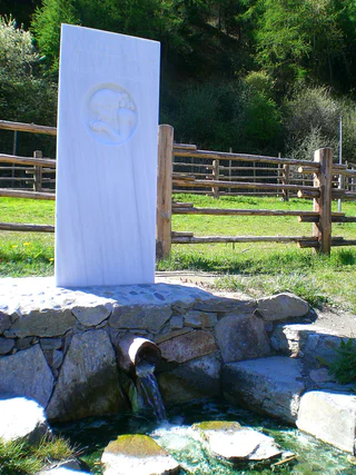
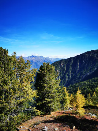
Przejdź do treści

dodano do ulubionych

usunięto z ulubionych

Coś poszło nie tak! Wystąpił problem. Spróbuj ponownie

Twoje konto jest właśnie tworzone

Twoje konto zostało pomyślnie utworzone i jesteś teraz zalogowany

Zalogowałeś się pomyślnie!

Twoje konto zostało pomyślnie utworzone, ale nie mogliśmy zalogować Cię automatycznie

Jesteś wylogowany

Filtr
Wybrane filtry
    Poziom trudności
    Czas trwania
    Odległość w km

    Wędrówki i wspinaczka w Vinschgau

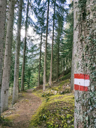
    Krajobraz to dar, który najlepiej odkrywać pieszo. W południowotyrolską wiosnę podziwiasz budzącą się do życia przyrodę w dolinie i na kwitnących halach, latem czekają na Ciebie przewiewne szczyty, warte odwiedzenia schroniska górskie i wysokogórskie trasy wędrówkowe. Jesienne wędrówki zachwycają wspaniałymi widokami i intensywnymi kolorami natury.

    Wyniki
    Waalwege
    "Kaandlwaal" irrigation channel path
    Martell/Martello, Vinschgau/Val Venosta
    At Kaandlwaal, which is still used for irrigation, hollow tree trunks (Kaandln) were joined together to channel water down from the mountains, and the Kaandlwaal trail winds up steeply right beside it.
    Poziom trudności: łatwy
    239 m wysokość w górę
    1h:30 min czas trwania
    Waalwege
    "Soywaal" irrigation channel path
    Martell/Martello, Vinschgau/Val Venosta
    An enjoyable hike and a spectacular Waal now put back in use: Soywaal trail
    begins at the Soybach stream at an altitude of 1,950 metres and ascends steeply
    through inaccessible terrain to Reitgraben.

    Refreshment stop:
    June–September

    Water flow:
    In the inns in Martelltal valley
    Poziom trudności: łatwy
    215 m wysokość w górę
    1h:15 min czas trwania
    Themed Hikes
    "Stabnerwaal" irrigation channel path
    Naturns/Naturno, Vinschgau/Val Venosta

    The Stabner Waalweg trail is one of the most beautiful hikes at Sonnenberg mountain in Vinschgau valley. This family-friendly route pairs perfectly with a visit to Juval castle.

    Poziom trudności: łatwy
    160 m wysokość w górę
    2h:00 min czas trwania
    Long-Distance Hiking Paths
    Alpine pastures panorama tour
    Mals/Malles, Vinschgau/Val Venosta

    The fantastic Alpine pasture panorama tour starts in the Schlinig Valley and continues via the Planatapatsch hut on the Watles adventure mountain to the Sesvenna mountain hut. Constantly accompanied by a marvellous panorama, this tour is a real treasure for all hiking and nature enthusiasts.

    Poziom trudności: średni
    665 m wysokość w górę
    5h:00 min czas trwania
    Long-Distance Hiking Paths
    Family hike Watles
    Mals/Malles, Vinschgau/Val Venosta

    A leisurely hike on the Watles adventure mountain. Perfect for families, this tour leads from the Plantapatsch mountain hut through the picturesque forests of Watles.

    Poziom trudności: łatwy
    132 m wysokość w górę
    1h:19 min czas trwania
    Hiking
    Jochwaal di Tarres
    Latsch/Laces, Vinschgau/Val Venosta
    A unique loop trail: Sure-footedness is required to reach this Waal trail, one of the highest in the entire Alps. Tarscher Jochwaal, no longer in use nowadays, was originally built in the 18th century.

    Refreshment stop:
    Latscher Alm hut, Tarscher Alm hut and Tarscher Alm mountain restaurant

    Water course:
    No water flow
    Poziom trudności: średni
    689 m wysokość w górę
    2h:40 min czas trwania
    Long-Distance Hiking Paths
    Marble Circuit Trail
    Martell/Martello, Vinschgau/Val Venosta

    This multi-day hike at high altitude is through the tree linein the Stelvio National Park.Twisting its way around the imposing Laas/Lasa mountains,the breath-takingMarble Circuit Trailhas a total length of 80 km. Part of the formidable Ortler Alps, this spectacular mountain range is internationally renowned for its unusual pure-white Laas/Lasa marble. With stops along the way the circuit trail can be hiked in one go or split into six single-day stages.

    Lining the Marble Circuit Trailare several panels delineating the rich natural diversity found along the trail. Each of these 30 info panels is centred on a specific theme. A further 10 orientation placards offering descriptions of the start and end of the trail are positioned at strategic points along the trail.

    Poziom trudności: trudny
    4164 m wysokość w górę
    36h:00 min czas trwania
    Themed Hikes
    Herbal path Flora TraFul
    Stilfs/Stelvio, Vinschgau/Val Venosta
    A world of medicinal and edible herbs grow on our doorstep.

    Along the Flora TraFul wild herb trail you’ll find information about our unique alpine plants and their multiple uses. The purpose of the Flora TraFul nature trail is to vividly illustrate how herbs are used in traditional folk medicine. Along the two-km-long hike, the rudiments of identification are explained, as well as the essentials of plant foraging, insights into herb processing, and the effects produced by some of the herbs.

    Starting point of the hike is the naturatrafoi Visitor Centre of Stelvio National Park, or at the bus stop.
    Poziom trudności: łatwy
    0 m wysokość w górę
    1h:40 min czas trwania
    Waalwege
    "Turnaunawaal" irrigation channel path
    Taufers im Münstertal/Tubre, Vinschgau/Val Venosta

    Enjoy the serenity and spectacular views on this sunny trail in Taufers im Münstertal near Italy’s border with Switzerland and explore castle ruins, Romanesque buildings, and sacrificial stones.

    Water flow: from May
    Refreshment stop: in the inns in Taufers im Münstertal

    Poziom trudności: średni
    290 m wysokość w górę
    2h:10 min czas trwania
    Hiking
    Winter hike Kulturpromenade Trail Solda
    Stilfs/Stelvio, Vinschgau/Val Venosta

    The panoramic hiking trail in the holiday region at the foot of Ortler mountain leads through the Sulden valley basin. Information boards and signs along the route relate the history of Sulden, while wooden figures and installations turn this walk into an immersive experience. Get ready to enjoy beautiful mountain panoramas amidst the glistening snow.

    Poziom trudności: łatwy
    172 m wysokość w górę
    2h:04 min czas trwania
    Waalwege
    "Latschanderwaal" irrigation channel path
    Latsch/Laces, Vinschgau/Val Venosta
    Latschanderwaal Trail shows how vital water was for the farmes: parts of the channel are cut into rock. This longer but level trail leads from Latsch to Kastelbell.

    Refreshment stop: 
    Bar at the cableway station 
    Restaurants at Laces and Castelbello

    Water course: 
    april-october
    Poziom trudności: łatwy
    65 m wysokość w górę
    1h:30 min czas trwania
    Themed Hikes
    "Wurzelweg" Trail
    Stilfs/Stelvio, Vinschgau/Val Venosta

    The "Wurzelweg" is a steep, almost vertical path in a beautiful mountain forest in the Stelvio National Park. The wooden sculptures along the path were installed by Toni Reinstadler in 2010. The path leads to the Orso/Langenstein mountain station, overcoming 400 meters in altitude.

    Poziom trudności: średni
    470 m wysokość w górę
    2h:00 min czas trwania
    Waalwege
    "Kastanienwaal" irrigation channel path
    Schlanders/Silandro, Vinschgau/Val Venosta
    Schlanderser Sonnenpromenade, the sun trail, lives up to its name, winding along Sonnenberg mountain, home to Mediterranean plants and chestnut trees, and through orchards down in the valley.

    Refreshment stop: In the inns in Schlanders
    Water flow: May-October
    Poziom trudności: łatwy
    70 m wysokość w górę
    0h:31 min czas trwania
    Long-Distance Hiking Paths
    Seppele Tour
    Mals/Malles, Vinschgau/Val Venosta

    The Seppelesteig tour is a leisurely circular hike where you can enjoy the idyllic scenery of Slingia and the green forests of Watles.

    Poziom trudności: średni
    320 m wysokość w górę
    2h:49 min czas trwania
    Hiking
    Uina Gorge
    Mals/Malles, Vinschgau/Val Venosta

    Fascinating hike on the High Alpine Trail of Schlinig/ Slingia to Uina Gorge, unique 900 m long high route cut into the rock in 1908-1910.

    Poziom trudności: średni
    832 m wysokość w górę
    7h:00 min czas trwania
    Themed Hikes
    Schnalswaal irrigation channel
    Kastelbell-Tschars/Castelbello-Ciardes, Vinschgau/Val Venosta

    Schnalswaal irrigation channel has been in use for more than 500 years and offers plenty to see: a Waalerhütte hut, a functional Waalschelle bell, chestnut woods, steppic vegetation, and, of course, Juval castle.

    Poziom trudności: łatwy
    300 m wysokość w górę
    3h:00 min czas trwania
    Waalwege
    Raminiwaal irrigation channel path
    Latsch/Laces, Vinschgau/Val Venosta
    Discover old ruins, chimes, and picnic areas at Raminiwaal Trail in the Untervinschgau region. This pleasant, almost level trail connecting Tarsch and Morter is nicely shaded and offers plenty to explore.

    Refreshment stop:
    Knofelkeller in Tarres
    Zum Riesen in Tarres
    Restaurants in Laces

    Water course:
    May-October
    Poziom trudności: łatwy
    0 m wysokość w górę
    0h:54 min czas trwania
    Waalwege
    Irrigation channel path "Frauwaal"
    Prad am Stilfser Joch/Prato allo Stelvio, Vinschgau/Val Venosta

    A perfect family hike: Frauwaal trail gently winds its way up from Prad to Lichten-
    berg, offering stunning views of Vinschgau valley and one of the largest castle 
    grounds in the country.

    Possibility of stopping for refreshments: In the taverns of Montechiaro and Prato
    No water flow

    Poziom trudności: łatwy
    234 m wysokość w górę
    2h:30 min czas trwania
    Hiking
    Alpine pastures tour Laces
    Latsch/Laces, Vinschgau/Val Venosta

    It is best to take the challenging 20.5 km long tour of the Laces and Tarres Alpine pastures between early June and early October.

    Poziom trudności: trudny
    1310 m wysokość w górę
    8h:00 min czas trwania
    Long-Distance Hiking Paths
    Long distance hike 2nd stage: Chamonna Tuoi CAS - Ardez
    Vinschgau/Val Venosta
    The second stage starts on the Chamonna Tuoi CAS and leads over the Lai Blau to Alp Sura and along the tree line to the village of Ardez, with its striking "Steinsberg".


    The route starts below the mighty Piz Buin in the direction of the picturesque Lai Blau (2,613 m above sea level), where it is worth taking a short break. Along the western flank you reach Alp Sura, which offers the ideal view for a short lunch break. Above the tree line with a magnificent view of the Lower Engadine and the unique villages, you hike via the hamlet of Munt d'Ardez to Ardez, the second stage destination.
    Poziom trudności: średni
    435 m wysokość w górę
    4h:19 min czas trwania
    Hiking
    Suspension Bridge Solda
    Stilfs/Stelvio, Vinschgau/Val Venosta

    The suspension bridge in Solda is 44 metres long and is 22 metres above the ground. It connects path no. 2, which leads to the Hintergrathütte, with path no. 1, which leads to the Schaubachhütte/Madritschhütte. The thunderous masses of water under the bridge give the crossing that certain something.

    Poziom trudności: średni
    185 m wysokość w górę
    0h:54 min czas trwania
    Snowshoe Hikes
    "Suachbichl" viewpoint
    Martell/Martello, Vinschgau/Val Venosta

    Discover the area of the Kondlwaal (wooden irrigation channel) and sunny Selva from Europe’s highest corn farm.

    Poziom trudności: łatwy
    269 m wysokość w górę
    1h:33 min czas trwania
    Hiking
    Marmotta peak
    Stilfs/Stelvio, Vinschgau/Val Venosta

    One of the classics in the Val Martello: glacier tour with fantastic views of the triumvirate of Königsspitze, Monte Zebru and Ortler as well as the Val Martello mountain Zufallspitze and Monte Cevedale.

    Poziom trudności: trudny
    1210 m wysokość w górę
    8h:45 min czas trwania
    Hiking
    Malga Soy
    Martell/Martello, Vinschgau/Val Venosta

    Relaxing hike to the rustic Malga Soy in Val Martello

    Start at the Hölderele parking in Val Martello and take the path through the forest and then path no. 4 to continue on a large forest road. You then reach a very steep part with few bends. Afterwards, you get to a bridge and then there is another short ascent. Before jumping on the fresh, green meadows you have to climb the last slightly steep ascent. The rustic Malga Soy is immersed in the green at the end of the meadow.

    Poziom trudności: średni
    598 m wysokość w górę
    2h:22 min czas trwania
    1 2 3 4 5 6 7 8 9 10 11 12