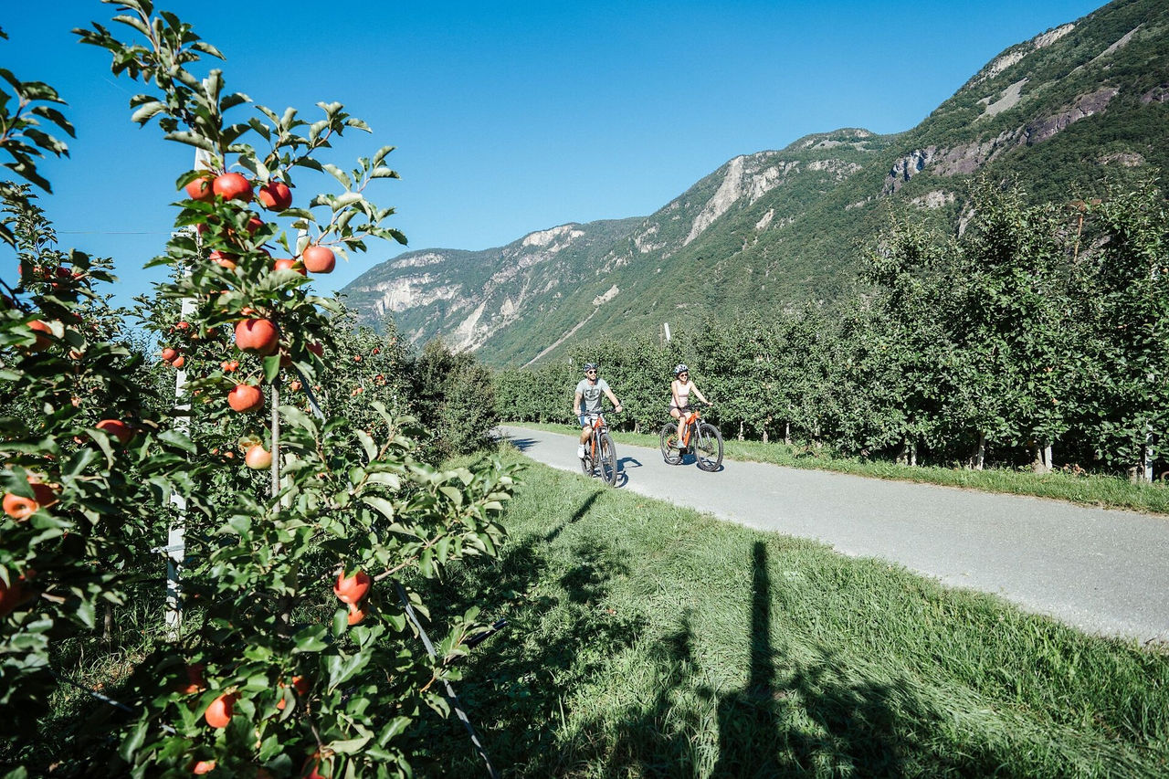
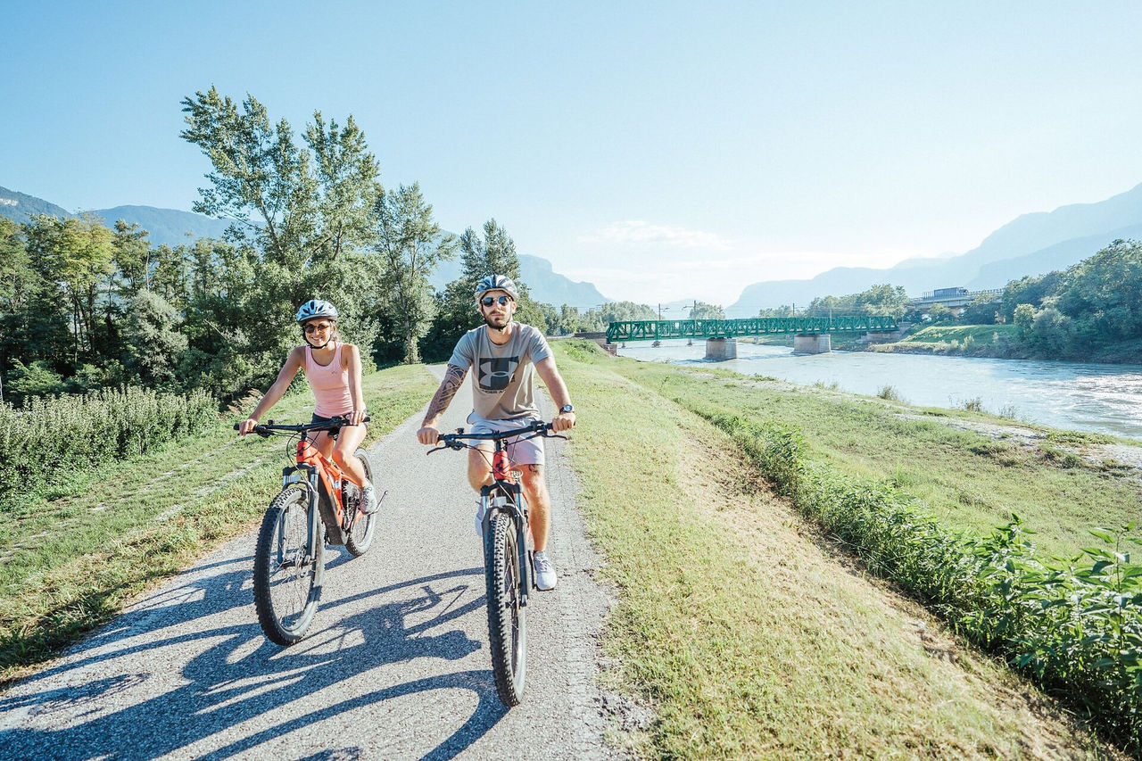
Skip to content

added to favourites

removed from favourites

Oops! Something went wrong. Try again

Your account is being created

Your account has been successfully created and you are now logged in

You’ve been logged in successfully!

Your account was created successfully, but we couldn't log you in automatically

You are logged out.

Filter
Selected filters
    Level of difficulty
    Duration
    Distance in KM

    Cycle routes in Bolzano/Bozen and environs

    You can travel long distances on a bike, feel a sense of freedom and warm up for the best adventures. Experience the thrill of discovering new places on two wheels in South Tyrol, where the cycling season starts as early as March. If you are a hardened cyclist, you’ll have your best time cycling on pass roads and on the valley cycle route. You’ll surely find a wealth of family-friendly excursions through South Tyrol’s unique cultural landscape and if you hop on the e-bike, you’ll probably travel even further.

    Results
    Mountain bike
    Moutainbiketour I Oberbozen - Rittner Horn
    Ritten/Renon, Bolzano/Bozen and environs
    From Soprabolzano to Monte del Lago Nero and the Rittner Horn.
    From the mountain station of the Ritten cable car in Oberbozen, you climb up through forests and meadows to Pemmern. The cable car takes you up to Schwarzseespitze (2,069 m). Attractive views and great panoramas accompany us on the little road, which climbs up to the Rittner Horn at 2.260 m with its namesake mountain hut.
    A beautiful two-wheeled tour with the summit of the high plateau to the Riviera of the Dolomites.
    Difficulty: medium
    681 m elevation gain
    28.9 Km distance
    E-Bikes
    Southern Wine Route
    Kurtatsch an der Weinstraße/Cortaccia sulla Strada del Vino, Bolzano/Bozen and environs
    The Southern Wine Route is a cycling tour of approximately 40 kilometers through the southernmost wine-growing regions of South Tyrol. It starts in the historic wine village of Kurtatsch/Cortaccia and passes through Margreid/Magrè, Kurtinig/Cortaccia, and Salurn/Salorno, the southernmost municipality of South Tyrol. The route then continues to Neumarkt/Egna and Auer/Ora before returning to Kurtatsch.
    Difficulty: medium
    163 m elevation gain
    41.3 Km distance
    Mountain bike
    Mountainbike-Tour IV Oberbozen - Rittner Horn
    Ritten/Renon, Bolzano/Bozen and environs
    From the mountain station of the cable car, the Schwarzsee Spitze along the beautifully laid out alpine path the wide alpine pastures between Unterhorn and the Rittner Alm, until at the Gasteiger Sattel you can look far into the mountain world of the Dolomites and Sarntal Alps. A beautiful mountain bike tour on comfortable paths with lots of panoramic views and several places to stop for refreshments.
    Difficulty: medium
    704 m elevation gain
    32.5 Km distance
    E-Bikes
    Maria Saal - Bad Siess - Tann
    Ritten/Renon, Bolzano/Bozen and environs
    This mtb-route on the Ritten starts in Maria Saal and leads to Bad Siess and on to Tann. There the route joins mtb-route 393. No technical demands, mainly on roads with little traffic and forest paths.
    Difficulty: easy
    321 m elevation gain
    4.1 Km distance
    Cycling
    Wine & bike: The Wine Road
    Bolzano/Bozen, Bolzano/Bozen and environs
    The circular bike tour leads through some of the most famous and beautiful historical wine villages along the South Tyrolean Wine Road, Cornaiano/Girlan, Appiano/Eppan, and Caldaro/Kaltern, well-known for their Pinot Blanc wine.

    From Bolzano follow the bike trail that leads to Cornaiano, a historical wine village featuring underground cellars that take up more space than the village itself. The next stage is San Michele/St. Michael, the actual centre of the Appiano castle region. A visit to the wineries in this outstanding wine region is really worthwhile. The wine route now leads back to Caldaro by the lake, famous not only for the wine named after the Kalterer See, but also because it is one of the most well-known wine villages in the province. The route then leads to the village Ora/Auer and from here returns to Bolzano following the Adige/Etsch river.
    Difficulty: medium
    436 m elevation gain
    49.2 Km distance
    E-Bikes
    Auer/Ora - Kalterer See Round
    Auer/Ora, Bolzano/Bozen and environs

    The bike tour from Auer to Lake Kaltern passes through vineyards and orchards. After a gentle ascent, you reach the lake and can enjoy the magnificent view.

    Difficulty: medium
    209 m elevation gain
    17.9 Km distance
    E-Bikes
    From Laives to Chiusa and Bressanone
    Brixen/Bressanone, Bolzano/Bozen and environs

    Cycle tour of approx. 55 km along the Brennero-Bolzano cycle route from Laives/Leifers along the Adige and Isarco rivers to Chiusa/Klausen and Bressanone/Brixen.

    Difficulty: medium
    465 m elevation gain
    56.2 Km distance
    E-Bikes
    By bike from gentle vineyards to the majestic Dolomites – from Egna to Castelrotto
    Kastelruth/Castelrotto, Bolzano/Bozen and environs

    The bike tour from Egna to Castelrotto offers fantastic views and a truly unique experience of South Tyrol’s landscape. From Egna, you’ll cycle along the scenic South Tyrolean Wine Road. Your destination, Castelrotto, is a charming village nestled at the foot of the Dolomites. Its historic center, with narrow alleyways and a striking church tower, invites you to soak in the local atmosphere. From here, you’ll enjoy breathtaking views of the surrounding Dolomites – well worth every bit of effort along the way.

    The starting point is easily accessible by train, and bikes are allowed on board. Unfortunately, buses do not transport bicycles. We recommend continuing from Castelrotto to Ponte Gardena (see Castelrotto–Vipiteno tour) to catch the train back from there.

    Difficulty: difficult
    1344 m elevation gain
    55.4 Km distance
    Cycling
    From Bolzano to Merano
    Algund/Lagundo, Bolzano/Bozen and environs
    Da Bolzano è possibile raggiungere Merano grazie alla pista ciclabile che passa attraverso i meleti e segue il percorso del Fiume Adige. Il tour passa vicino a Castel Firmiano, Terlano e Gargazzone. Superato Postal si arriva a Sinigo e subito dopo a Merano.

    You can reach Merano by bike thanks to the wonderful cycle path that runs thourgh the apple plantages and along the river Adige/Etsch. The tour also pass by Castle Firmiano/Sigmundskron, Terlano and Gargazzone. After Postal/Burgstall you will reach sinigo/Sinich and then Merano.

    If you rent your bike at the “Südtirol Rad” rental point in Bolzano, you may give it back at that company’s rental point in Merano so you can return by train to Bolzano. For the latter option, you may want to purchase the Bikemobil Card, which combines two different offers: unlimited travelling on all of South Tyrol’s means of public transport and a day trip on a borrowed bicycle.
     
    If you ride your own bicycle you can bring it with you on the train. The daily ticket for the bike costs € 7.
    Difficulty: easy
    77 m elevation gain
    33.4 Km distance
    Mountain bike
    Mountainbike-Tour II - Oberbozen - Rittner Horn
    Ritten/Renon, Bolzano/Bozen and environs
    Always on wide forest and alpine paths, you reach Riggermoos to Tann and on to Pemmern. From there, the traffic-calmed road leads to Rosswagen and through stone pine forests to Schönalm and along the beautifully laid out alpine path to the summit of the Rittner Horn at 2,260 m, where a unique panoramic view opens up.
    Difficulty: medium
    1216 m elevation gain
    33.6 Km distance
    Mountain bike
    Mountainbike-Tour III Oberbozen - Gasteiger Sattel
    Ritten/Renon, Bolzano/Bozen and environs
    The clearly visible stone walls along the trail bear witness to an alpine pasture dispute between Ritten and Villanders that was fought out here for over 500 years The beautifully laid out alpine pasture trail leads below the summit of the Rittner Horn to the Gasteiger Sattel. A long, therefore moderately difficult mountain bike tour in the Sarntal Alps with unforgettable views of the Dolomites.
    Difficulty: medium
    1200 m elevation gain
    36.9 Km distance
    Cycling
    Weinstraße - Vino 50
    Margreid an der Weinstraße/Magrè sulla Strada del Vino, Bolzano/Bozen and environs
    The Weinstraße Vino 50 runs through a beautiful wine region with gentle hills and vineyards. Along the way, there are wineries and places to stop for a break. The route is ideal for those who want to combine nature and enjoyment.
    Difficulty: medium
    172 m elevation gain
    41.6 Km distance
    E-Bikes
    Mölten- Schlaneid- Cable Car to Vilpian- Terlan- Mölten
    Mölten/Meltina, Bolzano/Bozen and environs
    A nice tour with the road bike from Mölten to Schlaneid, with the cable car to Vilpian from there the state road to Terlan and back to Mölten.
    Line 203: Cable car Vilpian- Mölten

    www.suedtirolmobil.info
    Line: 203 - Cable car - Vilpian/Mölten  
    Difficulty: medium
    1476 m elevation gain
    43.5 Km distance
    Long-distance cycle track
    Day Trip to Trento
    Laives/Leifers, Bolzano/Bozen and environs

    A leisurely day trip along the Adige cycle route to the beautiful city of Trento.

    Difficulty: medium
    123 m elevation gain
    56.4 Km distance
    E-Bikes
    Circuit Klobenstein - Lengmoos
    Ritten/Renon, Bolzano/Bozen and environs
    A mtb route runs as a ring route between the railstation Klobenstein to Lengmoos and from there to the Ritten Arena or the nearby starting point of the tour.
    Difficulty: easy
    68 m elevation gain
    2.4 Km distance
    Cycling
    Bolzano's bike routes
    Bolzano/Bozen, Bolzano/Bozen and environs
    A bike ride past the main sights of the town and its surroundings

    The beginning of our Bolzano bike-tour is the Talvera/Talfer bridge. We follow the cycle-lane along the left-hand bank of the river, going northwards, passing idyllic Castle Mareccio/Maretsch, nestling in the vineyards, up to Sant'Antonio/St. Anton, where the valley begins to narrow, and on to the fairy-tale Castle Roncolo/Runkelstein with its amazing frescoes. After visiting the castle (leave your bike in the bike-park below, before walking up the short but steep path to the castle), you make your way back to the Talfer bridge. At the Piazza Vittoria/Siegesplatz you could visit the new museum-display entitled "BZ 18-45" in the crypt of the Victory Monument. Then we cycle down the Corso Libertá/Freiheitsstrasse to the square of Gries, formerly a village-municipality in its own right and an internationally-renowned spa. The square is dominated by the massive baroque parish church and Benedictine monastery. Nearby is the old parish church of Gries with its romantic cemetery outside and a gem of Gothic wood-carving inside, the beautiful altar by Michael Pacher. From Gries we take the Vittorio Veneto street westwards. For the first 100 metres you will really need to pay attention to the traffic until you hit the cycle lane again. You then pass farms and vineyards before you come to the hospital.  Here the cycle lane forks and you head for the Via Druso/Drususstraße. At the big roundabout follow the signs for Appiano/Eppan as far as the bridge, then take the cycle lane to Castle Firmiano/Sigmundskron and the Messner Mountain Museum. The way back follows the bank of the Isarco/Eisack river, passing below several bridges. After the swimming pool complex we turn left just before the yellow iron bridge, now following the Talvera river until we come opposite the futuristic glass cube of the Museion modern art gallery. We are now back in the town centre, but we have to watch out: the Via Museo/Museumstraße, the Piazza Erbe/Obstplatz and the Piazza Walther Platz are pedestrianized and closed to cyclists, so that means pushing the bike. If you still have got some energy left, you could visit the Ötzi Museum, the Civic museum or the Natural History Museum.

    Difficulty: easy
    153 m elevation gain
    18.8 Km distance
    Long-distance cycle track
    Bike Trail Via Claudia Augusta
    Graun im Vinschgau/Curon Venosta, Bolzano/Bozen and environs
    After 2000 years of history, Via Claudia Augusta, the ancient Roman road that led from the Po River lowlands and the Adriatic Sea all the way to Bavaria and the Danube, is enjoying a renaissance. With the end of conflict and a united Europe, the Via Claudia Augusta has become a bridge joining and blending cultures, places and emotions. It is a symbolic route that spans three nations, each with its own diverse landscape and traditions, artistic treasures and culinary specialities, marked by a more approachable, youthful and ecologically sustainable tourism.

    The South Tyrolean part of the trail goes through Passo Resia, Val Venosta, Merano, Bolzano and Val d'Adige until Salorno.
    Difficulty: easy
    290 m elevation gain
    140.8 Km distance
    E-Bikes
    Short Trip from Laives/Leifers to Bolzano/Bozen
    Laives/Leifers, Bolzano/Bozen and environs

    Bolzano/Bozen is a popular destination for many cyclists, as the provincial capital is not far from Laives/Leifers and easily accessible.

    Difficulty: easy
    53 m elevation gain
    15.0 Km distance
    E-Bikes
    Day Trip to Merano/Meran
    Laives/Leifers, Bolzano/Bozen and environs

    Pleasing tour along the river Adige/Etsch, till you reach the thermal city Merano/Meran.


    Difficulty: easy
    105 m elevation gain
    38.4 Km distance
    Long-distance cycle track
    Cycling through the Most Beautiful Historic Towns of South Tyrol
    Klausen/Chiusa, Bolzano/Bozen and environs

    South Tyrol is a paradise for cyclists: well-developed bike paths, gentle hills, idyllic vineyards, and charming historic towns make every tour a unique experience. Five of Italy’s most beautiful villages, recognized as “Borghi più belli d’Italia”, are located in South Tyrol: Castelrotto, Egna, Glorenza, Chiusa, and Vipiteno.

    This collection takes you on a cycling journey to these historic places, each full of winding alleys, centuries-old architecture, and a truly special atmosphere. The routes lead you along peaceful river valleys, through lush vineyards and orchards, and across rolling hills with stunning panoramic views. You’ll ride past ancient castles, under arcades, and over cobbled streets that whisper stories from the past.

    The small squares and charming corners are just some of the highlights of these beautiful village centers. Whether you're an active cyclist or simply looking to relax and enjoy the landscape, these tours perfectly combine nature, culture, and pleasure. Hop on your bike, discover South Tyrol’s most beautiful borghi, and experience the region from a whole new perspective!

    By the way: you can ride the full route as a multi-day tour, or explore each stage as a day trip – depending on how much time you have. The final stage of the multi-day route follows the same path back to Chiusa, allowing you to enjoy a complete cycling experience each day and explore all of the borghi equally. You’ll find tips for getting to each day tour in the individual descriptions.

    Difficulty: difficult
    2073 m elevation gain
    273.0 Km distance
    Long-distance cycle track
    Day Tour to Lake Garda
    Laives/Leifers, Bolzano/Bozen and environs

    The racing bike ready to go? For racing lovers (but not only) almost a must: a day trip to Lake Garda!


    Difficulty: medium
    199 m elevation gain
    98.6 Km distance
    E-Bikes
    By bike from medieval charm to Mediterranean flair – from Glurns to Neumarkt
    Neumarkt/Egna, Bolzano/Bozen and environs

    Glurns, South Tyrol’s smallest town, enchants visitors with its historic walls, arcades, and hidden gems. This bike tour leads you along the Adige River, past green orchards and gentle vineyards, into the picturesque South Tyrolean lowlands. Upon arriving in Neumarkt, you’ll feel the shift in scenery: Mediterranean flair meets Alpine backdrop – narrow alleyways, charming wine cellars, and the South Tyrolean Wine Road, home to some of the region’s finest wines. A delightful ride through nature and history.

    Although Glorenza is accessible by bus, we recommend traveling to Mals if you're using public transport, as you can book a bike transport service there (bikes are not allowed on regular buses). From Malles, it’s just a 5-minute ride by bike to the starting point. For your return journey, Neumarkt’s train station is the ideal option.

    Difficulty: difficult
    67 m elevation gain
    105.8 Km distance
    E-Bikes
    Klobenstein - Riggermoos - Tann
    Ritten/Renon, Bolzano/Bozen and environs
    This mountain bike route starts at the railway station in Klobenstein and runs along wide trails to Riggermoos. There it joins MTB route 393, which leads from Oberbozen to the Rittner Horn.
    Difficulty: easy
    147 m elevation gain
    2.8 Km distance
    Mountain bike
    Bike & hike from Oberbozen to Rittner Horn
    Ritten/Renon, Bolzano/Bozen and environs
    A combined tour by mountain bike and on foot in the heart of South Tyrol to the summit of the Rittner Horn. From Oberbozen to the Schwarzseespitze and the Rittner Horn. Bike & hike to the 360° panoramic summit in the heart of South Tyrol.

    From the top station of the Ritten cable car in Oberbozen through light-flooded forests and meadows to Pemmern. With the cable car you "float" to the Schwarzseespitze (2,069 m) and from there you hike on comfortable paths to the summit of the Rittner Horn at 2,260 m, from where you can enjoy a unique panorama of South Tyrol's mountain world. A combined tour by mountain bike and on foot in the heart of South Tyrol.

    This MTB tour starts in Oberbozen at the mountain station of the cable car Ritten and follows the road in a westerly direction (sign and marking no. 2), at the fork in the road near the stores slightly uphill to the Zagglermoos and left through the small commercial zone to the beginning of the "Wald-Wild-Wunder-Weg". Here you turn left into the "Stauseeweg" (the family hiking trail is a pushing trail for bikers) until you reach the "Lobishof". Continue along the wide hiking trail (marking 18 A) to the "Bacherle", past the "Moserhof" to the country road (be careful at the junction). Here you turn right and follow the road for about 100 m to the bus stop in Riggermoos. Now cross the road to the left and walk moderately steep (marking no. 6) through the sparse "Gunggelwald" forest to the Tann. At the bus stop "Tann" follow the road with little traffic or the flanking footpath (marking no. 1) to Pemmern. At the valley station of the mountain railroad you buy the ticket for the entertaining ride, which saves you about 500 meters of ascent. Here a magnificent panorama opens up, from the western Dolomites, to the Brenta and Ortler groups, to the Ötztal Alps. Now you hike along the comfortable alpine path (marking no. 19 and later no. 1) on a slight incline to the "Unterhorn" and from there slightly ascending to the Rittner Horn shelter, which is located directly on the summit. The descent is again via trail no. 1 to the Unterhornhaus and always following trail no. 1 to the Schönalm and back to the bicycle parking area to Pemmern (1,538 m).

    Altitude difference: 681 m
    Highest point on the route: 2.260 m
    Lowest point on the route: 1.221 m
    Pure driving time: 3 hours 30 minutes
    Difficulty: easy blue S0-S1
    Difficulty: medium
    494 m elevation gain
    17.0 Km distance
    1