1/13
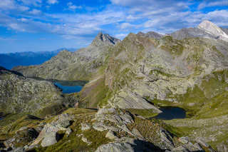
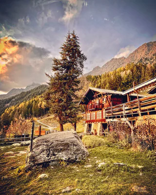
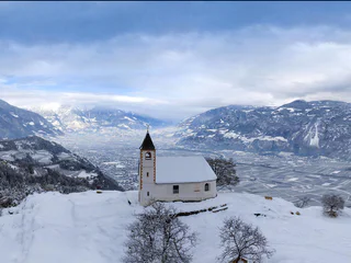
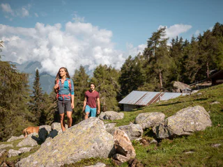
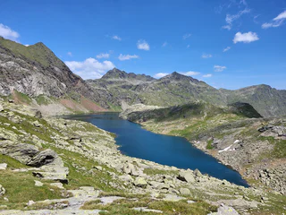
Spronser lakes - route from Pfelders/Plan
Tirolo/Tirol, Moos in Passeier/Moso in Passiria, Meran/Merano and environs
difficult
Obtížnost
961 m
Převýšení
6h:49 min
doba trvání
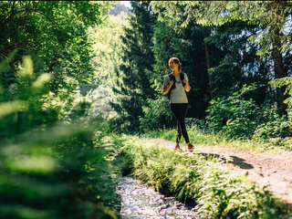
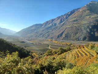
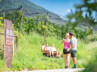
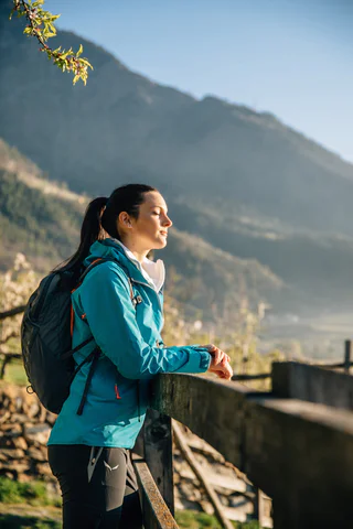
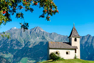
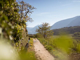
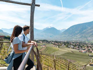
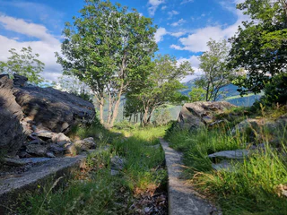
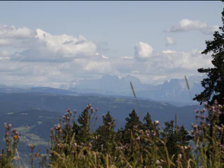
| Merano a okolí nabízí úžasné turistické stezky s nádhernými výhledy a malebnou přírodou. |
1/13
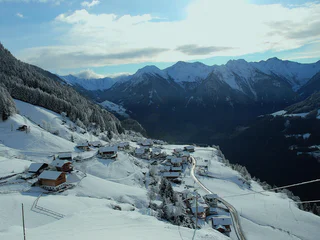
Tirolo/Tirol, Moos in Passeier/Moso in Passiria, Meran/Merano and environs
difficult
Obtížnost
961 m
Převýšení
6h:49 min
doba trvání
1/4
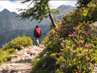
Tirolo/Tirol, Tirol/Tirolo, Meran/Merano and environs
medium
Obtížnost
229 m
Převýšení
3h:00 min
doba trvání

1/5
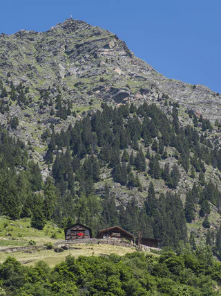
Avelengo Paese/Hafling Dorf, Hafling/Avelengo, Meran/Merano and environs
easy
Obtížnost
56 m
Převýšení
0h:36 min
doba trvání
1/9
Montesole/Sonnenberg - Parcines/Partschins, Naturns/Naturno, Meran/Merano and environs
medium
Obtížnost
225 m
Převýšení
2h:49 min
doba trvání
1/4
Scena/Schenna, Schenna/Scena, Meran/Merano and environs
easy
Obtížnost
175 m
Převýšení
1h:15 min
doba trvání
1/4
Velloi/Vellau, Algund/Lagundo, Meran/Merano and environs
difficult
Obtížnost
1216 m
Převýšení
4h:01 min
doba trvání
1/7
Plars di Mezzo/Mitterplars, Algund/Lagundo, Meran/Merano and environs
easy
Obtížnost
122 m
Převýšení
1h:48 min
doba trvání

San Pancrazio/St. Pankraz, St.Pankraz/San Pancrazio, Meran/Merano and environs
easy
Obtížnost
0 m
Převýšení
0h:30 min
doba trvání
1/7
Rablà/Rabland, Algund/Lagundo, Meran/Merano and environs
medium
Obtížnost
83 m
Převýšení
2h:55 min
doba trvání
1/4
Sorgente/Quellenhof, Riffian/Rifiano, Meran/Merano and environs
easy
Obtížnost
285 m
Převýšení
2h:30 min
doba trvání
1/2
Prissiano/Prissian, Tisens/Tesimo, Meran/Merano and environs
easy
Obtížnost
218 m
Převýšení
1h:48 min
doba trvání
1/4
Scena/Schenna, Schenna/Scena, Meran/Merano and environs
easy
Obtížnost
210 m
Převýšení
1h:30 min
doba trvání
Tirolo/Tirol, Tirol/Tirolo, Meran/Merano and environs
medium
Obtížnost
403 m
Převýšení
2h:25 min
doba trvání
Lagundo/Algund, Algund/Lagundo, Meran/Merano and environs
easy
Obtížnost
506 m
Převýšení
3h:30 min
doba trvání
1/2
Prissiano/Prissian, Tisens/Tesimo, Meran/Merano and environs
medium
Obtížnost
377 m
Převýšení
2h:22 min
doba trvání
San Nicolò/St. Nikolaus, Ulten/Ultimo, Meran/Merano and environs
medium
Obtížnost
86 m
Převýšení
1h:30 min
doba trvání

1/14
Tel/Töll, Partschins/Parcines, Meran/Merano and environs
medium
Obtížnost
276 m
Převýšení
2h:30 min
doba trvání
1/5
Postal/Burgstall, Vöran/Verano, Meran/Merano and environs
easy
Obtížnost
187 m
Převýšení
0h:40 min
doba trvání
1/4
Schennaberg/Monte Scena, Schenna/Scena, Meran/Merano and environs
medium
Obtížnost
600 m
Převýšení
3h:00 min
doba trvání
Proves/Proveis, Laurein/Lauregno, Meran/Merano and environs
easy
Obtížnost
61 m
Převýšení
0h:40 min
doba trvání
Santa Gertrude/St. Gertraud, Ulten/Ultimo, Meran/Merano and environs
easy
Obtížnost
513 m
Převýšení
1h:52 min
doba trvání
1/3
Plata/Platt, Moos in Passeier/Moso in Passiria, Meran/Merano and environs
medium
Obtížnost
622 m
Převýšení
3h:04 min
doba trvání

1/4
Prenn/Prenn, Schenna/Scena, Meran/Merano and environs
easy
Obtížnost
70 m
Převýšení
0h:45 min
doba trvání
1/4
Monte Scena/Schennaberg, Schenna/Scena, Meran/Merano and environs
medium
Obtížnost
330 m
Převýšení
2h:30 min
doba trvání
1/15
Montesole/Sonnenberg - Parcines/Partschins, Partschins/Parcines, Meran/Merano and environs
difficult
Obtížnost
846 m
Převýšení
2h:58 min
doba trvání

1/6
Senale/U.L. Frau i.W., U.L.Frau i.W.-St. Felix/Senale-S.Felice, Meran/Merano and environs
medium
Obtížnost
923 m
Převýšení
3h:46 min
doba trvání
1/9
Velloi/Vellau, Algund/Lagundo, Meran/Merano and environs
difficult
Obtížnost
1113 m
Převýšení
6h:25 min
doba trvání
1/5
Naturno/Naturns, Naturns/Naturno, Meran/Merano and environs
easy
Obtížnost
349 m
Převýšení
2h:30 min
doba trvání
1/4
Monte S. Vigilio/Vigiljoch, Lana, Meran/Merano and environs
easy
Obtížnost
410 m
Převýšení
3h:00 min
doba trvání
Lana di Sotto/Niederlana, Lana, Meran/Merano and environs
medium
Obtížnost
393 m
Převýšení
2h:12 min
doba trvání


