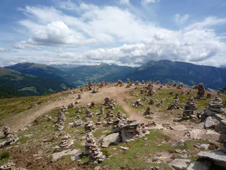
1/5
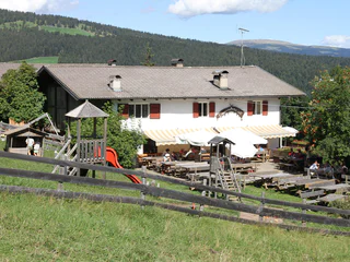
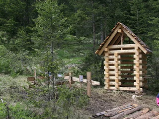
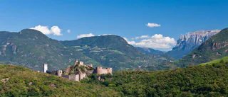
Mölten - Lanzenschuster
Vallesina/Versein, Mölten/Meltina, Bolzano/Bozen and environs
easy
Obtížnost
431 m
Převýšení
1h:43 min
doba trvání
| Turistika v Bolzanu a okolí vám nabízí jedinečné zážitky z procházek v nádherné přírodě. Užijte si kl |
1/5
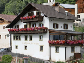
Vallesina/Versein, Mölten/Meltina, Bolzano/Bozen and environs
easy
Obtížnost
431 m
Převýšení
1h:43 min
doba trvání

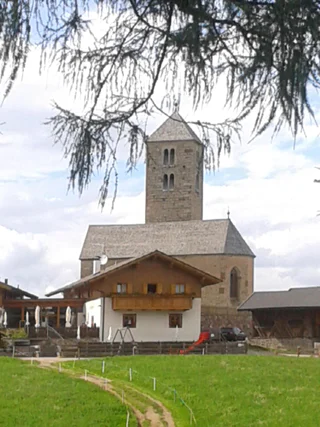
Pineta di Laives/Steinmannwald, Laives/Leifers, Bolzano/Bozen and environs
medium
Obtížnost
497 m
Převýšení
2h:30 min
doba trvání
Vallesina/Versein, Mölten/Meltina, Bolzano/Bozen and environs
easy
Obtížnost
405 m
Převýšení
1h:42 min
doba trvání
1/5
Vallesina/Versein, Mölten/Meltina, Bolzano/Bozen and environs
medium
Obtížnost
356 m
Převýšení
1h:13 min
doba trvání
1/5
Falzeben/Falzeben, Hafling/Avelengo, Bolzano/Bozen and environs
medium
Obtížnost
655 m
Převýšení
5h:19 min
doba trvání
1/2
Avelengo Paese/Hafling Dorf, Hafling/Avelengo, Bolzano/Bozen and environs
medium
Obtížnost
334 m
Převýšení
3h:04 min
doba trvání
Collalbo/Klobenstein, Ritten/Renon, Bolzano/Bozen and environs
easy
Obtížnost
252 m
Převýšení
1h:34 min
doba trvání
1/4
Vallesina/Versein, Mölten/Meltina, Bolzano/Bozen and environs
easy
Obtížnost
169 m
Převýšení
1h:15 min
doba trvání
1/2
Vallesina/Versein, Mölten/Meltina, Bolzano/Bozen and environs
easy
Obtížnost
34961 m
Převýšení
1h:55 min
doba trvání
Bolzano Centro/Bozen Zentrum, Bolzano/Bozen, Bolzano/Bozen and environs
medium
Obtížnost
388 m
Převýšení
2h:30 min
doba trvání
Ora/Auer, Vadena/Pfatten, Bolzano/Bozen and environs
difficult
Obtížnost
482 m
Převýšení
3h:30 min
doba trvání
1/4
Vallesina/Versein, Mölten/Meltina, Bolzano/Bozen and environs
medium
Obtížnost
863 m
Převýšení
5h:17 min
doba trvání
Rencio/Rentsch, Bolzano/Bozen, Bolzano/Bozen and environs
1/2
Vallesina/Versein, Mölten/Meltina, Bolzano/Bozen and environs
easy
Obtížnost
393 m
Převýšení
1h:22 min
doba trvání
S.Martino/Reinswald, Sarntal/Sarentino, Bolzano/Bozen and environs
easy
Obtížnost
100 m
Převýšení
4h:30 min
doba trvání
1/4
Collalbo/Klobenstein, Ritten/Renon, Bolzano/Bozen and environs
easy
Obtížnost
0 m
Převýšení
1h:19 min
doba trvání
1/3
Mölten/Meltina, Bolzano/Bozen and environs
easy
Obtížnost
157 m
Převýšení
1h:15 min
doba trvání
1/11
Vilpiano/Vilpian, Terlan/Terlano, Bolzano/Bozen and environs
difficult
Obtížnost
1446 m
Převýšení
9h:40 min
doba trvání
1/2
Verano/Vöran, Vöran/Verano, Bolzano/Bozen and environs
medium
Obtížnost
513 m
Převýšení
3h:31 min
doba trvání
Valdurna/Durnholz, Sarntal/Sarentino, Bolzano/Bozen and environs
medium
Obtížnost
0 m
Převýšení
5h:19 min
doba trvání
Vallesina/Versein, Mölten/Meltina, Bolzano/Bozen and environs
easy
Obtížnost
218 m
Převýšení
0h:54 min
doba trvání
1/3
Firmiano/Sigmundskron, Bolzano/Bozen, Bolzano/Bozen and environs
medium
Obtížnost
610 m
Převýšení
4h:43 min
doba trvání
1/4
Terlano/Terlan, Terlan/Terlano, Bolzano/Bozen and environs
easy
Obtížnost
486 m
Převýšení
2h:16 min
doba trvání

1/4
Vallesina/Versein, Mölten/Meltina, Bolzano/Bozen and environs
easy
Obtížnost
174 m
Převýšení
1h:13 min
doba trvání
1/5
Ora/Auer, Bronzolo/Branzoll, Bolzano/Bozen and environs
medium
Obtížnost
1067 m
Převýšení
5h:27 min
doba trvání
1/21
Terlano/Terlan, Terlan/Terlano, Bolzano/Bozen and environs
easy
Obtížnost
389 m
Převýšení
2h:25 min
doba trvání
1/2
Vallesina/Versein, Mölten/Meltina, Bolzano/Bozen and environs
medium
Obtížnost
722 m
Převýšení
4h:54 min
doba trvání
Soprabolzano/Oberbozen, Ritten/Renon, Bolzano/Bozen and environs
medium
Obtížnost
287 m
Převýšení
3h:00 min
doba trvání
1/3
Vallesina/Versein, Mölten/Meltina, Bolzano/Bozen and environs
easy
Obtížnost
268 m
Převýšení
1h:25 min
doba trvání
St. Oswald/S. Osvaldo - Kastelruth/Castelrotto, Kastelruth/Castelrotto, Bolzano/Bozen and environs
medium
Obtížnost
307 m
Převýšení
2h:25 min
doba trvání


