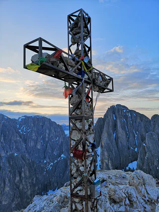
1/3
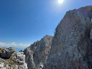
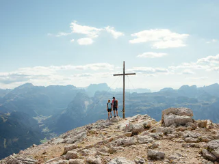
Via ferrata tour PIZ DA PERES
San Cassiano/San Cassiano, Al Plan/San Vigilio, Dolomites Region Kronplatz/Plan de Corones
medium
Difficulty
186 m
Elevation gain
1h:31 min
duration
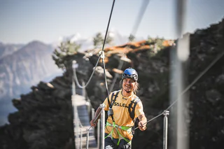
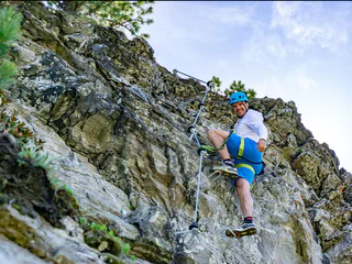
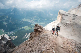
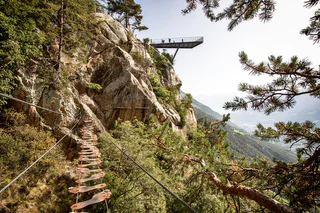
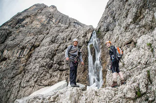
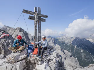
Via ferratas in South Tyrol take you where ordinary hiking trails don't reach. Fixed ropes, iron rungs and suspension bridges open up a completely different side of the mountains. Whether you're looking for your first via ferrata in the Dolomites or searching for the best via ferrata routes the Alps have to offer, South Tyrol has something for every level.
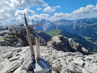
Easy via ferratas welcome beginners and families looking for a first taste of vertical adventure, while intermediate and challenging climbing routes reward experienced climbers with some of the most breathtaking scenery in the region. Many of the most iconic via ferratas of the Italian Dolomites run right through South Tyrol, across ridges, rock faces and peaks that are part of the UNESCO World Heritage Site.
Whether you're planning a single day out or want to combine several via ferratas in one trip, here you'll find all the routes to discover South Tyrol's via ferratas.
1/3
San Cassiano/San Cassiano, Al Plan/San Vigilio, Dolomites Region Kronplatz/Plan de Corones
medium
Difficulty
186 m
Elevation gain
1h:31 min
duration

Sesto/Sexten, Sexten/Sesto, Dolomites Region 3 Zinnen
medium
Difficulty
1758 m
Elevation gain
5h:30 min
duration
Sesto/Sexten
easy
Difficulty
676 m
Elevation gain
3h:00 min
duration
1/6
Lutago/Luttach, Ahrntal/Valle Aurina, Ahrntal/Valle Aurina
medium
Difficulty
350 m
Elevation gain
2h:00 min
duration
1/3
Campo Tures/Sand in Taufers, Sand in Taufers/Campo Tures, Ahrntal/Valle Aurina
medium
Difficulty
326 m
Elevation gain
1h:13 min
duration
1/14
Selva/Sëlva/Wolkenstein/Sëlva, Sëlva/Selva di Val Gardena, Dolomites Region Val Gardena
difficult
Difficulty
1271 m
Elevation gain
5h:05 min
duration
1/8
San Cassiano/San Cassiano, Badia, Dolomites Region Alta Badia
difficult
Difficulty
985 m
Elevation gain
7h:00 min
duration
Valdaora di Mezzo/Mitterolang, Prags/Braies, Dolomites Region 3 Zinnen
medium
Difficulty
1044 m
Elevation gain
3h:07 min
duration
1/37
S.Cristina Gherdëina/S.Cristina Val Gardena/S.Cristina Gherdëina/St.Christina in Gröden, S.Crestina Gherdëina/Santa Cristina Val Gardana, Dolomites Region Val Gardena
difficult
Difficulty
1436 m
Elevation gain
8h:30 min
duration
Lana del Vento/Windlahn, Sarntal/Sarentino, Bolzano/Bozen and environs
medium
Difficulty
408 m
Elevation gain
1h:04 min
duration
Sesto/Sexten, Sexten/Sesto, Dolomites Region 3 Zinnen
medium
Difficulty
0 m
Elevation gain
3h:00 min
duration
1/4
S.Cristina Gherdëina/S.Cristina Val Gardena/S.Cristina Gherdëina/St.Christina in Gröden, S.Crestina Gherdëina/Santa Cristina Val Gardana, Dolomites Region Val Gardena
medium
Difficulty
1105 m
Elevation gain
6h:30 min
duration
Sesto/Sexten, Sexten/Sesto, Dolomites Region 3 Zinnen
difficult
Difficulty
900 m
Elevation gain
7h:00 min
duration
1/4
Naturno/Naturns, Naturns/Naturno, Meran/Merano and environs
medium
Difficulty
68 m
Elevation gain
0h:10 min
duration
Sesto/Sexten
easy
Difficulty
728 m
Elevation gain
4h:30 min
duration
1/3
Badia/Badia, Badia, Dolomites Region Alta Badia
difficult
Difficulty
985 m
Elevation gain
7h:00 min
duration
San Cassiano/San Cassiano
difficult
Difficulty
1633 m
Elevation gain
8h:00 min
duration
Trafoi/Trafoi, Stilfs/Stelvio, Vinschgau/Val Venosta
medium
Difficulty
121 m
Elevation gain
0h:25 min
duration
1/4
Valdaora di Mezzo/Mitterolang, Olang/Valdaora, Dolomites Region Kronplatz/Plan de Corones
difficult
Difficulty
1670 m
Elevation gain
5h:43 min
duration
1/6
Pescosta/Pescosta, Sëlva/Selva di Val Gardena, Dolomites Region Val Gardena
easy
Difficulty
461 m
Elevation gain
1h:30 min
duration
Solda/Sulden, Stilfs/Stelvio, Vinschgau/Val Venosta
difficult
Difficulty
650 m
Elevation gain
4h:00 min
duration
Sesto/Sexten, Sexten/Sesto, Dolomites Region 3 Zinnen
difficult
Difficulty
1515 m
Elevation gain
4h:45 min
duration
S. Maddalena/St. Magdalena - Funes/Villnöss, Villnöss/Funes, Dolomites Region Lüsen Villnöss
difficult
Difficulty
1699 m
Elevation gain
6h:49 min
duration
1/6
Pescosta/Pescosta, Sëlva/Selva di Val Gardena, Dolomites Region Val Gardena
difficult
Difficulty
830 m
Elevation gain
2h:55 min
duration

1/5
Campo Tures/Sand in Taufers, Sand in Taufers/Campo Tures, Ahrntal/Valle Aurina
medium
Difficulty
350 m
Elevation gain
3h:30 min
duration
1/2
Selva/Sëlva/Wolkenstein/Sëlva, Sëlva/Selva di Val Gardena, Dolomites Region Val Gardena
difficult
Difficulty
1511 m
Elevation gain
5h:31 min
duration
1/2
Sesto/Sexten, Sexten/Sesto, Dolomites Region 3 Zinnen
medium
Difficulty
1200 m
Elevation gain
8h:00 min
duration
Sesto/Sexten, Sexten/Sesto, Dolomites Region 3 Zinnen
difficult
Difficulty
600 m
Elevation gain
7h:00 min
duration
Alpe di Siusi/Seiseralm
difficult
Difficulty
638 m
Elevation gain
1h:21 min
duration
1/3
Falzeben/Falzeben, Hafling/Avelengo, Meran/Merano and environs
difficult
Difficulty
729 m
Elevation gain
3h:10 min
duration
Thank you for signing up!
Your subscription is already active
Confirm your registration
To complete your subscription, open the email we just sent you and click on the confirmation link.
Can’t find it? Check your spam folder too.
We noticed that you tried to subscribe to the newsletter, but your email address is already registered. You will continue to receive our offers, tips and inspiration for your holiday.
We noticed that you already tried to subscribe to our Newsletter in the past but didn’t confirmed the subscription. We have resent you an email now, please check your inbox and spam folder to confirm.


