Classic and skating
Ulten/Ultimo, Meran/Merano and environs
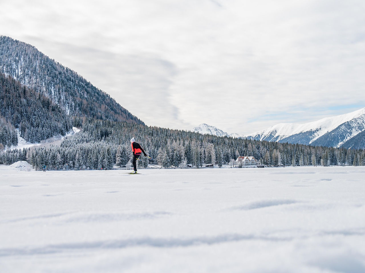
The new route is suitable for beginners as well as for cross-country skiers of all ages.
S přibližně 1 800 kilometry běžkařských tratí je Jižní Tyrolsko učiněným rájem běžkařů. A nezáleží na tom, zda se rozhodnete pro Dolomiti Nordicski, největší běžeckou arénu v Evropě, nebo nordic³ na západě regionu: Celá síť běžkařských tras nabízí požitkové tratě pro celou rodinu, osamocené úseky, vysokohorské stopy se spektakulárními výhledy nebo stopy s umělým osvětlením pro běžkaře všech úrovní.
The new route is suitable for beginners as well as for cross-country skiers of all ages.
Starting at the “Alte Säge” restaurant, this trail leads through the forest along the Sexten stream to Schmieden, a suburb of Sexten. There is a beautiful view of the surroundings and the nature of Sexten. This section is the first part of Trail No. 16.
In case of lack of snow only skating possible.
During the wintertime the vallunga trasforms hisself in a Winterwonderland. The snow which covers the forest trasmits a mystic flair and you can enjoy the quitness of the valley.
The Passo Lavazè (1800 m) is home to a number of trails leading through forests, across snowy plains and into the Fiemme Valley.
During the wintertime the vallunga trasforms hisself in a Winterwonderland. The snow which covers the forest trasmits a mystic flair and you can enjoy the quitness of the valley.
This track connecting Monte Pana to Saltria at Seiser Alm runs through the Iender Valley and is suitable for experienced cross-country skiers only. By reaching Seiser Alm you can run on up to 50 km of tracks. For less experienced skiers there is also a bus connection between Monte Pana and Saltria.
The Saltria - Monte Pana link trail is reserved exclusively for experienced cross-country skiers.
It begins on a descent through vast Alpine meadows, leading shortly afterwards through the woods and along narrow riverside trail, in a constant slope to Monte Pana. The trail features numerous twists and turns and the utmost of caution is advised on one particularly exposed stretch.
Demanding round-trip tours starting at the cross-country stadium in Toblach/Dobbiaco, often used as training tracks by various national cross-country teams from all over the world.
Demanding round-trip tours starting at the cross-country stadium in Toblach/Dobbiaco, often used as training tracks by various national cross-country teams from all over the world.
In Rein in Taufers / Riva di Tures there are different types of tracts. To be suited for everyone: amateurs or professionals, classic or freestyle. There are changing rooms and toilettes in the ski-center.
During the wintertime the vallunga trasforms hisself in a Winterwonderland. The snow which covers the forest trasmits a mystic flair and you can enjoy the quitness of the valley.
Demanding round-trip tours starting at the cross-country stadium in Toblach/Dobbiaco, often used as training tracks by various national cross-country teams from all over the world.
The wide track is well suited to skating and classic skiing, and is maintained on a daily basis. Just before and after arriving in Lazins/Lazines, there’s a trail to Zeppichl. This cross-country skiing trail is freely accessible without restrictions and has easy, medium-difficulty and challenging sections. On the way back to Pfelders/Plan (or Zeppichl) there’re a number of rapid descents, where skiers need to be on the lookout for pedestrians and oncoming cross-country skiers.
The route from Plan to the Lazinser Alm mountain pasture is rather tricky due in part to the long ascent and steep incline. But at the refuge in the wide valley basin below, one can enjoy almost effortless skiing at 680 m per lap on a 15 m run. The lap around Lazines is more challenging, at 1,336 m per lap on a 52 m run.
Setting out from Ritsch, this varied loop-route leads north over the Große Moos and through vast Alpine meadows towards the cable car for Ortisei/St. Ulrich, with the nearby Dolomite peaks of the Langkofel and the Plattkofel ever in sight. After a short uphill stretch, we head downwards through a stretch of woodland and over Alpine meadows with traditional Alpine dairy farms. In Hartl, you come to a curve in the trail and ski on, slightly uphill, along the slope through the vast Alpine meadows. There is a steep uphill stretch just before the trail meets the Möser trail, followed by easy, undulating terrain back to the set-off point in Ritsch.
natural snow slope from Rasun di Sopra to the biotope (direction to Anterselva di Sotto) - circuit
Demanding round-trip tours starting at the cross-country stadium in Toblach/Dobbiaco, often used as training tracks by various national cross-country teams from all over the world.
This cross-country trail, with its numerous curves, heads south from Saltria towards the Goldknopf and back again. The lowest-lying trail of the Seiser Alm, it runs in a variety packed series of undulating curves. Short stretches of the trail run through the wood, but for the most part, these tracks lead you through vast and sunny Alpine meadows.
Sunny cross country slope on the Lake Antholz (near the Biathlon centre).
During the wintertime the vallunga trasforms hisself in a Winterwonderland. The snow which covers the forest trasmits a mystic flair and you can enjoy the quitness of the valley.
Demanding round-trip tours starting at the cross-country stadium in Toblach/Dobbiaco, often used as training tracks by various national cross-country teams from all over the world.
Cross-country skiing in Carezza on the sunny side with a fantastic view of the Dolomite giants Rosengarten | Catinaccio and Latemar.
The “Schönfelder circular trail” has several access points and is located in Moos. With direct views of the Rotwand and the Sexten sundial. Ideally reached by public transportation (Rotwand bus stop) or, if necessary, by parking directly on site.
In case of lack of snow only skating possible.
A fantastic experience of nature through the winter-wood at the south side of the Lake of Dobbiaco. This short variant is needed to connect the east bank with the west bank.
A long and fantastic tour through the entire Höhlensteintal/Val di Landro valley.
“Im Gemärk” is the German name for a pass height located at 1,530 m. Shortly before the pass, the provincial border runs between the provinces of South Tyrol and Belluno.
SEA LEVEL: 1.350 m
PASSAGE: from Innerratschings/Racines di Dentro to Flading/Vallettina
LENGTH: 12 km
DEGREE OF DIFFICULTY: easy to medium-heavy
The cross-country slope Lazaun is situated next to the mountain station of the Lazaun cable car at 2,400 meters above sea level and is suitable for beginners. It is approx. 3 km long.
The Passo Lavazè (1800 m) is home to a number of trails leading through forests, across snowy plains and into the Fiemme Valley.
A long and fantastic track through the whole Höhlensteintal/Val di Landro valley.
“Im Gemärk” is the German name for a pass height located at 1,530 m. Shortly before the pass, the provincial border runs between the provinces of South Tyrol and Belluno.
Cross-country ski trail "Schönalm" approx. 3 km. Perfectly groomed nature trails. You can see a fascinating picture - the snowcapped peaks of the Dolomites, from the gruppo Sella to the Sciliar.