Skip to content
added to favourites
removed from favourites
Oops! Something went wrong. Try again
Your account is being created
Your account has been successfully created and you are now logged in
You are logged out.
Filter
Selected filters
    Level of difficulty
    Duration
    Distance in KM

    Cross-country skiing trails in South Tyrol

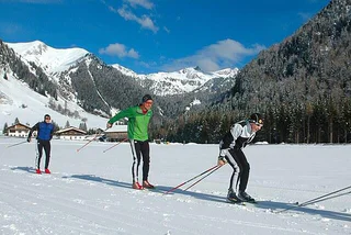
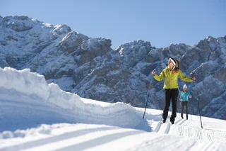
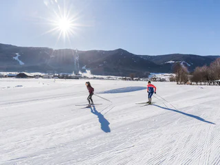
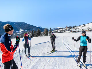
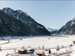
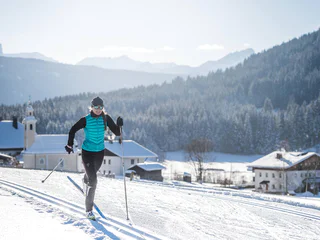
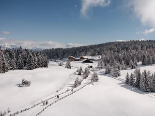
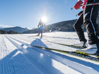
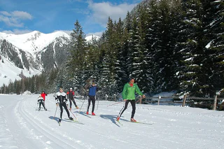
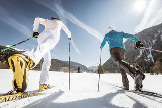
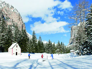
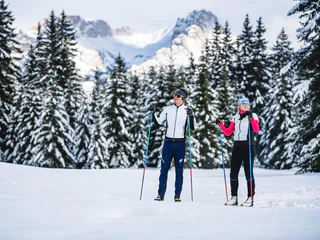
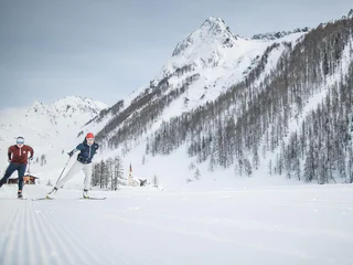
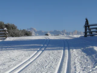
    With around 1,800 km of cross-country skiing trails, South Tyrol is a true cross-country skiing paradise. Whether you choose Dolomiti Nordicski, Europe's biggest cross-country ski resort, or Venosta Nordic, in the west: the entire cross-country ski network has pleasant trails for the whole family, secluded spots, high-altitude trails with awe-inspiring views or floodlit trails with all difficulty levels.

    Results
    Cross-country ski-track
    Ritsch cross-country trail
    Kastelruth/Castelrotto, Dolomites Region Seiser Alm

    This loop route starts and ends in Ritsch and passes through the Kleine Moos on practically flat terrain, making it perfect for newcomers to cross-country skiing. With exceptional views over the Dolomite peaks of the Langkofel and Plattkofel, the Ritsch Trail is an unforgettable experience. Those who are trying their hand at cross-country for the first time can get a real feel for the sport here before tackling the more challenging trails on the Seiser Alm.

    Difficulty: easy
    15 altitude up
    0h:00 min duration
    Cross-country ski-track
    Saltria cross-country trail
    Kastelruth/Castelrotto, Dolomites Region Seiser Alm

    This cross-country trail, with its numerous curves, heads south from Saltria towards the Goldknopf and back again. The lowest-lying trail of the Seiser Alm, it runs in a variety packed series of undulating curves. Short stretches of the trail run through the wood, but for the most part, these tracks lead you through vast and sunny Alpine meadows.

    Difficulty: medium
    74 altitude up
    0h:00 min duration
    Cross-country ski-track
    Hartl cross-country trail
    Kastelruth/Castelrotto, Dolomites Region Seiser Alm

    Setting out from Ritsch, this varied loop-route leads north over the Große Moos and through vast Alpine meadows towards the cable car for Ortisei/St. Ulrich, with the nearby Dolomite peaks of the Langkofel and the Plattkofel ever in sight. After a short uphill stretch, we head downwards through a stretch of woodland and over Alpine meadows with traditional Alpine dairy farms. In Hartl, you come to a curve in the trail and ski on, slightly uphill, along the slope through the vast Alpine meadows. There is a steep uphill stretch just before the trail meets the Möser trail, followed by easy, undulating terrain back to the set-off point in Ritsch.

    Difficulty: medium
    150 altitude up
    0h:00 min duration
    Cross-country ski-track
    Wolfsbühl cross-country trail
    Kastelruth/Castelrotto, Dolomites Region Seiser Alm

    This easy loop-route leads out from the Cross-Country Centre in Ritsch and heads north over the vast Alpine meadows. With the Langkofel and the Plattkofel, this stretch of the trail boasts an incredible panorama. A short but hard ascent takes you to the Wolfbühl, the highest point of the route. Then continue onwards through a stretch of wood and over easy, undulating terrain back to the beginning of the trail.

    Difficulty: easy
    154 altitude up
    0h:00 min duration
    Cross-country ski-track
    Panorama cross-country trail
    Kastelruth/Castelrotto, Dolomites Region Seiser Alm

    The Panorama cross-country trail is classed as one of the most challenging loop-routes on the Seiser Alm and, with the Langkofel, Plattkofel and the Schlern, boasts a landscape which is second to none. The trail starts at the Cross-Country Centre in Ritsch and leads up to the mountain station of the Panorama chairlift with numerous sweeping curves through the Palude di Ladinser Moos. When you get to the Laurinhütte hut, loop round and head back to the start of the trail.  

    Difficulty: difficult
    308 altitude up
    0h:00 min duration
    Cross-country ski-track
    Cross-country trail Hafling/Falzeben
    Hafling/Avelengo, Meran/Merano and environs
    Its moderate level of difficulty and the superb climatic conditions at Merano 2000 make the Falzeben cross-country skiing slope an ideal route for beginners, children and cross-country skiing aficionados alike. The track is suitable for both skating and classic cross-country skiing.
    Difficulty: medium
    74 altitude up
    0h:00 min duration
    Cross-country ski-track
    Joch cross-country trail
    Kastelruth/Castelrotto, Dolomites Region Seiser Alm

    The longest and most challenging cross-country trail of the Seiser Alm leads out from the Cross-Country Centre in Ritsch through vast Alpine meadows in a steep uphill to the mountain station of the Panorama chairlift. Then, in numerous curves, cross the Palude di Ladins/Ladinser Moos and continue on towards Joch and Spitzbühl, past the Laurinhütte hut and back to Ritsch. With the nearby Dolomite peaks of the Langkofel, Plattkofel and the Schlern massif, the views along this trail are breathtaking.

    Difficulty: difficult
    350 altitude up
    0h:00 min duration
    Cross-country ski-track
    Ritsch beginners run
    Kastelruth/Castelrotto, Dolomites Region Seiser Alm

    This easy loop trail is directly behind the Cross-Coutry Centre in Ritsch and leads from the Ritsch Hotel and Restaurant to the Große Moos. With outstanding views over the Langkofel and
    Plattkofel, this practice piste guarantees an unforgettable experience for young and old alike. Beginners can get a feel for cross-country skiing on the practice trails and hone their double poling, diagonal stride and herringbone techniques. The tracks are also ideal for warming-up before heading out on longer tours.

    Difficulty: easy
    30 altitude up
    0h:00 min duration
    Cross-country ski-track
    Reischach/Riscone
    Bruneck/Brunico, Dolomites Region Kronplatz/Plan de Corones

    Cross-country skiing is an alternative to skiing for many winter sports enthusiasts. Ath the foot of the Kronplatz/Plan de Corones, near the sports area in Riscone, a lovely circular trail goes through snow covered fields and meadows. The cross-country trail in Riscone is suitable for beginners as well as for advanced skiers.

    There are 3 different slopes:

    1. Cross country trail Reiperting - 2.2 km - easy

    2. Cross country trail Reischach - 3.6 km - easy

    3. Cross country trail Stefansdorf (complete round) - 5.5 km - easy

    Difficulty: easy
    145 altitude up
    0h:00 min duration
    Cross-country ski-track
    Link trail Sonne
    Kastelruth/Castelrotto, Dolomites Region Seiser Alm

    This link-trail connects the Hotel Sonne to the Möser, Wolfsbühl and Hartl trails. It ranges very little in elevation and is an easy run which is also suitable for beginners.

    Difficulty: easy
    39 altitude up
    0h:00 min duration
    Cross-country ski-track
    Cross-country ski trail "Schönalm"
    Ritten/Renon, Bolzano/Bozen and environs

    Cross-country ski trail "Schönalm" approx. 3 km. Perfectly groomed nature trails. You can see a fascinating picture - the snowcapped peaks of the Dolomites, from the gruppo Sella to the Sciliar.

    Difficulty: easy
    40 altitude up
    0h:00 min duration
    Cross-country ski-track
    Connection Tesido to Val Casies Valley track
    Welsberg-Taisten/Monguelfo-Tesido

    Connection from Tesido to the Val Casies Valley track. From the crossing point there is the possibility to sci to Santa Maddalena or to Monguelfo and near the train station further to the 3 Zinnen Dolomites area.

    Difficulty: easy
    6 altitude up
    0h:00 min duration
    Cross-country ski-track
    Pineta

    The bottom slope of Pineta is situated in the municipality of
    Lorenzago di Cadore (BL), at an altitude of 1056 m above sea level,
    formerly a summer retreat of His Holiness John Paul II. It can be
    reached from the Carnica trunk road 52, which connects Veneto
    with Friuli via the Mauria Pass. The slope is 2.5, 3, 4 and 5 km long and
    is suitable for both classic and freestyle techniques. It has an
    artifi cial snow system, a lighting system for the 2.5 km ring, ample
    parking and ski hire.

    Difficulty: easy
    169 altitude up
    0h:00 min duration
    Cross-country ski-track
    18 SEXTEN - Circular Trail in the Fischleintal Valley
    Sexten/Sesto, Dolomites Region 3 Zinnen

    The 4.5 km long "Rundloipe Fischleintal" trail runs through the Fischleintal valley. This is easily accessible by public transport (Fischleinboden bus stop). There is also a pay parking possibility.                                                                            

    Difficulty: medium
    101 altitude up
    0h:00 min duration
    Cross-country ski-track
    Cross-country skiing trail Rodenecker-Lüsner Alp
    Rodeneck/Rodengo, Brixen/Bressanone and environs
    The first destination we recommend for cross-country skiing is one of Italy’s largest high-mountain plateaus: the Rodenecker-Lüsner Alp. What you will find up there is a 15-kilometre trail suitable for both classic and skating styles. The trail, which features a total elevation gain of 300 metres, leads from the Zumis car park to the Roner Alm hut in gentle ups and downs, and on past the Pianer Kreuz chapel to the Starkenfeldhütte hut. Both huts are open in winter and serve a range of tempting regional dishes. The view of the glittering alpine meadows and Mt. Peitlerkofel enjoyed from the trail adds a touch of fabulousness to the experience.
    Difficulty: easy
    441 altitude up
    0h:00 min duration
    Cross-country ski-track
    Ski nordic Terenten
    Terenten/Terento, Brixen/Bressanone and environs
    Cross-country skiing at the cross-country track in the village centre; 3 km medium diffi culty and 2.5 km easy. Natural snow, start at the sports center in Terenten.
    Difficulty: medium
    62 altitude up
    0h:00 min duration
    Cross-country ski-track
    Cross country track Weißenbach/Rio Bianco
    Ahrntal/Valle Aurina, Ahrntal/Valle Aurina

    Improving the health by the movement in the fresh mountain air and enjoying the beautiful nature. Having rest and relaxation on the trails leading through meadows and forests. And in the end, refreshment in one of the traditional huts completes a day of cross-country skiing.

    Difficulty: medium
    226 altitude up
    0h:00 min duration
    Cross-country ski-track
    Forest trail
    Rasen-Antholz/Rasun Anterselva, Dolomites Region Kronplatz/Plan de Corones
    New forest cross country skiing trail behind the fish pond in Antholz Niedertal.
    Difficulty: medium
    Difficulty: medium
    26 altitude up
    0h:00 min duration
    Cross-country ski-track
    Martello - Track Schmelz 1 kilometer
    Martell/Martello, Vinschgau/Val Venosta

    The cross-country skiing trail in Schmelz, starting at the Hotel Waldheim at 1520m, is a forest hiking trail. Here it is allowed to hike on the cross-country trail, to go sledding and dogs are also allowed, but must be kept on a leash.

    Please give priority to cross-country skiers!

    Difficulty: easy
    17 altitude up
    0h:00 min duration
    Cross-country ski-track
    Martello - Track 3 kilometers
    Martell/Martello, Vinschgau/Val Venosta

    Applies to all trails in the biathlon center: suitable for classic and skating
    Starting point: at the Biathlon Center Grogg from 1700 m

    Challenging loop with the legendary Fragolino, which with its long climb and technically difficult descent, is one of the most difficult sections in the biathlon circuit.

    Recommended only for advanced cross-country skiers! Height difference: 60 m


    Difficulty: easy
    33 altitude up
    0h:00 min duration
    Cross-country ski-track
    Martello - Track 2 kilometers
    Martell/Martello, Vinschgau/Val Venosta

    Applies to all trails in the biathlon center: suitable for classic and skating
    Starting point: at the Biathlon Center Grogg from 1700 m

    The 2 km loop leads from the biathlon stadium first 1km flat along the orographically left side of the Plima, where you then immediately turn right. After another flat passage, a steep and demanding climb follows. After that, the trail is flat again until the snow depot, where an easy descent follows. Then you run flat again with two short crisp climbs towards the biathlon stadium.

    Height difference: 50 m


    Difficulty: easy
    27 altitude up
    0h:00 min duration
    Cross-country ski-track
    Martello - Track St.Maria i. Schmelz
    Martell/Martello, Vinschgau/Val Venosta

    The cross-country skiing trail in Schmelz, starting at the Hotel Waldheim at 1520m, is a forest hiking trail. Here it is allowed to hike on the cross-country trail, to go sledding and dogs are also allowed, but must be kept on a leash.

    Please give priority to cross-country skiers!

    Difficulty: easy
    133 altitude up
    0h:00 min duration
    Cross-country ski-track
    Martello - Track Schmelz 2 kilometers
    Martell/Martello, Vinschgau/Val Venosta

    The cross-country skiing trail in Schmelz, starting at the Hotel Waldheim at 1520m, is a forest hiking trail. Here it is allowed to hike on the cross-country trail, to go sledding and dogs are also allowed, but must be kept on a leash.

    Please give priority to cross-country skiers!

    Difficulty: easy
    30 altitude up
    0h:00 min duration
    Cross-country ski-track
    Martello - Track Biathlon center Grogg
    Martell/Martello, Vinschgau/Val Venosta

    Applies to all trails in the biathlon center: suitable for classic and skating
    Starting point: at the Biathlon Center Grogg from 1700 m


    1 km:

    Largely flat trail, without technically difficult climbs and descents. Ideal for beginners. Difference in altitude: 20 m


    2 km:

    The 2 km loop leads from the biathlon stadium first 1km flat along the orographically left side of the Plima, where you then immediately turn right. After another flat passage, a steep and demanding climb follows. After that, the trail is flat again until the snow depot, where an easy descent follows. Then you run flat again with two short crisp climbs towards the biathlon stadium.

    Height difference: 50 m


    3,3 km:

    Challenging loop with the legendary Fragolino, which with its long climb and technically difficult descent, is one of the most difficult sections in the biathlon circuit.

    Recommended only for advanced cross-country skiers!

    Height difference: 60 m


    4 km:

    The longest loop in the biathlon center for advanced cross-country skiers with technically challenging climbs and descents, but also flat gliding sections.

    Height difference: 60 m

    Difficulty: easy
    48 altitude up
    0h:00 min duration
    Cross-country ski-track
    Circular cross-country skiing slope in Vals
    Mühlbach/Rio di Pusteria, Brixen/Bressanone and environs
    The cross-country skiing trail in Vals is a beautiful route that is perfect for cross-country skiing. It offers a diverse landscape and is well-maintained. The trail is suitable for both beginners and advanced skiers, with various difficulty levels available. There are also options to rent equipment on-site. Overall, the cross-country skiing trail in Vals is definitely worth a visit!
    Difficulty: medium
    60 altitude up
    0h:00 min duration
    Cross-country ski-track
    Cross-country skiing trail Steinegg
    Karneid/Cornedo all'Isarco, Dolomites Region Eggental

    There is also the possibility of cross-country skiing in Steinegg|Collepietra. The starting point for the cross-country trail is between Steinegg|Collepietra and Gummer|San Valentino behind the Egger Moos craftsmen's zone at 1,250 m above sea level.
    There is the possibility of a shorter and longer loop.

    In case of unfavourable temperatures, the cross-country trail may be closed prematurely.

    Difficulty: easy
    67 altitude up
    0h:00 min duration
    Cross-country ski-track
    Ring Frin
    Welschnofen/Nova Levante, Dolomites Region Eggental

    The extensive and idyllic Frin meadows offer not only a great cross-country skiing route but also a magnificent panorama of the Rosengarten | Catinaccio and Latemar mountains.

    Difficulty: easy
    181 altitude up
    0h:00 min duration
    Cross-country ski-track
    Ring Angerle
    Welschnofen/Nova Levante, Dolomites Region Eggental

    Cross-country skiing in Carezza on the sunny side with a fantastic view of the Dolomite giants Rosengarten | Catinaccio and Latemar.                                                                  


    Difficulty: easy
    0 altitude up
    0h:00 min duration
    Cross-country ski-track
    Red cross-country ski run
    Sëlva/Selva, Dolomites Region Val Gardena

    During the wintertime the vallunga trasforms hisself in a Winterwonderland. The snow which covers the forest trasmits a mystic flair and you can enjoy the quitness of the valley.

    Difficulty: medium
    134 altitude up
    0h:00 min duration
    1 2 3 4 5 6 7 8 9 10
      image
      Summer
      Uphill Seespitz
      Meran and environs
      Starting point: Töll Etschbrücke (525 m) End point: Gasthaus …
      44 km total slope
      7 lifts
      Highest point: 2,505 m