Přeskočit na obsah
  • oblíbené

přidáno k oblíbeným

odebráno z oblíbených

Jejda! Došlo k problému, zkuste to prosím znovu

Vytváří se váš účet

Váš účet byl úspěšně vytvořen a nyní jste přihlášeni

Jste úspěšně přihlášeni!

Váš účet byl úspěšně vytvořen, ale nepodařilo se nám vás automaticky přihlásit

Jste odhlášeni

Filtr
Úroveň obtížnosti
Doba trvání
Vzdálenost v km

Všechny horské vrcholy

Prozkoumejte jedinečné vrcholy Jižního Tyrolska při výstupu na nejkrásnější vrcholy. Bezpečné túry vás dovezou do cíle a poskytnou vám horské zážitky, na které jen tak nezapomenete.

Výsledky
Hiking
Mountain Einachtspitze
Ratschings/Racines, Sterzing/Vipiteno and environs

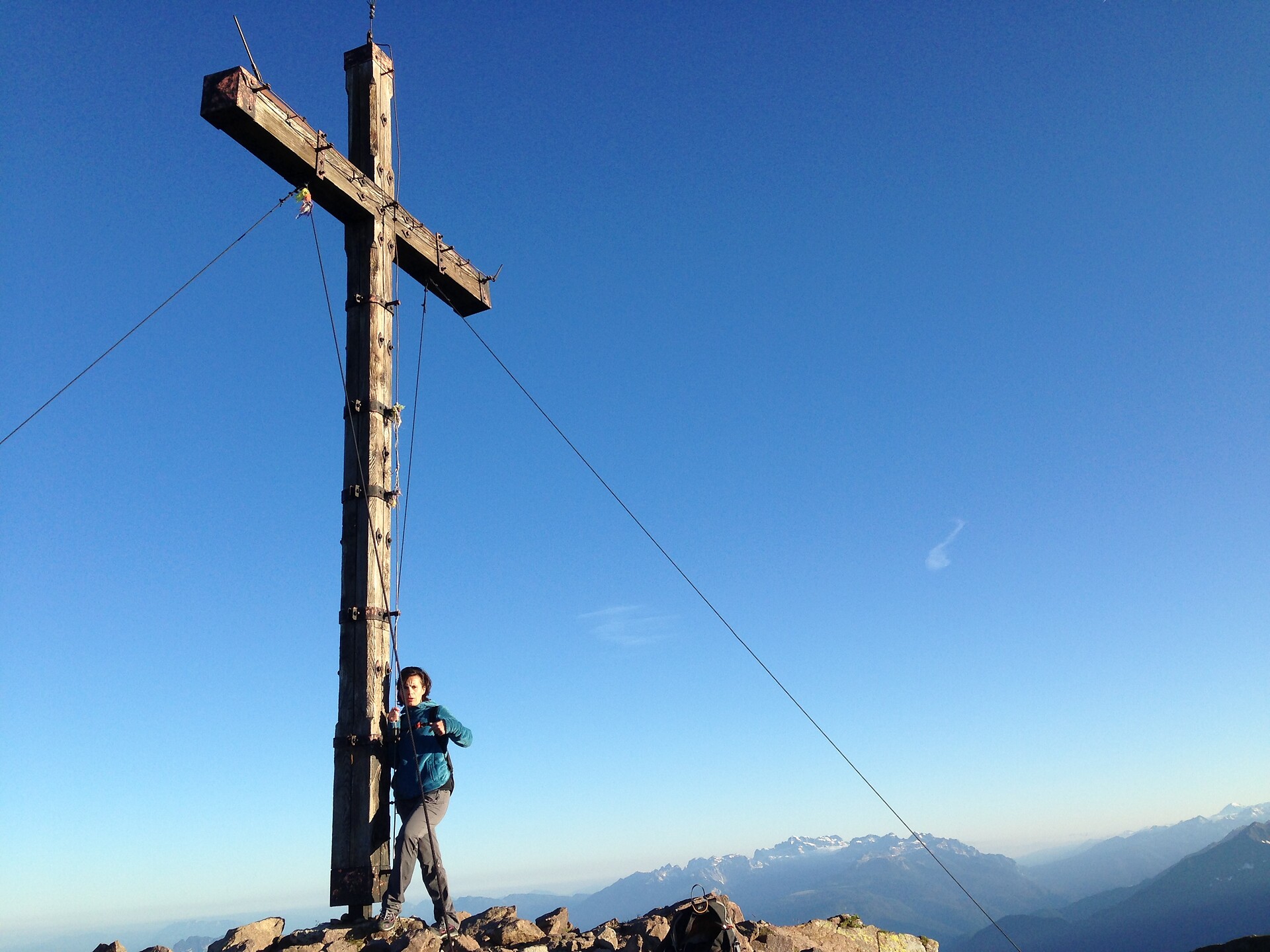
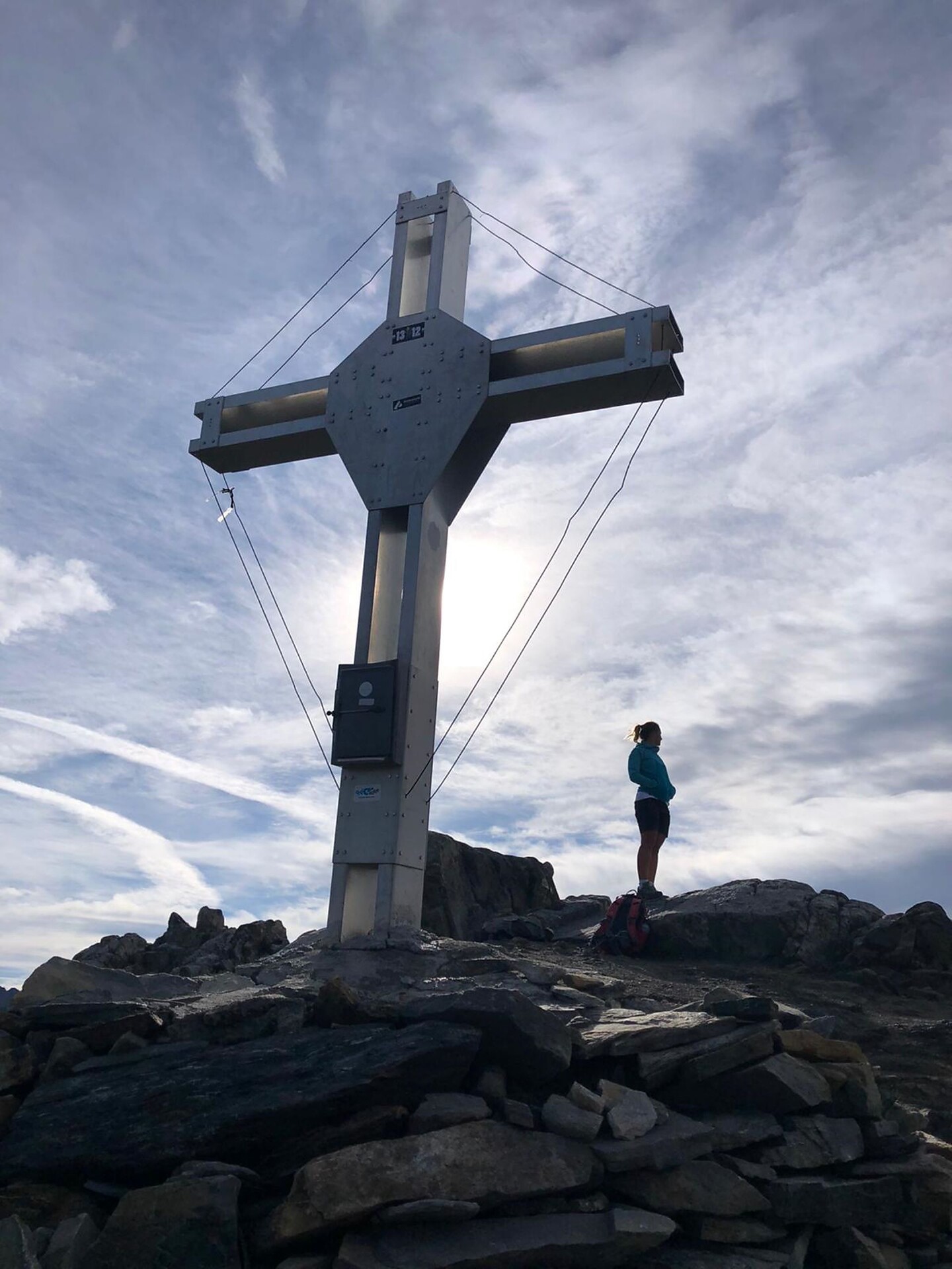
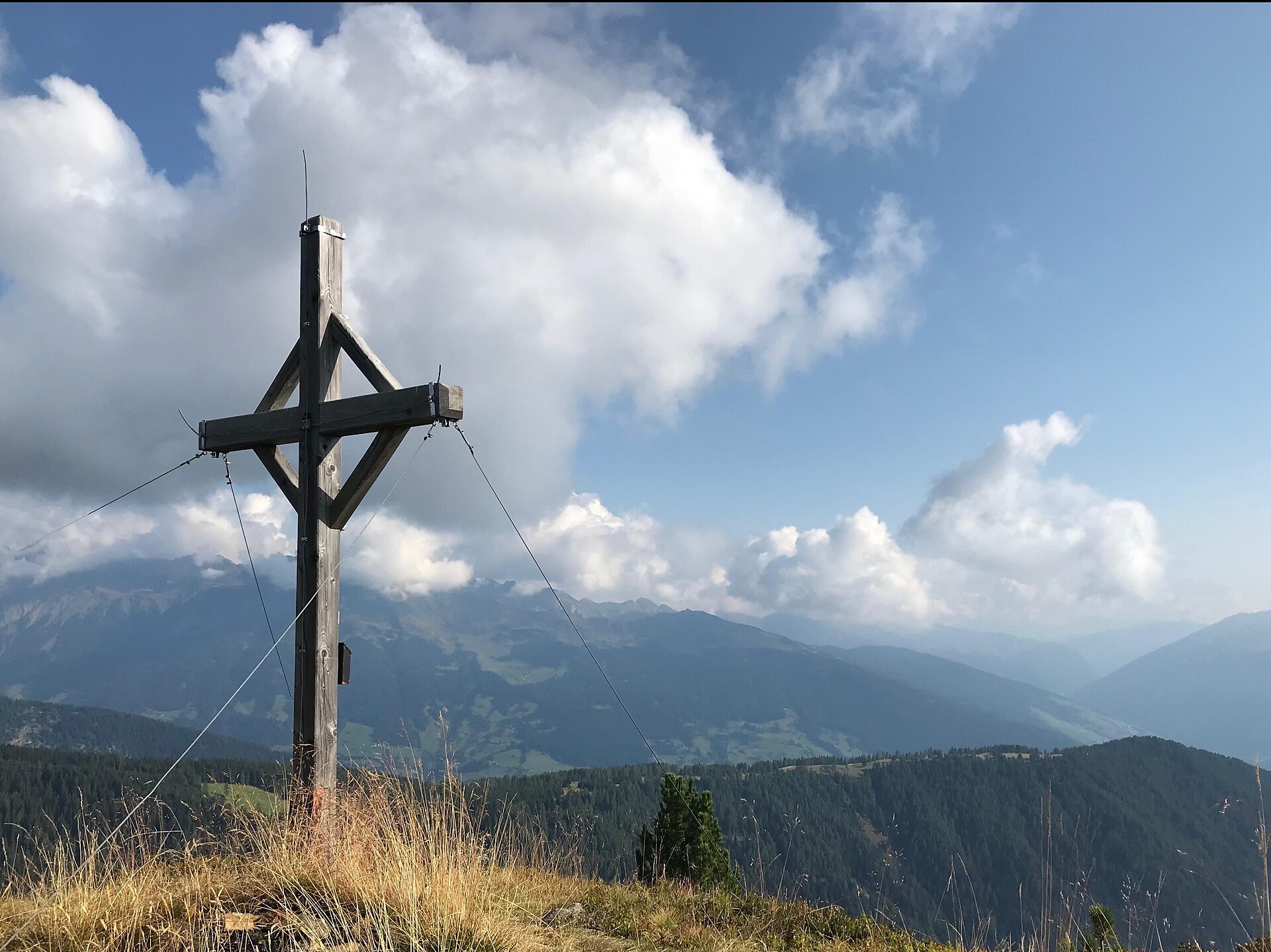
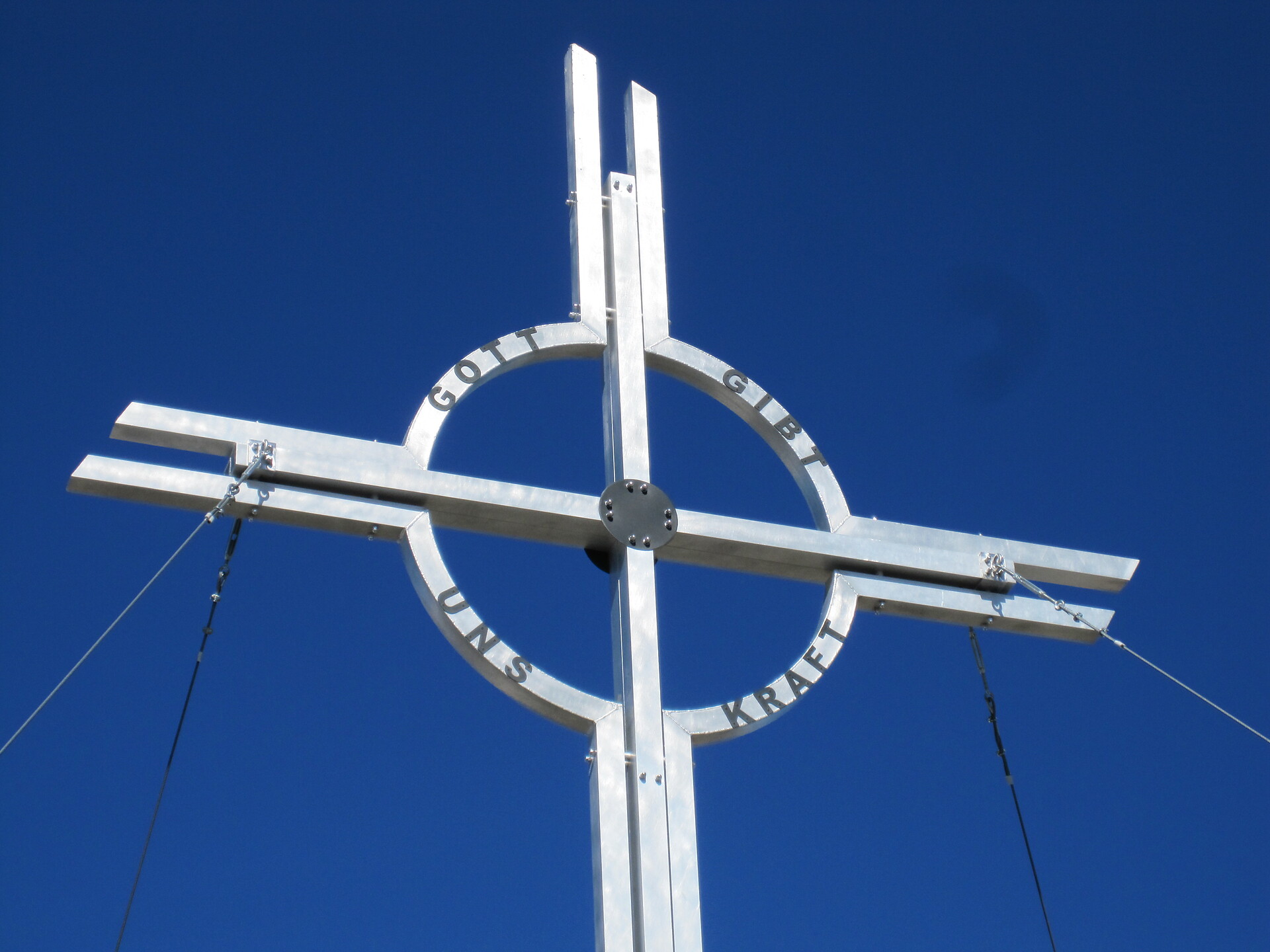
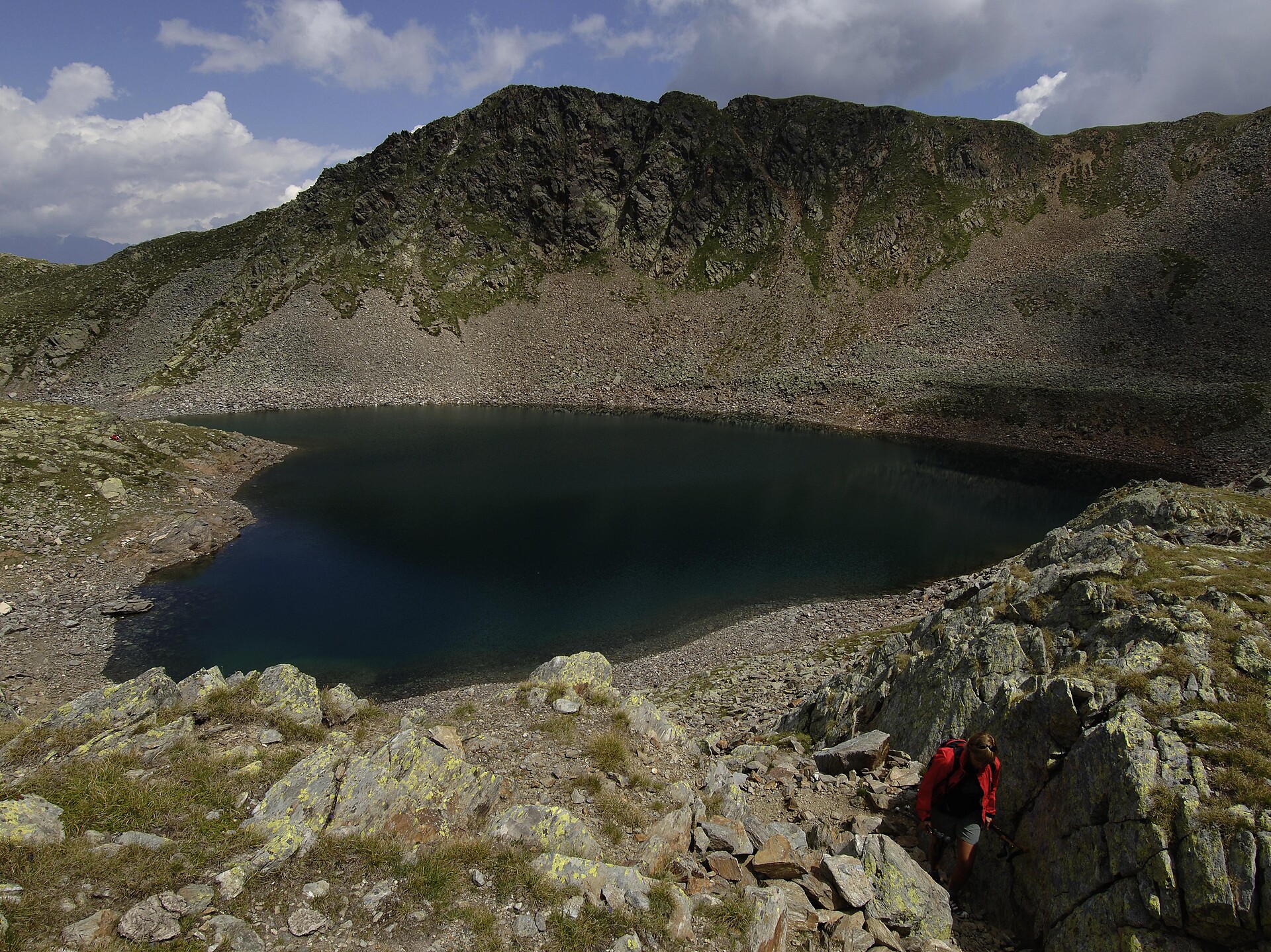
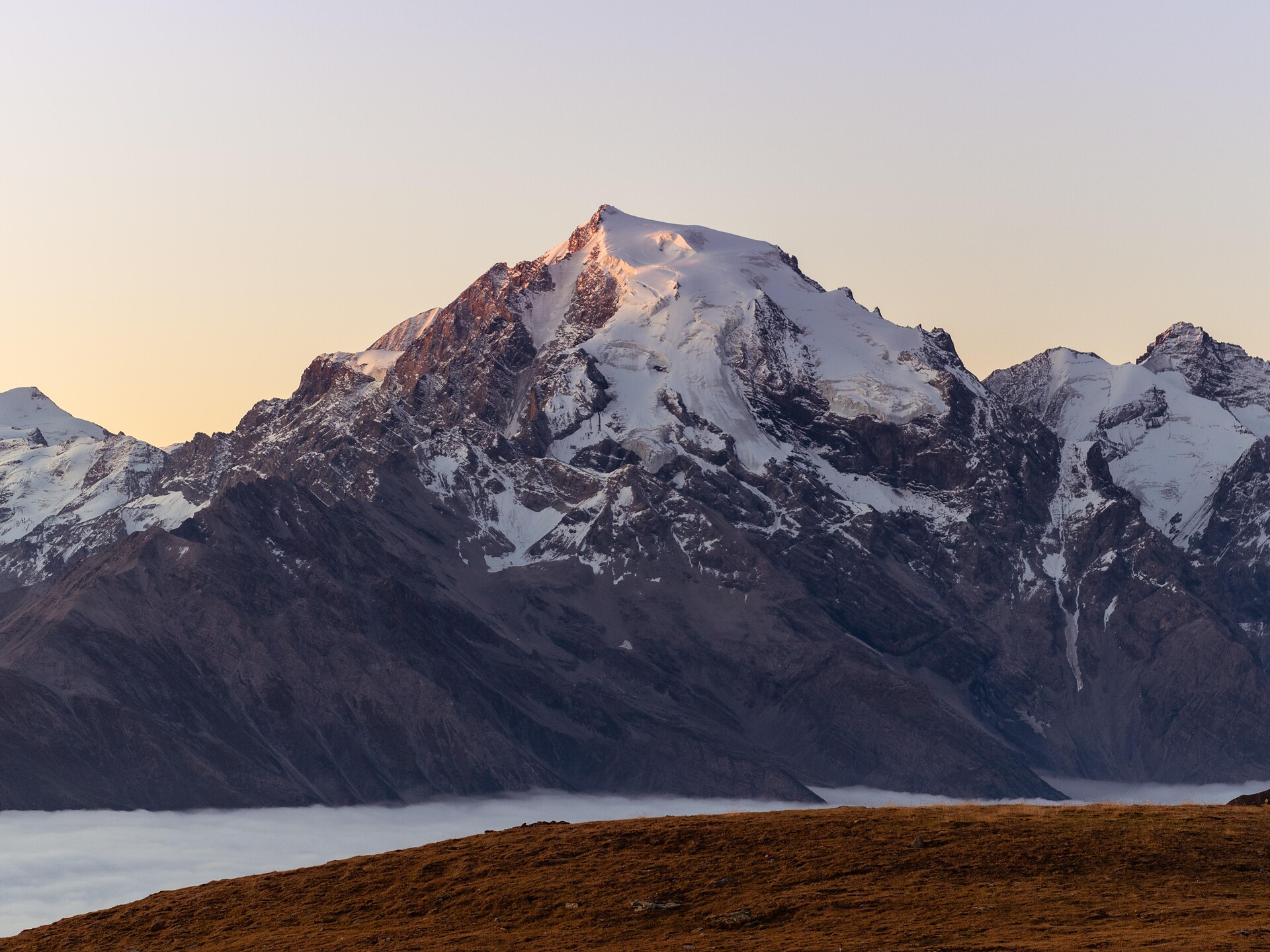
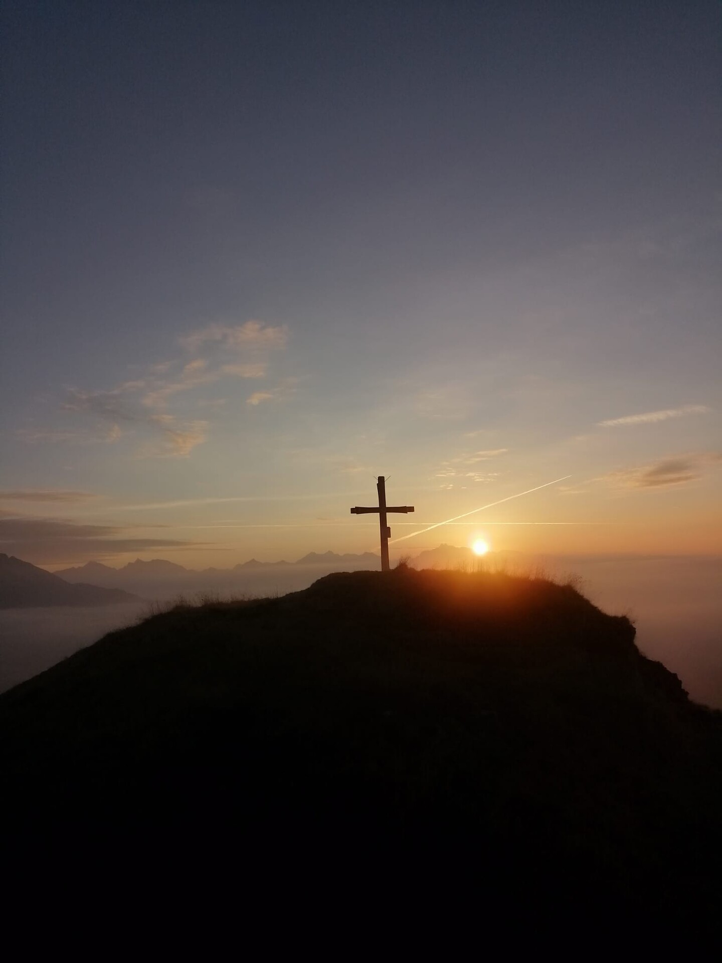
From the hamlet Gasse in the valley Ridnauntal past the farm group Entholz. Go up on path no. 24 through meadows and woods to the pasture Joggelealm. Passing the pasture Joggelealm, the path continues to the lake Fuchssee, from there following the markings to the small summit plateau with a new summit cross. The return follows the same route as the ascent.

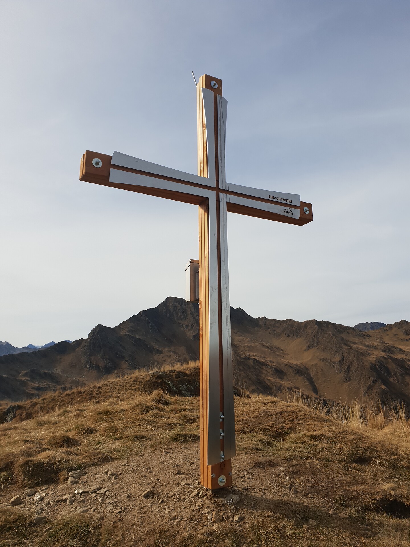
Variant: From the valley Ridnauntal follow path no. 26 through the valley of Valtigl until shortly before the pass. Then follow a wellmarked path without numbering alongside the pastures to the rewarding panoramic mountain Einachspitz. From there follow the red-white marking, past the small lake Fuchsee, through the mountain pasture Joggelealm and the new forest road to the starting point.

Obtížnost: střední
1005 m nadmořská výška
4h:13 min doba trvání
Hiking
Ebenes Jöchl
Martell/Martello, Vinschgau/Val Venosta

Crossing different altitudes you reach the top where you can enjoy a splendid view.

Obtížnost: vysoká
910 m nadmořská výška
4h:45 min doba trvání
Mountaineering
Peak Lazinser Rötelspitze/Cima Rossa (3,037 m)
Partschins/Parcines, Meran/Merano and environs

The Lazinser Rötelspitze/Cima Rossa Summit (3,037 m) is one of the most popular summits in the area of Meran/o and environs in the Texel Group Nature Park!


Obtížnost: vysoká
2146 m nadmořská výška
8h:00 min doba trvání
Mountaineering
Hiking trail to the place of discovery of Ötzi
Schnals/Senales, Vinschgau/Val Venosta

Challenging Alpine tour, which leads via the Similaunhütte mountain hut to the discovery site of the famous “iceman”.

Obtížnost: střední
1607 m nadmořská výška
8h:00 min doba trvání
Mountaineering
Mountain hiking on Monte Luco
U.L.Frau i.W.-St. Felix/Senale-S.Felice, Meran/Merano and environs

Mountain hike to the panoramic summit of the Mount Luco (2434 m). The hike starts at the Gampenpass/Passo Palade (1518 m) on the opposite side of the Gasthof Gampenpass hotel. The hiking path no. 10A leads you in 1,5 hour to the Laugen Alm - Malga Monte Luco. After a short break at the Alm the tour continuous on the hiking path 10 to the peak of Mount Luco (2434 m). Just before of the last steep ascent, on a small mountain saddle you have the option to take the less technical way to the top of the Monte Luco Piccolo (2290 m). Between the summits oft the great and small Mount Luco there is the beautiful and magnificent mountain lake Luco. Thanks to its widely outlook and awe-inspiring view, the Mount Luco belongs to one of the most outstanding lookouts of South Tyrol. The way back is along the hiking path no. 8A through the grass-grown south ridge and then on the hiking path no 10A firsts toward the Laugen Alm and further down to the Gampen Pass.

Obtížnost: střední
797 m nadmořská výška
2h:42 min doba trvání
Mountaineering
Hut to hut hiking: Krimmler Tauern - Trek
Prettau/Predoi, Ahrntal/Valle Aurina

HISTORICAL PATHS BETWEEN SOUTH TYROL AND SALZBURG REGION 

Tour: Kasern/Casere – Krimmler Tauernhaus mountain refuge – Warnsdorfer Hütte mountain refuge – Birnlücken Hütte mountain refuge Kasern/Casere

4 days – 3 overnight stays

The hike is rated intermediate-high for level of difficulty and offers unforgettable moments. The tour requires experience, not to suffer from vertigo, sure-footedness, physical fitness as well as suitable equipment. 


Obtížnost: vysoká
2618 m nadmořská výška
12h:15 min doba trvání
Hiking
Cima Gioveretto & Monte Cevedale
Martell/Martello, Vinschgau/Val Venosta

Alpine tour with impressive views of Ortler and Gran Zebru and overnight-stay possibility at Rifugio Martello or Rifugio Nino Corsi.

Obtížnost: vysoká
1873 m nadmořská výška
8h:01 min doba trvání
Hiking
Red Peak Val Martello
Martell/Martello, Vinschgau/Val Venosta

Wonderful hike with view of the fantastic mountain landscape. Start at the parking Genziana in Alta Val Martello and take path no.37 towards Red Peak/Rotspitze di Martello.

Obtížnost: vysoká
1099 m nadmořská výška
4h:19 min doba trvání
Mountaineering
Peak Roteck / Monte Rosso (3.337 m)
Partschins/Parcines, Meran/Merano and environs

The Roteck/Monte Rosso peak is the highest three-thousand-meter peak in the Texelgruppe Nature Park. Due to the long and partly steep ascent through the Zieltal, this tour is best divided into two days. The Lodnerhütte can be used as an overnight accommodation.

Obtížnost: vysoká
2467 m nadmořská výška
9h:41 min doba trvání
Hiking
Mittagspitze
Ratschings/Racines, Sterzing/Vipiteno and environs

Starting point is the hamlet Schluppes at the end of the Jaufental valley. From this point first you go 600 meters along a forest and then on the path no. 12 further into the valley. Turn left at the sign Mittagsspitze/no. 16 and walk up the quite steep way through the mountain forest. Continue on the marked trail over the tree line and towards the avalanche barrier under the mountain Mittagsspitze. The last piece again steeply along the ridge, to the summit cross at 2052 m. Hike the same path back to reach the starting point.

Obtížnost: střední
710 m nadmořská výška
2h:53 min doba trvání
Mountaineering
High Altitude Trail Neves
Mühlwald/Selva dei Molini, Ahrntal/Valle Aurina

The High Altitude Trail Neves - high above the lake Neves in Lappach/Lappago! The trail connects the two mountain refuges Edelraut Hütte/Ponte di Ghiaccio (2,545 m) and Chemnitzer Hütte/Giovanni Porro (2,419 m). 

The hike is rated intermediate for level of difficulty and offers unforgettable moments. The tour requires experience, not to suffer from vertigo, sure-footedness, physical fitness as well as suitable equipment. 

Obtížnost: vysoká
1086 m nadmořská výška
5h:46 min doba trvání
Mountaineering
Ascent of Mt. Conturines
Badia, Dolomites Region Alta Badia

Challenging hike in the Fanes group with start in San Cassiano. The Conturines peak is the highest peak of the Fanes group and offers a breathtaking view over the whole Val Badia valley.

The hike, perfect for keen mountaineers, requires safety, climbing skills and a good orientation skills.

Obtížnost: vysoká
1460 m nadmořská výška
6h:15 min doba trvání
Hiking
Rifugio Nino Corsi & Rifugio Martello
Latsch/Laces, Vinschgau/Val Venosta

Marvelous hike in Alta Val Martello, to the rustic refuges with a magnificent view of the Ortler mountain group in the heart of the Stelvio National Parc.

Obtížnost: nízká
550 m nadmořská výška
2h:46 min doba trvání
Mountaineering
Trumser Spitz Peak
Kastelbell-Tschars/Castelbello-Ciardes, Vinschgau/Val Venosta

The route on the sunny side is mostly snow-free and offers special mountain experiences, especially in early summer and autumn.

Obtížnost: vysoká
1631 m nadmořská výška
4h:50 min doba trvání
Hiking
Zufritt Peak
Martell/Martello, Vinschgau/Val Venosta

From the Lake Gioveretto up to the Grün- and Gelbsee Lake until the Gioveretto Peak with its wondreful view.

Obtížnost: vysoká
1583 m nadmořská výška
4h:54 min doba trvání
Mountaineering
Plomboden lakes circular hike
Kastelbell-Tschars/Castelbello-Ciardes, Vinschgau/Val Venosta

Plomboden lakes circular hike on the Monte Tramontana on Ciardes

Obtížnost: vysoká
1210 m nadmořská výška
5h:00 min doba trvání
Mountaineering
High Alpine Tour to the Ortler
Stilfs/Stelvio, Vinschgau/Val Venosta

In order to climb the summit of king Ortles at 3905m, you should stay the day before at the Julius-Payer hut (3.029m). After spending the night at the hut, you will climb up to the "Wandl", which is probably the technically most difficult part of the entire ascent. Now we cross the somewhat steep traverse at the upper end of the "Eisrinne", which has meanwhile become outdated in the upper section and which leads us over the "Bärenloch" up to "Tschierfegg" where the biv. Lombardi is located. This section has become more difficult in recent years due to the severe glacier retreat and you have to overcome a challenging ramp. The "Tschierfegg" is immediately followed by crevasse-rich terrain and a rather steep slope. Above we reach the gentle Ortler plateau where the ascent to the summit is moderate.

Obtížnost: vysoká
900 m nadmořská výška
4h:30 min doba trvání
1 2