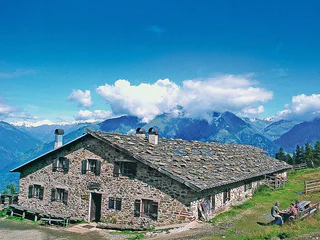
Südtirol Guide App Logo
Přeskočit na obsah

přidáno k oblíbeným

odebráno z oblíbených

Jejda! Došlo k problému, zkuste to prosím znovu

Vytváří se váš účet

Váš účet byl úspěšně vytvořen a nyní jste přihlášeni

Jste úspěšně přihlášeni!

Váš účet byl úspěšně vytvořen, ale nepodařilo se nám vás automaticky přihlásit

Jste odhlášeni

Filtr
Vybrané filtry
    Úroveň obtížnosti
    Doba trvání
    Vzdálenost v km

    MTB výlety a stezky

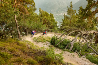
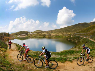
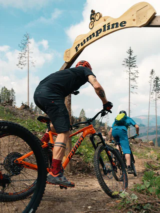
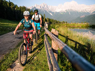
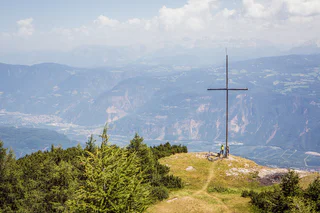
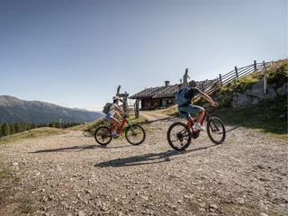
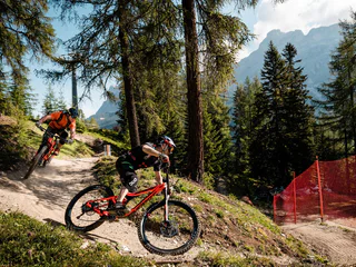
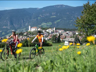
    Čistý adrenalin před působivou horskou scenérií: MTB výlety v Jižním Tyrolsku nabízejí zábavu pro každého bikera. Na cestu, vyrazte! Jako freerider prozkoumejte údolí ve Vinschgau, objevte Alpe di Siusi, největší alpskou louku v Evropě, na dvou kolech nebo pocítíte vítr při plynulém sjezdu z Kronplatzu. Jihotyrolské MTB túry jsou zárukou zábavy z jízdy a zážitků z přírody.

    Výsledky
    E-MTB
    Cycle tour to the Fiechtalm
    Ulten/Ultimo, Meran/Merano and environs
    The route starts directly at the Weißbrunn Lake and leads in a slight ascent over the forest road to the Fiechtalm, which is open from the beginning of June to the end of October.
    Obtížnost: střední
    188 m nadmořská výška
    3.3 Km vzdálenost
    E-Bikes
    To the Staller Saddle
    Rasen-Antholz/Rasun Anterselva, Dolomites Region Kronplatz/Plan de Corones

    The challenging tour to the Staller Sattel ass is one of the classic routes for South Tyrolean cycling enthusiasts. A gravel track leads you from Niederrasen along the river to Antholz Niedertal. The route continues through the village of Antholz Mittertal and along the paved main road to the beautiful Lake Antholz. From there, the final ascent to the 2,052 m high Staller Sattel alpine pass begins, which boasts numerous hairpin bends and breathtaking viewpoints (Important! Temporary one-way traffic regulation with traffic light: from South Tyrol to Austria every hour from the 30th to the 45th minute; from Austria to South Tyrol every hour from the full hour to the 15th minute).

    Obtížnost: vysoká
    1424 m nadmořská výška
    22.3 Km vzdálenost
    E-MTB
    Leitenalm -Tour
    Schenna/Scena, Meran/Merano and environs

    The roadway to the Taser has always been a classic for mountain bikers. After the construction of the forest road, which begins at the Taser, it is now possible to reach the extremely scenic mountain basin directly below the steeply rising peaks of the Ifinger and the Scheiber, by mountain bike.

    Obtížnost: vysoká
    1337 m nadmořská výška
    13.5 Km vzdálenost
    E-Bikes
    S. Pietro in Valle - Pontives
    Lajen/Laion
    Start in St. Peter im Tal at the Maringerhof. The trail leads through the forest in the direction of Pontives. Along the way are the ice springs, where the beer from the former brewery of St. Peter im Tal used to be stored. After a short climb we reach the Unterspisserhof farm and soon the Pontives craft zone. From there we can also go to St. Peter and in the future also to Ortisei.
    Obtížnost: nízká
    168 m nadmořská výška
    2.2 Km vzdálenost
    Downhills
    Gassl Trail
    Olang/Valdaora, Dolomites Region Kronplatz/Plan de Corones

    The easiest trail in the Kronplatz family: Launched in mid-2015, it winds down the eastern face of the mountain from the middle station Olang 1+2 lift over countless bends all the way down to Casola-Gassl. Although it’s chock-full of easy jumps and low-banked curves, its ever-changing route layout won’t distract you from appreciating the stunning panoramic views – a perfect place to whip up an appetite for freeriding!

    Obtížnost: střední
    0 m nadmořská výška
    6.4 Km vzdálenost
    Downhills
    Freeride Bike-Parcours Gardenaccia - La Villa
    Badia, Dolomites Region Alta Badia
    Freeriding is one of the most adrenaline-pumping ways to ride a bike. Mountain bikes are used to descend mountain paths with bumps, jumps and various natural obstacles such as roots, stones and bushes.
    In the Gardenaccia Freeride Bike Park, starting from the mountain station of the Gardenaccia chairlift at an altitude of 1,750 m, two routes have been created:
    •  the first one, more difficult, is for bikers who already have good riding skills, looking for strong emotions
    • the second is easier and suitable for less experienced bikers.
    The start of the bike park can be reached by taking the Gardenaccia chairlift from La Villa.
    At the Gardenaccia chairlift there is the possibility to rent freeride bikes.
    Obtížnost: vysoká
    5 m nadmořská výška
    3.2 Km vzdálenost
    Downhills
    Furcia Trail
    Al Plan/San Vigilio, Dolomites Region Kronplatz/Plan de Corones

    The Herrnsteig trail's little brother too is packed with flow and curves. But while it's nowhere near as wild and bumpy, its 124 bends and turns between the top of Mount Kronplatz and Passo Furcia make it at least equally winding and dizzying. To get back up to the top, simply hop on the Ruis cable car at Passo Furcia. The big challenge on this trail is to master it without pedalling and with as little use of the brakes as possible. It is ideal for medium-advanced and pro bikers who wish to get to most out of an active riding style.

    Obtížnost: střední
    0 m nadmořská výška
    4.9 Km vzdálenost
    E-MTB
    293 Wuhnleger Lake tour
    Tiers am Rosengarten/Tires al Catinaccio, Dolomites Region Seiser Alm

    Witnesses to the event recall the air-raid of 1943 which created the small lake at the Wuhnleger. It is now home to toads, salamanders and dragonflies, and showcases an immense biodiversity. The view of the Catinaccio and the Torri del Vajolet together with their mirror-image in the lake is an unmissable natural spectacle.

    Obtížnost: nízká
    405 m nadmořská výška
    11.0 Km vzdálenost
    E-Bikes
    Cicling route Monguelfo - Brunico
    Bruneck/Brunico, Dolomites Region Kronplatz/Plan de Corones
    On two wheels through the Pustertal Valley! Explore part of the Pustertal Valley cycle route in a relaxed manner. From Monguelfo to Brunico by bike.
    Start: Monguelfo-Tesido – Monguelfo, village
    Destination: Brunico
    Distance: 17,9 km
    Difference in altitude: 73 m
    Obtížnost: nízká
    144 m nadmořská výška
    17.9 Km vzdálenost
    E-MTB
    Uphill Trumser Alb'l
    Kastelbell-Tschars/Castelbello-Ciardes, Vinschgau/Val Venosta
    Uphill Trumser Alb'l from Kastelbell - marvellous panoramic views guaranteed.
    Obtížnost: střední
    1567 m nadmořská výška
    15.1 Km vzdálenost
    Downhills
    Herrnsteig Trail
    Bruneck/Brunico, Dolomites Region Kronplatz/Plan de Corones

    Incredibly long, insanely challenging and winding like there's no tomorrow: The Herrnsteig freeride trail is already legendary. One of the Alps' very best, it starts with a 20-minute cable car ride to the top of Mount Kronplatz and takes you down the north face of the mountain on an 8 km bare-knuckle ride worth an impressive 1300 m of difference in altitude. And it never has to be the same: On both sides of the original trail, a number of track alternatives branch off – towards endless fun and kicks. The perfect trail for pros and medium-advanced riders.

    Obtížnost: střední
    0 m nadmořská výška
    7.5 Km vzdálenost
    E-Bikes
    MTB tour to the Spitzen Alpine hut
    Ulten/Ultimo, Meran/Merano and environs
    The route starts at the Zoggler reservoir in St. Walburg (dam wall) and leads along a forest road to the Spitzen alpine hut (1.856 m), which is open from mid-June to early September.
    Obtížnost: střední
    714 m nadmořská výška
    7.4 Km vzdálenost
    Mountain bike
    Bike Beats - San Cassiano Bridge Line
    Badia, Dolomites Region Alta Badia

    The Bridge Line is a variant for the last section of the Avëna Trail. The path that descends along the last stretch of wood on the slope of Piz Sorega has a spectacular view of the town of San Cassiano.

    Obtížnost: nízká
    49 m nadmořská výška
    368.0 m vzdálenost
    Downhills
    Crazy Bunny Line
    Al Plan/San Vigilio, Dolomites Region Kronplatz/Plan de Corones

    With plenty of jumps, bumps and bends in quick succession, this line is an “up-in-the-air” variant along the Furcia trail. If you’re not afraid to let go of the brakes and take off, you’re in for tons of fun on this trail.

    Level: medium

    Obtížnost: střední
    0 m nadmořská výška
    491.0 m vzdálenost
    E-MTB
    MTB tour to the Kirchberg Valley
    Ulten/Ultimo, Meran/Merano and environs
    The route starts in St. Gertraud (bus stop) and leads along a forest road to the Kirchberg Alm (1,887 m), which is managed from mid-June to early September and continues to Bärhapp (2,296 m). There the forest road ends and the route continues via hiking trail no. 108 to Rabbijoch.
    Obtížnost: střední
    1071 m nadmořská výška
    8.5 Km vzdálenost
    Mountain bike
    Bike Beats - San Cassiano Mans Trail
    Badia, Dolomites Region Alta Badia

    With the "Mans Trail" the Bike Beats “menu” offers even more adrenalin. After the Heart, the Eye, the Veins and the Breath, it's time for the Hands. The Trail Mans - in Ladin language hands, of moderate difficulty, calls for a sensitive touch and careful attention while riding along a fun route, where the trick lies in finding the optimal equilibrium between manual technique and balance.

    Obtížnost: nízká
    0 m nadmořská výška
    1.9 Km vzdálenost
    E-MTB
    Schloss Annenberg Tour (Castello di S. Anna)
    Latsch/Laces, Vinschgau/Val Venosta

    This challenging uphill trip to S. Martino in Monte runs from Laces over some loose cobble and up some steep paths and involve some areas where the bike must be pushed. The maximum gradient is 24% and therefore this trail is only recommended for experienced mountain bikers.

    Obtížnost: střední
    1167 m nadmořská výška
    13.4 Km vzdálenost
    E-MTB
    To the Brunst Alm Hut
    Rasen-Antholz/Rasun Anterselva, Dolomites Region Kronplatz/Plan de Corones

    The excursion to the Brunst Alm mountain hut first takes us out of the valley, past the football pitch in Niederrasen and underneath the Pustertaler Straße road. We then head towards Oberolang and cycle uphill through the village and past the parking lot of the Kids’ World Olang. From there, the challenging ascent begins on a gravel path into the forest, which then leads to our destination of the Brunst Alm. The ascent is rewarded with a breathtaking view of the Olang mountain range and the Kronplatz.

    Obtížnost: vysoká
    1048 m nadmořská výška
    10.4 Km vzdálenost
    E-MTB
    Stuanbruch-Trail
    Partschins/Parcines, Meran/Merano and environs
    Route length in km: 10,9
    Vertical climb: ascent 100m – descent 1.260m
    Surface: forest path, root passages, stones, loose stones, steep to very steep, cart path, loose stones, no banister or railings, fencing
    Required technical skills: S1/S2 – moderately difficult with some difficult sections
    Obtížnost: střední
    36 m nadmořská výška
    10.1 Km vzdálenost
    E-Bikes
    Bike Tour Brixen - Villnöß
    Brixen/Bressanone, Brixen/Bressanone and environs
    In addition to unique landscapes, imposing mountains and traditional villages, you can expect different types of terrain: Roads, gravel and forest paths will lead you through the Villnöß valley up to the Dolomite giants of the Odle mountains. Once at their foot, the traditional alpine huts reward you with a cosy atmosphere and South Tyrolean delicacies.
    Obtížnost: vysoká
    1048 m nadmořská výška
    20.6 Km vzdálenost
    Mountain bike
    299 Rifugio Firenze Tour Alternative
    S.Crestina Gherdëina/Santa Cristina Val Gardana, Dolomites Region Val Gardena

    This variant leads to one of the most famous photo spots since the advent of social media. The ascent is only for really fit bikers and even with an ebike, the slope is only suitable for trained legs. But at the summit you are rewarded with a wonderful view of the Odle peaks, the Sella massif and the Sassolungo. But beware: if you cycle up the steep gravel roads, you also have to cycle down on them, and that requires a lot of strength, both uphill and downhill.                                                          

    Obtížnost: vysoká
    399 m nadmořská výška
    2.9 Km vzdálenost
    E-Bikes
    To the Malga Stelvio di Sopra/Oberen Stilfser Alm
    Stilfs/Stelvio, Vinschgau/Val Venosta

    The mountain bike tour leads along a forest path to the Malga Stelvio di Sopra/Oberen Stilfser Alm, which makes it ideal for e-bikers. At the end of this relatively easy tour, a managed alpine hut awaits you, with its own alpine dairy and refreshment facilities.

    Obtížnost: nízká
    504 m nadmořská výška
    9.5 Km vzdálenost
    E-MTB
    Uphill Freiberger Alm/Mahd
    Kastelbell-Tschars/Castelbello-Ciardes, Vinschgau/Val Venosta
    By bike to the Freiberger Alm/Mahd on the Kastelbell Nörderberg
    Obtížnost: střední
    1111 m nadmořská výška
    10.5 Km vzdálenost
    E-Bikes
    Klapfberg Valley
    Ulten/Ultimo, Meran/Merano and environs
    The route starts at the farm Falschauer and leads along a forest road to the Klapfberg alpine hut (1.946 m), which is open from mid-June to early September.
    Obtížnost: střední
    599 m nadmořská výška
    5.8 Km vzdálenost
    Mountain bike
    Bike Beats - San Cassiano Ödli Trail
    Badia, Dolomites Region Alta Badia

    The trail “Ödli” is ideal to enjoy the Dolomites in all their beauty. Ödli means eyes in the Ladin language and it is with their own eyes that taking the easiest of the Bike Beats trails, bikers will have the opportunity to admire the magnificent scenery.
    The trail extends along the right slope of the Piz Sorega for a total length of 1460 m and an altitude difference of 142 m.

    Obtížnost: nízká
    0 m nadmořská výška
    1.7 Km vzdálenost
    Downhills
    Dragon Trail
    Olang/Valdaora, Dolomites Region Kronplatz/Plan de Corones
    New in summer 2022 in the Bike Park Kronplatz is the "Dragon Trail": the trail, over 2 kilometers long, winds along the hillside from the summit to the middle station of the Olang 1+2 lift. The highlight is definitely crossing the Dragon's Head and the Dragon's Tail, where you have a beautiful panorama of the surrounding Dolomites at the same time.
    Obtížnost: nízká
    0 m nadmořská výška
    2.0 Km vzdálenost
    Mountain bike
    Brixen Bikepark: Jerry Line
    Brixen/Bressanone, Brixen/Bressanone and environs

    The Jerry Line is really easy. Jerry, the creator of the line who also gave it its name, has never designed it too steep, never too rough and never to tight: It is simply ideal for beginners and kids. There are only 300 metres of difference in elevation from the trailhead to the trail end, but in between are 4.2 km trail fun for the whole family.


    Level of difficulty: Green – very easy
    Novice-friendly line with soft bends and flowing route. There are no artificial obstacles or jumps, the line is also suitable for children. Basic knowledge of mountain bikes required.

    Obtížnost: nízká
    5 m nadmořská výška
    4.2 Km vzdálenost
    E-Bikes
    Furkelpass / Passo Furcia
    Al Plan/San Vigilio, Dolomites Region Kronplatz/Plan de Corones

    We start this tour in Niederrasen and it first takes us out of the valley to Neunhäusern, where we then turn left towards Niederolang. We then continue past the church to the hamlet of Mühlbach and on to Gassl, where the valley station of the Olang cable car is located. This is where the ascent to the Furkel Pass at 1,789 metres above sea level begins. We initially ride along a gravel road until we turn onto the paved Furkelstraße, which then leads us to our destination. Once we reach the pass, we can enjoy the marvellous view of the surrounding mountains before returning to Niederrasen along the same route.

    Obtížnost: vysoká
    832 m nadmořská výška
    14.2 Km vzdálenost
    E-MTB
    Sellaronda MTB tour - anti-clockwise
    Corvara, Dolomites Region Alta Badia

    Spectacular Dolomite peaks and legendary mountain passes: The Sellaronda is one of the most beautiful and popular circular routes in the Alps and offers all kinds of exciting options in winter or in summer. One of these is the Sellaronda mountain biking tour. The tour requires a good level of physical fitness and mountain biking experience, because there are some tricky climbs and a few difficult descents to manage. However, for the last few years there has been the option of avoiding some of the particularly steep climbs by using lifts, making it possible to complete the tour in a day.

    Following the Sellaronda MTB Tour Anti-Clockwise there is a total height difference of about 1.020 m to be cycled uphill and several descents through single trails or forest roads. Therefore it is more suited to those who enjoy cycling uphill on your MTB or e-bike. The time needed to complete the tour varies according the ability of the biker: from a minimum 6 to a maximum of 9 hours, with a lunch break included.

    www.sellaronda-mtb.com

    Obtížnost: vysoká
    3370 m nadmořská výška
    55 Km vzdálenost
    Downhills
    Spitzhorn Trail
    Olang/Valdaora, Dolomites Region Kronplatz/Plan de Corones
    The Spitzhorn Trail is divided into three sections: the first part, which breaks off from the Gassl Trail, is a sequence of very smooth flowing curves, the middle section features jumps and features in an open area with great visibility to the scenic Wallride. The last section runs through the forest, alternating between natural terrain and various wooden footbridges that eventually lead back to the existing trail.
    Obtížnost: střední
    0 m nadmořská výška
    1 Km vzdálenost
    1 2 3 4 5 6 7 8 9 10 11 12 13 14