Skip to content
added to favourites
removed from favourites
Oops! Something went wrong. Try again
Your account is being created
Your account has been successfully created and you are now logged in
You are logged out.
Filter
Selected filters
    Level of difficulty
    Duration
    Distance in KM

    Waalwege canal trails in Vinschgau/Val Venosta

    Due to scarce rainfall, farmers in Vinschgau had to come up with creative ideas.  That’s why they built the so-called "Waale", irrigation canals that transported water to pastures and fields. Today, the fascinating narrow trails that meander through forests, orchards, past castles, forts and chapels, are popular hiking destinations – surprisingly, the irrigation canals on the Malser Haide in the Obervinschgau valley have also been declared a UNESCO World Heritage Site. Above all in spring and autumn, you should walk through this Mediterranean-like landscape and listen to the healing sound of water.

    Results
    Hiking
    Hike along the Ilswaal Canal
    Schlanders/Silandro, Vinschgau/Val Venosta

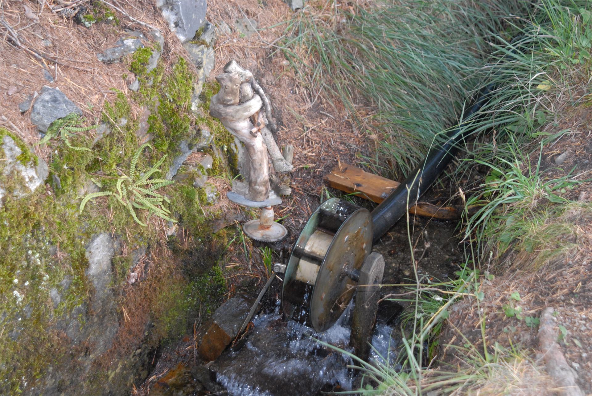
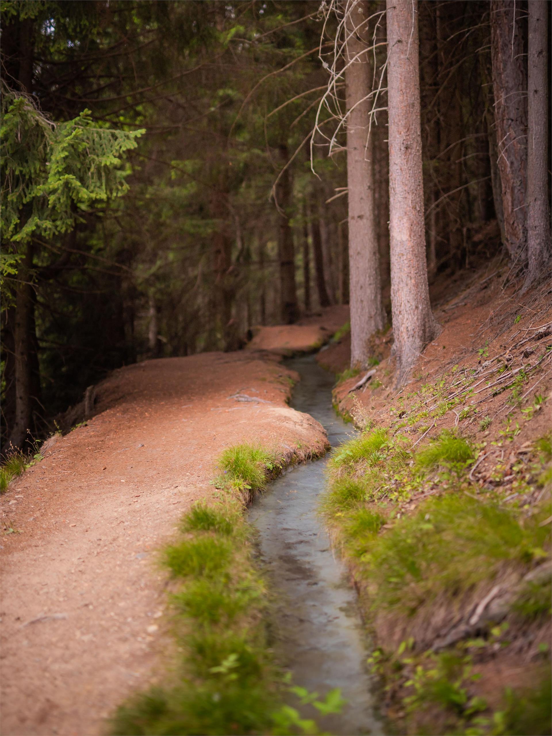
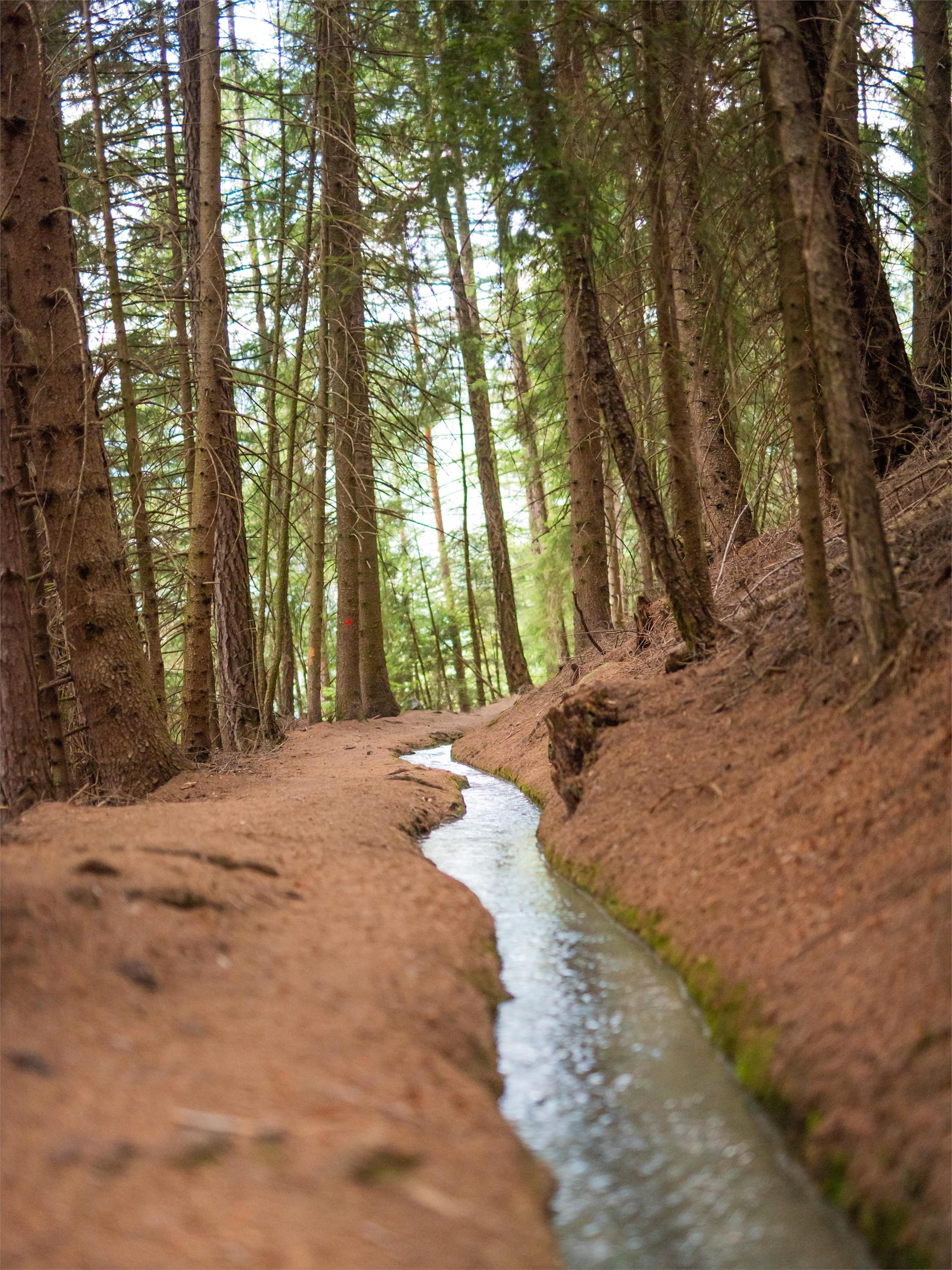
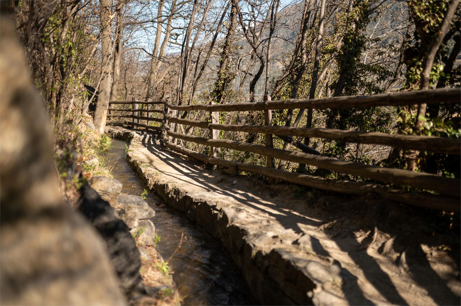
    From spring to autumn, the ever-changing Ilswaal irrigation canal carries water, so in these months it is perfect for a canal hike in the sunshine.

    From Schlanders, the trail leads past the Schlandersberg Castle (Schloss Schlandersberg) which is a nice place to enjoy the view. It continues past the wild gorge of the Schlandraunbach stream to the St Ägidius Church near Kortsch.

    Duration: 2 hr 30 min
    Cumulative elevation gain: 440 m

    Difficulty: medium
    300 altitude up
    1h:06 min duration
    Hiking
    Via Vinum Venostis
    Kastelbell-Tschars/Castelbello-Ciardes, Vinschgau/Val Venosta

    The new theme path provides an insight into viniculture and wine history and spans an arc between agriculture and gastronomy. Different information panels describe local grape varieties, landscape and culinary specialties. The Val Venosta wine path is perfectly walkable from Easter to November and takes you along the irrigation channel paths (Latschander irrigation channel path and Senales irrigation channel path) over long distances. This hike of about 2.5 hours can be made in both directions and it is also possible to choose specific sections only.

    Difficulty: medium
    398 altitude up
    2h:40 min duration
    Hiking
    The irrigation channel path "Frauwaal"
    Prad am Stilfser Joch/Prato allo Stelvio, Vinschgau/Val Venosta

    This hike starts at Prato and continues slightly above the wide valley floor, to the idyllically situated village of Montechiaro.

    Difficulty: easy
    181 altitude up
    1h:30 min duration
    Hiking
    Kaandlwaal tour
    Martell/Martello, Vinschgau/Val Venosta

    The wonderful wooden irrigation channel set in Val Martello’s Selva is an attraction for young and old. It is ideal for a family excursion thanks to its marvelous location at the sunny slope.

    Difficulty: easy
    239 altitude up
    1h:11 min duration
    Hiking
    Ramini Irrigation channel path
    Latsch/Laces, Vinschgau/Val Venosta
    Small works of art await you along the old irrigation channels.
    We start in Tarres just above the picturesque village and turn right into the so-called Raminiwaal - Ramini irrigation cannel path with trail number 18. On our journey of discovery of the small works of art in and around the water, we also enjoy the view of Laces and the surrounding area. We cross the ‘Laces Valley’ and now follow trail number 18 A through the lush green mixed forest to the IceForum in Laces. Then follow the main road into the centre. You can then get back to Tarres by bus 269 or alternatively via the old Tarres road number 1 (watch out for the steep section).
    Difficulty: easy
    0 altitude up
    0h:54 min duration
    Hiking
    Senales irrigation channel path to Juval Castle
    Kastelbell-Tschars/Castelbello-Ciardes, Vinschgau/Val Venosta

    Hiking along old irrigation channels is one of the favorite Sunday activities of South Tyroleans - hardly surprising, because these walks are easy and you can take them with the whole family. One of the most beautiful is the Senales irrigation channel path!

    Difficulty: easy
    300 altitude up
    3h:00 min duration
    Hiking
    Hike along the Neuwaal
    Schlanders/Silandro, Vinschgau/Val Venosta

    This trail starts much further up, on the Aussereggen farm along the slopes of the Monte Sole at Silandro/Schlanders and is one highest irrigation canal trails in the entire Venosta Valley. The trail passes through narrow walkways and wooden bridges through fields and larch forests in the peaceful Schlandrauntal Valley.

    Difficulty: medium
    124 altitude up
    0h:49 min duration
    Hiking
    Sun Promenade
    Schlanders/Silandro, Vinschgau/Val Venosta

    The Sun Promenade leads along a small irrigation channel carrying water from spring until autumn. There is a magnificent view from the trail of the old Schlanders town centre this as well as of the apple orchards up to Göflan and the Stelvio National Park.

    Difficulty: easy
    0 altitude up
    0h:31 min duration
    Hiking
    Latschander irrigation channel trail
    Latsch/Laces, Vinschgau/Val Venosta

    The last big irrigation path of Val Venosta dates back to 1873, using the waters of the Adige River near Coldrano at an altitude of 660 metres and ending after 6 kilometres in Galsaun, municipality of Castelbello.

    Difficulty: easy
    154 altitude up
    1h:43 min duration
    Hiking
    Hike along the Zaalwaal
    Schlanders/Silandro, Vinschgau/Val Venosta

    Zaalwaal
    A hike along a picturesque irrigation channel, or Waal, near Schlanders with fabulous views of the chestnut groves and orchards that carpet the Vinschgau Valley.

    Difficulty: easy
    240 altitude up
    1h:03 min duration
    Hiking
    Latschander irrigation channel path
    Latsch/Laces, Vinschgau/Val Venosta

    The zigzag shaped Latschander irrigation channel path in between Laces and Castelbello was created in 1872/1873 and provides an ideal walk for the whole family. Those who wish to stroll along the entire irrigation channel trail should allow approximately 2.5 hours to do so.

    Difficulty: easy
    50 altitude up
    2h:00 min duration
    Hiking
    "Suachbichl" viewpoint
    Martell/Martello, Vinschgau/Val Venosta

    Discover the area of the Kondlwaal (wooden irrigation channel) and sunny Selva from Europe’s highest corn farm.

    Difficulty: easy
    269 altitude up
    1h:33 min duration
    Hiking
    Turnaunawaal irrigation channel path
    Taufers im Münstertal/Tubre, Vinschgau/Val Venosta

    Hike on a sunny slope along the Turnaunawaal irrigation channel path

    Water supply: from May
    Refreshments: in the restaurants in Taufers im Münstertal/ Tubre in Val Monastero

    Difficulty: medium
    281 altitude up
    2h:30 min duration
    Hiking
    Tour Ramini-Montani
    Latsch/Laces, Vinschgau/Val Venosta

    A very special and various tour between Tarres and Morter. The tour starts at Tarres.

    Difficulty: medium
    493 altitude up
    3h:32 min duration
    Hiking
    Hike along the Fischerwaal Canal
    Prad am Stilfser Joch/Prato allo Stelvio, Vinschgau/Val Venosta

    The irrigation channel is shady in the middle of the Stelvio National Park. The “Waalschelle”, which is fixed to a larch above the irrigation channel, can be heard from afar.

    Duration: 30 min
    Cumulative elevation gain: 100 m

    Difficulty: easy
    114 altitude up
    0h:22 min duration
    Hiking
    Neuwaal irrigation channel path
    Latsch/Laces, Vinschgau/Val Venosta
    In the footsteps of the ancient rock paintings of the Waaler.
    We start at the IceForum in Laces and follow trail no. 5 to the Margrinböden picnic area. There we enjoy the view over the castle ruins of Ober- & Untermontani. We then continue to the fork in the path where we follow path number 5a downhill to the Bierkeller. From there, the route leads through the orchards along the tarmac road back to the starting point. Variation: if you prefer a longer walk, you can descend from the Marginböden via the ruins of Ober- & Untermontani Castle and walk back along the irrigation channel path Mareinwaal via the Bierkeller.
    Difficulty: easy
    177 altitude up
    1h:26 min duration
    Hiking
    The Oberwaal Trail
    Mals/Malles, Vinschgau/Val Venosta

    Family hike - Oberwaal Irrigation Channel Trail to Mals/ Malles in the Vinschgau Valley

    Difficulty: easy
    0 altitude up
    0h:45 min duration
    Hiking
    Irrigation channel path round (Rautwaal-Neuwaal-Mareinwaal)
    Latsch/Laces, Vinschgau/Val Venosta

    The relaxed circular trail leads hikers along the traditional Laces irrigation systems. It starts at Morter and heads from the Mareinwaal over the Neuwaal and the Rautwaal irrigation channel paths.

    Difficulty: easy
    292 altitude up
    2h:47 min duration
    Hiking
    Castle path
    Kastelbell-Tschars/Castelbello-Ciardes, Vinschgau/Val Venosta

    The Castle path - An experience for the family on the Monte Sole at Castelbello

    Difficulty: medium
    233 altitude up
    2h:00 min duration
    Hiking
    Hiking tour along the sun trail
    Mals/Malles, Vinschgau/Val Venosta

    Sonnensteig trail - the theme trail in Upper Vinschgau Valley

    There are some interesting points of exploration along this themed route such as the Benedictine abbey, the paths along the irrigation canals (known locally as ‘Waale’) as well as the natural landscape and some of the legends of the Alta Vinschgau Valley. And if you prefer, you can select just specific sections of the themed trail of interest to you. 

    Difficulty: medium
    392 altitude up
    7h:00 min duration
    1