Piani di Rosim/Rosimboden
Solda/Sulden, Stilfs/Stelvio, Vinschgau/Val Venosta
medium
Difficulty
554 m
Elevation gain
2h:45 min
duration
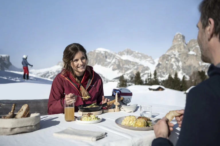
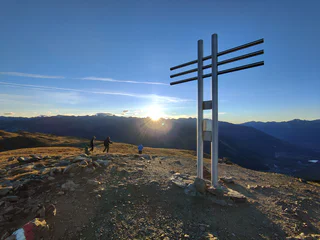
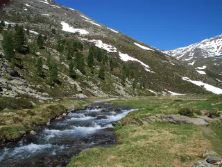
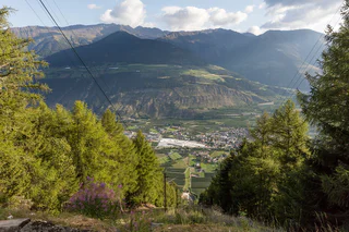
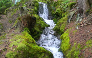
Walking is the best way to enjoy wonderful stretches of greenery. During your spring in South Tyrol, you can witness the awakening of nature in the valley and on the alpine meadows in bloom. Midsummer days are equally surprising: people are lured to mountain peaks, marvel at sweeping views and indulge in the traditional dishes served in quaint mountain huts. Go on a hike to watch the spectacle of autumn’s glorious colours and relax in nature.
Solda/Sulden, Stilfs/Stelvio, Vinschgau/Val Venosta
medium
Difficulty
554 m
Elevation gain
2h:45 min
duration
Tarres/Tarsch, Latsch/Laces, Vinschgau/Val Venosta
easy
Difficulty
120 m
Elevation gain
0h:40 min
duration
Montechiaro/Lichtenberg, Prad am Stilfser Joch/Prato allo Stelvio, Vinschgau/Val Venosta
easy
Difficulty
234 m
Elevation gain
2h:30 min
duration
1/5
Tubre/Taufers i. M., Mals/Malles, Vinschgau/Val Venosta
difficult
Difficulty
1417 m
Elevation gain
7h:30 min
duration
1/9
Oris/Eyrs, Laas/Lasa, Vinschgau/Val Venosta
medium
Difficulty
880 m
Elevation gain
4h:01 min
duration
Transacqua/Ennewasser, Martell/Martello, Vinschgau/Val Venosta
difficult
Difficulty
1424 m
Elevation gain
4h:16 min
duration
Altavalle/Hintermartell, Martell/Martello, Vinschgau/Val Venosta
medium
Difficulty
0 m
Elevation gain
2h:30 min
duration
1/3
Gomagoi/Gomagoi, Stilfs/Stelvio, Vinschgau/Val Venosta
medium
Difficulty
347 m
Elevation gain
2h:16 min
duration
Transacqua/Ennewasser, Martell/Martello, Vinschgau/Val Venosta
difficult
Difficulty
1583 m
Elevation gain
4h:54 min
duration
1/4
Slingia/Schlinig, Mals/Malles, Vinschgau/Val Venosta
medium
Difficulty
415 m
Elevation gain
2h:45 min
duration
1/2
Altavalle/Hintermartell, Martell/Martello, Vinschgau/Val Venosta
easy
Difficulty
324 m
Elevation gain
1h:58 min
duration
Mazia/Matsch, Taufers im Münstertal/Tubre, Vinschgau/Val Venosta
easy
Difficulty
502 m
Elevation gain
1h:43 min
duration
Burgeis/Burgusio, Mals/Malles, Vinschgau/Val Venosta
easy
Difficulty
146 m
Elevation gain
0h:45 min
duration
1/4
Lasa/Laas, Laas/Lasa, Vinschgau/Val Venosta
medium
Difficulty
523 m
Elevation gain
1h:49 min
duration
Martello/Martell, Martell/Martello, Vinschgau/Val Venosta
medium
Difficulty
630 m
Elevation gain
5h:00 min
duration
1/3
Planol/Planeil, Mals/Malles, Vinschgau/Val Venosta
difficult
Difficulty
600 m
Elevation gain
4h:30 min
duration
1/3
Montechiaro/Lichtenberg, Prad am Stilfser Joch/Prato allo Stelvio, Vinschgau/Val Venosta
medium
Difficulty
642 m
Elevation gain
3h:19 min
duration
Solda/Sulden, Stilfs/Stelvio, Vinschgau/Val Venosta
easy
Difficulty
424 m
Elevation gain
2h:31 min
duration
Solda/Sulden, Stilfs/Stelvio, Vinschgau/Val Venosta
easy
Difficulty
697 m
Elevation gain
1h:30 min
duration
1/3
Montechiaro/Lichtenberg, Prad am Stilfser Joch/Prato allo Stelvio, Vinschgau/Val Venosta
medium
Difficulty
369 m
Elevation gain
2h:00 min
duration
Trafoi/Trafoi, Stilfs/Stelvio, Vinschgau/Val Venosta
easy
Difficulty
600 m
Elevation gain
3h:58 min
duration
Transacqua/Ennewasser, Martell/Martello, Vinschgau/Val Venosta
easy
Difficulty
269 m
Elevation gain
1h:33 min
duration
Vinschgau/Val Venosta
medium
Difficulty
510 m
Elevation gain
2h:30 min
duration

1/6
Oris/Eyrs, Laas/Lasa, Vinschgau/Val Venosta
medium
Difficulty
992 m
Elevation gain
4h:52 min
duration
Ciardes/Tschars, Kastelbell-Tschars/Castelbello-Ciardes, Vinschgau/Val Venosta
medium
Difficulty
420 m
Elevation gain
2h:00 min
duration
Trafoi/Trafoi, Stilfs/Stelvio, Vinschgau/Val Venosta
easy
Difficulty
987 m
Elevation gain
4h:31 min
duration
Tschars/Ciardes, Kastelbell-Tschars/Castelbello-Ciardes, Vinschgau/Val Venosta
easy
Difficulty
244 m
Elevation gain
3h:00 min
duration
1/3
Trafoi/Trafoi, Stilfs/Stelvio, Vinschgau/Val Venosta
difficult
Difficulty
1560 m
Elevation gain
5h:22 min
duration
1/8
Oris/Eyrs, Laas/Lasa, Vinschgau/Val Venosta
easy
Difficulty
132 m
Elevation gain
0h:49 min
duration
Morter/Morter, Latsch/Laces, Vinschgau/Val Venosta
easy
Difficulty
292 m
Elevation gain
2h:47 min
duration
Thank you for signing up!
You are already subscribed
Confirm your registration
To complete your subscription, open the email we just sent you and click on the confirmation link.
Can’t find it? Check your spam folder too.
We noticed that you are already subscribed to our Newsletter. We will update you on exclusive offers, fun adventures and more so you can make the best out of your vacation.
We noticed that you already tried to subscribe to our Newsletter in the past but didn’t confirmed the subscription. We have resent you an email now, please check your inbox and spam folder to confirm.