
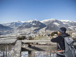
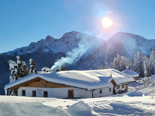
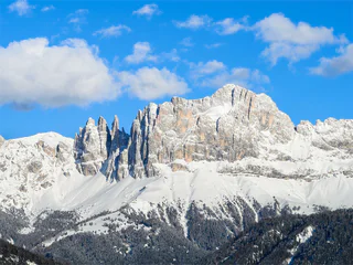
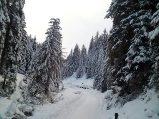
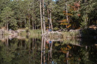
La Ferata – The old railway line featuring Bronze Sculptures and Snow Depths - Winter
Selva/Sëlva/Wolkenstein/Sëlva, Urtijëi/Ortisei, Dolomites Region Val Gardena
easy
Obtížnost
61 m
Převýšení
2h:31 min
doba trvání
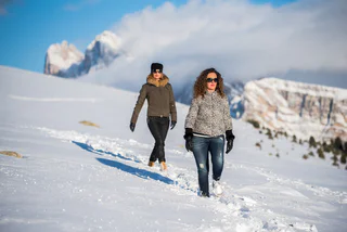
Během zimních túr po upravených stezkách poznáte klidnou stránku Jižního Tyrolska. Objevte okouzlující vyhlídky v Dolomitech, zasněžené lesy v tichých bočních údolích a vychutnejte si přírodu na vlastní pěst v absolutním tichu. Na sněžnicích se vydáte daleko od sjezdovek a lanovek do nedotčených lesů. Tak se turistika na sněžnicích a zimní turistika stává skutečným zážitkem.
Selva/Sëlva/Wolkenstein/Sëlva, Urtijëi/Ortisei, Dolomites Region Val Gardena
easy
Obtížnost
61 m
Převýšení
2h:31 min
doba trvání
1/4
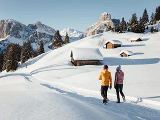
Scena/Schenna, Schenna/Scena, Meran/Merano and environs
easy
Obtížnost
320 m
Převýšení
2h:00 min
doba trvání
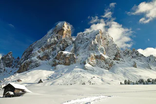
Ausserprags/Braies di Fuori, Prags/Braies, Dolomites Region 3 Zinnen
easy
Obtížnost
47 m
Převýšení
0h:40 min
doba trvání
San Leonardo i.P./St. Leonhard i.P., St.Leonhard in Passeier/San Leonardo in Passiria, Meran/Merano and environs
medium
Obtížnost
183 m
Převýšení
1h:31 min
doba trvání
Valgiovo/Jaufental, Ratschings/Racines, Sterzing/Vipiteno and environs
medium
Obtížnost
569 m
Převýšení
2h:31 min
doba trvání
1/2
Ortisei/Urtijëi/St. Ulrich/Urtijëi, Urtijëi/Ortisei, Dolomites Region Val Gardena
easy
Obtížnost
101 m
Převýšení
0h:39 min
doba trvání
1/2
Obereggen/Obereggen, Deutschnofen/Nova Ponente, Dolomites Region Eggental
easy
Obtížnost
183 m
Převýšení
1h:25 min
doba trvání
1/11
Parcines/Partschins, Partschins/Parcines, Meran/Merano and environs
easy
Obtížnost
118 m
Převýšení
0h:58 min
doba trvání
Monguelfo/Welsberg, Welsberg-Taisten/Monguelfo-Tesido
medium
Obtížnost
144 m
Převýšení
2h:00 min
doba trvání
1/2
Obereggen/Obereggen, Deutschnofen/Nova Ponente, Dolomites Region Eggental
medium
Obtížnost
454 m
Převýšení
3h:30 min
doba trvání
1/3
Mazzon/Mazon, Neumarkt/Egna, Alto Adige Wine Road
difficult
Obtížnost
1408 m
Převýšení
7h:00 min
doba trvání
1/2
Valdaora di Sopra/Oberolang, Olang/Valdaora, Dolomites Region Kronplatz/Plan de Corones
easy
Obtížnost
291 m
Převýšení
1h:07 min
doba trvání

1/2
Alpe di Rodengo/Rodenecker Alm, Lüsen/Luson, Dolomites Region Lüsen Villnöss
medium
Obtížnost
0 m
Převýšení
5h:00 min
doba trvání
1/2
S. Candido/Innichen, Toblach/Dobbiaco, Dolomites Region 3 Zinnen
medium
Obtížnost
715 m
Převýšení
2h:30 min
doba trvání
1/3
Nova Levante/Welschnofen, Welschnofen/Nova Levante, Dolomites Region Eggental
medium
Obtížnost
429 m
Převýšení
2h:34 min
doba trvání
Obereggen/Obereggen, Deutschnofen/Nova Ponente, Dolomites Region Eggental
medium
Obtížnost
519 m
Převýšení
3h:00 min
doba trvání
1/2
Maranza/Meransen, Mühlbach/Rio di Pusteria, Brixen/Bressanone and environs
medium
Obtížnost
218 m
Převýšení
1h:49 min
doba trvání
1/3
Luson/Lüsen, Lüsen/Luson, Dolomites Region Lüsen Villnöss
medium
Obtížnost
403 m
Převýšení
2h:10 min
doba trvání
1/2
Valdaora di Mezzo/Mitterolang, Welsberg-Taisten/Monguelfo-Tesido
easy
Obtížnost
40 m
Převýšení
1h:25 min
doba trvání

1/2
Salorno/Salurn, Alto Adige Wine Road
easy
Obtížnost
115 m
Převýšení
0h:30 min
doba trvání
1/2
S. Candido/Innichen, Toblach/Dobbiaco, Dolomites Region 3 Zinnen
easy
Obtížnost
319 m
Převýšení
2h:00 min
doba trvání
1/2
San Cassiano/San Cassiano, Badia, Dolomites Region Alta Badia
easy
Obtížnost
545 m
Převýšení
2h:30 min
doba trvání
Niederdorf/Villabassa, Dolomites Region 3 Zinnen
medium
Obtížnost
416 m
Převýšení
2h:06 min
doba trvání
1/8
Montesole/Sonnenberg - Parcines/Partschins, Partschins/Parcines, Meran/Merano and environs
easy
Obtížnost
155 m
Převýšení
2h:04 min
doba trvání
1/5
Longiarù/Campill, San Martin /San Martino, Dolomites Region Kronplatz/Plan de Corones
medium
Obtížnost
284 m
Převýšení
1h:40 min
doba trvání
Ponticolo/Pontigl, Brenner/Brennero, Sterzing/Vipiteno and environs
medium
Obtížnost
529 m
Převýšení
1h:49 min
doba trvání
1/5
Aldino/Aldein, Aldein/Aldino
medium
Obtížnost
18 m
Převýšení
1h:46 min
doba trvání
S. Maddalena/St. Magdalena - Casies/Gsies, Gsies/Valle di Casies
medium
Obtížnost
503 m
Převýšení
2h:00 min
doba trvání
Jaufental/Valgiovo, Ratschings/Racines, Sterzing/Vipiteno and environs
medium
Obtížnost
211 m
Převýšení
1h:23 min
doba trvání
Colle/Pichl, Gsies/Valle di Casies
easy
Obtížnost
200 m
Převýšení
3h:00 min
doba trvání


