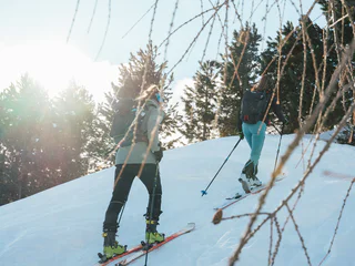
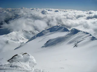
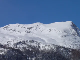
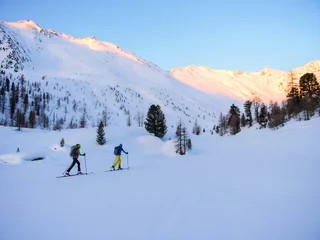
This sunny tour rewards ski tourers with a magnificent view of the surrounding mountains. The extensive ascent and descent terrain, surrounded by the highest mountains of the Vinschgau Valley, offers plenty of peace and untouched nature.
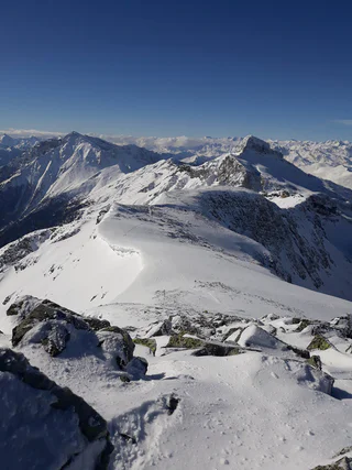
Nedotčená krajina, klid stranou sjezdovek a svahy pokryté hlubokou vrstvou prašanu a firnu. Chcete se raději řítit přímo dolů po dolomitských svazích? Dáváte přednost povlovnějším vrcholům? Máte rádi výhledy do dáli? Nebo se snad spokojíte jen s těmi nejvyššími vrcholy? Ať už preferujete cokoliv, jedno je jisté: Pokud se vydáte na skialpinistickou výpravu v Jižním Tyrolsku, užijete si jedinečné přírodní zážitky spojené se sportovními dobrodružstvími.
This sunny tour rewards ski tourers with a magnificent view of the surrounding mountains. The extensive ascent and descent terrain, surrounded by the highest mountains of the Vinschgau Valley, offers plenty of peace and untouched nature.
Easy tour with a stunning panoramic view.
Highest point: 2,517 m
Altitude difference: 1,150 m
Approx. time for ascent: 5 hours
> Avalanche report
Information without guarantee
Moderatly difficult ski tour
Time of the year: late winter to spring
Avalanche danger: Beware of snow slabs in the middle section when there is a lot of snow
Rewarding tour with magnificent views over the Venosta Valley, and the Passo Resia.
Time of the year: Throughout winter
Avalanche risk: Snow boarders should be on the look out for snow slabs at the Schartl steep slope!
Starting point: Madonna di Senales/Unser Frau (1,508 m a.s.l)
Ascent: 1,586 m elevation gain, 5 hours
Best time: March to May
A double summit (western summit 3,083 m a.s.l, eastern summit 3,094 m a.s.l) to the west of the Mastaun summit and the Mastaunjoch pass. Take the trail upwards from Madonna di Senales/Unser Frau through the Mastauntal Valley, as with Tours 9, until you reach flat ground having negotiated the steep slope. Then, take a right in a north-westerly direction until you come to the Mastaunjoch pass (2,927 m a.s.l) and the quite difficult climb up to the western summit. You can also turn off towards the north beneath the Mastaunjoch pass and climb to the eastern summit, which is the easier one. The descent is similar to the ascent.
For practised skiers with Alpine experience
The Hasenöhrl is the easternmost three-thousand metre mountain of the Ortler group with an imposing view. The crossroads to the Oberjochmoarhof farm is the starting point of the tour.
Starting point of the ski tour to the Glockhauser mountain is the car park in Melago/Melag. From there north-westward across soft ground up to the last post of a disused ski lift. Across the steep slope towards the right and further towards Melagtal Valley. At the bridge, cross to the right-hand side of the valley and at a height of 2,300 m veer left to the Schönkar ridge. After the large trough from right to left across stepped terrain on to a shoulder. Across the back, left up to the ridge (take care!) and further up to the summit. Your climb is rewarded with a beautiful valley view and panoramic view to the nearby summits.
Descend via the Mitterkar or along the ascent route.
The Felbe summit is with its northwest mountainside to the Pfitsch valley a ski tour classic in the Pfunderer mountains. The beautiful ski slopes are a special reward here.
Technical skiing grade: moderately difficult.
Alpine grade: difficult, pickaxe and crampons recommended.
Maps: Tabacco No. 037, Kompass No. 44.
Difficult ski tour
Time of the year: Spring
Refreshment stop: Lazins inn
A beautiful ski tour with a rewarding destination: fantastic views of the Ortles and the Königsspitze.
This ski tour is one of the most popular in the Upper Vinschgau and offers powdery firn snow until late spring. Around the striking border mountain you can enjoy the view over an overwhelming high mountain landscape.
Breathtaking steep ski tour at the south side of the “Tuxer Hauptklamm”.
From Melag (car park) in northern direction diagonally left to the upper end of the drag lift. From there diagonally right over the southern slope up to a level with a crossroads (2090 m). Flat right to the bridge over the Melager stream. On the right side of the valley inwards to point 2321 m on the map. Here the brooks divide ("Zwischenbach" on the map). One climbs up a little steeply to the left of the right stream and ends on a hill at the beginning of a wide, flat valley. Through this valley to its end. There through a short but steep hollow up to a saddle (2600 m). Through the following, flat hollow at the left edge until
to their end. Up through a hollow again. Then first right over a ridge and further left into a flat depression (2800 m). Through it, then again left through a hollow and right up to the yoke with the wayside cross. Up to the elevation at 3049 m, one climbs another half hour with the skis on the left and then over a short ridge - not difficult - to the worthwhile lookout point with a pole.
This ski tour is easy
Time of the year: Throughout winter
Avalanche risk: located on a steep slope of the Sailer Valley, pay attention to snow slabs!
Refreshment stop: Auerhof inn
Starting point: Certosa/Karthaus (1,327 m a.s.l)
Ascent: 1,602 m elevation gain, 4.5-5 hours
Best time: December to May
Also orographically speaking to the right of the Penaudtal Valley and more southerly towards Vinschgau Valley. The ascent is also from Certosa/Karthaus into the Penaudtal Valley, as with the ski tour to the Grubenspitze, but to Mountain pasture Penaud; continue up the Penaudtal Valley, take a left at altitude 2,500 and climb the lateral valley in a south-easterly direction. It is possible to reach the summit on skis. Descend by the same route.
For good skiers.
The hike starts at the Kühhof car park above Latzfons. Head northwest on forest trail over the open Alpine meadows passing through sparse larch and pine forests to the Klausner Hütte mountain hut (1923 m). Continue along the hiking trail passing the Rungger Hütten huts and Plankenbach brook. Also known as the Kreuzweg (Way of the Cross), the trail then crosses a pine forest before winding its way up a steep slope to the pilgrimage church and mountain shelter at Latzfonser Kreuz. Continue up trail no. 9. Finally, the route leads to the Kassiansee mountain lake and the Kassianspitze summit (2581 m) slightly beyond. The return is back the same way as the ascent.
Starting point: Maso Corto/Kurzras, car park (2,011 m a.s.l)
Ascent: 1,445 m elevation gain, 5 hours
Best time: December to May
The Schwemserspitze is south of the Weißkugel with which it creates a massif between the Schnalstal valley and Matschertal valley. The ascent is from Maso Corto/Kurzras across along Sommerweg (summer path) as far as the bridge, then in each case turning left into the Langgrubtal Valley. Then turn towards the north and climb the steep slopes as far as the Schwemser Ferner glacier. The easiest way to climb the glacier is by the south-west ridge. You can descend along the same route.
For good skiers with Alpine experience
If you want to experience the most powerful mountains of all mountains up close, you shouldn't miss a ski tour to the Suldenspitze peak. This tour is with a duration of 4 hours and 6 km an easy tour and rewards the ski tourers with an unique alpine panorama of Königsspitze Peak, König Ortler Peak and Cevedale Peak.
From Trafoi mountain village to Tuckettspitze peak. In the west of South Tyrol, home to the sprawling Ortler region, the little village of Trafoi is perched at an elevation of nearly 1,570 m. The charming surroundings and the pristine nature of Stilfserjoch National Park are ideal for hikes and tours of all kinds, with breathtaking panoramic views over the Alps drawing tourists and locals alike to the Trafoi glacier region year after year. Ski tourers reaching Tuckettspitze peak will be greeted with a unique Alpine panorama.
The leisurely ski tour, which is mostly oriented to the south, is located in the middle of the Fanes-Senes-Prags natural park. The summit view at 2,307 m offers a view of well-known mountain peaks in the area: Drei Zinnen, Hohe Gaisl, Tofana, Monte Cristallo.
IMPORTANT: Before starting any ski tour/snowshoe excursion, you must check the weather conditions and danger avalanches report (https://avalanche.report), asking also experts (alpine guides etc.).
Starting point: Mountain station Grawand (3,212 m a.s.l) or Refuge Bella Vista (2,842 m a.s.l)
Ascent: 700 m elevation gain, 3 hours
Best time: November to May
Descend to the edge of the right-hand tongue of the Hochjoch glacier at approx. 2,700 m a.s.l. Follow the hilly moraine ridges rising diagonally eastwards until you come to a short, steep slope and the edge of the glacier. The trail continues over a wide but rather flat glacier to Hauslabjoch pass at 3,279 m a.s.l with spectacular views. From this point, you already have an unimpeded view of the Ötzi pyramid. After a short downhill trek you come to the stone pyramid at 3,210 m a.s.l. Descend using the same route and then the valley trail to Maso Corto/Kurzras.
For intermediate level skiers with Alpine experience
Easy ski tour for beginners on the Rosskopf leisure mountain at Sterzing / Vipiteno. Start by the Rosskopf mountain station to the Sterzingerhaus mountain hut and on to the biotope Kastellacke. Turn on left here and beneath the crest upwards to the Rosskopf summit.
An easy summit tour at Weißenbach/Rio Bianco at an elevation of 2,474 metres.
Slope orientation: north-west
Highest point: 2,474 m
Altitude difference: 1,090 m
Approx. time for ascent: 4 hours
Avalanche danger: moderate
> Avalanche report
Information without guarantee