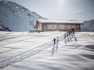
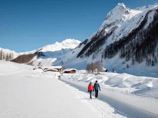
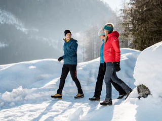
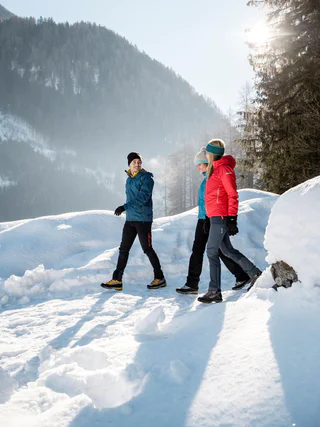
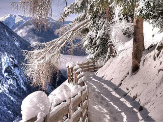
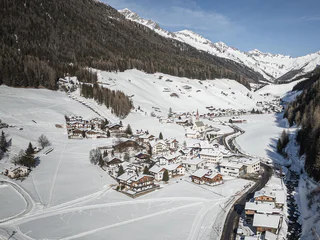
Südtirol Guide App Logo
Przejdź do treści

dodano do ulubionych

usunięto z ulubionych

Coś poszło nie tak! Wystąpił problem. Spróbuj ponownie

Twoje konto jest właśnie tworzone

Twoje konto zostało pomyślnie utworzone i jesteś teraz zalogowany

Zalogowałeś się pomyślnie!

Twoje konto zostało pomyślnie utworzone, ale nie mogliśmy zalogować Cię automatycznie

Jesteś wylogowany

Filtr
Wybrane filtry
    Poziom trudności
    Czas trwania
    Odległość w km

    Zimowe Wędrówki w Dolinie Aurina

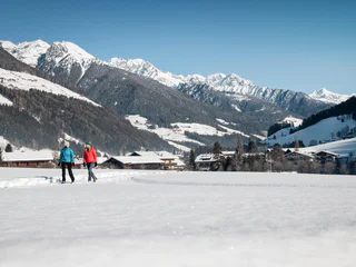
    Przeżyj zimową przygodę podczas wędrówek w Dolinie Aurina. Odkryj urokliwe trasy, które oferują piękne widoki i doskonałe warunki do zimowego trekkingu.
    Wyniki
    Hiking
    Winter walk - Ahornach/Acereto Tote Möser (palude)
    Sand in Taufers/Campo Tures, Ahrntal/Valle Aurina


    Tote Möser, Totes Moos, Totmoos are the various names of this moorland biotope above Acereto. A remote small plateau with a few isolated pine trees, in winter usually covered with a thick blanket of snow. Grouse area. Recommended equipment: snow and water repellent winter hiking clothing, mountain trekking shoes, warm drink, torch, spikes or trail crampons and gaiters.

    Poziom trudności: łatwy
    166 m wysokość w górę
    0h:34 min czas trwania
    Hiking
    Winter walk - Kematen in Taufers/Caminata di Tures Wissemannhof
    Sand in Taufers/Campo Tures, Ahrntal/Valle Aurina

    The mountain farm Wissemanhof is situated high up between Cantuccio and Caminata in steep terrain and benefits from stunning views.

    Be aware of the avalanche danger. More information at the alpine schools and the mountain guides.
    A detailed map is available in the tourist offices.

    Poziom trudności: średni
    274 m wysokość w górę
    1h:49 min czas trwania
    Hiking
    Winter walk - Mühlwald/Selva dei Molini Holzerhof
    Mühlwald/Selva dei Molini, Ahrntal/Valle Aurina

    The former farmers’ tavern Holzerhof high up opposite Cima del Tuono: typical high-up mountain farm in a sunny spot.

    Be aware of the avalanche danger. More information at the alpine schools and the mountain guides.
    A detailed map is available in the tourist offices.

    Poziom trudności: średni
    337 m wysokość w górę
    2h:30 min czas trwania
    Hiking
    Winter hike | Trejer Alm
    Sand in Taufers/Campo Tures, Ahrntal/Valle Aurina

    The cable car first takes you up to Speikboden at 2,000m. From there, the leisurely winter hike starts along the forest road to the hut Trejer Alm. Beautiful views of the surrounding mountains are included! An insider tip: right after the hut Trejer Alm you reach the lake Trejer See, a unique nature-protected high moor at 2,000m.

    Poziom trudności: łatwy
    66 m wysokość w górę
    2h:00 min czas trwania
    Hiking
    Winter walk - Rein in Taufers/Riva Tures Ebner- + Koflerhof
    Sand in Taufers/Campo Tures, Ahrntal/Valle Aurina

    Winter walk on the sunny slope of Riva high valley, to old and newly restored brick farms with timber barns, past shimmering larches and pines.

    Be aware of the avalanche danger. More information at the alpine schools and the mountain guides.
    A detailed map is available in the tourist offices.

    Poziom trudności: łatwy
    109 m wysokość w górę
    1h:30 min czas trwania
    Hiking
    Winter hiking trail Ameisberg
    Prettau/Predoi, Ahrntal/Valle Aurina
    Breath the sparkling air and enjoy the silence of nature!   Altitude: 1460 m - 1868 m
    Poziom trudności: średni
    408 m wysokość w górę
    2h:27 min czas trwania
    Hiking
    Winter walk - Roanerhof
    Sand in Taufers/Campo Tures, Ahrntal/Valle Aurina

    Roaners Bauernkuchl is a mountain farm 600 m above Taufers Castle.

    Be aware of the avalanche danger. More information at the alpine schools and the mountain guides.
    A detailed map is available in the tourist offices.

    Poziom trudności: łatwy
    231 m wysokość w górę
    2h:00 min czas trwania
    Hiking
    Winter walk - Mühlwald/Selva dei Molini
    Mühlwald/Selva dei Molini, Ahrntal/Valle Aurina

    The 1200 m high Selva dei Molini is a community with well-cared for highly insulated farm houses scattered in the landscape.

    Be aware of the avalanche danger. More information at the alpine schools and the mountain guides.
    A detailed map is available in the tourist offices.

    Poziom trudności: łatwy
    105 m wysokość w górę
    2h:30 min czas trwania
    Hiking
    Winter walk - Kofler zwischen den Wänden
    Sand in Taufers/Campo Tures, Ahrntal/Valle Aurina

    Kofler zwischen Wänden, which means Kofler between walls, is the ideal name for a mountain farm perched in the middle of a rock ledge. Worthwhile destination, extreme location, exciting easy walk. Special feature on the side of the path: the wolf pit in which, according to legend, wolves used to be caught.

    Be aware of the avalanche danger. More information at the alpine schools and the mountain guides.
    A detailed map is available in the tourist offices.

    Poziom trudności: łatwy
    269 m wysokość w górę
    1h:30 min czas trwania
    Hiking
    Winter walk - Kematen in Taufers/Caminata di Tures Uttheim/Villa Ottone
    Sand in Taufers/Campo Tures, Ahrntal/Valle Aurina
    Lovely hike from Kematen in Taufers/Caminata di Tures to Uttenheim/Villa Ottone. Suitable all year round. 

    Be aware of the avalanche danger. More information at the alpine schools and the mountain guides.
    A detailed map is available in the tourist offices.
    Poziom trudności: łatwy
    0 m wysokość w górę
    1h:13 min czas trwania
    Hiking
    Winter walk - Lappach/Lappago Zösen/Val di Cesa
    Mühlwald/Selva dei Molini, Ahrntal/Valle Aurina

    Zösen/Cesa: a pretty, remote high valley with light mixed pine forest at the foot of Roten Riffl/Scoglio Rosso.

    Be aware of the avalanche danger. More information at the alpine schools and the mountain guides.
    A detailed map is available in the tourist offices.

    Poziom trudności: łatwy
    265 m wysokość w górę
    1h:30 min czas trwania
    Hiking
    Winter walk - Sand in Taufers/Campo Tures Roaner/Ahornach/Acereto
    Sand in Taufers/Campo Tures, Ahrntal/Valle Aurina

    Roaners Bauernkuchl, mountain farm at 1560 m ... on the sunny Acereto hill. Partly steep walking, poles, spikes and trail crampons advisable as possibly icy in parts.

    Be aware of the avalanche danger. More information at the alpine schools and the mountain guides.
    A detailed map is available in the tourist offices.

    Poziom trudności: średni
    694 m wysokość w górę
    2h:30 min czas trwania
    Hiking
    Winter hike | Sonnklar Nock
    Sand in Taufers/Campo Tures, Ahrntal/Valle Aurina
    Wonderful winter hike on the highest point at Speikboden with 360° winter panorama. With the cable car and the chairlift it goes up to 2,400m. From there you can already see the summit cross of the Sonnklar Nock. Passing the Sonnklarhütte, you reach your destination after a leisurely winter hike of just under half an hour.
    Poziom trudności: łatwy
    10 m wysokość w górę
    0h:30 min czas trwania
    Hiking
    Winter walk - Sand in Taufers/Campo Tures Ahornach/Acereto
    Sand in Taufers/Campo Tures, Ahrntal/Valle Aurina

    Beautiful winter hike to Ahornach/Acereto – sun-kissed, scattered rural settlement on a slope, opposite imposing Wasserfallspitz/Punta della Cascata.

    Be aware of the avalanche danger. More information at the alpine schools and the mountain guides.
    A detailed map is available in the tourist offices.

    Poziom trudności: średni
    461 m wysokość w górę
    2h:00 min czas trwania
    Hiking
    Winter hiking trail to the Stegeralm hut
    Prettau/Predoi, Ahrntal/Valle Aurina
    Breath the sparkling air and enjoy the silence of nature! Enjoy the stunning view of the mountains of the Ahrntal valley!
    Altitude:
    1476 m - 1973 m
    Poziom trudności: średni
    536 m wysokość w górę
    2h:30 min czas trwania
    Summer
    Walk path Bacher valley (Rein in Taufers/Riva di Tures)
    Sand in Taufers/Campo Tures, Ahrntal/Valle Aurina

    Rein is one of the most oldest villages in the Tauferer Valley. The beautiful high valley is encircled by the three thousand meter peaks of the Rieserferner mountains, from which the Hochgall proudly sticks out. Rein lies in the heart of the Rieserferner Ahrn Nature Park.

    Poziom trudności: łatwy
    50 m wysokość w górę
    1h:30 min czas trwania
    Hiking
    Winter Hike Knuttenalm alpine hut
    Sand in Taufers/Campo Tures, Ahrntal/Valle Aurina

    The Knutten alpine hut is located in the Vedrette di Ries Nature Park, one of the seven nature parks in South Tyrol. From the parking lot, starts the easy hiking tour which leads on the slightly uphill forest road no. 9 for Knutten alpine hut. The hut is starting point for many hikes and ski tours. A sunny, 90-minute winter hike: an ideal daytrip for the whole family Starting point: Parking area in the back part of Riva di Tures Highest point: 1.911 m

    Be aware of the avalanche danger. More information at the alpine schools and the mountain guides.
    A detailed map is available in the tourist offices.

    Poziom trudności: łatwy
    231 m wysokość w górę
    2h:00 min czas trwania
    Hiking
    Winter walk - Rein in Taufers/Riva di Tures Inderederhof
    Sand in Taufers/Campo Tures, Ahrntal/Valle Aurina

    Tour on the broad Riva valley floor, past the extensive river and scree landscape to several refreshment stops.

    Be aware of the avalanche danger. More information at the alpine schools and the mountain guides.
    A detailed map is available in the tourist offices.

    Poziom trudności: łatwy
    154 m wysokość w górę
    1h:30 min czas trwania
    Hiking
    Winter walk - Lappach/Lappago Kneipp facility
    Mühlwald/Selva dei Molini, Ahrntal/Valle Aurina

    Lappago bathed in luminous winter light at the foot of gentle Sasso Tondo.

    Be aware of the avalanche danger. More information at the alpine schools and the mountain guides.
    A detailed map is available in the tourist offices.

    Poziom trudności: łatwy
    66 m wysokość w górę
    1h:00 min czas trwania
    1